 
        
        The Mausoleum of Asaf ibn Burhiya in the city of Osh
The Mausoleum of Asaf ibn Burhiya — Companion of the Legendary Solomon


        The Mausoleum of Asaf ibn Burhiya — Companion of the Legendary Solomon
 
        
        The following countries do not require a visa for citizens of Kyrgyzstan, or a visa can be obtained at the border, 2014:
 
        
        If you have a transit flight through Singapore Changi Airport or just some time before your flight, here are some activities you can enjoy at the airport:
 
        
        Electronic airline ticket (e-ticket) is essentially no different from a regular paper ticket. The only difference is that all the necessary information (flight route, fare, passenger data, etc.) is recorded not in the boxes of a paper airline ticket, but in a computer file. A database is created on the airline's server, where all records of the electronic ticket are collected, with each airline ticket having its own unique number associated with the set of records.
 
        
        Many of you fly for business or leisure. Here are some tips and recommendations for air travelers. In total, there are 112 tips – and this is far from an exhaustive list.
 
        
        June 26 – July 10, 2014 "Naryn Ring"
 
        
        Route No. 1
 
        
        Water routes are in a somewhat more limited position. The fact is that many mountain rivers allow for rafting on kayaks, catamarans, and even on rafts, but their lengths are so short that one day (say, Sunday) is more than enough for a rafting trip. This reduces their usability. Only large rivers provide the opportunity for complex and interesting routes. The water commission of the tourism federation of Kyrgyzstan has developed and recommends the following water routes across the republic:
 
        
        2 difficulty categories
 
        
        The longest and most extensive routes covering various regions of the republic are as follows:
 
        
        South of Kyrgyzstan. Pamir-Alai
 
        
        This tourist area includes two ancient monuments — the caravanserai Tash-Rabat and the settlement of Koshoy-Korgon. They are located on the banks of the Kara-Koyun River, sixty-eight kilometers apart: the caravanserai is situated in the middle reaches of the river, while the settlement is in the lower reaches.
 
        
        The Sary-Chelek Nature Reserve is referred to as a realm of magical beauty, located on the southern slopes of the Chatkal Range, in the basin of the Khoja-Ata River in the Jalal-Abad region. The territory of the reserve stretches from the foothill steppes to the snow-capped peaks. Towering mountain ranges and blooming valleys, sheer weathered cliffs and turbulent rivers, deciduous and coniferous forests, snowy summits and blue lakes, high grass meadows and impenetrable thickets — all of this
 
        
        It can be confidently said that there is no gorge in the republic that is "unsuitable" for mountain tourism. Importantly, mountain routes that involve crossing passes necessarily encompass several tourist zones or, at the very least, two such zones.
 
        
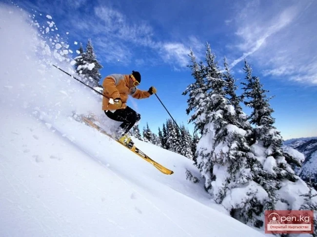
        In the last decade, places of true pilgrimage for passionate skiing tourists have become the Caucasus, the Carpathians, the Khibiny, the Urals, and the Sayan Mountains. Even in flat areas, artificial ski trails are being created through the efforts of enthusiastic amateurs. The wave of universal fascination has reached Central Asia: ski complexes have been established in the Zailiyskiy Alatau in Kazakhstan — "Chimbulak" and in the Pskem Ridge in Uzbekistan — "Chimgan." But
 
        
        Approved by the resolution of the Government of the Kyrgyz Republic dated February 20, 2012 No. 120
 
        
        Bishkek from March 25, 1999 No. 34 LAW OF THE KYRGYZ REPUBLIC ON TOURISM
 
        
        Memo for Kyrgyz Travelers This memo contains important information for all travelers and rules that will help you avoid difficulties during your trip. Before leaving for the airport, we kindly ask you to check for the following documents:
 
        
        General geographical characteristics and tourism development in the Kyrgyz Republic.
Please provide the text you would like me to translate.
 
        
        In the Talas Valley, at the foot of the rocky hill Manastyn Chokusu, stands the Tomb of Manas, known to every Kyrgyz. Such a rare structure made of burnt brick and carved terracotta could be a provincial counterpart to the famous tombs of ancient Sogdiana, built by masters from Samarkand and Bukhara. However, when researchers delved into the study of the very distinctive ornaments of the Tomb, they were surprised to find that in terms of style, they were close to the patterns of Kyrgyz
 
        
        In the middle reaches, the Sokh River receives the tributary Abghol (a river from the lake), at the mouth of which, on a river terrace, lies the village of the same name. Above the village of Abghol stands the Khan Fortress, embodying the power of the Kokand Khanate (17th century). The fortress has been well preserved to this day. In the courtyard, there is a stone slab with rock engravings of animals and horsemen on camels. The drawings are, of course, much older than the fortress walls and
 
        
        The city of Uzgen was founded in the 8th-9th centuries on a steep terrace of the Kara-Darya River. It is known that a trade route from Fergana to Semirechye passed through Uzgen. From the 10th to the 13th centuries, Uzgen was a major trading center, a powerful fortress, and the southern capital of the Karakhanid state.
 
        
        Single-Chamber Mosque of Takhti-Suleiman is unique in its location, as it is built on the eastern peak of Suleiman Mountain. In recent decades, this structure has been associated with the name of Muhammad Zahiriddin Babur - a descendant of Timur (Tamerlane) and has been referred to as Babur's House. In his work, Mr. E. de Youfalvi de Mezo-Kovesd - the head of the French ethnographic expedition of 1877 to Central Asia, describing the city of Osh, provides quite detailed information about
 
        
        Rinat Abdullakhan Mosque is located in the center of the city of Osh at the southeastern foothills of Suleiman Mountain. The name of Abdullakhan II (1534-1598) from the Shaybanid dynasty has preserved the architectural monument in popular tradition. The mosque was built in the mid-16th century during the period of Abdullakhan II's greatest power, when as a result of his military campaigns, he managed to unite under his rule not only Maveraunahr (the region between the Amu Darya and Syr
 
        
        Osh - one of the oldest cities in Central Asia, located on the southeastern edge of the Fergana Valley at the northern foothills of the Pamir-Alai. Surrounded by greenery, it stretches along the banks of the mountain river Ak-Buura at an altitude of 940-1070 meters above sea level.
 
        
        Mausoleum of Shah-Fazil is one of the most significant architectural monuments of the XI-XII centuries. The mausoleum is located in the Ala-Buka district, in the ancient village of Safed-Bulan, the name of which unites two great cultures - Arab and Turkic.
 
        
        Saymaluu-Tash is a small plateau hidden at an altitude of over 3000 meters among the peaks of the Fergana Range near the Kugart Pass. Saymaluu-Tash translates to "patterned, painted stone," but it is not just a stone or a solitary rock covered in petroglyphs; it is a vast gallery of tens of thousands of stones scattered chaotically by nature, on the black surfaces of which one or two, or even several highly artistic drawings can be clearly seen.
 
        
        Tash-Rabat Caravanserai, located on the banks of the Kara-Koyun River, is undoubtedly the most significant representative of historical architecture that emerged during the activation of the Great Silk Road in the Tian Shan mountains. Among the mighty ridges rise the ruins of a fortified caravanserai, built by the local ruler Muhammad Khan on the ancient caravan route from Semirechye to Kashgar. The caravanserai was constructed in the 15th century (1408-1415) and served as an inn for merchants
 
        
        Archaeologists claim that the region of Pre-Issyk-Kul was inhabited by ancient humans during the Lower Paleolithic era, with around a thousand ancient tools found as evidence. Underwater research was conducted on Lake Issyk-Kul from 1985 to 1989, searching for the remnants of sunken cities. Several historically valuable items dating back 2000-2500 years were discovered, along with nine from medieval settlements and three from antiquity. One such find is the city of Chigu (the city of the Red
 
        
        In the Dzhergalansk fauna complex, in a deep river-eroded cliff, the history of the earth is visible through its layers and deposits. Here, an almost complete skeleton of a rhinoceros, a mammoth tusk and tooth, a bison jaw, and remains of a glacial elephant were found, among others.
 
        
        Tamga-Tash. At an altitude of 1684 m, in a beautiful old park on a steep cliff by Lake Issyk-Kul, is the military sanatorium "Issyk-Kul." The area near the village of Tamga, from the word "mark," was once a well-known place for many travelers and also for Buddhist monks. The Buddhist monuments, represented by Tibetan rock texts, gained worldwide fame. The most significant are inscriptions on four stones, located 1 km apart and situated 5-7 km from the lake. Tamga-Tash
 
        
        In 1888, the great Russian traveler and explorer of Central Asia, Nikolai Mikhailovich Przhevalsky, stopped in Karakol. During his fifth expedition, having arrived from St. Petersburg to Pishpek, he contracted typhoid fever and died in Karakol on October 20. Initially, a wooden cross with a commemorative plaque was erected at the grave of the great scientist. Later, a competition was announced for the best design of a memorial monument. Out of 89 projects, one was approved - the project by a
 
        
        Tourism in Kyrgyzstan Tourist resources are understood as a set of natural and artificial (man-made) objects suitable for creating a tourist product. Natural tourism resources are the sum of resources contained in the lithosphere, hydrosphere, atmosphere, and biosphere. In other words, natural resources are bodies and phenomena of nature that can be involved in tourist activities.
 
        
        Kyrgyzstan and Its Tourist Resources Tourism in the world is based on the targeted and reasonable use of tourist resources, which consist of objects of tourist interest and the impressions that tourists can gain from perceiving these objects. Objects of tourist interest can be natural, historical, or socio-cultural: landscape and climatic zones, geological and hydrogeological objects (rocks, caves, rivers, lakes, waterfalls, glaciers, etc.), monuments of history and architecture, small peoples
 
        
        The Kyrgyz Republic is located in the northeastern part of Central Asia, in the very "heart" of the Eurasian continent. Its territory covers 199.9 thousand square kilometers and stretches 925 km from east to west, and 453 km from north to south. The borders of the Republic are shared with Kazakhstan to the north, China to the southeast, Tajikistan to the southwest, and Uzbekistan to the west.
 
        
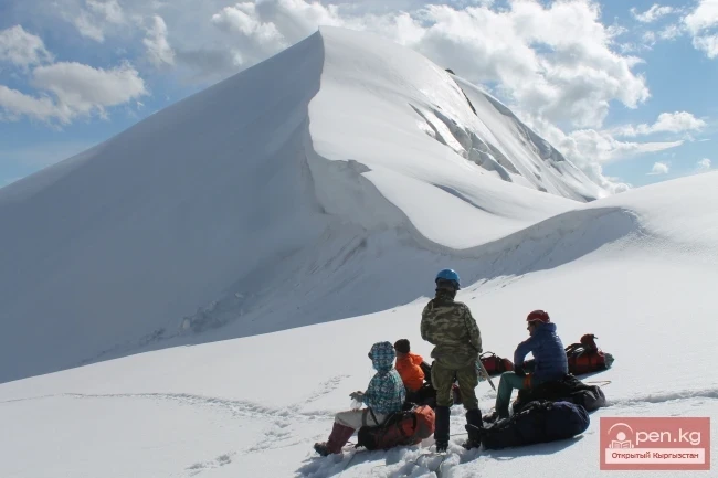
        Types of Tourism in Kyrgyzstan Based on the diverse tourism resources available in Kyrgyzstan, the tourism development program until 2010 identified the following priority types of tourism. Mountain Adventure Tourism, including mountaineering and expeditions.