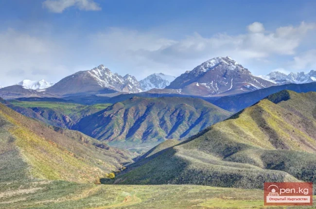
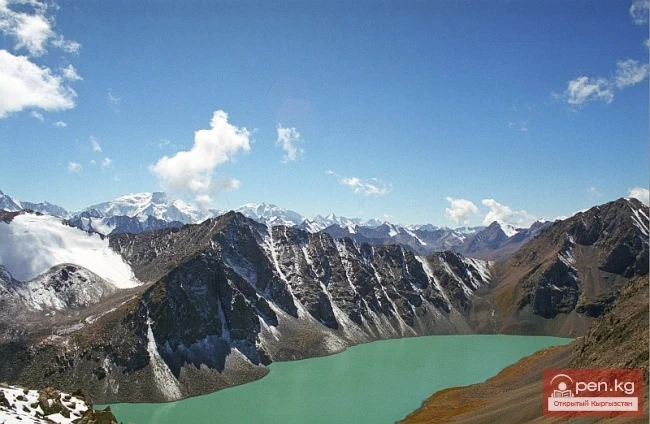
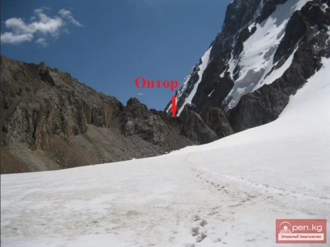
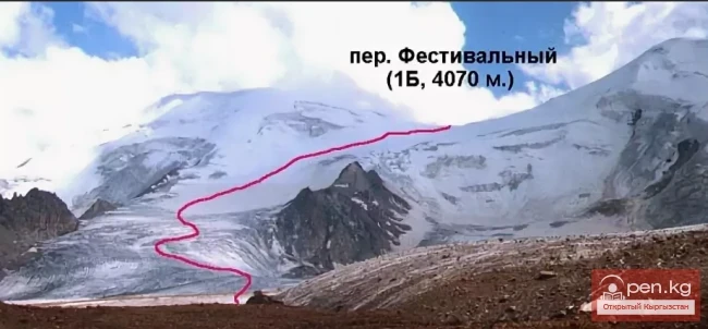
Memorable hike with elements of extreme to Ontor Pass In the Terskey Alatoo system, there is a pass that tourists prefer over others. There is a reason for this. The route to it is simple yet intricate. The views that unfold before travelers amaze with their pristine beauty. This is Ontor Pass. Indeed, the route to the pass is quite passable, with diverse vegetation and fauna. Nevertheless, all the components of an exciting mountain hike are present – rocky peaks, glaciers, noteworthy
Festival Pass – a challenging, exciting trekking adventure At an altitude of 4000 meters lies the pass, which has been given a difficulty category of IIБ. It is called the Festival Pass. The Festival Pass stretches between the peaks of the Terkey Ala-Too ridge. This challenging crossing was first conquered in 1957 by a team of climbers led by M. M. Gantsevich. Since it was conquered by Soviet climbers, it was named in the traditions of the Soviet era – Festival Pass. This was because that year
Passes in Naryn Tash-Rabat Pass (height 3968) is located in the Naryn region and stretches from Tash-Rabat to Torugart. Tash-Rabat, which translates to Stone Courtyard, is believed to have been a key point for crossing the Tian Shan, as it not only provided shelter for merchants but also served as a fortress against raiders. Trade caravans passed through Tash-Rabat on their way to the cities of the Fergana Valley. The ancient caravanserai on the cold three-kilometer pass is one of the most
Jalalabad Passes Kaldama Pass (height 3062) is located in the Jalalabad region and stretches from Kazarman to Jalal-Abad. The ascent to Kaldama Pass begins gently, and in this section, it is very beautiful: far below, a river flows in a deep canyon, and the mountain landscapes gain power right before your eyes. The pass is a transit route, used by regular vehicles traveling towards Kazarman. It is quite challenging for heavy trucks to climb this pass. Numerous sharp turns require truck drivers
Talas Passes The Otmok Pass (height 3330) is located in the Talas region and stretches from Susamyr to Talas, connecting the region with the Suusamyr Valley and the Bishkek — Osh highway. The road tests your patience, but generously rewards the eye and heart with beauty and unforgettable impressions. The alpine highlands around the upper point of the Otmok Pass are intensively used as summer pastures. The Karabuura Pass (height 3302) is located in the Talas region and stretches from Talas to
Osh Passes Taldyk Pass - a pass in the Alai Range, oriented from north to south, connects the valley of the Gyulcha River in the north with the Alai Valley in the south. The pass is located in the Osh Region, 160 kilometers south of the city of Osh, and serves as a gateway to one of the highest and most beautiful roads in the world — the Pamir Highway. The height of the pass is 3615 m. In the 1930s, a road was opened from Osh, through the Taldyk Pass, allowing access to China or to Lenin Peak.
Mountain Passes of Issyk-Kul Region San-Tash Pass (height 2195 m) is located in the Issyk-Kul region and stretches from Tyup to Jirgalen, in the eastern part of the Central Tien Shan. The road from the Issyk-Kul basin to Almaty (Alma-Ata) passes through San-Tash. In the vicinity of the pass, there are numerous burial mounds dating back to the 7th-3rd centuries BC. A grand burial complex is located southwest of the beginning of the San-Tash Pass, at the foot of Adyr. The central feature of the
Main Passes in the Chui Valley Shamsi Pass is located in the Chui region and stretches from Shamsi to Kochkor. In the upper zone of the Shamsi gorge, 60 km south of the city of Tokmak, lies the Shamsi Pass. Its height is 3570 m. It serves as a link between the Kochkor and Chui valleys. Tuu-Ashu Pass (height 3586) is located in the Chui region and stretches from Karabalta to Susamyr. Tuu-Ashu is the pass connecting the Chui valley with the southern regions of Kyrgyzstan. It is located 135 km
Roads in the Sky Irkeshtam Pass is located in the Osh region and stretches from Sary-Tash to Kashgar. The "Irkeshtam" border crossing between the Kyrgyz Republic and the People's Republic of China is located 76 kilometers east of the village of Sary-Tash at the Irkeshtam Pass, which is 2841 meters above sea level. Irkeshtam begins in the city of Osh in southern Kyrgyzstan. The road goes south along the valleys of the Taldyk and Gulcho rivers to the village of Sary-Tash (Yellow
Geographical Reference: Ala-Kul (Ala-Kyol, Alakul, Alaköl) is a closed lake in the Terkey-Alatau region, in the Central Tien Shan, Kyrgyzstan. It means "Mottled Lake" in Kyrgyz. It is located in the upper reaches of the Kurgaktor River, a right tributary of Karakol, at an altitude of 3532 meters. It has a glacial origin: the glacier, after retreating, still occupies the upper part of the valley. There are no islands in the lake.