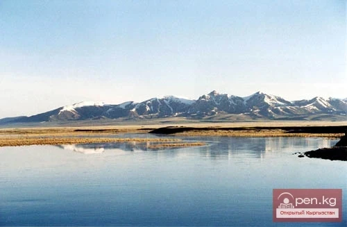
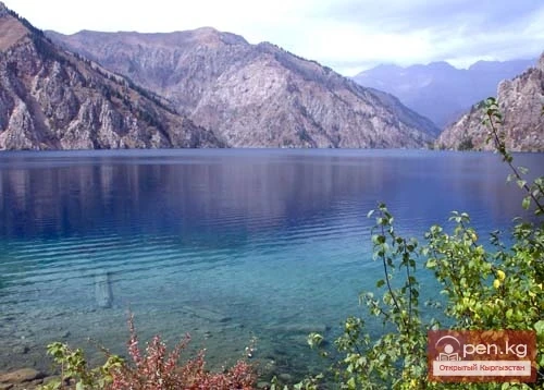
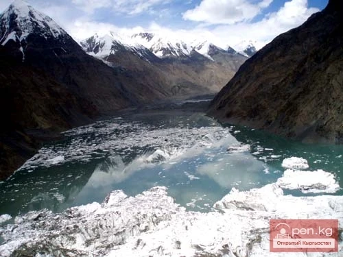
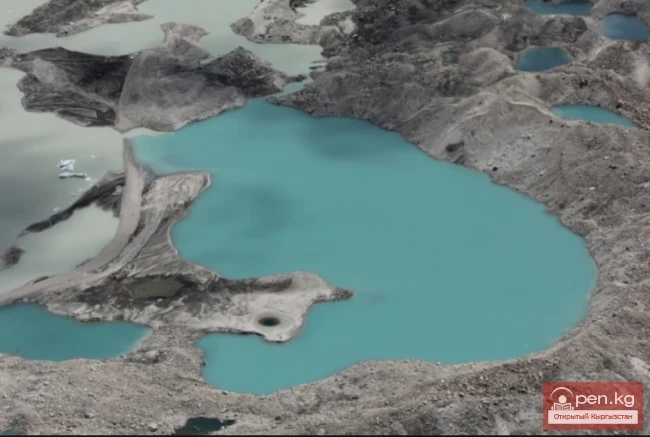
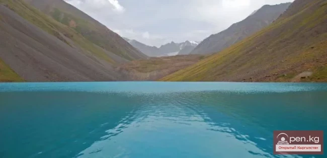
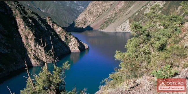
Geographical Reference: Ala-Kul (Ala-Kyol, Alakul, Alaköl) is a closed lake in the Terkey-Alatau region, in the Central Tien Shan, Kyrgyzstan. It means "Mottled Lake" in Kyrgyz. It is located in the upper reaches of the Kurgaktor River, a right tributary of Karakol, at an altitude of 3532 meters. It has a glacial origin: the glacier, after retreating, still occupies the upper part of the valley. There are no islands in the lake.
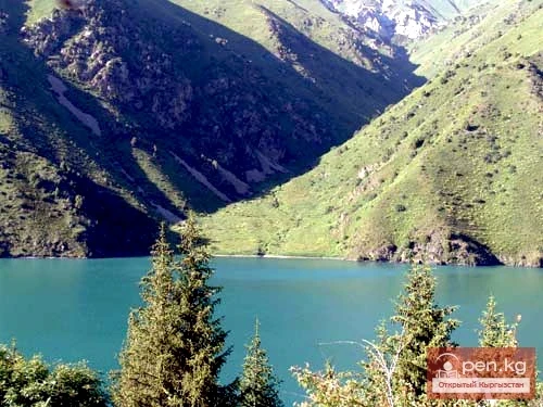
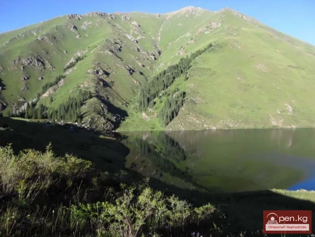
Lake Alakul (Alaköl) lies in the glacial valley of the left tributary of the Kurgaktor River, a right tributary of Karakol, at an altitude of 3532 meters above sea level. The length of the lake is 2.8 km, and its width is 0.5 km. The length of the shoreline is 6.8 km. This is perhaps one of the most beautiful places in the Terkey-Alatau region. You can reach it either from below or through one of the easy passes over the rocky ridges surrounding the lake. There are no roads leading to the lake. You have to travel on foot or on horseback.
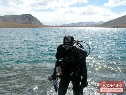
Diving: The lake is not of interest for diving due to poor visibility and difficult accessibility.
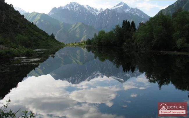
Lake Alakul (Alaköl) is perhaps one of the most beautiful places in the Terkey-Alatau region. It means "Mottled Lake" in Kyrgyz. You can reach it either from below or through one of the easy passes over the rocky ridges surrounding the lake.
The path to the lake from the Karakol valley begins just below the Auytor River, the left tributary of the river. Here, a pedestrian bridge made of several logs is thrown over the stream, with an iron cable as a railing. It is about 3 kilometers from the confluence of Köl-Tor and On-Tor to this point. On the right bank of Auytor is a fenced area where shepherds stay. According to some sources, there was an alpine camp here (according to other data, the alpine camp was at the confluence). The Auytor River is small; the road simply crosses it, but if you don't want to wade through it, there is a bridge about two hundred meters upstream.
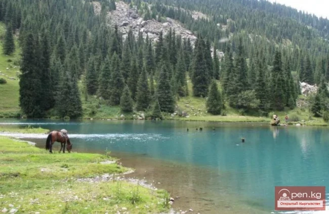
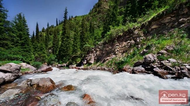
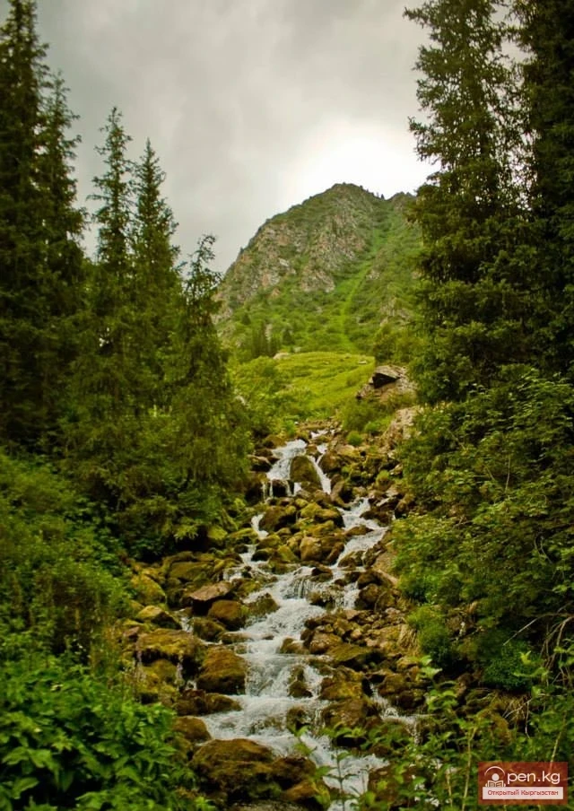
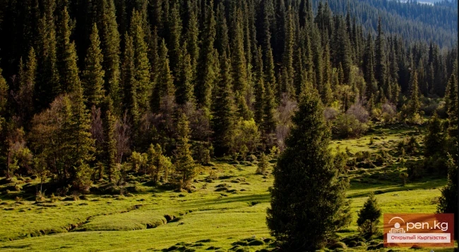
The trail leading to the lake immediately enters the forest and has a typical mountain-taiga character. It rises quite gently and gradually veers left, leading to a fairly large clearing, which is closed off by a steep grassy slope of an ancient landslide that blocked the valley. Further, the trail serpentines up this slope, veering right under the trees, and after hopping over rocks, leads to the river's overflow. (Below the landslide, the water goes under the rocks and does not appear until Karakol). A little further upstream stands a small log cabin, known as the "Orphan" shelter. Next to it, on gravel among the trees, there are good spots for tents. It takes no more than an hour and a half to walk here from the river.
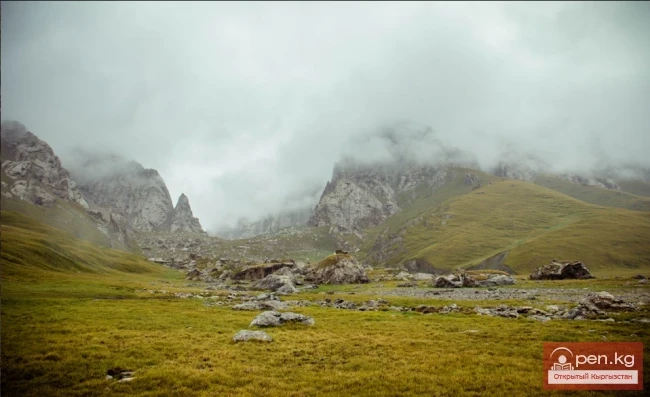
Above the shelter, the forest ends, and the trail goes along the shore, occasionally winding between bushes. Soon the valley splits: straight ahead is the path to Kurgaktor Pass (1B), while to the right, along the river, goes the main trail leading to the lake.
The water here falls quite steeply in cascades over the rocks, and you have to climb along the cliffs. Higher up, after a left turn, the river flows along the bottom of the gorge, leaving enough space for the trail, but then the gorge narrows, becomes steeper, and you have to scramble left onto the rocks.
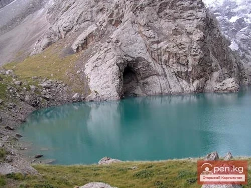
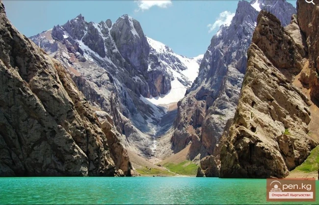
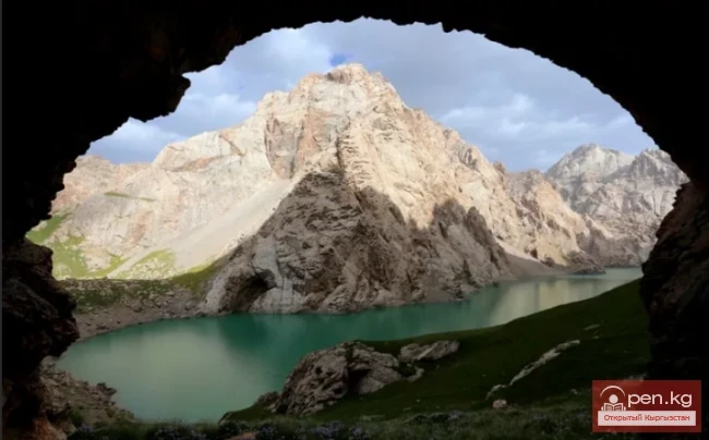
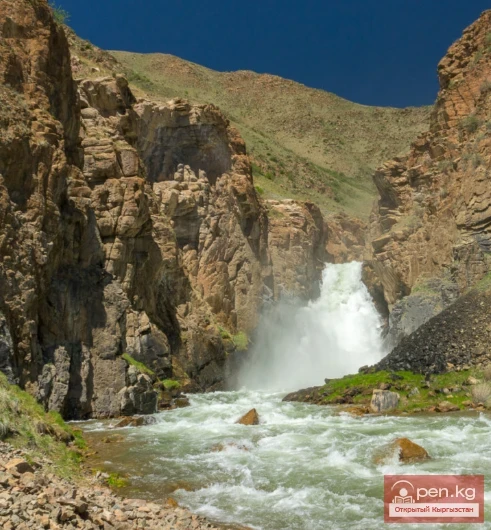
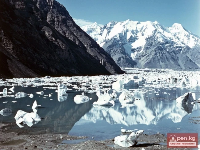
Further, the valley widens again, and the trail leads to a steep, morainic front left by a retreating glacier, above which the gorge is closed off by smoothed rock walls. A beautiful waterfall cascades from these rocks, flowing directly from the lake. From here, the trail goes left onto the scree and then gradually rises to the right, leading above the rocky drops to flat monoliths that serve as a dam. From there, there is an immediate view of the lower part of the lake. If desired, you can pitch a tent on the stone slabs. The ascent from the shelter to the lake takes about 2 hours.
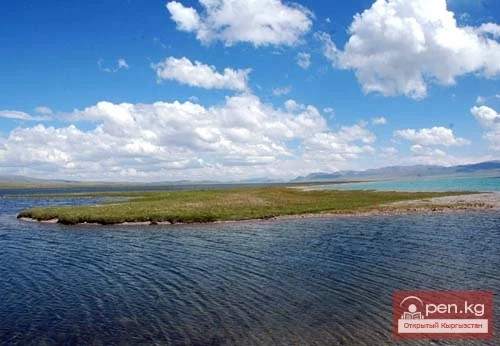
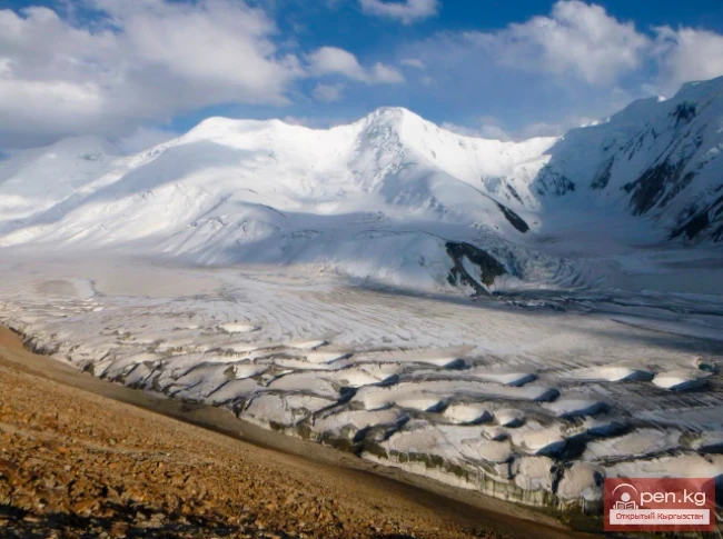
The lake is large: it stretches 2.8 kilometers from west to east, and its average width is about 500 meters. It was formed in a depression carved by a glacier, which, having retreated, still occupies the upper part of the valley.
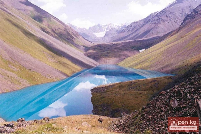
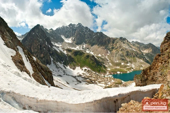
Directly south of the source of the river, the saddle of Panoramic Pass (1A) leading to the Köl-Tor River is visible. To see the upper part of the lake, you need to go left along the trail, which gradually ascends to the top of the rocky ridge. Further, it traverses the slope, bypassing several more ridges encountered along the way, and then gradually climbs to Alakul Pass. From the trail, there are excellent views of the lake, and as you ascend, the main ridge of the Terkey-Alatau with the peaks Aksu, Jigit, Karakol, and Oguz-Bashi becomes visible to the south. The best time for photography from the pass is, of course, either morning or evening. In the middle of the day, the sun shines directly in your eyes. So if you reach the lake at noon, it is better to descend from the trail to the shore and stay overnight.
The ridge of Alakul Pass is scree-covered and quite wide. To descend, it is better not to start directly from the tour (the lowest point), but from the western saddle, which is separated from the eastern one by a small rocky elevation. It is more convenient to walk on the left side of the couloir, where you can enjoy rolling down the fine scree. Below, the trail begins, which leads to the drying river Davakutor, flowing from under Kurgaktor Pass.
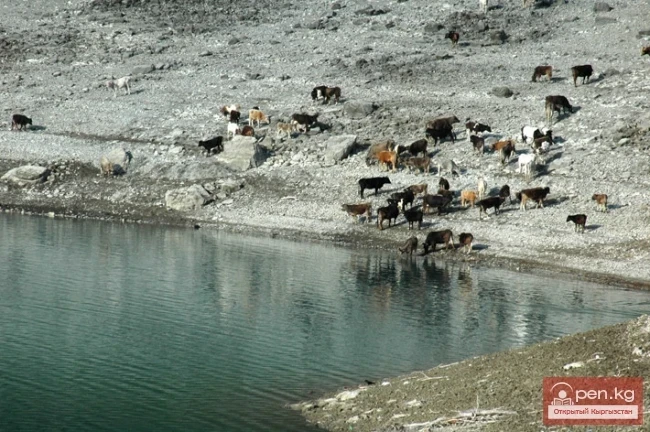
Here, the path disappears among grassy hills, and you just have to walk along the wide valley to the right along the stream, where at the exit from the rocky gates it reappears, jumping over the stones to the right bank, and then returning back to the left. In the meadows of the Keldyke valley (the name of the river after the confluence of all its sources), herds of cows and horses constantly graze, which, in fact, have trampled a fairly good trail. It is very pleasant to run down it, and it is important not to miss the spot where you need to jump over the stones to the other bank again. The trail soon enters the forest and quickly descends into the Arashan valley.
In total, it takes an hour and a half to ascend to the pass from the end of the lake, and no more than half an hour to descend to the water, after which you can descend into the Arashan River valley in an hour and a half.