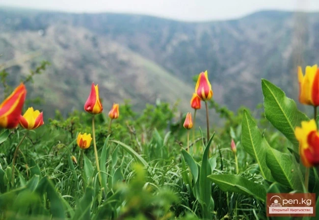
Zone "Isfayram-Sai". The left tributary of the Isfayram-Sai River is the Surme-Tash River, which originates from glaciers above the peak of Kara-Kaayk ("black pole"), while the right tributary is Archa-Kanysh, merging at an elevation of about 2850 m. The Isfayram-Sai gorge is very rocky. Thickets of juniper and shrubs often hang over the water. Several side gorges of small tributaries branch off from the main gorge in the upper reaches: Kel, Jashil-Kel, Sauk-Dzhailoo, Melek-Suu, and others that are smaller. The upper part of the Isfayram-Sai valley is characterized by steep, sharply compressed side slopes. Just below the mouth of Surme-Tash, on the rocks of the right side of the valley, at a height of about 30 meters above the river, stone drawings are carved.
The gorge of the left tributary of the Surme-Tash River, Melek-Suu, is represented by thickets of rowan, birch, maple, and juniper. The place where it flows into Surme-Tash is covered with rare shrubs. In the middle of the gorge, remnants of marble mining operations have been preserved in the riverbed. Birch thickets are found in the upper reaches. At the sources lies a large glacier called Kosmonavtov.
One of the most interesting areas of the zone is the very narrow gorge of Kel, a right tributary of Surme-Tash. The side slopes of this gorge rise with almost vertical walls, dotted with narrow couloirs. In the lower part of the walls, small stone debris flows down. In the river floodplain, birch, rowan, and numerous shrubs grow: hawthorn, barberry, wild rose, tal, thickets of reeds, and cattails. The picturesque area of Bait, located upstream, is very beautiful. It represents a scenic mountain valley with green slopes densely covered with real juniper forest. Along the bottom of the gorge, tall poplars, sprawling willows, and hazelnuts grow along the riverbed.
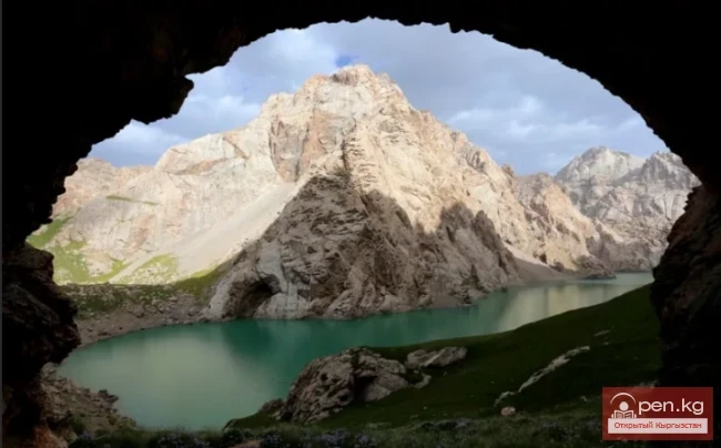
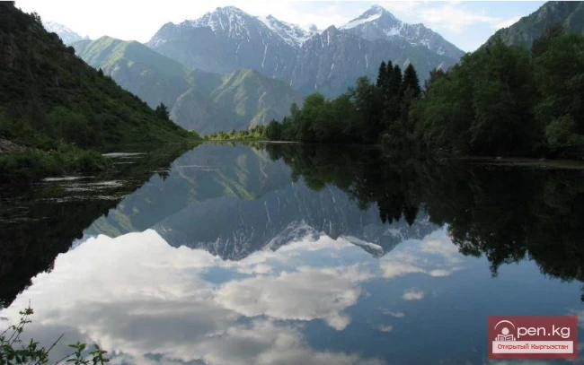
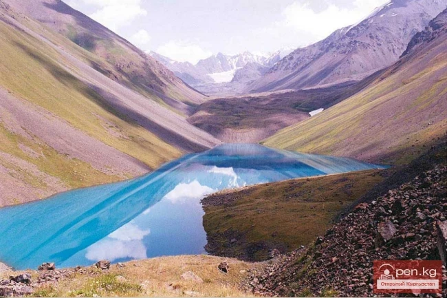
In a small high-altitude valley near the village of Kel, there is a luxurious apricot orchard. In the upper reaches of the Kel gorge, at the upper forest boundary behind a huge landslide called "Posogo-Korum" ("threshold of stone debris"), among steep slopes lies the high-altitude lake Kel, heavily overgrown with reeds. This is a paradise for ducks and teal. Wild boars can be found in the vicinity. About 250 m above this lake, further up the gorge, lies another, even more beautiful lake. Its shores are covered with dense juniper thickets.
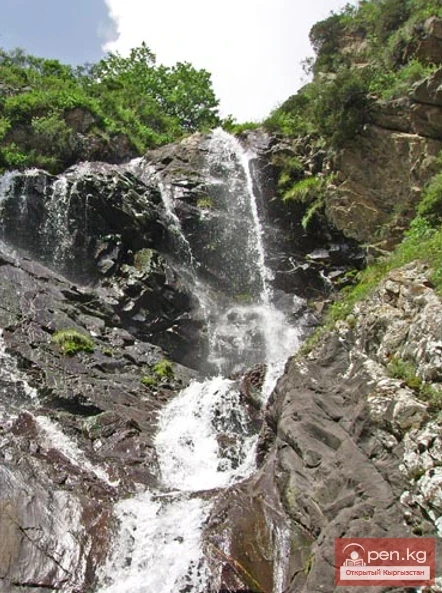
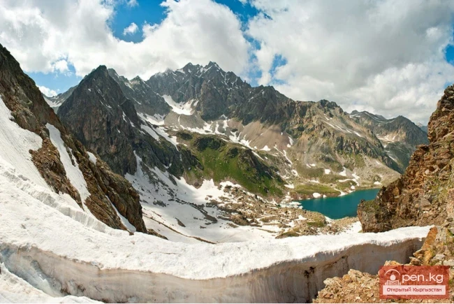
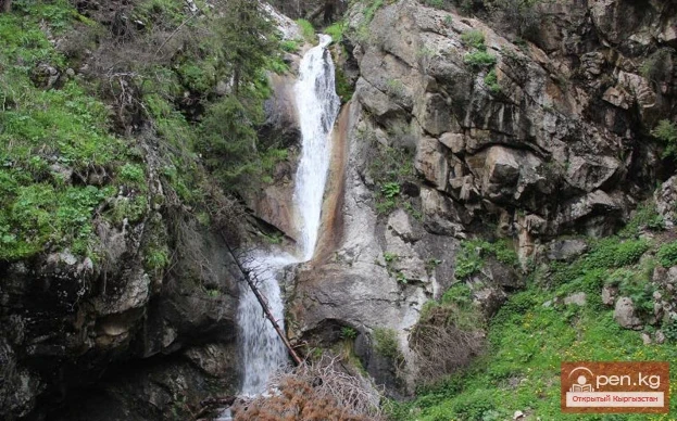
Several attractive lakes are located in the gorge of the Minzhilki River, which merges with the Kainyda River near the village of Lyangar. Many small lakes hide among the morainic debris in the upper part of the Isfayram-Sai River. In the upper reaches of the Jashil-Kel River (a tributary of Surme-Tash), at an altitude of about 3500 m, lies the moraine-dammed lake Karavan-Kel, surrounded on all sides by mighty five-thousanders. A large moraine-glacial lake is located near the source of Jashil-Kel. Under the Kichik-Bulak pass in the upper reaches of the Sauk-Dzhailoo tributary, south of the watershed, lies the lake Kyzyl-Oyrok-Kel. Approximately 250 m above the mouth of Jashil-Kel, a beautiful waterfall cascades down from a steep twenty-meter cliff in its gorge. In the middle of the Tegermen gorge, at an altitude of 2600 m, one can visit the former lake Yashin-Kel ("storm lake"), which formed over 200 years ago as a result of an earthquake. A river flowed out of it, which over time eroded the dam that held it back, and in June 1966, the lake's water rushed into the valley of the Tegermench River, and then spilled as a mudflow into the Isfayram-Sai River. At an altitude of 4150 m lies the Tegermench Lake, from which the river of the same name originates. From the lake, the slope rises steeply to the Tegermench pass (4810 m). Through it, one can reach the upper reaches of Archa-Kanysh.
The valley of Archa-Kanysh ("delighting with juniper") — the right tributary of Isfayram-Sai — looks like a narrow and deep canyon, through which it is practically impossible to pass. It must be bypassed from above. Among the rock debris and scree, beautifully curved trunks of juniper grow. The sources of the river are located on the slopes of Kichik-Alay and its spurs. In the upper reaches, there are many marmots and goats. Above the middle reaches of the river, on the ridge of the Alay Range, lies the Tengizbay pass (3774 m), from which a beautiful panorama of the mountains and the Alay Valley opens.
Two easily accessible karst caves, Arpalik, located 4 km northwest of the village of Uch-Korgon, are very attractive excursion sites within the zone. The deep and narrow canyon of Kapchigay, located south of the highway from Uch-Korgon to Vualdil, is very beautiful. From the zone, one can take a car trip to the ruins of the ancient settlement of Maidan-Tepe (4th century BC - 4th century AD), which is located near the village of Kirkidon in the southern outskirts of the Kirkidon reservoir.