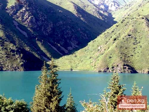
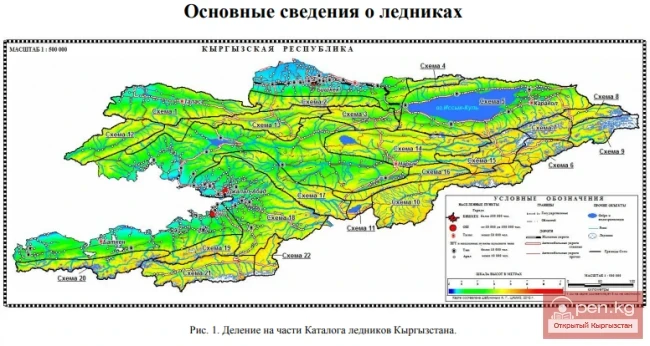
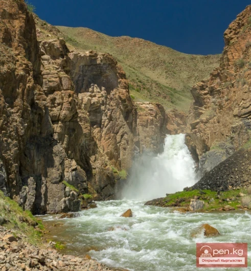
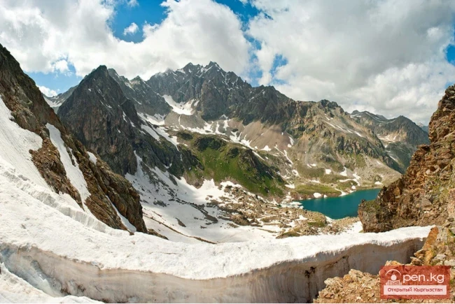
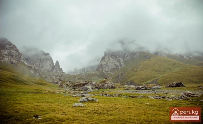
In the territory of Kyrgyzstan, there are 750 lakes, reservoirs, and small ponds with a total area of 6836 km², which accounts for 3.4% of the territory of the republic. Among them, 16 lakes and 11 reservoirs each have an area of more than 1 km². Many lakes are small, with a surface area of 0.02—0.2 km². Predominantly, the lakes are located in the high mountain zone, at the ends of glaciers, at altitudes of 3000—4000 m.

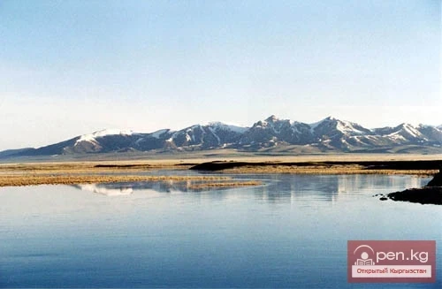
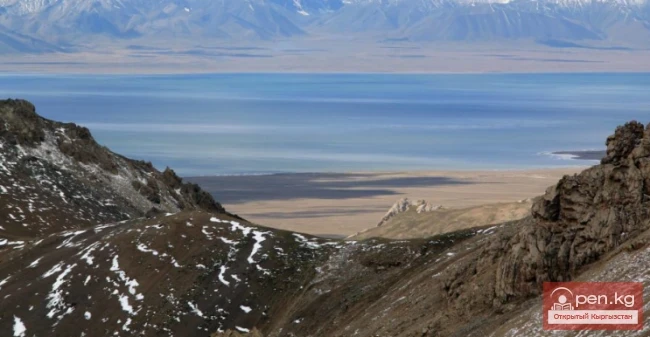
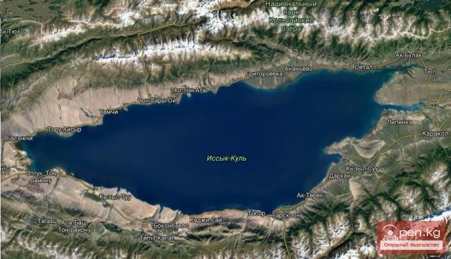
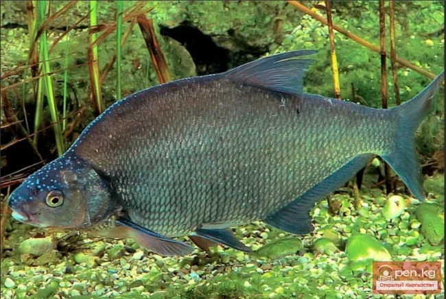
The largest lake in Kyrgyzstan is Issyk-Kul. It is one of the largest mountain lakes in the world. It is located in a tectonic depression between the Teskey Ala-Too and Kungey Ala-Too ranges. The absolute height of the water level is 1607 m, the surface area is 6236 km², maximum depth is 668 m, average depth is 278.4 m, length of the lake is 178 km, maximum width is 60 km, average width is 35 km, water volume is 1738 km³, and the length of the shoreline is 688 km. From the mid-19th century to the end of the 20th century (1856 — 2000), the water level in the lake dropped by 8.5 m. In the late 1980s, some stabilization was observed in its rise (from 3 cm to 13 cm). Issyk-Kul is a non-freezing lake and, in terms of thermal regime, belongs to the subtropical type, although it is located in a temperate zone and at a significant altitude above sea level. The annual temperature fluctuation is within positive values (from 20 to 4°C). The water mineralization is 5.97‰ or grams per liter. Currently, about 30 rivers feed their waters into the lake year-round. A significant portion of the water balance comes from atmospheric precipitation. A small amount of water is supplied underground. In the outflow part of the water balance, evaporation plays an exceptional role. Part of the river runoff is used for irrigation, but return waters still flow into the lake basin in one way or another. Currently, 22 species of fish inhabit Issyk-Kul, of which 10 were introduced from other water bodies, and 12 are indigenous. The introduced and acclimatized species, developing in the lake, have negatively affected the local species. Issyk-Kul is one of the largest water bodies in Eurasia, where many species (and in large numbers) of waterfowl winter. In the summer, the lake is exceptionally favorable for recreation.

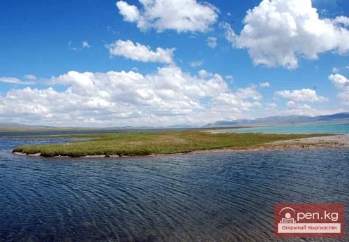
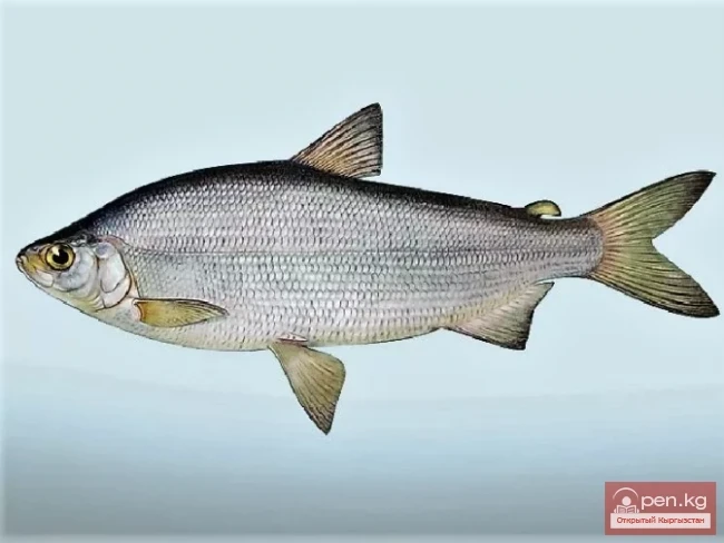
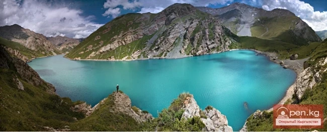
The second largest lake by surface area is Son-Kul, located in the intermountain depression between the Moldo-Too, Sonköl-Too, and Boor-Alba ranges. The water level is 3016 m above sea level. The surface area is 270 km², the maximum depth is 22 m (officially accepted as 15.1 m), the average depth is 9.2 m, the length of the lake is 29 km, the maximum width is 18 km, the average width is 9.6 km, the water volume is 2.64 km³, and the length of the shoreline is 96 km. The water in Son-Kul is fresh, and the lake is outflowing — it drains into the Kajyrty River. In the basin of Son-Kul, 18 rivers and streams flow into the lake. The water mineralization is 0.3—0.4 g/l. The level is stable. It freezes in late October — early November and opens in late April. The amplitude of temperature fluctuations ranges from 0°C to 12°C. In terms of thermal regime, Son-Kul belongs to lakes of the temperate zone. During the warm season, migratory waterfowl (66 species) arrive here. Notably, Son-Kul is a nesting site for the Indian goose. By nature, Son-Kul is a fishless lake. However, over the last 30—35 years, species such as vendace, grayling, and the indigenous fish of Issyk-Kul, the naked osman (kök-chaar), have been acclimatized here.

The third largest lake by surface area is Chatyr-Kul, located between the At-Bashy and Torugart-Too ranges, in the western Ak-Sai valley. The water level is 3520 m above sea level. The area of the lake is 161.1 km², the maximum depth is 19 m, and the prevailing depths are 2—3 m. The length of the lake is 22.8 km, the maximum width is 10.5 km, the average width is 7.4 m, the water volume is 0.85 km³, and the length of the shoreline is 58.5 km. The watershed area is 1050 km². A significant water flow, the Kök-Ayghyr, and 23 other small rivers and streams flow into the lake. This is a closed lake, but the water mineralization is close to fresh (2 g/l). Over the last 100 years, the lake level has dropped by almost 4 m. From October to April, it is frozen, with ice thickness reaching 1.5 m in severe winters. The ichthyofauna consists of small aquatic organisms; there are no fish. During the summer, migratory waterfowl arrive.

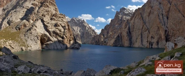
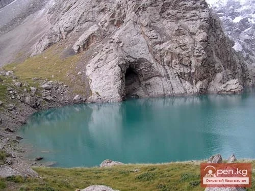
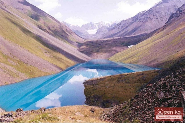
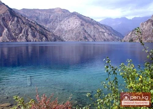
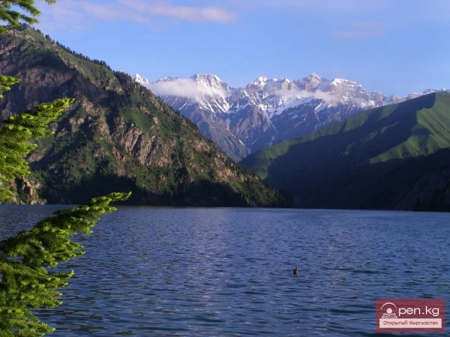
Sary-Chelek is one of the most beautiful lakes in Kyrgyzstan, of landslide origin. It is located in the basin of the Koozh-Ata River, on the southeastern slope of the Chatkal range. The water level is 1878 m above sea level. The surface area is 4.92 km², the length of the lake is 7.5 km, the maximum width is 2280 m, and the average width is 650 m. The maximum depth is 234 m, and the average depth is 98 m. According to researchers, the lake basin was formed as a result of a mountain collapse about 10,000 years ago. The collapse blocked the valley of the Sary-Chelek River, above which a significant amount of water accumulated. The Toskoool River flows out from under the dam. The shoreline is quite complex, jagged, and steep. The water level has seasonal fluctuations — it reaches its maximum in May and its minimum in December. It freezes at the end of December and opens in April. In summer, the water temperature reaches 19.8°C, while in winter it fluctuates from 4°C to 0°C. The waters are weakly mineralized, reaching 200—500 mg/l. Fish species present include: marinka, carp, and other species. Beautiful landscapes with tree vegetation surround the lake. It is rich in recreational resources. A specially protected area has been organized — a biosphere reserve of global significance.

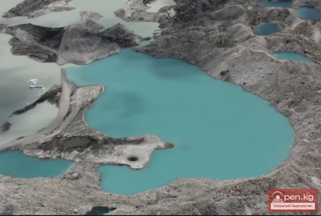
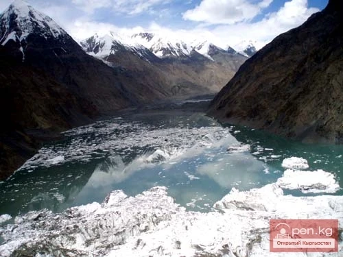
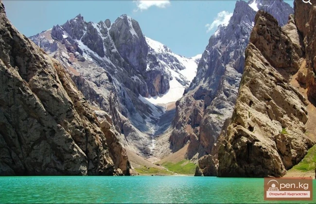
Among the lakes whose origin is related to glaciers, Lake Merzbacher is interesting for its regime, located between the South and North Enilchek glaciers. The lake basin consists of ice, is filled annually with meltwater from the glaciers, and each year at the end of summer, it breaks out under the South Enilchek glacier, creating a flood in the Enilchek River that exceeds the average annual water discharge by 10 times.

It fills up until the summer of the following year, reaching its previous level. Breakouts lasting 5—6 days occur in August, sometimes also in September. The water level of the lake is at an altitude of 3304 m, with a length of about 4 km, a width of 1 km, and a surface area of 4.5 km². These data change over time, depending on the condition of the glaciers.