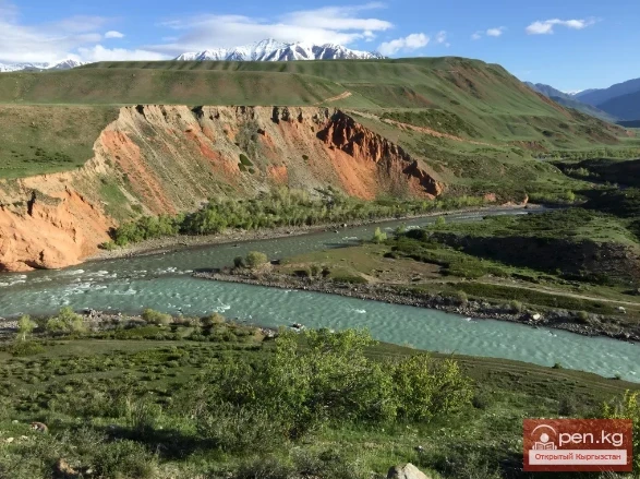
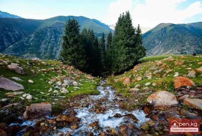
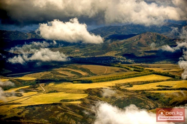
The territory of Kyrgyzstan is predominantly mountainous, with peaks almost everywhere reaching the climatic line, and in most mountain ranges, the ridge zone is covered with temporary glaciation. An important place in the natural resources of Kyrgyzstan is occupied by the potential resources of glaciers, as a source of the purest fresh water and one of the main sources of river feeding. The total water reserves stored in glaciers are estimated at 650 km³. By these indicators, Kyrgyzstan can be compared to the Gorno-Badakhshan Autonomous Region of Tajikistan. Glacial water is a renewable resource; the ice reserves that melt in summer are replenished by atmospheric precipitation falling on them in solid form.
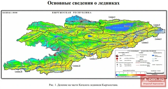
In Kyrgyzstan, 6,516 glaciers larger than 0.1 km² have been registered. Their total area is 8,047.8 km², which is 4% of the territory of Kyrgyzstan. If we also consider small glaciers with an area of less than 0.1 km², the number of glaciers reaches 7,633, and their area increases to 81,077 km². The sizes of glaciation and the spatial position of glaciers and glacial areas are determined by a combination of natural factors, the leading ones being the absolute heights of mountain ranges, their position relative to the directions of humid air masses, and the total winter atmospheric precipitation. For example, on the southwestern slope of the Fergana Range, more than 1,000 mm of precipitation falls, including in the form of snow. However, due to insufficient moisture, glaciation is poorly developed, while in the area of the Ak-Shiyrak massif, precipitation is four times less, but powerful glaciation is developed. The main centers of glaciation are located in mountain knots and in latitudinally oriented ridges, whose absolute heights exceed 4,500—5,000 m.
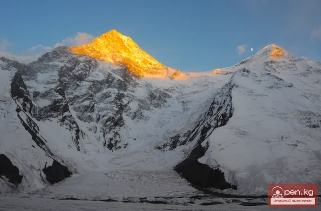
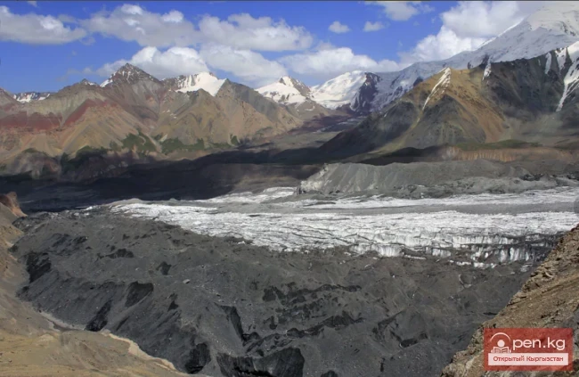
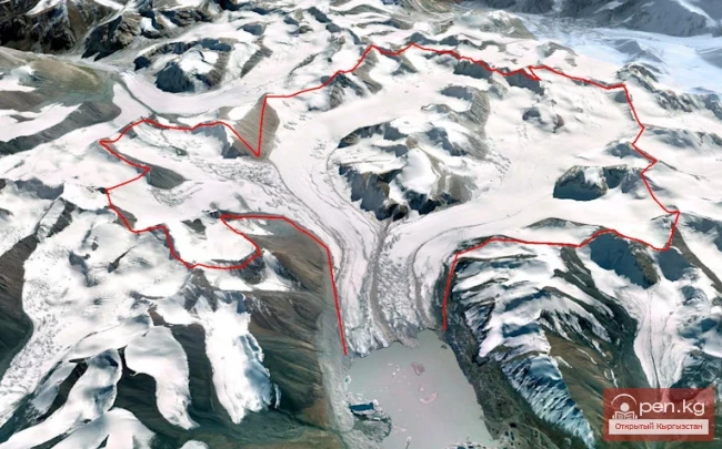
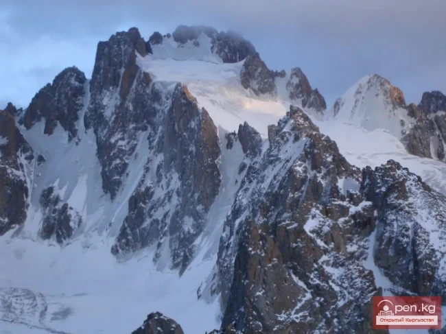
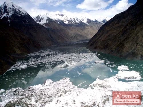
The largest area of modern glaciation is found in the region of the Khan-Tengri and Pobeda peaks in the basin of the Sary-Jaz River. This is a unique glacial area where individual glaciers reach gigantic sizes. In this area, there are 340 independent glaciers with a total area of 1,581 km². Among them is the Southern Enilchek Glacier, which is part of the largest mountain glaciers in the world. Its length is 589 km, area 613.2 km², and the end of its tongue descends to an altitude of 2,880 m. Nearby is the Northern Enilchek Glacier, which is 328 km long and has an area of 216.2 km². Its tongue descends to an altitude of 3,400 m and ends at Lake Merzbacher. In addition, there are several glaciers longer than 20 km (Semyonov, Mushketov, Kainy, etc.). The second largest area of modern glaciation is the northern slope of the Chon-Alai Range. The absolute heights of the ridge in the central part reach 7,139 m (Lenin Peak), and the average height of the section of the ridge within the territory of Kyrgyzstan is about 6,000 m. Its northern slope is completely covered with snow and firn. The total area of modern glaciation on the northern slope of the Chon-Alai Range is 1,329.3 km², of which 697.5 km² is located on the territory of Kyrgyzstan.

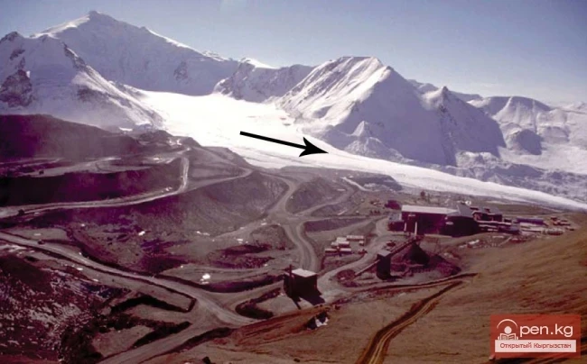
On a small territory of the Ak-Shiyrak mountain massif, glaciers and snow cover are present, belonging to two major river basins of Kyrgyzstan — the Sary-Jaz River and the Naryn River. In an area of 30 x 40 km, glaciers cover 435 km², which constitutes 44% of the area. The total number of glaciers is 154. The largest is the Petrov Glacier, which is the source of the Kum-Tör River, with a length of 14 km and an area of 70.6 km².
One of the glacial areas of Kyrgyzstan is the northern slope of the Kakshaal-Too range, stretching from the canyon of the Sary-Jaz River in the east to the canyon of the Kakshaal River (Ak-Sai). This section contains about 600 glaciers with a total area of 90.76 km². The glaciation is particularly strong in the 70 km section covering the basins of the Chon-Uzyongku-Kuush and Mydyryum rivers. Here rises the Danakov Peak (5,982 m), around which large glaciers with a total area of 443 km² are concentrated (Ak-Sai, Ai-Talaa, Otto-Tash). This area is sometimes referred to as the Ak-Sai glacial knot. The second largest glacial knot on the northern slope of Kakshaal-Too is the basin of the Jangart River, located west of the Sary-Jaz gorge. Here, about 400 glaciers with a total area of 393.5 km² are concentrated.
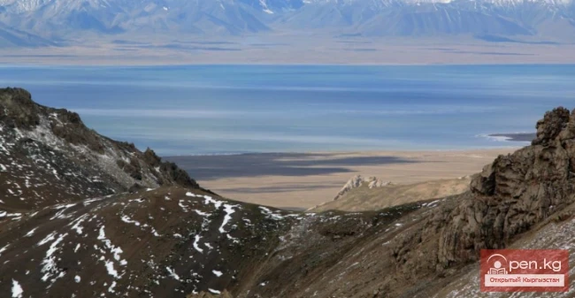
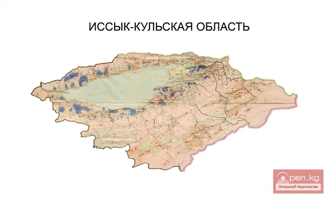
In the basin of Lake Issyk-Kul, glaciers are located on the southern slope of the Kungey Ala-Too and on the northern slope of the Teskey Ala-Too. There are 159 glaciers on Kungey Ala-Too with an area of 140.3 km². Small glaciers (up to 1 km²) predominate, located in the upper reaches of the valleys, isolated from each other. Most of the glaciers are in the basin of the Chon-Ak-Suu River (52 glaciers with a total area of 65.6 km²). The largest glacier, which bears the same name, has an area of 8.1 km² and a length of 6.1 km. On the northern slope of the Teskey Ala-Too, there are 675 glaciers with an area of 510.1 km². Of these, 14 glaciers have an area of more than 5 km², while the remaining glaciers are smaller — over 70% have an area from 0.1 to 0.5 km². The largest glacier, Konurolyon (length 5.8 km, area 11 km²), is located in the basin of the Ak-Terek River. The Kara-Batkaк glacier (length 3.5 km, area 4.5 km²) is the most studied, with continuous observations conducted by scientists from the Tenir-Toos Physical Geography Station of the National Academy of Sciences of Kyrgyzstan for about fifty years.

On the northern slope of the Talas Ala-Too, there are 202 glaciers with an area of 120.7 km², and on the southern slope within the territory of the Kyrgyz Republic, there are another 62 glaciers with an area of 10.8 km². The glaciation is dispersed. Small cirque and hanging glaciers predominate, with the largest being the Glacier Around the World (length 3.6 km, area 6.8 km²), located in the basin of the Ur-Maaral River.
Among the peripheral ranges, the Kyrgyz Ala-Too has significant glaciation. In its central part, along the meridian of Bishkek, its ridge zone is completely covered with snow and ice. To the east of the Issyk-Ata basin and west of the Sokuluk basin, the glaciers are characterized as isolated centers. In these directions, the sizes of glaciers decrease. The Kyrgyz Ala-Too has 607 glaciers with an area of 530.4 km², of which almost 80% of the total number of local glaciers and 90% of the total area of glaciation are concentrated on the northern slope of the ridge. Most of the glaciers are located in the basins of the Sokuluk, Ala-Archa, Alamudun, and Issyk-Ata rivers, where the largest glaciers (over 5 km²) are also found. The largest glacier, Golubina (length 5.5 km, area 9.4 km²), is located in the basin of the Ala-Archa River.
In the Internal Tenir-Too, between the Teskey Ala-Too to the north and the Kakshaal-Too to the south, and between the Ak-Shiyrak massif to the east and the Fergana Range to the west, there are several ridges that carry dispersed glacial areas in their ridge zone. These are the Borcoldoy (250.3 km²), At-Bashy (106.2 km²), Zhanı-Zher (59 km²), Zhetim-Bel (71.5 km²), Zhetim (136.6 km²), Nura (25.8 km²), and Naryn-Too (69.4 km²) ridges.
Among the ridges surrounding the Fergana Valley, the most powerful glaciation is developed on the Alai Range, where 1,360 glaciers with an area of 956.3 km² are concentrated. A number of them on the southern slope belong to the territory of Tajikistan. More than 80% of them are located on the territory of Kyrgyzstan (1,088 glaciers with an area of 816.2 km²). Of the total number of glaciers, 37% have an area from 0.1 km² to 1 km², 40% up to 5 km², and four glaciers have areas of more than 10 km². The largest, Abramov Glacier (length 9 km, area 25.2 km²), is located on the southern slope at the foot of the main ridge in the basin of the Kök-Suu River at the confluence of the Kyzyl-Suu River (the basin of the Amu-Darya River).

The western continuation of the Alai Range is the Turkestan Range, where significant glaciation is also developed. On its northern slope, there are 306 glaciers with an area of 299 km². More than half of them are glaciers smaller than 1 km². Large glaciers and the main areas of glaciation are concentrated in the basins of the Sokh and Isfara rivers. Here, 4 glaciers have sizes of more than 10 km² (Temingen, Shurovsky, etc.).
The average height of the Fergana Range in the western part is 3,300—3,500 m, increasing to the east, reaching 4,500—4,800 m in the area of the junction with the Alai Range. Despite the large amount of atmospheric precipitation (up to 2,000 mm), there are no glaciers in the western part. Glaciers are concentrated in the eastern part of the ridge. Here, there are a total of 383 glaciers with an area of 195.8 km². The glaciers are small, with 83% of all glaciers being less than 0.5 km². The main areas of glaciers are in the basins of the Tar River (source of the Kara-Darya) and Alabuga (left tributary of the Naryn). Most glaciers are of the hanging and cirque type. The length of the largest glacier is 5.4 km, and the area is 7.4 km².
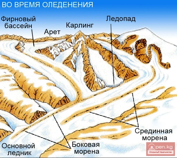
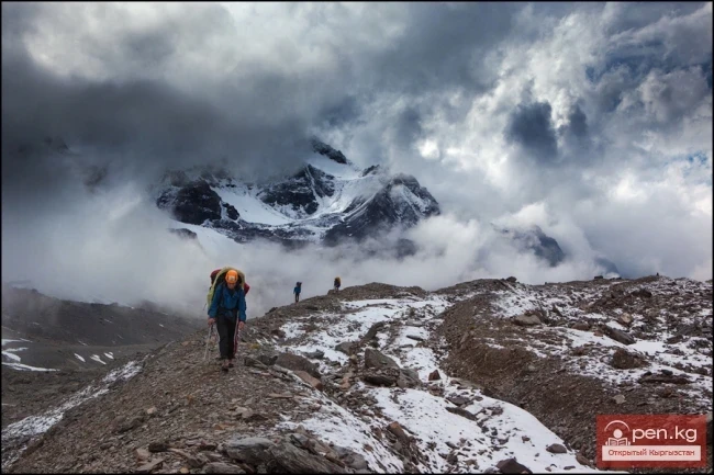
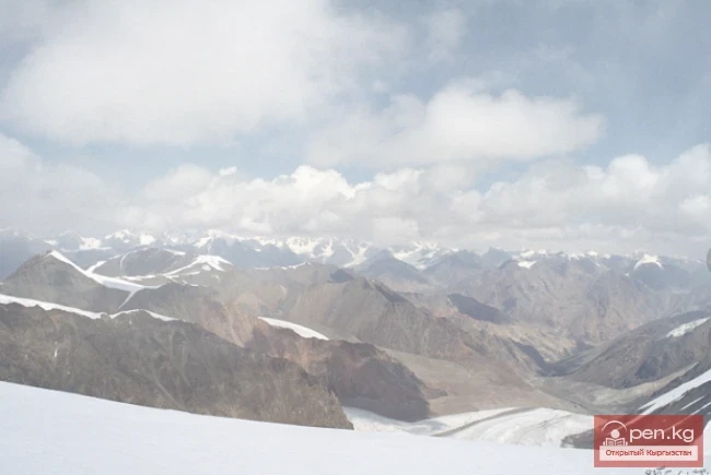
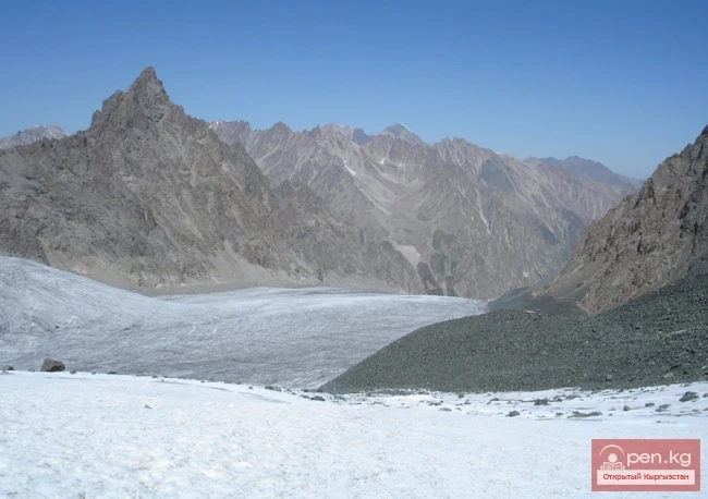
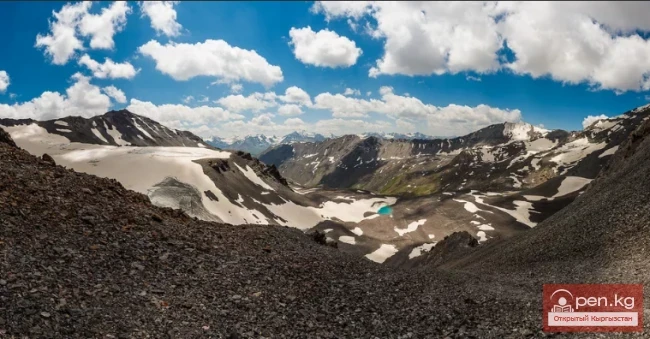
In Tenir-Too, glaciers of all morphological types characteristic of mountain glaciation (from hanging and cirque to giant dendritic) are found. A distinctive feature of the glaciation of Tenir-Too is the presence of glaciers with flat tops, located on highly elevated remnants of ancient denudation surfaces. The main mass consists of small glaciers, which occupy 80% of all glaciers in number. However, in the glacial knots, in the most elevated parts of the ridges and intermountain valleys, valley, complex-valley, and cartesian types of glaciers are developed, where the main mass of ice is concentrated. They receive additional nourishment from snow transport, avalanches, and meltwater from sunny slopes.
A very important indicator is the range of glaciation, i.e., areas located above the snow line. On the peripheral ridges, the snow line passes at altitudes of 3,300—3,400 m. In the internal ridges, they rise to heights of 4,400—4,600 m. In the territory of Kyrgyzstan, there is a pattern of increasing snow line from the northwest to the southeast. Depending on the hydrometric conditions of a specific year, the heights of the snow line are subject to fluctuations.
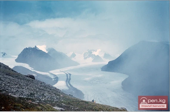
The movement of glaciers depends on the size of the specific glacier, feeding conditions, and the slope of the terrain. Daily movements of valley glaciers in the lower part are about 2 cm, and closer to the firn line — 3—3.5 cm. Annual movement ranges from 5—7 m to 11—12 m.

For the glaciers of Kyrgyzstan, a retreat trend has been characteristic since the mid-19th century. This trend has particularly increased at the end of the 20th century. Almost every glacier has retreated by 800—1,000 m from its previous positions over these 120—150 years. This is evident in those glaciers where long-term observations of the spatial position have been conducted (Kara-Batkaк, Abramov, Ak-Sai, etc.). Some glaciers, against the backdrop of general retreats, show a tendency for sharp advance (Mushketov, Kainy, etc.), while others remain unchanged (Southern Enilchek). In 1956—57, the Mushketov Glacier in the upper reaches of Sary-Jaz advanced by 2.5 km, then entered a long phase of retreat. Similar processes occurred on the glaciers Kainy, Northern Kara-Sai, Bordu, Chomoy, Abramov, etc.
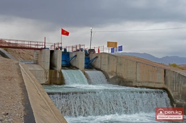
Meltwater from glaciers accounts for almost 30—35% of the feeding of several rivers in Kyrgyzstan. They especially abundantly nourish rivers in the summer when agricultural fields most need water for irrigation.