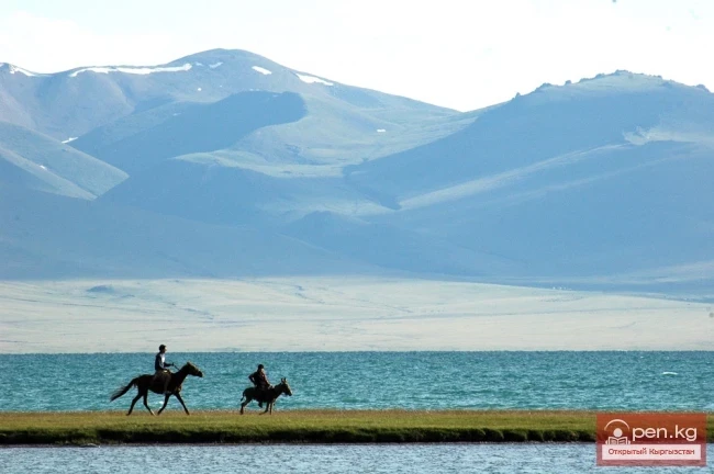
CHARACTERISTICS OF GLACIERS IN RIVER BASINS
To provide a complete understanding of the glaciation in the upper reaches of the Sarydzhaz River, we present brief characteristics of glaciation in the basins of its tributary rivers.
Basin of the Otyuka River (glaciers No. 1 — 18).
In the basin of the Otyuka River, the westernmost on the southern slope of the Terskey-Alatau range, there are 18 glaciers with a total area of 9.4 km². Most of the glaciers are concentrated in the western part of the basin, where the main watershed ridge reaches heights of 4300—4400 m. They are represented by valley and cirque-valley types. In the eastern part of the basin, where the Terskey-Alatau range gradually descends and its heights do not exceed 4200 m, small hanging glaciers prevail, with areas not exceeding 0.3 km². The basin is characterized by numerous small glaciers and snowfields with an area of less than 0.1 km², mainly located in the basins of the Mamuntor, Chonashu, and Kichine-Burkut rivers. The ridge-like arrangement of glaciers, the northwestern orientation favorable to prevailing winds, and a relatively high amount of precipitation (600—700 mm) all contribute to the existence of small glaciers here. The basin has a relatively high glacier coefficient (2.1),

Basin of the Kensu River (glaciers M 19—21).
At the sources of the Kensu River, there are only three small glaciers with a total area of 0.7 km². The flat-topped nature of the ridge zone of the Terskey-Alatau range, with elevations not exceeding 4300 m, does not favor the development of large glaciers. The latter are located in wind shadow areas and are fed by snow drift.

Basin of the Kashkatora River (glacier No. 22).
In the upper reaches of the Kashkatora River, there is only one cirque-valley glacier with an area of 0.3 km². The basin is characterized by a series of empty cirques, where three small glaciers and minor snowfields are sheltered in shaded areas.
Between the basins of the Kashkatora and Ashutora rivers lies a small valley glacier No. 23. It is a smaller part of another valley glacier that descends through a transverse valley cutting through the Terskey-Alatau range towards Kazakhstan and is the source of the Tuyukash River (Tekes River).

Basin of the Ashutora River (glaciers No. 24—37).
In this basin, there are 14 glaciers with a total area of 14.1 km².
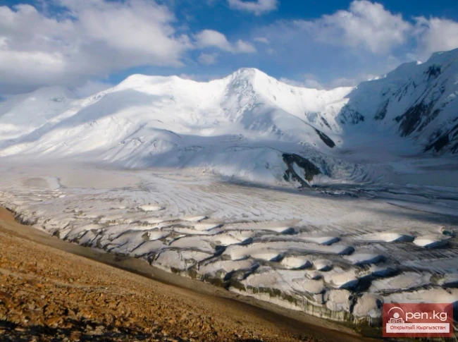
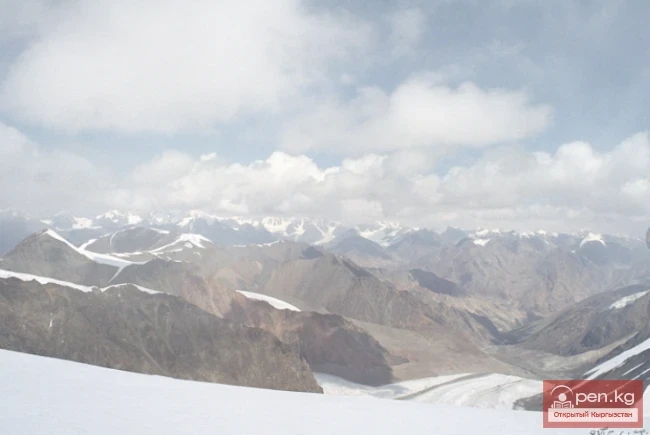
The dissection of the Terskey-Alatau range within the basin, due to the increase in absolute and relative heights, is significant, which determines the diversity of morphological types of glaciers. The largest are the valley-type glaciers — Keydelya (3.6 km²), Tynay (2.3 km²), and Baigazy (4.4 km²), which account for 75% of the total glaciated area of the basin. Cirque glaciers are small in size, located in deep cirques with southern and southwestern exposures. They occupy only the inner part of the cirques and are surrounded by bare slopes. Their nourishment occurs either through direct accumulation of snow on the glacier surface or through snow drift. They do not have slope-fed nourishment. The ridge areas are characterized by small snowfields and hanging-type glaciers, which are located on both the windward western and leeward eastern sides. To the west of the basin, there is a typical flat-topped glacier No. 24 for leveled watersheds (Fig. 8).

Basin of the upper reaches of the Sarydzhaz River (glaciers No. 38—81).
This basin includes the glaciers of the actual sources of the Sarydzhaz River and the glaciers on the northern slope of the Aydyrtor range, excluding its westernmost section — the basin of the Turegeldynsaya River.
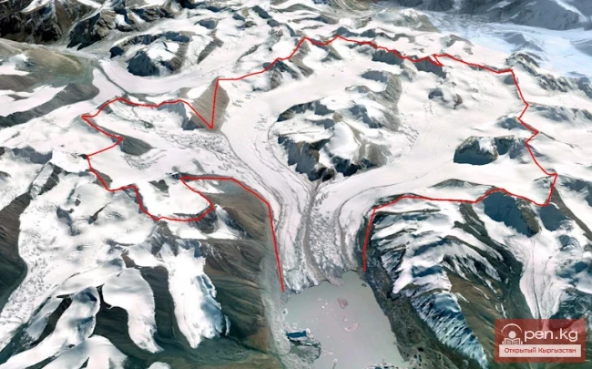
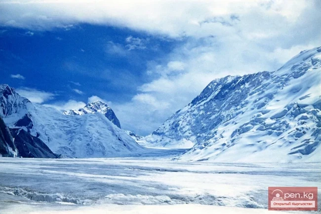
In the basin, there are 44 glaciers with a total area of 118.5 km². Of these, 64.1 km² belongs to the Semenov Glacier system, which originates on the northwestern slopes of the Semenov Peak, at the junction of the Terskey-Alatau and Sarydzhaz ranges.

The significant length of the Semenov Glacier (over 20 km) makes it one of the largest glaciers not only in the Tien Shan but also in the USSR. The main area of firn lies on the northern slopes of the Sarydzhaz range, from the foot to the very ridge, covered with firn and snow. Avalanches also play a significant role in the nourishment of the glacier and its tributaries.
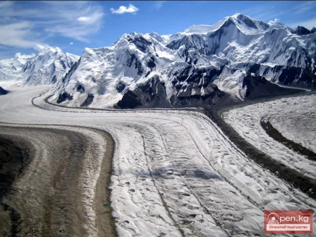
From the right, two tributaries (glaciers No. 45, 46) with a total area of 5.3 km² flow into the Semenov Glacier from the slopes of the Terskey-Alatau. The main mass of ice comes from five left tributaries (glaciers No. 47, 49, 51, 53, 55). They flow down from the Aydyrtor range and, merging with the main glacier, form morainic ridges on its surface (Fig. 9). The left tributaries are quite large, with lengths reaching 3—4 km. One of the features of the Semenov Glacier was considered to be the presence of a 5—6-kilometer "dead zone" in its terminus.

However, using the method of velocity cross-sections, it was established that the ice in the dead zone moves at a speed of 4—5 cm per day, so it cannot be considered "dead." Another characteristic feature of the Semenov Glacier, like some other large glaciers of the Tien Shan, is its peculiar surface structure; smooth areas alternate with areas of "pockmarked" relief — surfaces with numerous depressions resembling karst formations.
The depressions are asymmetrical and are mainly located along lines of maximum ice movement speed.
The diameter of individual depressions is 30—50 m. In some of them, meltwater accumulates, forming numerous lakes.
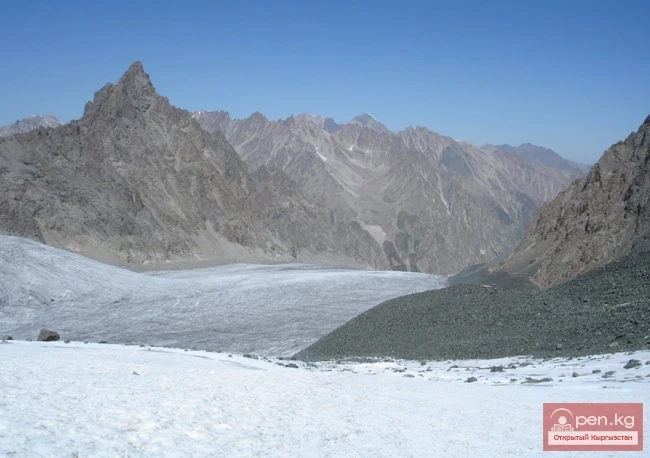
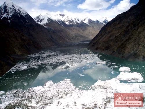
The western part of the northern slope of the Aydyrtor range is characterized by large valley and cirque-valley glaciers, as well as hanging valley glaciers (No. 61—81).

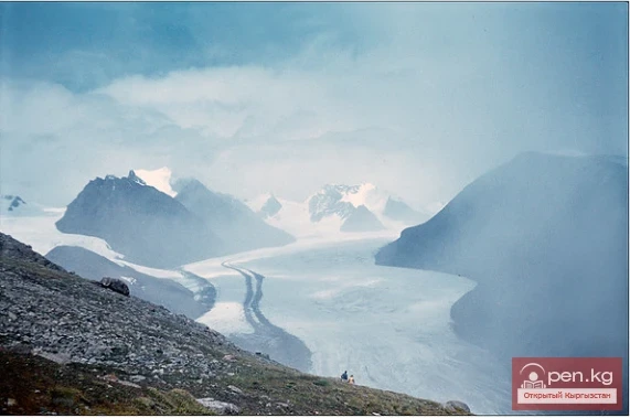
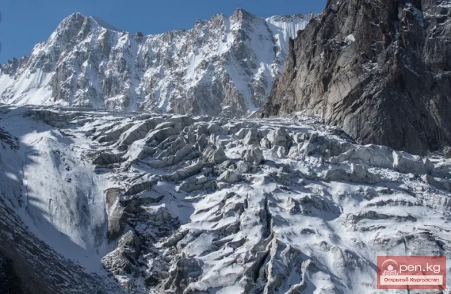
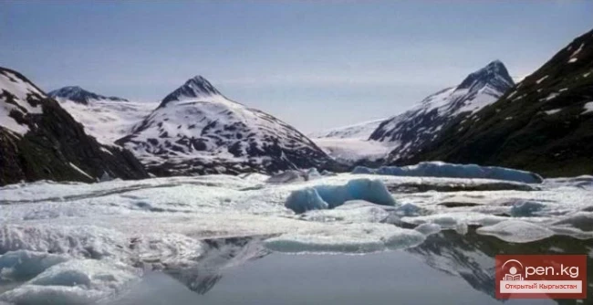
They are located in well-developed spacious valleys and, unlike the glaciers in the eastern part of the range, do not form large icefalls and steep firn slopes. They are characterized by a gradual transition from a bowl-shaped firn basin to a calm surface of the glacier body (Fig. 10). The surfaces of the glaciers are relatively clean or slightly contaminated with fine earth. Only lateral moraines are well developed, often containing cores of dead buried ice. There are usually no terminal morainic ridges, and extensive sandur fields extend below the ends of the glaciers (Fig. 11).

Almost all glaciers have northern exposures.
Basin of the Turegeldynsaya River (glaciers M 82—85).
In the basin of the Turegeldynsaya River (northern slope of the Aydyrtor range), there are four glaciers with a total area of 4.3 km². The basin is open to the northwest, facing moisture-bearing winds. Its distinctive feature is that the height of the firn line (3870 m) is the lowest for the entire basin of the upper reaches of the Sarydzhaz River.
Basin of the Aydyrtor River (glaciers No. 88—110).
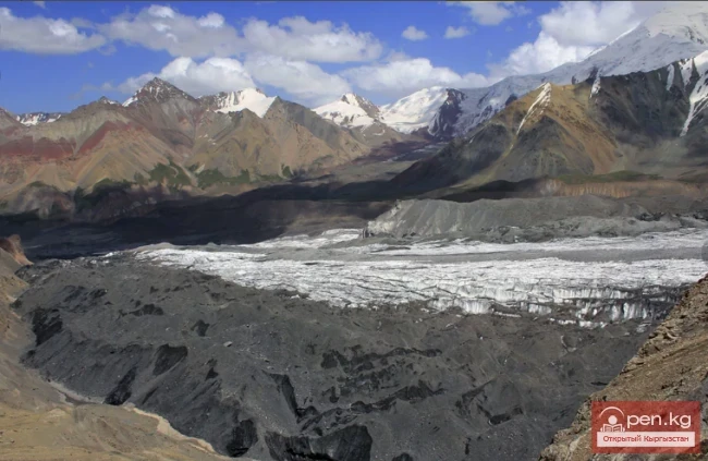
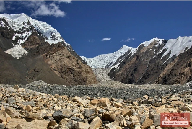
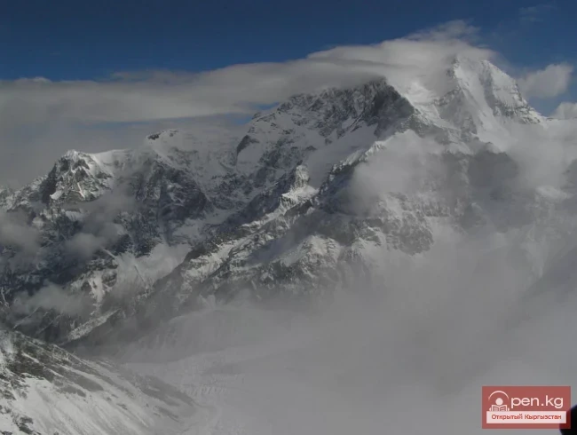
At the sources of the Aydyrtor River lies the largest glacier in the basin of the upper reaches of the Sarydzhaz River — the Mushketov Glacier, with an area of about 70 km², including its tributaries. Unlike the Semenov Glacier, it has asymmetry in nourishment: all seven tributaries flow down from the northern slope of the Sarydzhaz range. The southern slope of the Aydyrtor range within the glacier basin

Mushketov has no glaciers at all (Fig. 12). The firn area of the glacier is located in a huge cirque with steep and high one-and-a-half-kilometer walls at the junction of the Aydyrtor and Sarydzhaz ranges. Despite the slight slope (5—6°), the Mushketov Glacier, like the Semenov Glacier, has an uneven bumpy surface, intersected by numerous crevasses. The system of surface moraines is clearly expressed only in the upper part of the glacier; in the lower part, this clarity is lost due to the recent advance of the glacier. The Mushketov Glacier belongs to the type of pulsating glaciers, characterized by catastrophic movements. The left edge of the glacier is slightly higher than the right, resulting in the lowest tributary (glacier No. 100) not smoothly merging into the body of the glacier but rather hitting its edge and effectively not participating in nourishment. The glacier and its tributaries receive most of their nourishment from avalanches. The tributaries are broken by numerous firn falls and icefalls and steeply descend to the main glacier. The terminus of the Mushketov Glacier ends at an altitude of 3440 m and has no terminal morainic ridge.

Other valley and cirque-valley glaciers of the left tributaries of the Aydyrtor River up to its confluence with the Achektashsu River have similar nourishment characteristics and morphology. Numerous small forms of glaciation — hanging and cirque glaciers (Fig. 13).

On the southern slope of the Aydyrtor range within the basin, in the ridge zone at elevations above 4000 m, there are five cirque glaciers (No. 88—92) with a total area of 1.8 km². The tongues of the glaciers are reserved, allowing them to descend to an altitude of 3760 m, i.e., much lower than similar glaciers on the southern slope of the Terskey-Alatau range, although nourishment occurs in the same way as the latter, through direct precipitation on the glacier surface and snow drift from the northwestern and northern slopes.
Basin of the Achektashsu River (glaciers 111 — 119)
In the basin of the Achektashsu River, which flows into the Aydyrtor River, there are nine glaciers with a total area of 27.9 km².
The main background of glaciation consists of relatively large valley-type glaciers, reaching lengths of 5—7 km (Fig. 14). The glaciers descending from the slopes of the Sarydzhaz range resemble the glaciers in the upper reaches of the Aydyrtor River, while the glaciers located in the foothills of the range are similar to the valley glaciers on the northern slope of the Aydyrtor range.

At the sources of the Achektashsu River, there is a large valley glacier. One of its flows is directed into the valley of the Achektashsu River, and the other — into the adjacent valley of the Tyuz. The boundaries of the basins are so leveled that the ice divide between the ice flows can only be determined conditionally. On the slopes of the valley, both on the windward and leeward sides, there are a number of hanging glaciers, sometimes with areas exceeding 1 km².
Basin of the Kashkatora River (glaciers No. 124—126).
The basin is located in the foothills of the Sarydzhaz range. In its upper reaches, three valley glaciers with a total area of 6.9 km² are arranged in a fan shape. The westernmost of them (glacier No. 126) has a reserved terminus. The glaciers are characterized by a relatively low firn line (3960 m) for the basin as a whole, have steep firn fields, and exhibit significant transporting activity. The entire valley of the Kashkatora River is covered with morainic ridges.

Basin of the Kuzguna River (glaciers No. 127—131)
The Kuzguna River basin is characterized by small forms of glaciation, although the glaciers have extensive firn basins. However, the insignificant height of the foothills of the Sarydzhaz range does not favor the development of large valley glaciers here. The small valley glaciers and even smaller hanging glaciers in the basin have a significant glacier coefficient of 1.9.
Basin of the Tyuz River (glaciers No. 132—161).
In the basin of the Tyuz River, the second largest river after the Aydyrtor River, there are 30 glaciers with a total area of 27.0 km². In terms of glaciation characteristics, the basin can be divided into eastern and western parts. The eastern part is an area of extensive glaciation with large valley glaciers possessing powerful firn basins; the western part, located along the foothills of the Sarydzhaz range, is characterized by an abundance of small forms of glaciation, among which small cirque and hanging glaciers predominate.
The main area of glaciation (19.0 km²) consists of large glaciers located in the upper reaches of the main valley and its tributaries. Around the periphery of the basin, on the slopes of the large valleys, there are numerous cirque-hanging and hanging-type glaciers, which account for 70% of the total number of glaciers and only 29.6% of the total glaciated area of the basin. Among them, cirque-hanging glaciers, which have become widespread in the basin, account for 50% of all glaciers. The various absolute and relative heights, different exposures, diversity of morphological types of glaciers, and significant length of the basin all contribute to a wide range of firn line elevations. It ranges from 3950 m for valley glaciers with northern exposure to 4250 m for cirque glaciers with southern exposure.

Basin of the Koiulghusu River (glaciers No. 162—169).
The Koiulghusu River flows directly into the Tyuz River near its mouth.
The significant length of the basin, its isolation, and the characteristics of glaciation allow for an independent characterization of the basin.
In the upper reaches of the valley, there is a large valley glacier No. 165 with an area of 4.7 km², around which are cirque and hanging glaciers, mainly nourished by snow drift.
Basin of the Korumdu River (glaciers No. 170—181).
The Korumdu River is a tributary of the Sarydzhaz River and in its upper reaches divides into two branches: Chon-Korumdu and Kichine-Korumdu. In the basin of the Kichine-Korumdu River, there are only five glaciers. However, the area of glaciation here is larger than in the basin of the Chon-Korumdu River, amounting to 12.1 km². Of these, 9.9 km² belongs to the valley glacier No. 180, which occupies a vast cirque with a multi-kilometer firn area (Fig. 15).

Basin of the Bel-Karasu River (glaciers No. 182—183).
In the upper reaches of the small valley of the Bel-Karasu River, located in the foothills of the Sarydzhaz range, there are only two glaciers with a total area of 0.8 km². One of them (glacier No. 182) has an extensive firn basin and flows into the valley as a small narrow tongue. On the northeastern slope, a small hanging glacier No. 183 is attached.
Basin of the Shiluna River (glaciers No. 184—192).
The valley of the Shiluna River is open to the northwest and is bounded by low, flat-topped foothills. The ridge zone of the Sarydzhaz range in this area resembles the eastern part of the Aydyrtor range; high, steep slopes with individual peaks. In the valley of the Shiluna River, there are small glaciers predominantly of valley type with extensive firn fields. On the leveled watershed section, there is a flat-topped glacier No. 180. The height of the firn line in the basin is about 4000 m.

Basin of the Karagayte River (glaciers No. 193—198).
In this small valley, oriented to the north, there are six glaciers with a total area of 6.8 km². The upper reaches of the valley are closed by a huge cirque, in which three valley glaciers, separated from each other by low rocky ridges, are located, descending down narrow tongues.
As they exit the valleys, the tongues of the glaciers merge into one powerful reserved tongue. The firn line in the basin lies at an altitude of 3900 m.
Basin of the Mukachi River (glaciers No. 199—201). In the small area of the Mukachi River basin, there are three glaciers with a total area of 3.7 km². In the center of the narrow valley lies glacier No. 200 with a half-reserved tongue.
The reservation of glacier tongues in the western part of the Sarydzhaz range is one of the most characteristic features of glaciation.
In the ridge part of the spur that separates the basins of the Mukachi and Tyuz rivers, there are two small glaciers No. 202 and 203 with a total area of 0.6 km². The streams flowing from them flow directly into the Sarydzhaz River.

Basin of the Tyuz River (glaciers No. 204—210).
The valley of the Tyuz River is the last major valley on the western side of the Sarydzhaz range. Here, there are seven glaciers, four of which are cirque-valley glaciers located in a chain along the axial ridge. In this basin, the characteristic of the reserved tongues of glaciers is particularly pronounced. Sometimes the entire tongue of the glacier represents a stone glacier flowing from the cirque. As it descends into the main valley, the "stone" tongues block it, creating the impression of a series of terminal morainic ridges of a degrading valley glacier. Glacial ice in its pure form has only been preserved within the cirques themselves. The surface of the glaciers is characterized by high contamination. In the ridge part of the range, on steep slopes, there are small hanging glaciers.
Basin of the Taldybula River (glaciers No. 211—212).
In the basin of the Taldybula River, the ridge part of the Sarydzhaz range does not exceed 4500 m. The ridge is narrow and rocky.
Shallow cirques are free of ice. There are only two hanging-type glaciers in the basin, sheltered in the ridge zone. They are oriented to the northwest, with a total area of 0.4 km².
Rivers of Kyrgyzstan