Mushketov Glacier

admin Glaciers
VK X OK WhatsApp Telegram
Mushketov Glacier

Mushketov Glacier


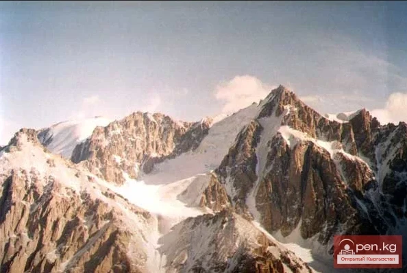
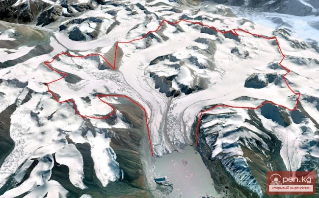
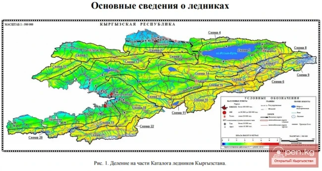
A valley tree-like glacier in the Central Tien Shan in Kyrgyzstan (Issyk-Kul region), located on the northern slope of the Sarydjaz ridge, at the sources of the Aditor River, a left tributary of the Sarydjaz River.

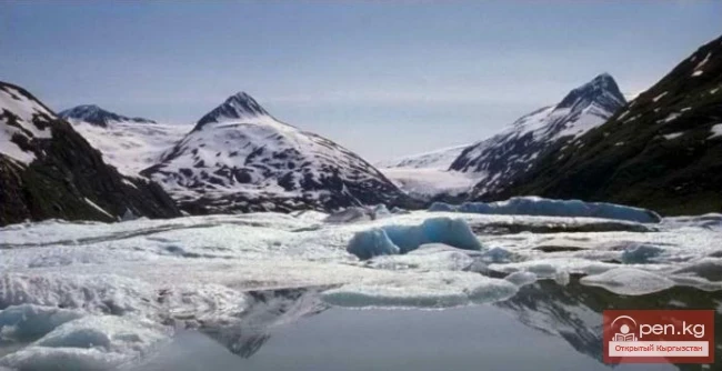
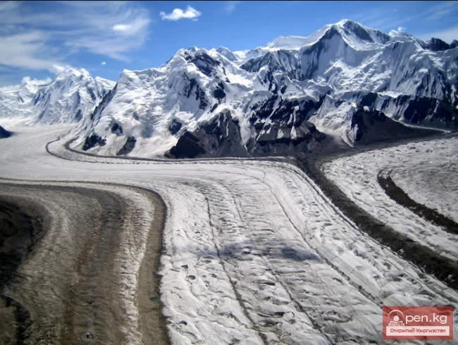
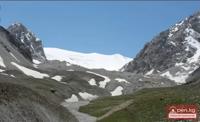
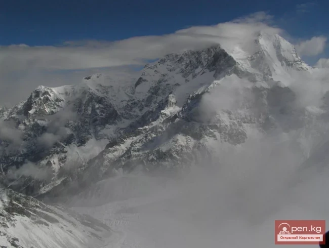
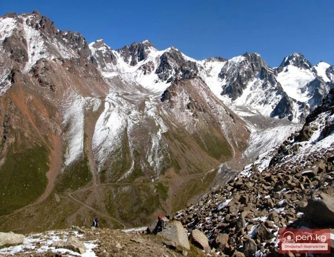
The length of the glacier is 20.5 km, with a width ranging from 1 to 1.8 km. The area is 68.7 square kilometers. The feeding area lies in a huge cirque at an altitude of 4500 to 5500 meters above sea level, with the firn line at an altitude of 4100 meters above sea level.
Mushketov Glacier

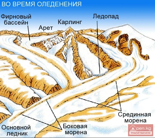
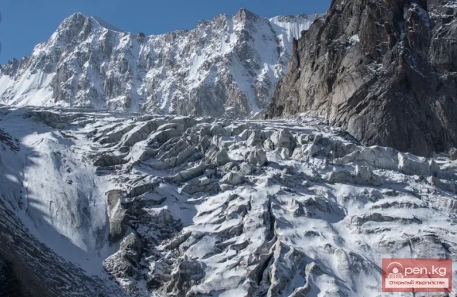
The tributaries are broken by numerous firn and ice falls and steeply descend to the main glacier.

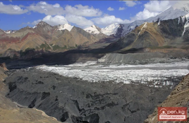
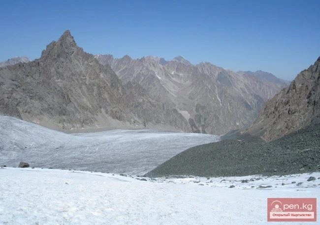
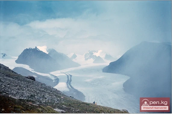
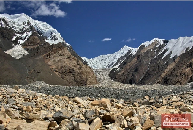
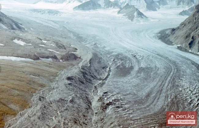
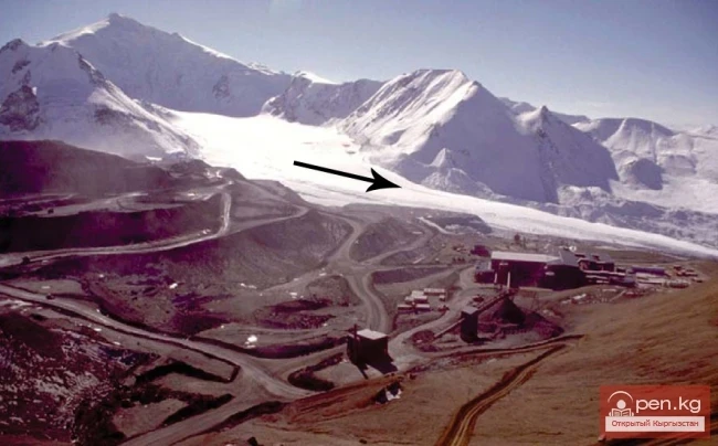
The tongue of the glacier ends at an altitude of 3440 meters above sea level. The lower part of the glacier is covered by moraine for a distance of 5 km. In 1957, there was a sharp movement of the glacier: its tongue advanced down the valley by 4.5 km.
Mushketov Glacier

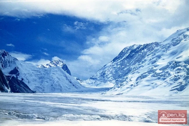
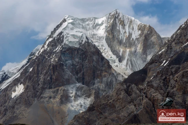
Unlike the Semenov Glacier, it has an asymmetry in feeding: all seven tributaries flow down from the northern slope of the Sarydjaz ridge. The southern slope of the Aditor ridge within the basin of the Mushketov Glacier has no glaciers at all. The firn area of the glacier is located in a huge cirque with steep and high one-and-a-half-kilometer walls at the junction of the Aditor and Sarydjaz ridges.

Despite the slight slope (5—6°), the Mushketov Glacier, like the Semenov Glacier, has an uneven bumpy surface, cut by numerous crevasses.
Mushketov Glacier

The system of surface moraines is clearly expressed only in the upper part of the glacier; in the lower part, this clarity is lost due to the recent advance of the glacier. The Mushketov Glacier belongs to the type of pulsating glaciers, which are characterized by catastrophic movements. The left edge of the glacier is somewhat higher than the right, causing the lowest tributary to not smoothly merge into the body of the glacier but to hit its edge and effectively not participate in feeding. The main share of the glacier's feeding comes from avalanches.
Mushketov Glacier

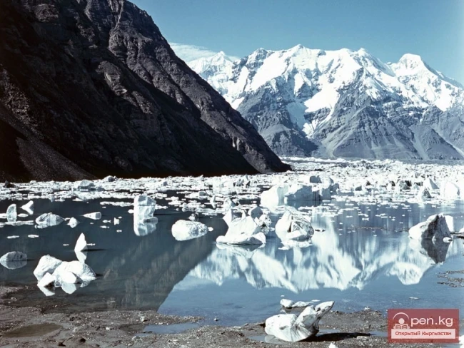
Currently, the glacier is retreating. The glacier was named after the outstanding Russian explorer Ivan Vasilyevich Mushketov. There is no information about climbers visiting these areas. These places are practically untouched for climbers.

Some peaks south of the Mushketov Glacier and in the upper reaches of the Semenov Glacier have been explored from the sides of the Bayan-Kol and North Inylchek glaciers, but reliable information about this is lacking. The area can be accessed by high-passability vehicles from the city of Karakol through the Chon-Ashuu pass.
Mushketov Glacier

First along the Otuk River to its confluence with the Sarydjaz River, then the road goes up the right bank of the Sarydjaz River to the border post of Echkilitash.
VK X OK WhatsApp Telegram

Read also:

Semenov Glacier

Semenov Glacier

Semenov Glacier - the basin of the upper reaches of the Sarydjaz River. This basin includes the...

Kainyndy Glacier

Kainyndy Glacier

Kainy Between Kokshaal-Tau and Kainy-Katta lies the powerful Kuyakap Glacier, and between...

Lenin Glacier

Lenin Glacier

Lenin Glacier — a mountain valley glacier on the northern slope of the Zaalai Range (Pamirs), in...

Glacier Kyzylsu

Glacier Kyzylsu

Kyzylsu - Red Water The Kyzylsu Glacier (often referred to as the Eastern Kyzylsu) is a complex...

Nalivkin Glacier

Nalivkin Glacier

Nalivkin Glacier. One of the right tributaries of the largest glacier in Pamir, Fedchenko Glacier....

Glacier Starlet

Glacier Starlet

Zvezdochka The Zvezdochka Glacier flows into the Inylchek Glacier, 40 km from the tongue of the...

Glacier Archa-Bashi

Glacier Archa-Bashi

Archa-Bashi Glacier on the Alai Range The Archa-Bashi Glacier is large and dendritic, located at...

Glacier Golubina

Glacier Golubina

Golubina Glacier The Golubina Glacier is of the valley type and is located on the northern slope...

Petrov Glacier

Petrov Glacier

Petrov Glacier - a glacier in Central Tien Shan On a small area of the Ak-Shiyrak mountain range,...

Nura Glacier

Nura Glacier

The Nura Glacier is located in the basin of the Eastern Kyzylsu River A large complex valley...

Aksai Glacier

Aksai Glacier

Ak-Sai Glacier The glacier is located 40 km from Bishkek in the picturesque Ala-Archa gorge at an...

Kolpakovsky Glacier

Kolpakovsky Glacier

The Kolpakovsky Glacier is the most significant glacier of the Terkey-Ala-Too range. Its length is...

Glacier Koy-Kap

Glacier Koy-Kap

Koy-Kap - Glacier in the Khan-Tengri Massif The Kaindy Ridge, which separates the valleys of the...

The Saridzhaz Ridge

The Saridzhaz Ridge

Sarydjaz The mighty snow-covered barrier of the Sarydjaz mountain range rises in the Central Tian...

Komarov Glacier

Komarov Glacier

Komarov Glacier (Ak-Sai), Kokshaalsky Ridge The first survey of the glaciation in this area was...

Abramov Glacier

Abramov Glacier

Slow Retreat of the Abramov Glacier The Abramov Glacier in the Pamir-Alai mountains is one of the...

The Ridge of Inylchektau

The Ridge of Inylchektau

Inylchektau A mountain range in the Central Tien Shan in Kyrgyzstan. It is located in the basin of...

The Peak of Gorky

The Peak of Gorky

Pik Gorkogo (6050 m) - located in the Central Tien Shan in the Tengri-Tag ridge. The southern...

Glacier Korzhenevskogo

Glacier Korzhenevskogo

The Greatest Glacier of Pamir On August 22, 1953, eight climbers from the Pamir expedition of the...

Glaciers of Kyrgyzstan

Glaciers of Kyrgyzstan

The territory of Kyrgyzstan is predominantly mountainous, with peaks almost everywhere reaching...

Peak Djigit

Peak Djigit

Peak Djigit - height 5170 meters. It is located in the main watershed ridge of the Terskey Alatau...

Upper Naryn

Upper Naryn

Upper Naryn includes the upper part of the Naryn River basin from the vicinity of the town of...

"Ala-Archa Zone"

"Ala-Archa Zone"

Ala-Archa Zone is located 30 km south of Bishkek in the central part of the Kyrgyz Ala-Too range...

Peak Karakol

Peak Karakol

Peak Karakol (5281 m) Located in the Oguz Bashi massif on the southern shore of Lake Issyk-Kul;...

Meridional Ridge

Meridional Ridge

Meridional Ridge The main nodal uplift of the Central Tien Shan on the border of Kyrgyzstan and...

Peak Adygene

Peak Adygene

Peak Adygene. It is located at the top of the gorge of the same name on the northern slope of the...

River Kyzyl-Suu

River Kyzyl-Suu

Kyzyl-Suu (Kyzyl-Suu River, Красная река) - a river in Kyrgyzstan and Tajikistan, the right source...

Talas Ridge

Talas Ridge

Talassky Ala-Too A mountain range located in the Western Tien Shan system. Most of it is situated...

River Ak-Suu

River Ak-Suu

The main channel of the Ak-Suu River is at least 20-22 kilometers long. The lower part of the...

Write a comment: