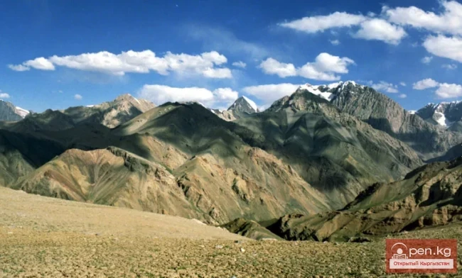
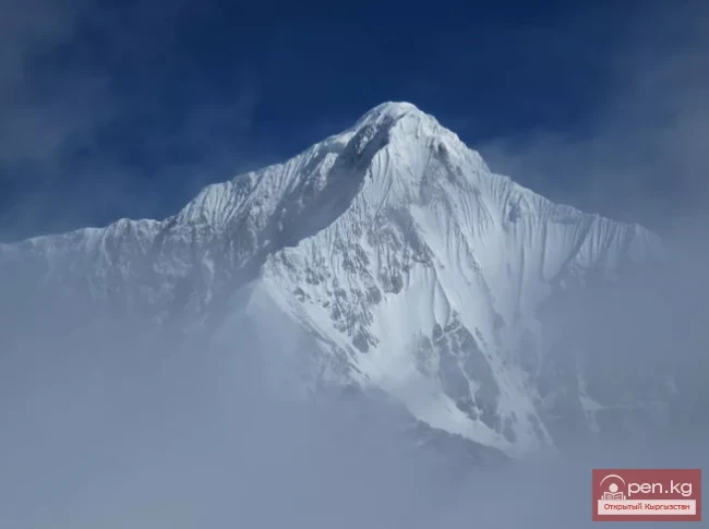
The title "Хребет Какшаал-Тоо" translates to "Kakshaal-Too Ridge" in English.

admin Mountain ranges
VK X OK WhatsApp Telegram
Kakshaal-Tuu Ridge

Kakshaal-Tuu


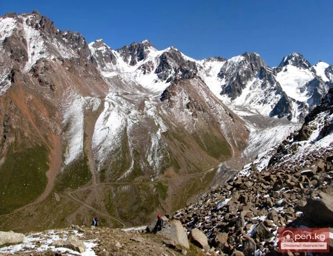
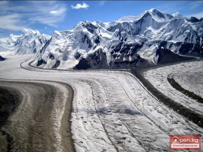
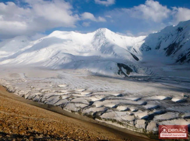
A mountain range in the Central Tian Shan system, on the border of Kyrgyzstan and China. The length of the range is about 582 km, width is 54 km, and the highest point is Victory Peak (7439 m). The average height (above sea level) is 4500 m. The western part of the Kakshaal-Tau range forms the southern boundary of the Inner Tian Shan. The range is composed of clay slates, sandstones, limestones, pierced by granite intrusions. Alpine relief predominates with a total glaciation area of 983 km².
Kakshaal-Tuu Ridge

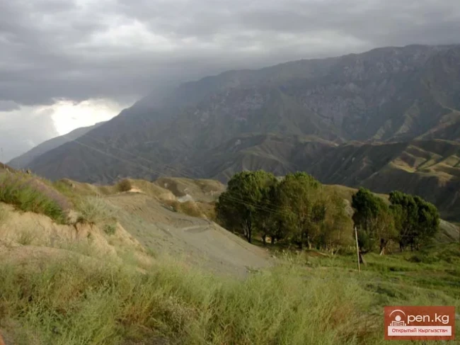
On the northern slope of the Kakshaal-Tuu range, there are 600 glaciers. Their total area is 90.76 km². The vegetation on the northern slope consists of steppes, while the southern slope features meadow steppes and alpine meadows.

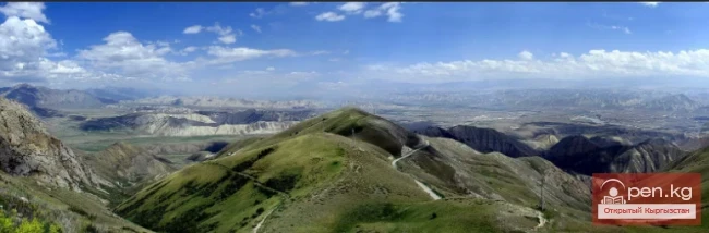
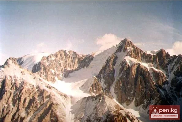
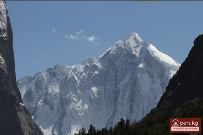
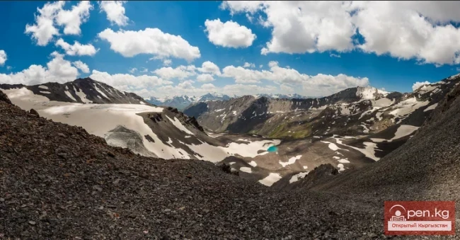
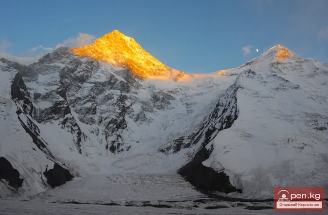
The Western Kakshaal-Tuu is the southernmost and highest range in Kyrgyzstan. It is formed by three latitudinal ridges: Terskey Ala-Tuu, Jetym, and Borkoldoy. These ridges are located in the Central Tian Shan between Lake Issyk-Kul and the Taklamakan Desert. The highest section of the range, extending 70 km, lies between the through valleys of the Kakshaal River to the south and the Uzengugush and Mydyryum rivers to the north, which cut through the range and carry their waters into the Tarim basin.
Kakshaal-Tuu Ridge

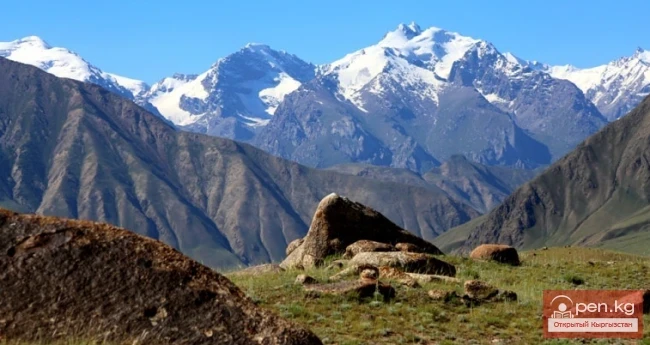
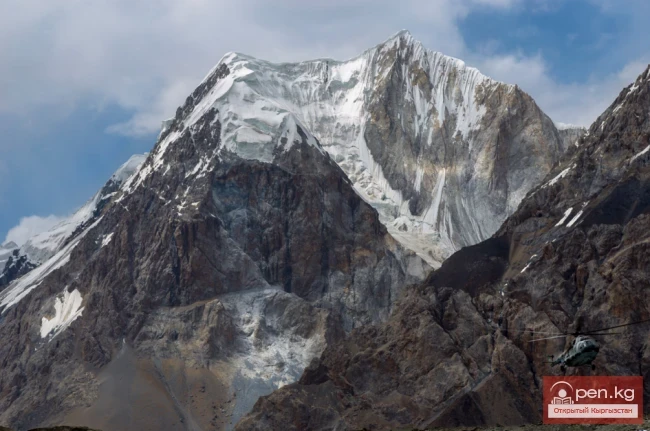
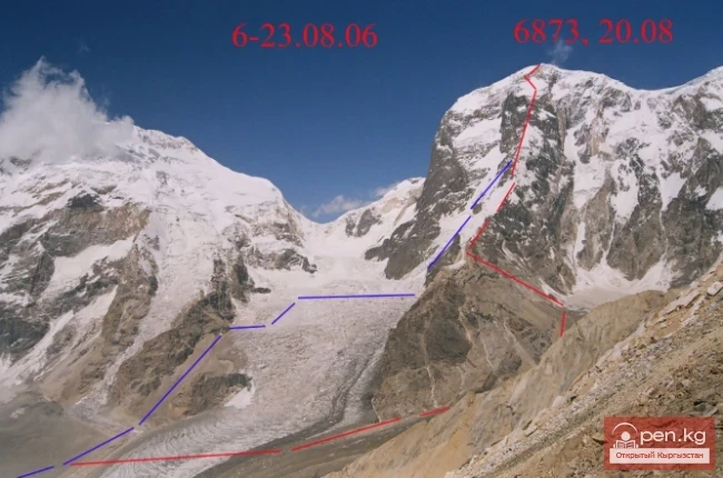
In this area, there are a large number of peaks with heights around 6000 m. The most interesting among them are Peak Kyzyl-Asker (5842 m), Peak Krylya Sovetov (5800 m), Peak Schmidt (5954 m), Peak Dankov (5982 m), Peak Chon-Turasy or Joldash (5729 m), Peak Alpinist (5641 m), and Peak Sergey Korolev (5816 m). This area is characterized by a combination of alpine forms (many vertical rock walls with a height difference of about 1.5 - 2 km) with extensive glaciation, second only to the glaciation around Victory Peak in the Tian Shan. The Ak-Sai glacial node (153 glaciers with a total area of 443 sq. km) is one of the largest in the Tian Shan.

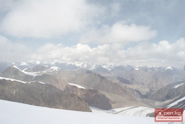
The entire area, including the lowlands, is a zone of permafrost. The terrain is heavily marshy.

The snow line is located at an altitude of about 4000 - 4500 m above sea level. The valleys of the rivers have a relatively high absolute altitude of about 3000-3500 m above sea level.
Kakshaal-Tuu Ridge

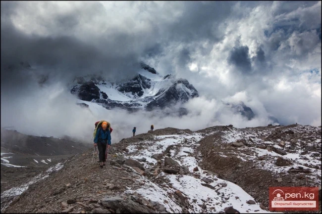
The climate in the valley is harsh. The average monthly temperature in summer is around -5 to -8 °C, and the weather is unstable. This area is rarely visited by people; over the long period since its discovery, it has been visited by no more than 5 climbing expeditions. The Western Kakshaal can still be considered a "white spot" on the map. For modern expeditions, visiting this area presents a great opportunity not only to find new climbing routes but also to conquer new peaks that have yet to be touched by human feet.
VK X OK WhatsApp Telegram

Read also:

Meridional Ridge

Meridional Ridge

Meridional Ridge The main nodal uplift of the Central Tien Shan on the border of Kyrgyzstan and...

The Saridzhaz Ridge

The Saridzhaz Ridge

Sarydjaz The mighty snow-covered barrier of the Sarydjaz mountain range rises in the Central Tian...

Kuylytau Ridge

Kuylytau Ridge

Kuylytau A mountain range in the Central Tien Shan, in Kyrgyzstan. It is located between the...

Jumgaltau Ridge

Jumgaltau Ridge

Jumgaltau A mountain range in the northern part of the Tien Shan, in Kyrgyzstan. The ridge extends...

The Moldotau Ridge

The Moldotau Ridge

Moldotau A mountain range in the Inner Tian Shan, in the central part of Kyrgyzstan, south of Lake...

The Atbashi Ridge

The Atbashi Ridge

Atbash The mountain range belongs to the southern arc of the Inner Tien Shan in Kyrgyzstan. It...

Zhalay Range

Zhalay Range

Zaalai Ridge A ridge oriented in a latitudinal direction, separating the Pamir and the Alai...

Talas Ridge

Talas Ridge

Talassky Ala-Too A mountain range located in the Western Tien Shan system. Most of it is situated...

Fergana Range

Fergana Range

Fergana Ridge A mountain range in the Tien Shan that stretches from southeast to northwest,...

The Ridge of Inylchektau

The Ridge of Inylchektau

Inylchektau A mountain range in the Central Tien Shan in Kyrgyzstan. It is located in the basin of...

Alay Ridge

Alay Ridge

Alay Range A mountain range of the Pamir-Alai mountain system in Kyrgyzstan and partially in...

Zailiysky Alatau Ridge

Zailiysky Alatau Ridge

Zailiyskiy Alatau A mountain range in the northwest of the Tian Shan (on the border of Kazakhstan...

Terskey Alatoo Ridge

Terskey Alatoo Ridge

Terskey Alatau The Terskey Alatau Ridge is very beautiful in its variety of landscapes. In one...

Naryn-Too Ridge

Naryn-Too Ridge

Naryn-Tau The area is hard to access and rarely visited. Due to the low glaciation and modest...

Glaciers of Kyrgyzstan

Glaciers of Kyrgyzstan

The territory of Kyrgyzstan is predominantly mountainous, with peaks almost everywhere reaching...

Kungey-Alatau Ridge

Kungey-Alatau Ridge

Kungey-Alatau To the south of the Zailiysky Alatau, beyond the deep longitudinal valleys of the...

Semenov Glacier

Semenov Glacier

Semenov Glacier - the basin of the upper reaches of the Sarydjaz River. This basin includes the...

Turkestan Range

Turkestan Range

Turkestan Range A high mountain range oriented in a latitudinal direction, approximately 340 km...

Kyrgyz Ridge

Kyrgyz Ridge

Kyrgyz Mountain Ridge A mountain range that borders the Chuy Valley and the Moyunkum Desert to the...

Aksai Glacier

Aksai Glacier

Ak-Sai Glacier The glacier is located 40 km from Bishkek in the picturesque Ala-Archa gorge at an...

Ak-Sai Valley

Ak-Sai Valley

Ak-Sai Valley - the Kyrgyz Pole of Cold Located in the south of the Naryn region, it is bordered...

Mushketov Glacier

Mushketov Glacier

Mushketov Glacier A valley tree-like glacier in the Central Tien Shan in Kyrgyzstan (Issyk-Kul...

Write a comment: