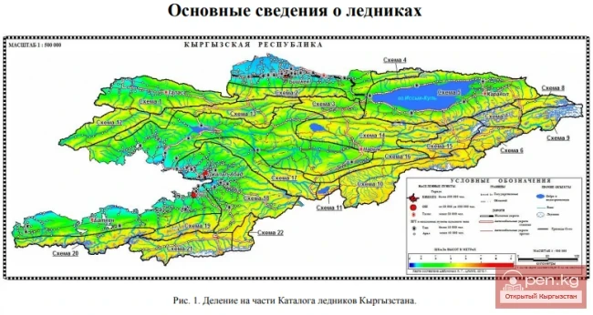
Kuylytau Ridge

admin Mountain ranges
VK X OK WhatsApp Telegram
Kuylytau Ridge

Kuylytau


A mountain range in the Central Tien Shan, in Kyrgyzstan. It is located between the rivers Kuyly and Uchkel (the Sarydjaz basin). The length of the ridge is about 50 km, and the maximum height is 5203 m. The ridge is composed of limestones, metamorphic schists, and granites.

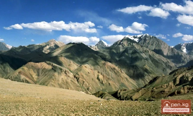
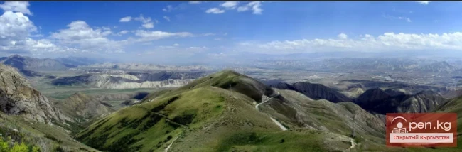
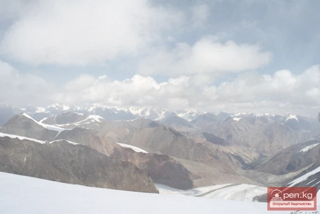
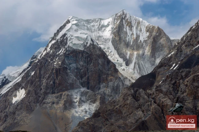
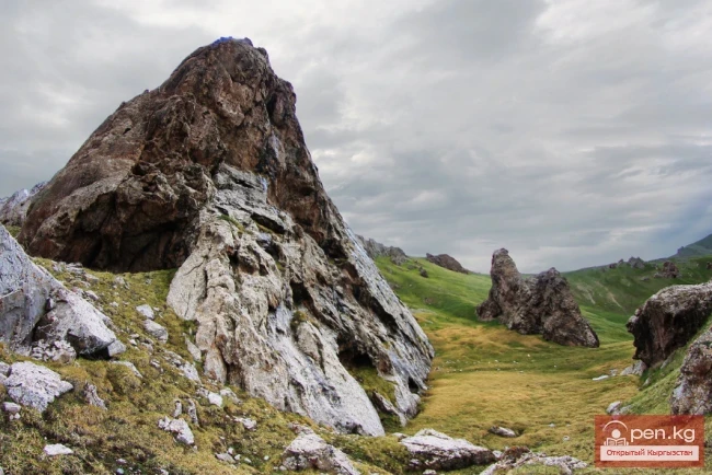
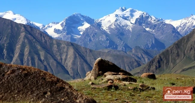
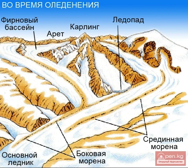
The Kuyly massif extends approximately 50 km in the latitudinal direction and 25 km in the meridional direction. The natural boundaries of the area are the rivers Sary-Djaz, Uch-Kel, Sarychat, Kuyly, and the Kuyly pass. The ridge is located parallel to the Terskey-Alatau ridge but further south. To the east, it almost adjoins the Sary-Djaz ridge, and to the west, it is adjacent to the Akshyirak ridge. The average height of the Kuyly ridge is 4700 m, and the highest peaks rise above 5000 m (Constitution Peak - 5203 m). The terrain of the ridge is quite diverse and significantly differs from the traditional Tien Shan, resembling the steep walls of cirques, powerful steps of glaciers, large slopes of gorges, and short approaches typical of the Central Caucasus. The average height of the snow line is about 3700-3900 m on the northern slopes and 4000-4200 m on the southern slopes. The heights of the glacier tongues are 3700-3900 m.
Kuylytau Ridge

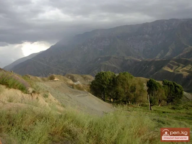
The rivers on the northern slope have wide, easily accessible trough-type valleys. The valleys on the southern slope in the upper reaches are usually troughs, while in the middle and lower reaches, they are difficult to traverse and hard to access, except for the Terakty river.

The northern boundary of the Kuyly area is usually considered to be the valley of the Keolu River (Kuyly Eastern River) - a right tributary of the Sary-Djaz River. The valley is a typical trough oriented to the northeast. The length of the valley is about 50 km.

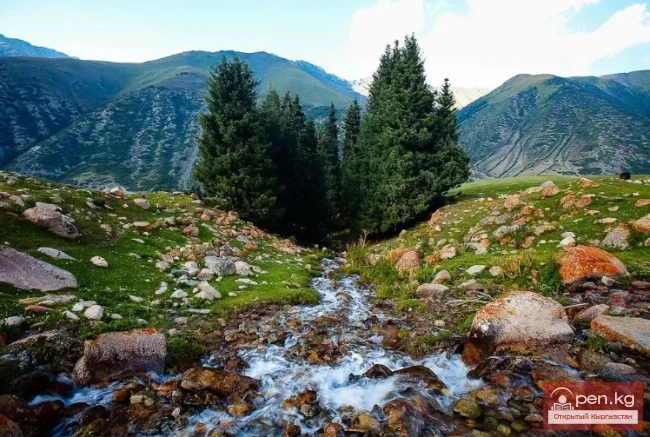
The river itself has carved into the bottom of the trough. The width of the trough bed reaches 700 m. The bottom of the trough is a terrace, covered with grass in the lower part, with patches of spruce forest in places.

The southern boundary of the Kuyly massif is considered to be the Uch-Kel River, also a right tributary of the Sary-Djaz River.
Kuylytau Ridge

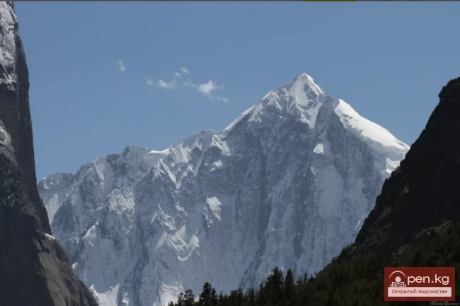
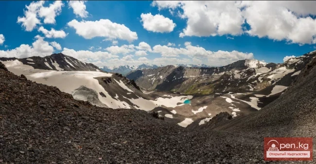
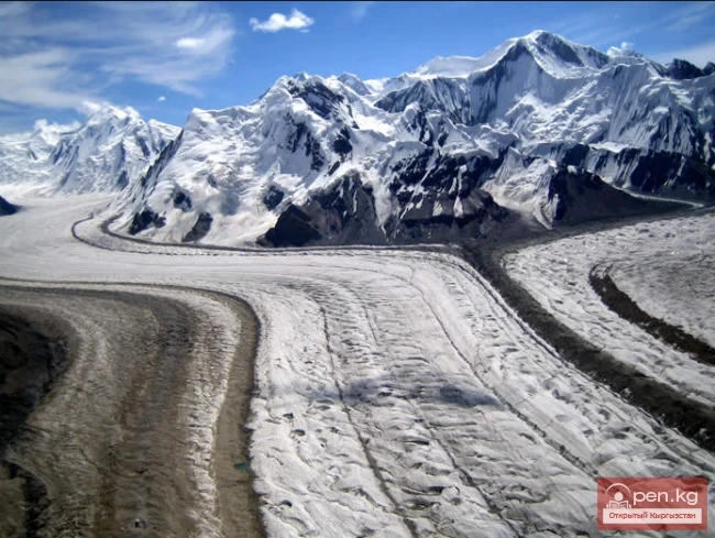
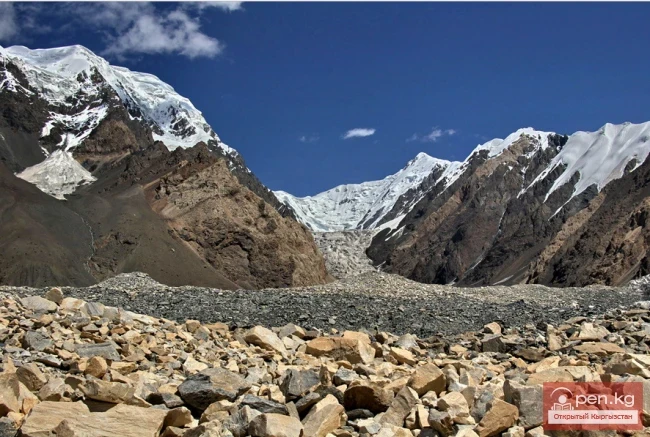
The largest area of modern glaciation is found in the basins of the rivers Ashutor, Karator, and Bordutor on the northern slope of the Kuyly ridge, and the rivers Terakty, Kuyly, Southern, Bashkul, and Ikichat on the southern slope. The glaciers are valley glaciers, located in complex multi-cirque areas and associated with the ridges of the main watersheds, both hanging and cirque types, located on transverse spurs in areas of lower absolute heights. Flat-topped glaciers are not typical for the Kuyly massif. The maximum length of the glaciers is 5-6 km, with the tongues of large valley glaciers descending to heights of 3500-3600 m, while the tongues of cirque and hanging glaciers are found at altitudes of 3900-4100 m.

The glaciers are mainly fed by atmospheric precipitation and also by avalanches.
Kuylytau Ridge

The height of the snow line varies from 3600 to 3900 m on the northeastern and eastern slopes, and up to 4100-4600 m on the southern slopes.

The passes are predominantly of snowy, snow-ice, and less frequently rocky-ice nature, with difficulty categories of 3A-3B. The heights of the passes range from 3600 to 4800 m.
VK X OK WhatsApp Telegram

Read also:

The Saridzhaz Ridge

The Saridzhaz Ridge

Sarydjaz The mighty snow-covered barrier of the Sarydjaz mountain range rises in the Central Tian...

Jumgaltau Ridge

Jumgaltau Ridge

Jumgaltau A mountain range in the northern part of the Tien Shan, in Kyrgyzstan. The ridge extends...

The Moldotau Ridge

The Moldotau Ridge

Moldotau A mountain range in the Inner Tian Shan, in the central part of Kyrgyzstan, south of Lake...

Naryn-Too Ridge

Naryn-Too Ridge

Naryn-Tau The area is hard to access and rarely visited. Due to the low glaciation and modest...

Terskey Alatoo Ridge

Terskey Alatoo Ridge

Terskey Alatau The Terskey Alatau Ridge is very beautiful in its variety of landscapes. In one...

The Ridge of Inylchektau

The Ridge of Inylchektau

Inylchektau A mountain range in the Central Tien Shan in Kyrgyzstan. It is located in the basin of...

Meridional Ridge

Meridional Ridge

Meridional Ridge The main nodal uplift of the Central Tien Shan on the border of Kyrgyzstan and...

Fergana Range

Fergana Range

Fergana Ridge A mountain range in the Tien Shan that stretches from southeast to northwest,...

The Atbashi Ridge

The Atbashi Ridge

Atbash The mountain range belongs to the southern arc of the Inner Tien Shan in Kyrgyzstan. It...

Talas Ridge

Talas Ridge

Talassky Ala-Too A mountain range located in the Western Tien Shan system. Most of it is situated...

Kungey-Alatau Ridge

Kungey-Alatau Ridge

Kungey-Alatau To the south of the Zailiysky Alatau, beyond the deep longitudinal valleys of the...

Zailiysky Alatau Ridge

Zailiysky Alatau Ridge

Zailiyskiy Alatau A mountain range in the northwest of the Tian Shan (on the border of Kazakhstan...

Alay Ridge

Alay Ridge

Alay Range A mountain range of the Pamir-Alai mountain system in Kyrgyzstan and partially in...

Turkestan Range

Turkestan Range

Turkestan Range A high mountain range oriented in a latitudinal direction, approximately 340 km...

Semenov Glacier

Semenov Glacier

Semenov Glacier - the basin of the upper reaches of the Sarydjaz River. This basin includes the...

Zhalay Range

Zhalay Range

Zaalai Ridge A ridge oriented in a latitudinal direction, separating the Pamir and the Alai...

Kyrgyz Ridge

Kyrgyz Ridge

Kyrgyz Mountain Ridge A mountain range that borders the Chuy Valley and the Moyunkum Desert to the...

Small Naryn

Small Naryn

Small Naryn encompasses the valley of the river of the same name, located between the ridges of...

Glacier Kyzylsu

Glacier Kyzylsu

Kyzylsu - Red Water The Kyzylsu Glacier (often referred to as the Eastern Kyzylsu) is a complex...

Ak-Sai Valley

Ak-Sai Valley

Ak-Sai Valley - the Kyrgyz Pole of Cold Located in the south of the Naryn region, it is bordered...

Kara-Suu

Kara-Suu

The "Kara-Suu" Zone is located in the eastern part of the southern slope of the Chatkal...

Natural Park Kyrgyz-Ata

Natural Park Kyrgyz-Ata

Kyrgyz-Ata Natural Park is located in the basin of the river of the same name, which flows down...

Zone "Aflatun"

Zone "Aflatun"

Aflatun Zone is located on the southeastern slopes of the Chatkal Ridge and occupies the basin of...

Glacier Koy-Kap

Glacier Koy-Kap

Koy-Kap - Glacier in the Khan-Tengri Massif The Kaindy Ridge, which separates the valleys of the...

River Ak-Suu

River Ak-Suu

The main channel of the Ak-Suu River is at least 20-22 kilometers long. The lower part of the...

River Karakulja

River Karakulja

Karakulja The Chatkal River in its upper reaches is called Karakulja (translated - Black Ram),...

Write a comment: