Small Naryn

admin Natural ecological complexes
VK X OK WhatsApp Telegram
Small Naryn


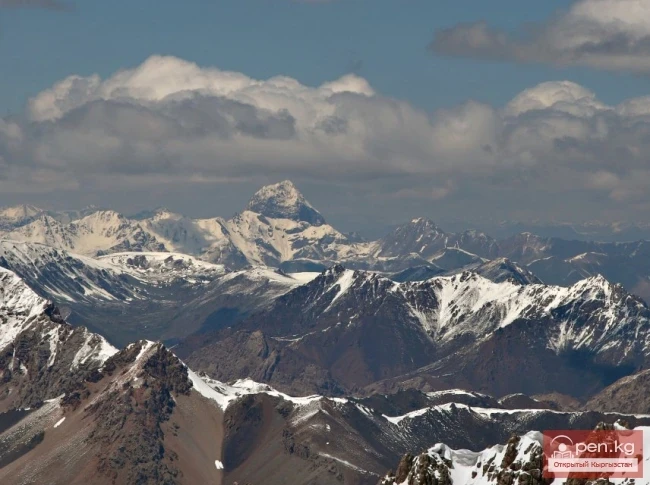
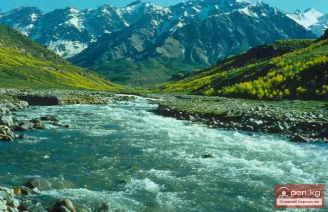
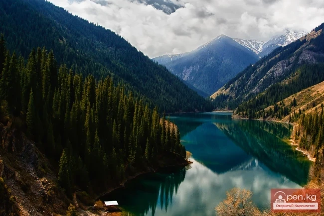
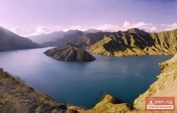
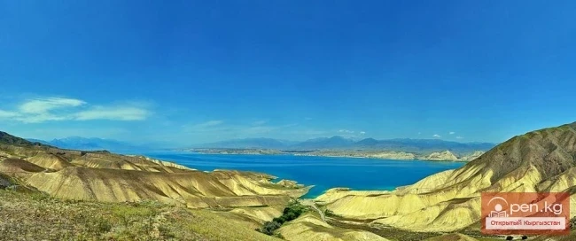
Small Naryn encompasses the valley of the river of the same name, located between the ridges of Jetim-Bel, Kapkatash, Karadjorgo, Jetim-Too, Uch-Emchek, and Terskey Ala-Too. Approximately 25 km from its mouth, Small Naryn flows into the Naryn; the valley of the river, transforming into the southern slopes of the Kapkatash ridge, makes a sharp turn at a right angle and continues to stretch almost 100 km to the east. On the right bank of the river, in the area of the bend and on the northern slopes of the small ridge of Nura (length 45 km), park-type spruce forests can be found. Further upstream, about 45 km from the bend, the left tributary Archalu flows into Small Naryn.

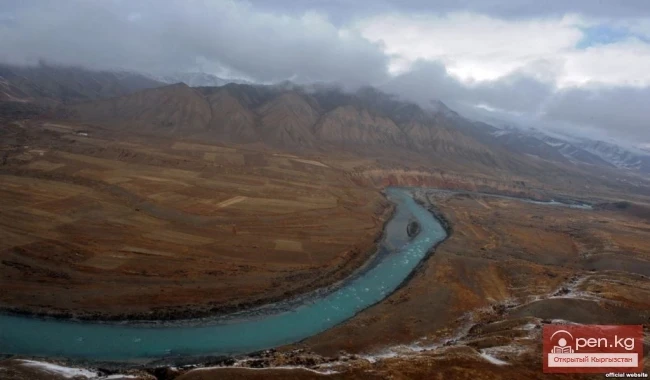
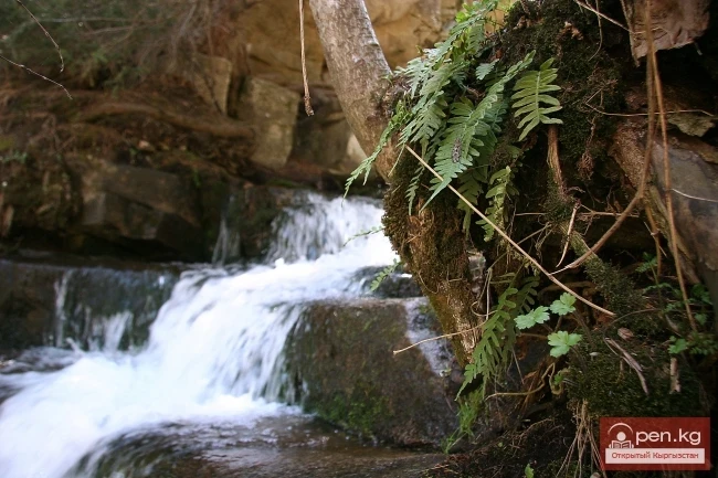
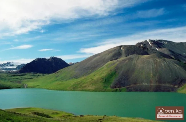
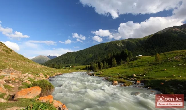
Small Naryn is known in its upper reaches as Buurkan. It changes its name after the confluence with the river Uch-Emchek (a right tributary of Jyluu-Suu). The valley of the Buurkan River, surrounded by the ridges of Uch-Emchek and Jetim-Bel, crosses vast areas of gravel plains. The Buurkan River originates from a lake of the same name, located to the west of the Arabel Pass at an altitude of 3820 m. The lake is 1.5 km long, 550 m wide, and 10 m deep. The outflow from the lake into the valley of the river occurs through a rocky threshold in a cascade of spectacular waterfalls. Strictly to the north, winding around the rocks, the road snakes its way. Soft, rounded peaks accompany the road to the Dolon Pass (3030 m). Along the floodplain of the Naryn, dense thickets of tugai forests are located. The composition of these forests is very rich and includes: poplar, birch, Dzhungarian willow, and numerous shrubs, among which myrcaria and sea buckthorn stand out.

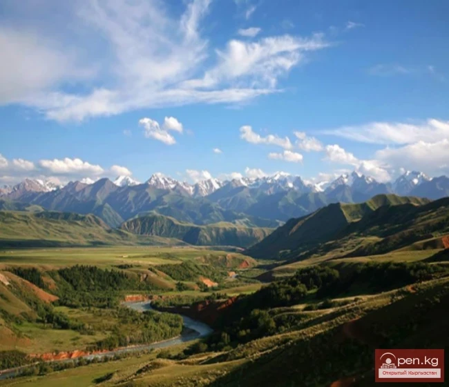
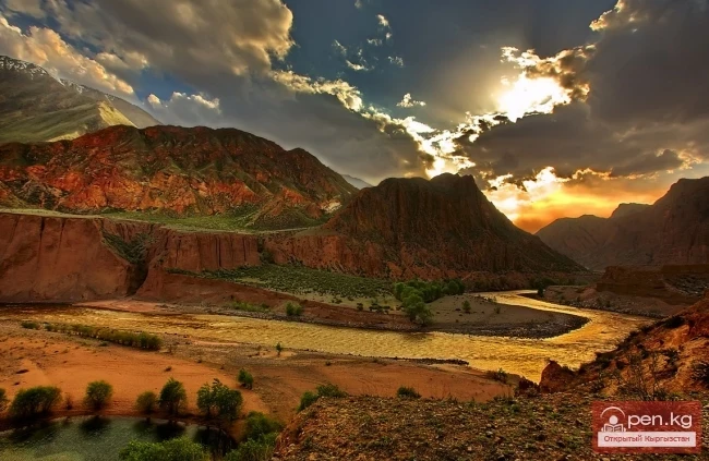
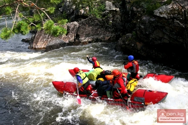
50 km from the confluence of the Small and Big Naryn, the ridges of Naryn-Too and Jetim-Too converge, enclosing the valley. The river roars through the gorge for several kilometers.

Above the Naryn, on the more humid northern slopes of the Naryn-Too ridge facing the river valley, at altitudes from 1800 to 3000 meters, forests of Tien Shan spruce can be found. In the areas of Uch-Bulak, Kashka-Su, and Baibiche, the spruce forest resembles a true taiga.
VK X OK WhatsApp Telegram

Read also:

Zone "Maly Naryn"

Zone "Maly Naryn"

The "Maly Naryn" zone encompasses the valley of the river of the same name, located...

Upper Naryn

Upper Naryn

Upper Naryn includes the upper part of the Naryn River basin from the vicinity of the town of...

"Upper Naryn Zone"

"Upper Naryn Zone"

The "Upper Naryn Zone" includes the upper part of the Naryn River basin from the...

Naryn-Too Ridge

Naryn-Too Ridge

Naryn-Tau The area is hard to access and rarely visited. Due to the low glaciation and modest...

Ak-Talaa

Ak-Talaa

Ak-Talaa includes the valleys of the Ala-Buka, Arpa, and Terek rivers, as well as the southern...

Zone "At-Bashi"

Zone "At-Bashi"

The At-Bashi Zone includes the Atbashi-Karakoyun Valley. The center of the zone, the village of...

Zone "Chatyr-Kel"

Zone "Chatyr-Kel"

The Chatyr-Kel Zone includes a significantly elevated intermountain basin with a lake of the same...

The Valley of Chichkan

The Valley of Chichkan

The Chichkan River flows from the north into the Toktogul Reservoir. It is a small river with...

Kara-Suu

Kara-Suu

The "Kara-Suu" Zone is located in the eastern part of the southern slope of the Chatkal...

"Orto-Tokoy Zone"

"Orto-Tokoy Zone"

The Orto-Tokoy Zone encompasses the territorial foothills at the western end of the Terskey...

Kekemeren River

Kekemeren River

Kekemeren River is one of the most amazing and beautiful rivers in Kyrgyzstan. The Kekemeren is...

Suusamyr Valley

Suusamyr Valley

The length of the valley is 155 km. It is bordered on the north by the Kyrgyz Ala-Too, on the...

Lake Kulun

Lake Kulun

Kulung - "foal" The Kulung and Kulung Minor lakes are a group of lakes, enchanting with...

Inner Tian Shan

Inner Tian Shan

It is precisely about this region that famous travelers such as Semenov-Tian-Shansky, Mushketov,...

Zone "Aflatun"

Zone "Aflatun"

Aflatun Zone is located on the southeastern slopes of the Chatkal Ridge and occupies the basin of...

Terskey Alatoo Ridge

Terskey Alatoo Ridge

Terskey Alatau The Terskey Alatau Ridge is very beautiful in its variety of landscapes. In one...

Thermal Waters of Ugut

Thermal Waters of Ugut

Thermal waters of Ugut are located on the left bank of the Naryn River, 110 km west of the city of...

Zone "Tar"

Zone "Tar"

The "Tar" zone includes the valley of the river of the same name and its tributaries. In...

Glacier Kyzylsu

Glacier Kyzylsu

Kyzylsu - Red Water The Kyzylsu Glacier (often referred to as the Eastern Kyzylsu) is a complex...

River Karakulja

River Karakulja

Karakulja The Chatkal River in its upper reaches is called Karakulja (translated - Black Ram),...

Kurpsayskoye Reservoir

Kurpsayskoye Reservoir

Kurpsayskoye Reservoir — a canyon-type reservoir Kurpsayskaya Hydroelectric Power Station — HPP on...

"Chon-Kemin Zone"

"Chon-Kemin Zone"

Chon-Kemin Zone includes the valleys of the Chon-Kemin and Kichi-Kemin rivers between the high...

Lake Teshik-Kul

Lake Teshik-Kul

Lake Teshik-Kul (also Teshik-Köl) — is a hard-to-reach high-altitude lake It is located at an...

Zone "Isfayram-Sai"

Zone "Isfayram-Sai"

Zone "Isfayram-Sai". The left tributary of the Isfayram-Sai River is the Surme-Tash...

Talas Ridge

Talas Ridge

Talassky Ala-Too A mountain range located in the Western Tien Shan system. Most of it is situated...

The River Aflatun

The River Aflatun

Aflatun River – the largest right tributary of the Kara-Suu River in the Jalal-Abad region. The...

"Suusamyr Zone"

"Suusamyr Zone"

The Suusamyr Zone includes the eponymous high-altitude valley stretching 155 km. To the north, it...

Kuylytau Ridge

Kuylytau Ridge

Kuylytau A mountain range in the Central Tien Shan, in Kyrgyzstan. It is located between the...

Natural Park Kyrgyz-Ata

Natural Park Kyrgyz-Ata

Kyrgyz-Ata Natural Park is located in the basin of the river of the same name, which flows down...

Chatkal River

Chatkal River

Chatkal - a mountain river in Kyrgyzstan and Uzbekistan, Before the formation of the Charvak...

Zone "Toktogul"

Zone "Toktogul"

The Toktogul Zone includes the Ketmentebin intermountain basin in the lower reaches of the Naryn...

Kyzyl-Unkyur

Kyzyl-Unkyur

The "Kyzyl-Unkyur" Zone is located 15 km northeast of the village of Arslanbap in the...

Semenov Glacier

Semenov Glacier

Semenov Glacier - the basin of the upper reaches of the Sarydjaz River. This basin includes the...

Lake Kara-Suu

Lake Kara-Suu

Lake Kara-Suu is located in the Toktogul district. It is a dam-type lake, and its level depends on...

Natural Park "Besh-Tash"

Natural Park "Besh-Tash"

Besh-Tash Nature Park is located south of the city of Talas on the northern slopes of the Talas...

River Kyzyl-Suu

River Kyzyl-Suu

Kyzyl-Suu (Kyzyl-Suu River, Красная река) - a river in Kyrgyzstan and Tajikistan, the right source...

Rivers of Kyrgyzstan

Rivers of Kyrgyzstan

The formation of runoff and the hydrographic network in the territory of Kyrgyzstan is greatly...

Write a comment: