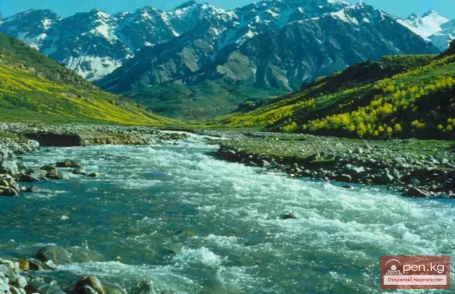
Chatkal - a mountain river in Kyrgyzstan and Uzbekistan,
Before the formation of the Charvak Reservoir, it was the left tributary of the Chirchik River (Syr Darya basin). It originates on the southwestern slopes of the Talas Alatau. In its upper reaches, it flows through a wide ancient glacial valley. Below the confluence with the Ters River, the valley narrows, transitioning into a deep gorge. The banks of the Chatkal River form terraces 7-10 m high. The river often splits into channels. After receiving a large tributary on the right - the Sandalash River, Chatkal becomes abundant in water. By the beginning of the first canyon, the river converges into a single channel. The length of the canyon is 2.5-3.0 km.


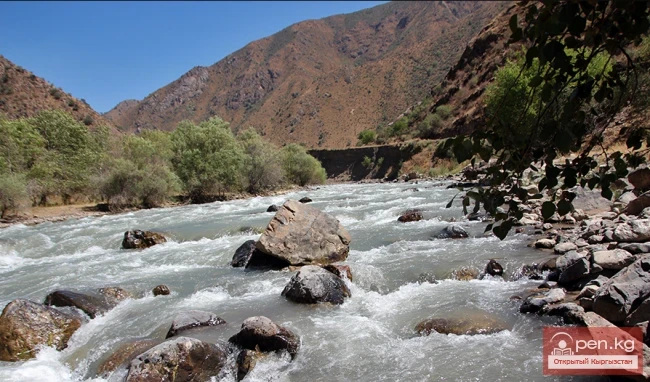
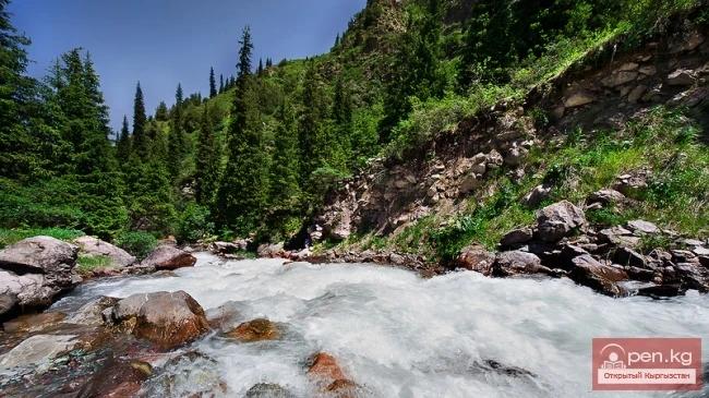
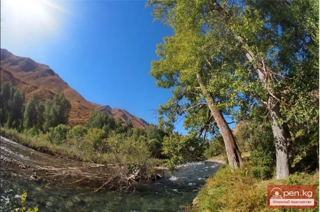
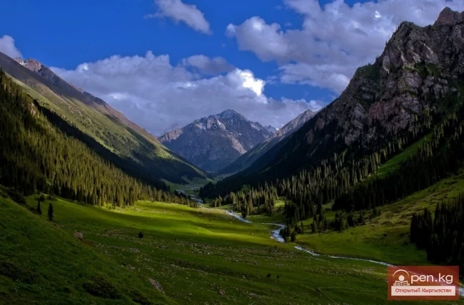
In the first section, just above the confluence of the left tributary Ters, Chatkal flows through a wide treeless valley. The riverbed is deepened into the valley floor to 30-40 m, forming a canyon. Along the entire river, a narrow strip of forest grows, mainly consisting of poplar, and shrubs. In this section, Chatkal alternates between splitting into channels and flowing in a single bed. The current is fast. There are many rapids, similar to one another.
The rapids are most often located at river bends and consist of large rocky shoals at the convex bank and cliffs at the concave bank.

The narrow stream, constricted by the shoal, sharply converges to the cliff, creating a strong squeeze and waves at the exit. Sometimes there are rocks in the flow that complicate entry or exit. There are also small blockages, roots, and low-hanging trunks and branches of trees, sometimes in very narrow channels. There are practically no pools. The total number of rapids approaches, apparently, a hundred. Notable are the rapids with individual characteristics, located 5 km upstream and just before the mouth of the right tributary Sandalash. There are no landmarks for these rapids; the banks are too uniform. A road runs along the right bank, which crosses to the left bank before the village of Yangibazar.
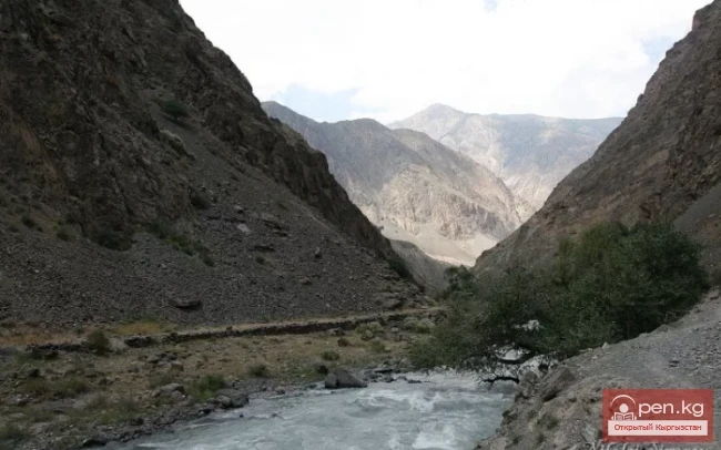
After a slight widening of the valley, the second ten-kilometer canyon follows. A sharp turn of Chatkal to the left, then to the right serves as a landmark for the beginning of the second canyon. A trail running along the right bank almost at the water's edge ascends the mountain. At the entrance to the canyon, there is a rapid and about 10 easy rapids within the canyon itself. The river is wide here, with steep slopes rising 150-200 m. There are squeezes and high waves.

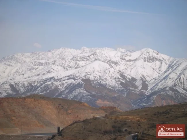
Just beyond the canyon is a picturesque spot on the river: in the distance along the left bank, the snowy peaks of the Chatkal Range are visible. The next basin begins with many steeply falling channels. They then converge into a single channel and enter the beautiful third canyon of Chatkal.
After 3 km, the third, most picturesque canyon of Chatkal begins, stretching 4 km. The canyon is purely rocky, very narrow, with sharp turns. The height of the vertical walls reaches up to 100 m. There are 6 rapids in the canyon, of which 2 need to be scouted.
In the next short basin, there is a serious rapid with a squeeze on the left turn of Chatkal.

Next is the fourth canyon, which is not beautiful: the banks are low, bare, with some scree, and there are no impressive rocky walls. But it is from the fourth canyon that the most difficult rapids begin. The river becomes more powerful, and the gradient and current speed increase. The rapids follow one after another.
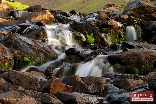
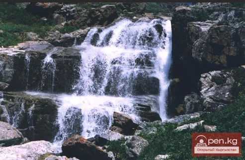
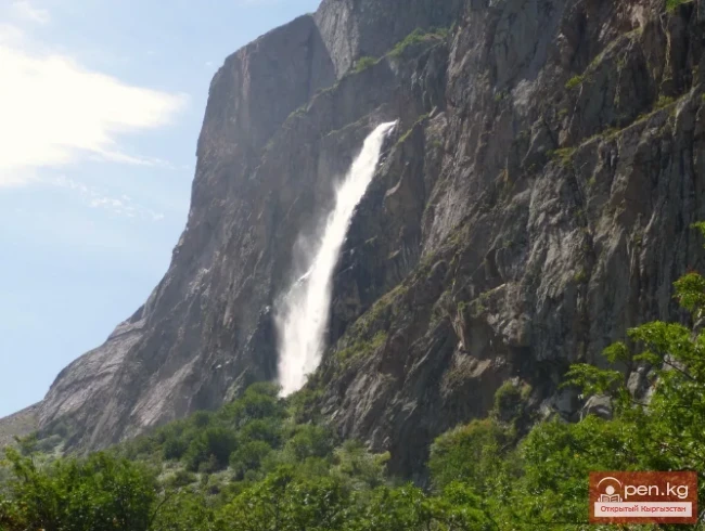
From the fourth canyon to the mouth of the left tributary - the Naysa River, there are 4 rapids. Opposite the mouth of Naysa, a stream flows in, where a waterfall of 10-15 m height is located 200 m from Chatkal. From Naysa begins a cascade of 7 rapids, the third of which is the most dangerous.
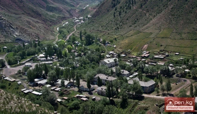
Below the mouth of Naysa, on the right bank of Chatkal, there is the first apiary (former meteorological station) with a garden. 4 km downstream on the left bank is the village of Arab, consisting of four houses, with a cable crossing opposite the apiary. Then, on the right bank, there are two more apiaries, the last of which is called Kharkush. Near it is a cable crossing, opposite the ruins of an old apiary.
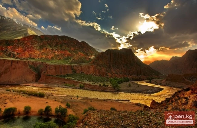
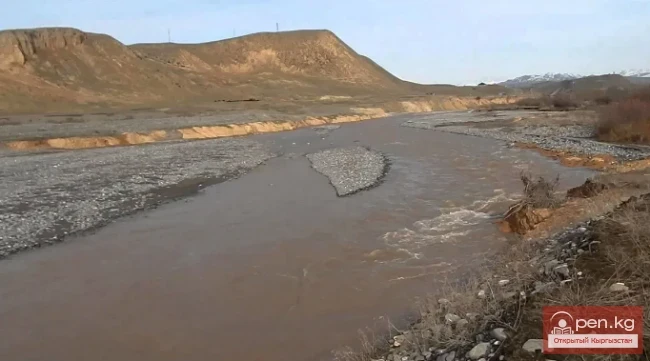
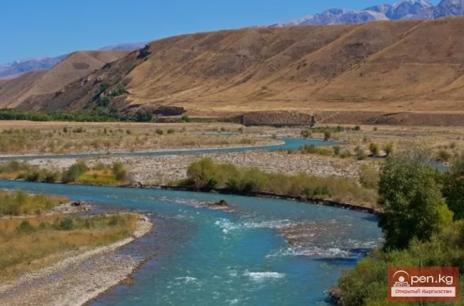
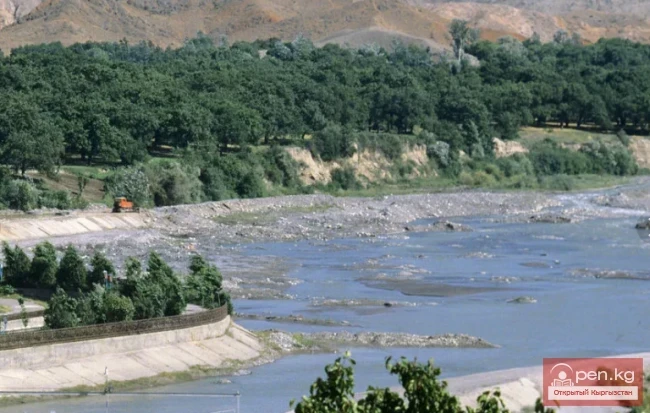
Before the Kharkush apiary, there are still 20 dangerous rapids. Just after the apiary, there is an impassable section 300-500 m long, and downstream, the river sometimes resembles a staircase with frequent steps and spills. Sections of the staircase alternate with wide rapids with many rocks. Small pools between the rapids appear only 1.5-2 km below the confluence of the left tributary - Kishlaksaya. At the mouth of Kishlaksaya, there is an apiary on the left bank, and on the right, there are thickets of wild grapes. At the mouth of Akbulak (a left tributary), there is a paved bridge over Chatkal. The road runs through the Akbulak valley and downstream along Chatkal. Chatkal, as if pressing against the massif of the Big Chimgan, turns north.

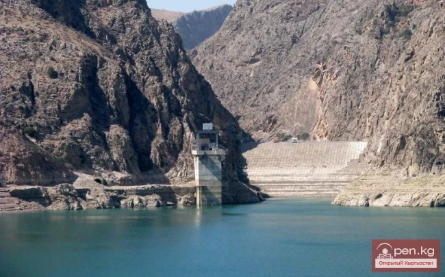
Above the mouth of Akbulak begins the beautiful fifth canyon. It contains dangerous rapids. In some places, due to the vertical cliffs dropping straight into the water, scouting and safety are complicated. The fifth canyon ends above the village of Aurakhmat. Near Aurakhmat is the last rapid; beyond that, Chatkal is supported by the Charvak Reservoir.
The length of Chatkal is 217 km. The area of the basin is 7110 km².
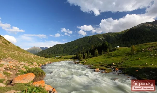
Chatkal is predominantly fed by snow.
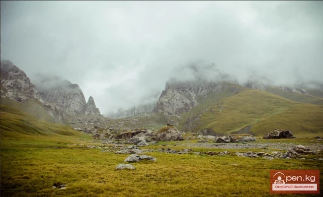
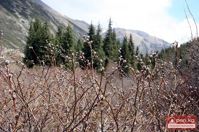
The natural conditions of the area are also interesting. The forest along the river is deciduous, while on the slopes, in the middle reaches of Chatkal, there is juniper reaching giant sizes; forests of wild apple trees, plums, hawthorn, barberry, cherries, irgi, apricots, and many walnut trees, with almonds and wild grapes also present.
The largest tributaries of Chatkal are on the left: Ters (8.1% of the basin) and Akbulak (11.9% of the basin), and on the right: Sandalash (16.8% of the basin) and Koksu (5.9% of the basin). The average water flow near the mouth is 72.6 m³/sec, with a maximum of 180 m³/sec. In the territory of the Republic of Uzbekistan, Chatkal receives the following tributaries (from source to mouth):

Akbulak - on the border of Kyrgyzstan and Uzbekistan (left);
Kazanaksay (right);
Khudoydodsay (right);
Chukraksu (right);
Paltau (right);
Yangikurgansay - flows into the Charvak Reservoir from mid-spring to late autumn (left);
Koksu - flows into the Charvak Reservoir from mid-spring to late autumn (right).
The Pskem River also flows into it. Below the Charvak Reservoir, the river is called Chirchik.
The fluctuation of water flow in Chatkal in September is very significant (at the mouth from 45 to 110 m/sec) from year to year. For comparison, the water flow at the mouth of Chatkal in September 1981 was 50-55 m/sec, while in the same period in 1987 it was about 80 m/sec. The average gradient of the entire Chatkal riverbed is 8 m/km. The maximum is 20 m/km.
The width of the river varies from 3-10 m in the canyons to 80-100 m in the intermountain basins. The flow speed is 1.5-4.0 m/sec.
The average water temperature in Chatkal in September is 9-12 degrees.
In the vicinity of the village of Obi-Rahmat (Aurakhmat) in 2003, the remains of a boy aged 9-12, resembling a Neanderthal and Cro-Magnon, were found on the bank of the right tributary of Chatkal, the Paltau River, in the Obi-Rahmat grotto (41°34"08.8" N, 70°08"00.3" E). The age of the remains is at least 50,000 years.

During the Soviet era, popular tourist routes such as the Alyam Ring passed through Chatkal. The Chatkal River was popular among water tourism enthusiasts. In October 1975, the 2nd All-Union Water Tourism Technique Competition was held on the Chatkal River near Brichmulla, dedicated to the 30th anniversary of the victory of the Soviet people over fascist Germany. 22 teams from the union republics, as well as from the cities of Moscow and Leningrad, participated in the competition. Currently, due to border issues, tourism on Chatkal is complicated.
Author of the first photo - Ivan Bondarenko