Zone "Min-Kysh" (a thousand birds)
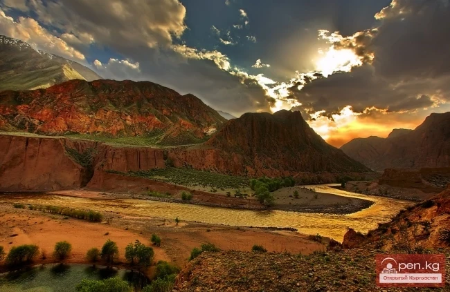
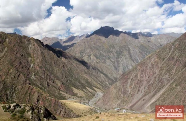
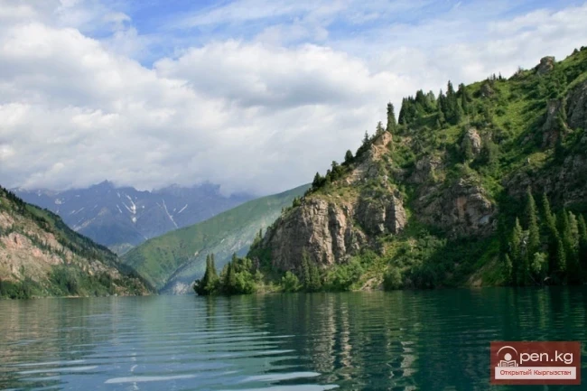
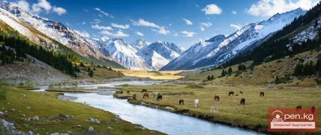
The zone "Min-Kysh" (a thousand birds) includes the fabulously beautiful valley of the same name, which is about 40 kilometers long. The valley rises from 1400 to 3100 meters above sea level. Its maximum width is two kilometers. The valley is framed by the Kabak-Too ridge (4144 m) and the Moldo-Too ridge (4418 m).
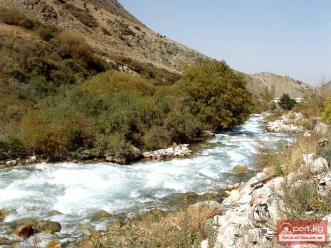
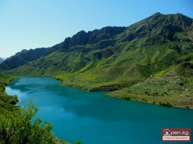
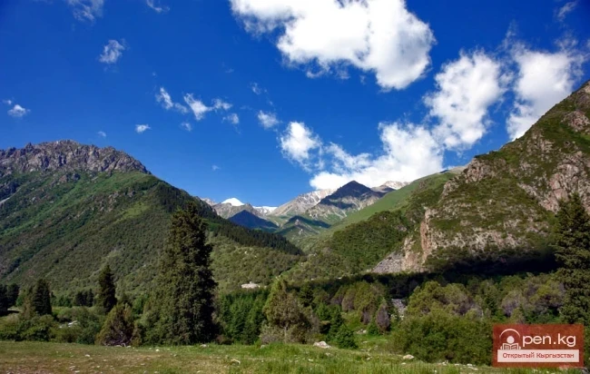
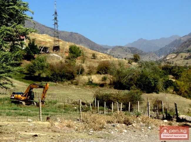
At the lower part of the zone, where the Min-Kush flows into the Kekemeren, lies the village of Ornok. A road runs from the village along the riverbed to the village of Min-Kush. The river's floodplain is overgrown with poplar-willow forests and shrubs of rowan, blackberry, barberry, and honeysuckle. The slopes descend to the river in terraces. The side gorges are covered with floodplain forests. The flat areas of the terraces are occupied by agricultural land. In the middle reaches of the Min-Kush river lies the village of the same name.
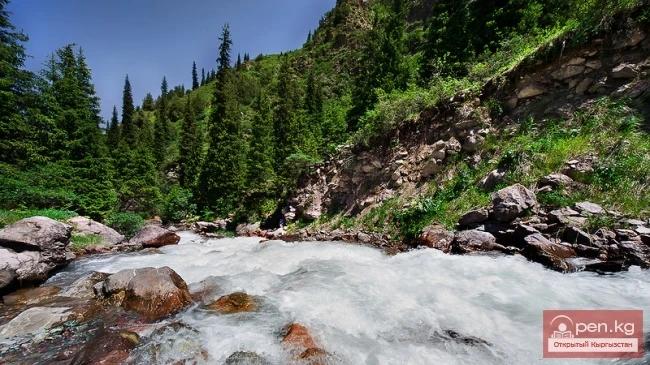
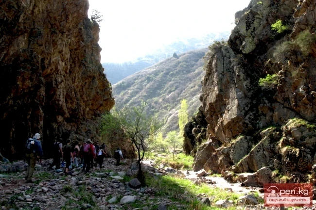
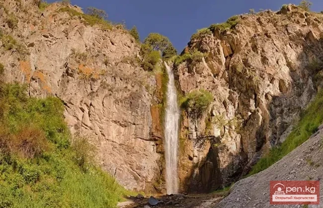
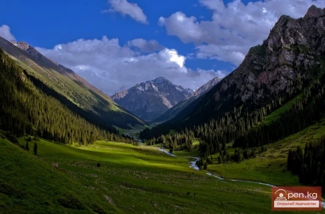
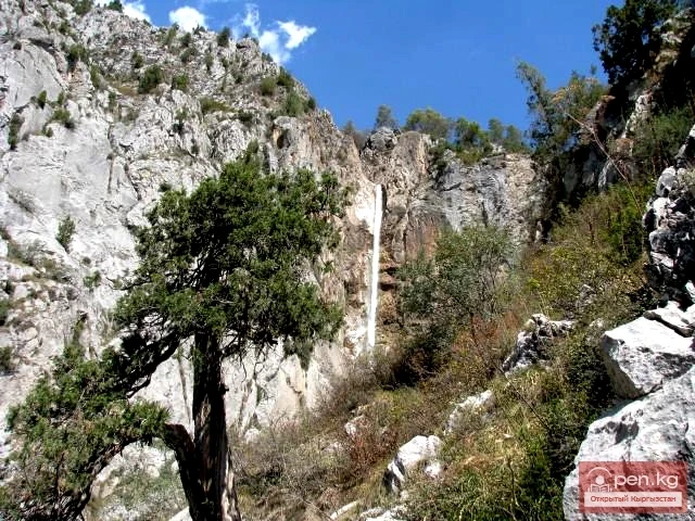
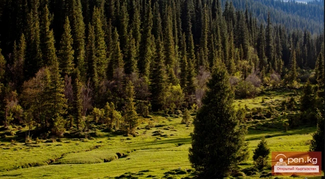
In the rather steep slopes, caves and grottos can be found. On the southern slopes of Kabak-Too, covered with dense mixed forests, is the Min-Bugu area ("a thousand deer"). Poplars, birches, willows, and rowans are gradually being displaced by Tien Shan firs. Huge shaggy pyramids fill all the gorges, climbing steep slopes up to the ridges. Small rivers flow down from the edges of the gorge, falling in spectacular cascades into the riverbed of the Min-Kush.
The riverbed is relatively shallow but rises steeply. In some places, the gorges along the river are so steep and narrow that it is impossible to pass through them. One has to climb over the passes to then descend back into the river valley. Sometimes it is necessary to make one's way along reddish rocks washed by turbulent streams of water. The river thunders as it hurls a tight flow onto the rocky debris, knocking one off their feet and showering them with myriads of crystal splashes that fill the air with coolness. Piles of rocks alternate with dense spruce forests interspersed with sunlit clearings. Beautiful meadows are dotted with tall grasses and flowers.
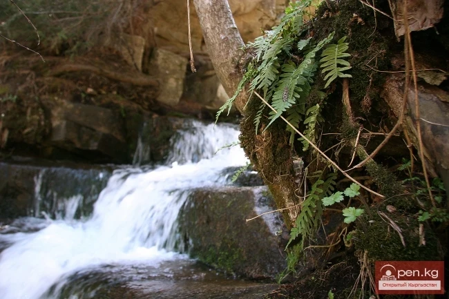
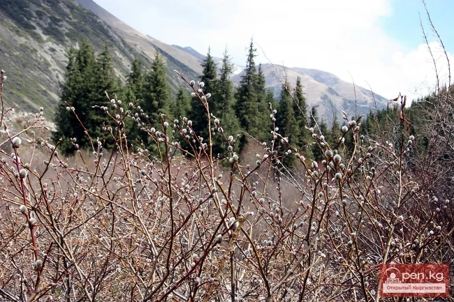
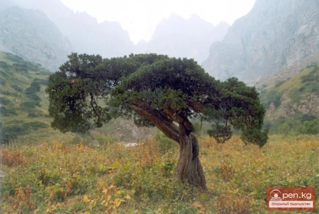
As the gorge rises, the forest gradually thins out, giving way to thickets of creeping juniper, tall grass meadows, and rocky debris with long trails. The cliffs rise like insurmountable walls directly from the raging water. In sheltered spots, patches of unmelted snow from winter hide away.
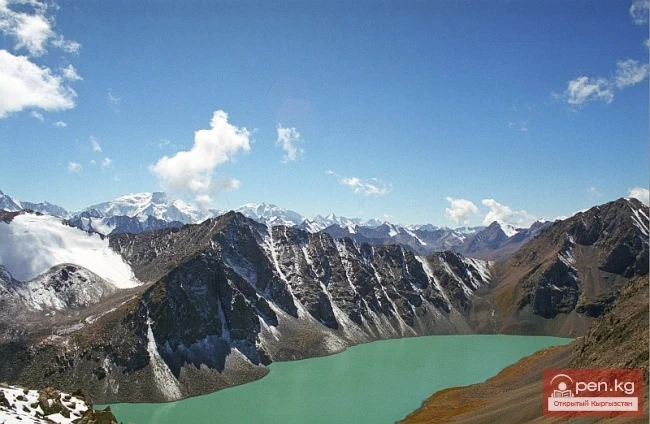
Over the passes in the side ridges of the gorge, one can reach the Jumgal or Naryn valleys, while the Donguzi pass ("wild boar") leads to the Son-Kul area.
The names of places in the valley speak of the numerous animals that inhabit this zone. The gorge is populated by a restless world of birds. Among them are warblers, tits, goldfinches, pigeons, snowflakes, starlings, thrushes, black-throated redstarts, nightingales, crows, and hawfinches. The ringing songs, whistles, and chirps create an extraordinary forest music that begs to be recorded on a tape. On rainy days, those recordings will help dispel sadness with memories of wonderful days spent in nature. In the mountain rivers, one can observe the amazing sight of a gray bird, the dipper, diving for food. It flies up to a branch, shakes itself off, spots something in the current, and dives back into the water.
In the spruce forest, your presence will be announced by the sharp cry of a nutcracker. It will persistently accompany you until you leave.
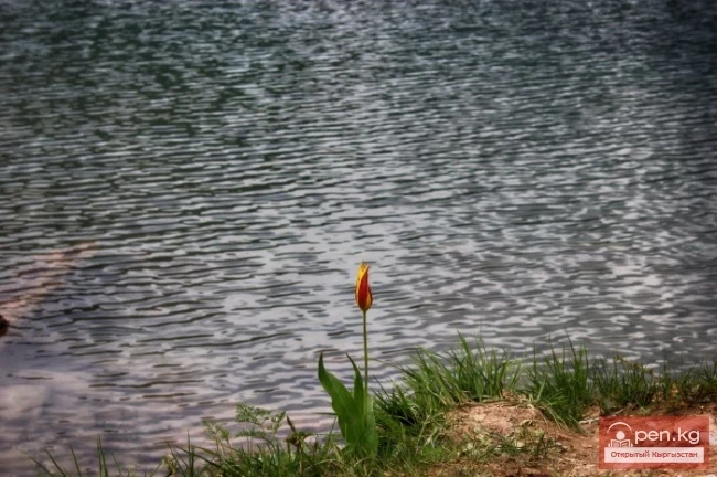
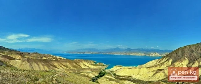
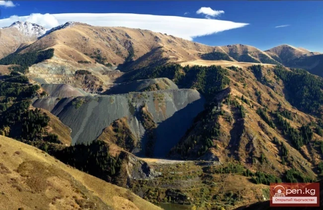
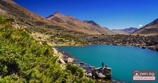
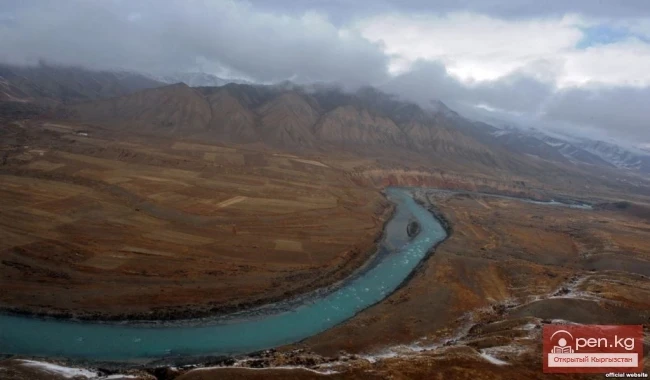
On the northern slopes of the Moldo-Too ridge, near the village of Ak-Kel, lies a mysterious non-freezing lake with cool mountain water. The saturation of the water's color is emphasized by the contrast of the colorful vegetation covering the shores. At the headwaters of the Min-Kush river, there is an abandoned underground mine.
The territory of the zone includes the botanical reserve "Min-Kush." There are mineral water springs "Beshene-Say" and "Chemindy," discovered in the valleys of the rivers of the same name, located about 50 km from the village of Chayek.
Read also:
Zone "Padsha-Ata"
The "Padsha-Ata" zone includes the gorge of the same name and is located near the...
Kekemeren River
Kekemeren River is one of the most amazing and beautiful rivers in Kyrgyzstan. The Kekemeren is...
Zone "Kety"
Kegety Zone is located 75 km from Bishkek in the gorge of the same name on the road to the village...
"Chon-Kemin Zone"
Chon-Kemin Zone includes the valleys of the Chon-Kemin and Kichi-Kemin rivers between the high...
Zone "Toguz-Toroo" ("Nine Chestnuts")
The zone "Toguz-Toroo" ("nine bays") includes the valley of the same name, the...
"Suusamyr Zone"
The Suusamyr Zone includes the eponymous high-altitude valley stretching 155 km. To the north, it...
Zone "Isfayram-Sai"
Zone "Isfayram-Sai". The left tributary of the Isfayram-Sai River is the Surme-Tash...
Zone "Chatyr-Kel"
The Chatyr-Kel Zone includes a significantly elevated intermountain basin with a lake of the same...
"Orto-Tokoy Zone"
The Orto-Tokoy Zone encompasses the territorial foothills at the western end of the Terskey...
Kara-Suu
The "Kara-Suu" Zone is located in the eastern part of the southern slope of the Chatkal...
Small Naryn
Small Naryn encompasses the valley of the river of the same name, located between the ridges of...
Zone "At-Bashi"
The At-Bashi Zone includes the Atbashi-Karakoyun Valley. The center of the zone, the village of...
"Issyk-Ata Zone"
Issyk-Ata Zone is located 80 km from Bishkek and includes two gorges — Issyk-Ata and Tuyuk...
Zone "Yassy"
The Yassy Zone occupies the valley of the same name, located near the city of Uzgen, 80 km from...
Kyzyl-Unkyur
The "Kyzyl-Unkyur" Zone is located 15 km northeast of the village of Arslanbap in the...
Zone "Ak-Talaa"
The "Ak-Talaa" zone includes the valleys of the Ala-Buka, Arpa, and Terek rivers, as...
"Alamedin Zone"
Alamedin Zone is located 25 km from Bishkek in the valley of the same name and the surrounding...
Zone "Tar"
The "Tar" zone includes the valley of the river of the same name and its tributaries. In...
Zone "Toktogul"
The Toktogul Zone includes the Ketmentebin intermountain basin in the lower reaches of the Naryn...
Kgety Waterfall
Big Kegety Waterfall The waterfall is located in the Kegety Gorge, which is in the Chuy region, 18...
Talas Ridge
Talassky Ala-Too A mountain range located in the Western Tien Shan system. Most of it is situated...
Kara-Balta Gorge
Kara-Balta Gorge is located on the northern slope of the Kyrgyz Ala-Too. The Kara-Balta Gorge...
"Ala-Archa Zone"
Ala-Archa Zone is located 30 km south of Bishkek in the central part of the Kyrgyz Ala-Too range...
Kgety Gorge
The Kegety Gorge is located 75 km from Bishkek on the northern slopes of the Kyrgyz Ridge and is...
Valley of Ak-Tyuz
Ak-Tyuz - "White Valley" The Ak-Tyuz Valley is located on the southwestern slopes of the...
Zone "Aflatun"
Aflatun Zone is located on the southeastern slopes of the Chatkal Ridge and occupies the basin of...
Mayluu-Suu (Mayli-Sai)
The "Maili-Sai" Zone is located in close proximity to one of the major industrial...
Natural Park "Besh-Tash"
Besh-Tash Nature Park is located south of the city of Talas on the northern slopes of the Talas...
Shamsi Gorge
The Shamsi Gorge is located 120 km from the city of Bishkek and 60 km south of the city of Tokmak....
Zone "Shakhimardan" (Shaimerden)
The Shakhimardan Zone (Shaimerden) encompasses the basin of the Shakhimardan-Sai River. There is a...
Zone "Arslanbap" (Arslanbob)
Arslanbap Zone (Arslanbob) is located on the southwestern slopes of the Fergana Range in the...
The River Aflatun
Aflatun River – the largest right tributary of the Kara-Suu River in the Jalal-Abad region. The...
Kainyndy Glacier
Kainy Between Kokshaal-Tau and Kainy-Katta lies the powerful Kuyakap Glacier, and between...
Fergana Range
Fergana Ridge A mountain range in the Tien Shan that stretches from southeast to northwest,...
The title "Сох" translates to "Sokh" in English.
Narrow echoing gorges, through which in the gloomy depths flows a river bound by rocky jaws;...
Lake Alakol and Alakol Pass
Geographical Reference: Ala-Kul (Ala-Kyol, Alakul, Alaköl) is a closed lake in the Terkey-Alatau...
Natural Complex of Shamsi
The Shamsi Natural Complex is located 85 km east of Bishkek and includes the territory of a valley...
Zone "Maly Naryn"
The "Maly Naryn" zone encompasses the valley of the river of the same name, located...
Kara-Balta
Kara-Balta, which translates as "Black Axe," is one of the youngest cities in the Kyrgyz...
Valley of the Chatkal River
Chatkal Valley is 30 to 50 km wide and stretches from the southwest to the northeast for 150 km....
Chatkal River
Chatkal - a mountain river in Kyrgyzstan and Uzbekistan, Before the formation of the Charvak...
"Sary-Chelek Zone"
Sary-Chelek Zone ("yellow bowl") territorially coincides with the basin of the Khoja-Ata...
Caves of the Kok-Kiya River
Kok-Kiya River (Green Slope) - the easternmost right tributary of Ak-Sai, flows down from the...
"Upper Naryn Zone"
The "Upper Naryn Zone" includes the upper part of the Naryn River basin from the...
Suusamyr Valley
The length of the valley is 155 km. It is bordered on the north by the Kyrgyz Ala-Too, on the...
Chon Ak-Suu Gorge or Grigorievskoe
Grigorievskoe Gorge is one of the wonderful and picturesque natural attractions Chon Ak-Suu Gorge,...
"Manas Zone"
The "Manas" zone is located 63 km from the city of Talas, south of the village of...
Turgen-Aksu Gorge
The Natural Beauty of Turgen-Aksu Gorges are those rare places in nature that have not been...