Zone "Shakhimardan" (Shaimerden)

admin Natural ecological complexes
VK X OK WhatsApp Telegram
Shakhimardan Zone (Shaimerden)

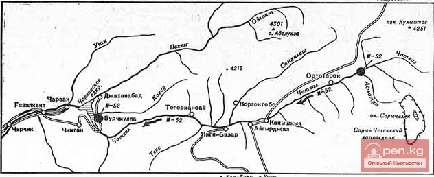
The Shakhimardan Zone (Shaimerden) encompasses the basin of the Shakhimardan-Sai River. There is a road leading here from the city of Osh to the village of Frunze. The village produces the best antimony in the world. There are many springs with low-temperature mineralized water in its vicinity.
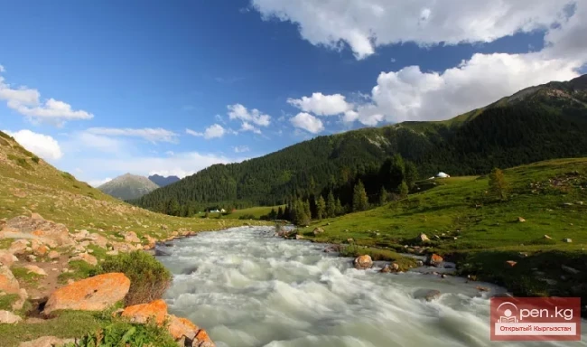
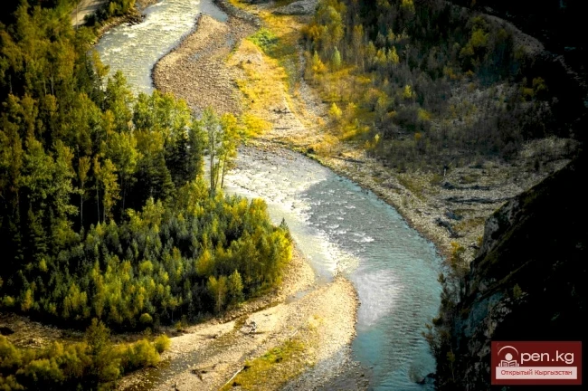
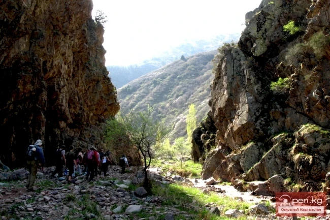
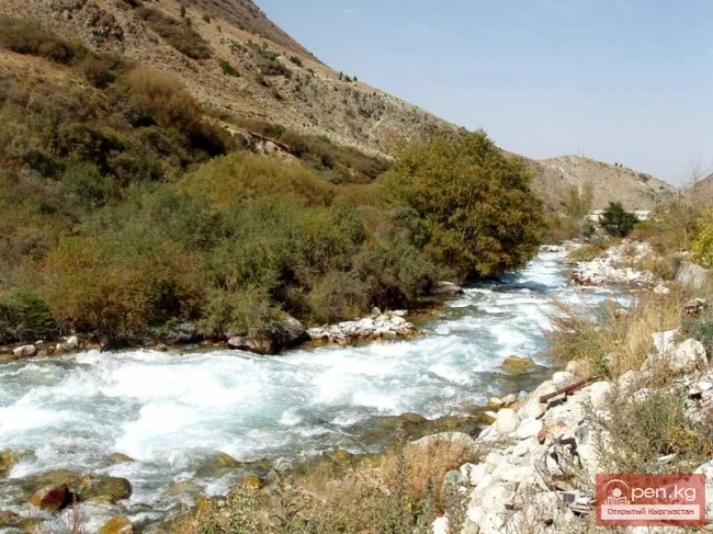
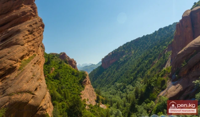
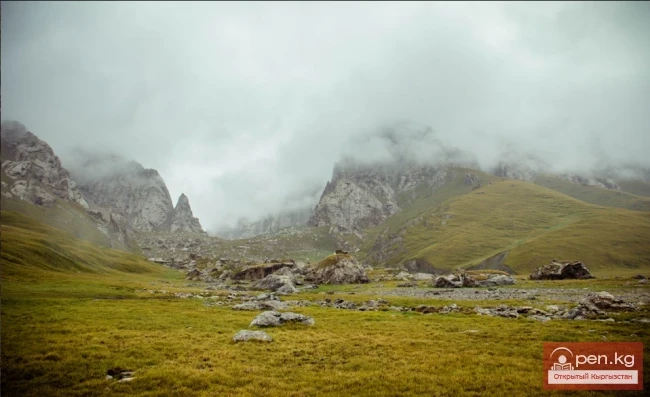
The Shakhimardan-Sai River is formed by the Ak-Suu (on the left) and Kek-Suu (on the right). Below the confluence of these rivers in the valley of the Shakhimardan-Sai stand two powerful cliffs, Kala-Choku and Uzun-Choku. In front of them, the riverbank is covered with dense thickets of poplar and willow. The towering cliffs are conveniently used as panoramic points for viewing the surrounding landscapes. At the foot of Kala-Choku, images of goats are carved. Below the drawings, there are depressions that served as places for sacrifices.
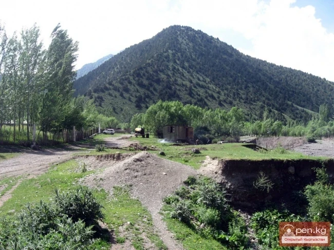
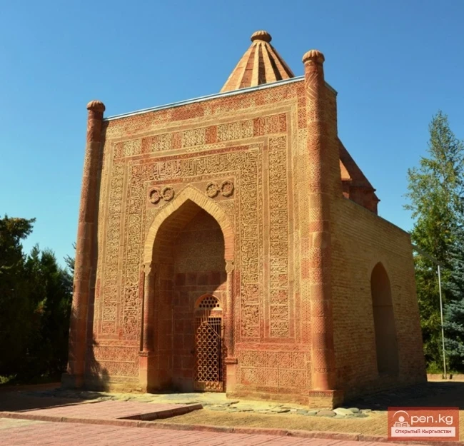
At the confluence of the turbulent milky-white Ak-Suu with the transparent blue flow of the Kek-Suu River, in a narrow gorge at an altitude of about 1400 m, lies the resort town of Hamza-Abad. It is named after the famous Uzbek poet Hamza Hakimzade Niyazi. A monument has been erected in his honor at the entrance to the town. There are many shops and tea houses here. The surroundings of the town are entirely covered with apricot orchards.
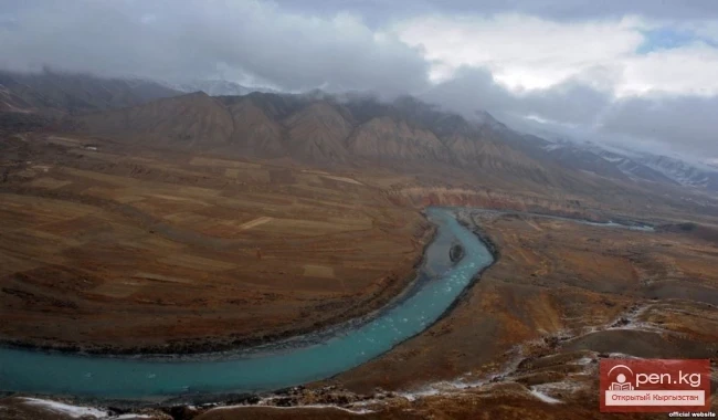
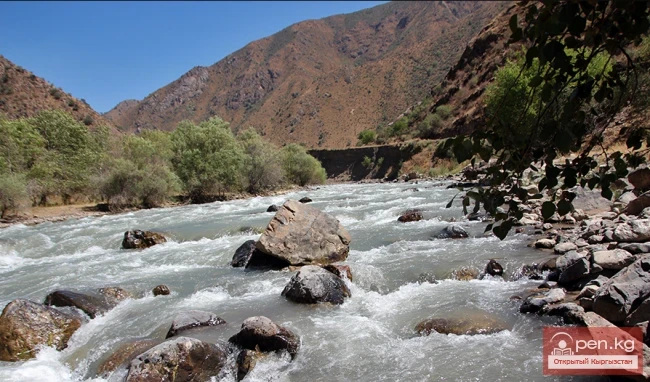
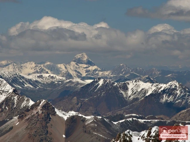
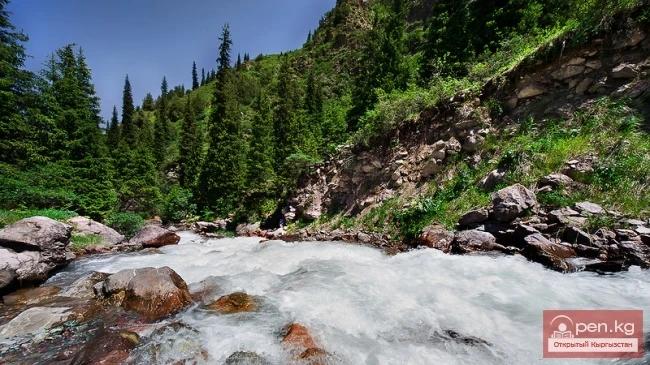
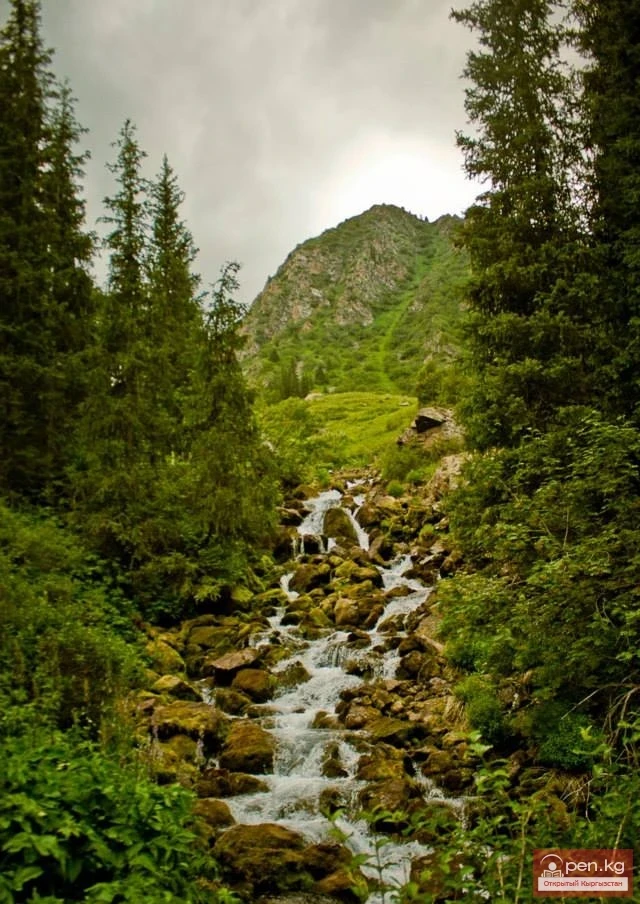
The lower part of the Ak-Suu valley is wide, and the river flows through several channels. About 10 km upstream, on the shore, lies the village of Iordan (Yardan). Nearby, at an altitude of 1550 m, the not very large but full-flowing Dugoba River flows into Ak-Suu from the south, carving its way through a picturesque gorge. Above the Ak-Suu River rises a red cliff — Tag. Then, to the left, Ak-Suu receives the Shivali tributary. The road winds among thickets of silver juniper. Even further up, 5-7 km from the mouth of Shivali, the turbulent flow of the Gajir River bursts into Ak-Suu from the right, gaining strength during its steep descent from the mighty ridge of the Alai Mountains. The sources of Ak-Suu, formed by the confluence of Eki-Davan and Archa-Bashi, are located in the ridge zone of the Alai Mountains and the adjacent Kuruq-Sai mountain range at an altitude of about 3700 m. The ridge is heavily dissected by cirques, couloirs, numerous glaciers with powerful icefalls, and extensive snowfields.
Shakhimardan Zone (Shaimerden)

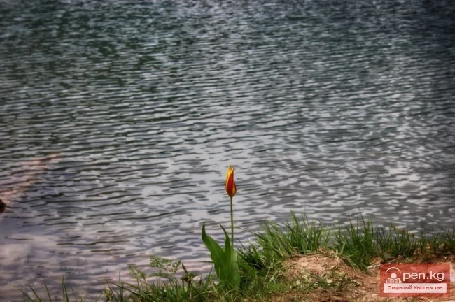
On the left bank of the Ak-Suu River is the botanical reserve "Chyragdan," covering an area of 500 hectares to protect a section of low-mountain desert steppe vegetation and habitats of tulips — pink and Fergana. In the upper reaches of the Ak-Suu River, there is a "gallery" of rock paintings.
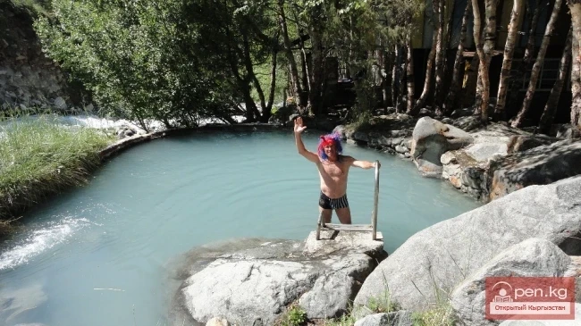
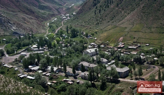
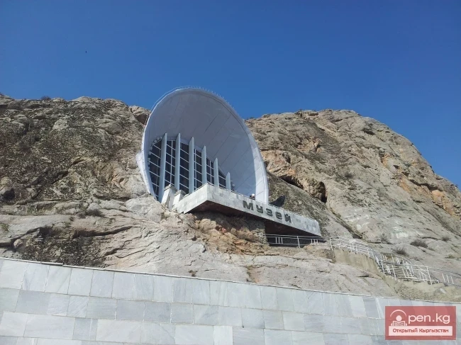
In the Kek-Suu gorge is the famous mountain-climatic resort and tourist base "Shakhimardan." In the upper reaches of the Kek-Suu gorge, about 7 km from the resort at an altitude of 1650 m, lies the picturesque Kyrban-Kel or Blue Lake, formed as a result of an earthquake over a hundred years ago. A huge landslide of marbled limestone served as a kind of dam, blocking the swift Kek-Suu in its upper course. In the vicinity of the lake, the "Blue Lake" resort operates, which uses the hydrogen sulfide water from a spring that surfaces below the dam for therapeutic purposes. The water in Kyrban-Kel is blue, but the lake itself is lifeless. Next to it, in the Kek-Suu gorge, there is another lake, which, due to the bright greenery of the surrounding juniper forests and lush herbs, is called Jashil-Kel ("green"). Relatively small in size, it is cozily situated in a rocky gorge.
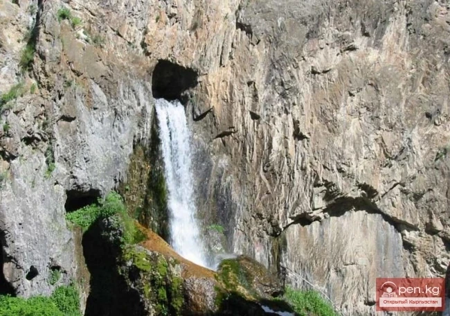
In the zone, several caves can be visited. Among them, the most notable is the Jidalik or Warm Cave, declared a natural monument and geological reserve. It is located on the southern bank of the Shakhimardan River, 0.7 km along the road south of the village of Jidalik and 3 km by road from the village of Frunzenskoe. The total length of the cave is about 180 m. The entrance is located 33 m above the river level. The cavity consists of several halls, which contain various crystalline and stalactite formations. In the lower hall, there is a small lake with warm water (22°C). The conditions in the cave are favorable for establishing a speleotherapy treatment center.
Another interesting cave, Kalmyk-Unkyur, is located on the right bank of the Kek-Suu River, 9 km southeast of the town of Hamza-Abad. It features a fairy-tale underground hall 60 m long, 35 m wide, and 15 m high. There is a small lake in it. Another cave, Katta-Upkyur, is located on the southeast slope of Mount Ishkel, 7 km west of the village of Kadamzhai in the basin of the Apkhor River. It contains rock paintings.
VK X OK WhatsApp Telegram

Read also:

Dugoba

Dugoba

This area is located 40 km from the village of Kadamjay, where the best antimony in the world is...

Kyzyl-Unkyur

Kyzyl-Unkyur

The "Kyzyl-Unkyur" Zone is located 15 km northeast of the village of Arslanbap in the...

"Suusamyr Zone"

"Suusamyr Zone"

The Suusamyr Zone includes the eponymous high-altitude valley stretching 155 km. To the north, it...

Zone "Isfayram-Sai"

Zone "Isfayram-Sai"

Zone "Isfayram-Sai". The left tributary of the Isfayram-Sai River is the Surme-Tash...

Mollo Niyaz

Mollo Niyaz

Mollo NIYAZ (1820-1896) - poet, thinker, and educator. He was born in the Shai-Merden valley...

Kekemeren River

Kekemeren River

Kekemeren River is one of the most amazing and beautiful rivers in Kyrgyzstan. The Kekemeren is...

Zone "Padsha-Ata"

Zone "Padsha-Ata"

The "Padsha-Ata" zone includes the gorge of the same name and is located near the...

The Valley of Chichkan

The Valley of Chichkan

The Chichkan River flows from the north into the Toktogul Reservoir. It is a small river with...

River Karakulja

River Karakulja

Karakulja The Chatkal River in its upper reaches is called Karakulja (translated - Black Ram),...

"Orto-Tokoy Zone"

"Orto-Tokoy Zone"

The Orto-Tokoy Zone encompasses the territorial foothills at the western end of the Terskey...

Zone "Aflatun"

Zone "Aflatun"

Aflatun Zone is located on the southeastern slopes of the Chatkal Ridge and occupies the basin of...

Kara-Suu

Kara-Suu

The "Kara-Suu" Zone is located in the eastern part of the southern slope of the Chatkal...

Zone "Yassy"

Zone "Yassy"

The Yassy Zone occupies the valley of the same name, located near the city of Uzgen, 80 km from...

"Chon-Kemin Zone"

"Chon-Kemin Zone"

Chon-Kemin Zone includes the valleys of the Chon-Kemin and Kichi-Kemin rivers between the high...

Natural Park Kyrgyz-Ata

Natural Park Kyrgyz-Ata

Kyrgyz-Ata Natural Park is located in the basin of the river of the same name, which flows down...

Kek-Art

Kek-Art

The "Kek-Art" Zone encompasses the surroundings of the city of Jalal-Abad, as well as...

Small Naryn

Small Naryn

Small Naryn encompasses the valley of the river of the same name, located between the ridges of...

"Alamedin Zone"

"Alamedin Zone"

Alamedin Zone is located 25 km from Bishkek in the valley of the same name and the surrounding...

Zone "Toktogul"

Zone "Toktogul"

The Toktogul Zone includes the Ketmentebin intermountain basin in the lower reaches of the Naryn...

Suusamyr Valley

Suusamyr Valley

The length of the valley is 155 km. It is bordered on the north by the Kyrgyz Ala-Too, on the...

Zone "Chatyr-Kel"

Zone "Chatyr-Kel"

The Chatyr-Kel Zone includes a significantly elevated intermountain basin with a lake of the same...

"Issyk-Ata Zone"

"Issyk-Ata Zone"

Issyk-Ata Zone is located 80 km from Bishkek and includes two gorges — Issyk-Ata and Tuyuk...

Zone "Talas"

Zone "Talas"

The "Talas" zone is located in the central part of the Talas River valley and includes...

Zone "Tar"

Zone "Tar"

The "Tar" zone includes the valley of the river of the same name and its tributaries. In...

"Upper Naryn Zone"

"Upper Naryn Zone"

The "Upper Naryn Zone" includes the upper part of the Naryn River basin from the...

Kursheb River

Kursheb River

Kursheb, Kursheb River, in the upper reaches — Gulcha, A river in Kyrgyzstan, flowing through the...

The River Aflatun

The River Aflatun

Aflatun River – the largest right tributary of the Kara-Suu River in the Jalal-Abad region. The...

River Ak-Suu

River Ak-Suu

The main channel of the Ak-Suu River is at least 20-22 kilometers long. The lower part of the...

Zone "Maly Naryn"

Zone "Maly Naryn"

The "Maly Naryn" zone encompasses the valley of the river of the same name, located...

Chatkal River

Chatkal River

Chatkal - a mountain river in Kyrgyzstan and Uzbekistan, Before the formation of the Charvak...

Kara-Balta

Kara-Balta

Kara-Balta, which translates as "Black Axe," is one of the youngest cities in the Kyrgyz...

Zone "At-Bashi"

Zone "At-Bashi"

The At-Bashi Zone includes the Atbashi-Karakoyun Valley. The center of the zone, the village of...

Zone "Kety"

Zone "Kety"

Kegety Zone is located 75 km from Bishkek in the gorge of the same name on the road to the village...

Zone "Osh"

Zone "Osh"

The "Osh" zone introduces tourists to the attractions of the ancient city of Osh. The...

Valley of Kok-Kiya

Valley of Kok-Kiya

Rocky Canyons of the Kok-Kiya Valley Kyrgyzstan is rich in beautiful and unique places. In the...

Abshir-Sai

Abshir-Sai

Abshir-Sai (Waterfall Gorge) is located in the mountain valley of the river of the same name,...

River Kyzyl-Suu

River Kyzyl-Suu

Kyzyl-Suu (Kyzyl-Suu River, Красная река) - a river in Kyrgyzstan and Tajikistan, the right source...

Comments (1)

Я
Владимин
25 June 2019 21:45
Хорошо описано. Я бывал в этих краях. Хочу добавить, что так же в этих местах, (южнее Иордана) есть небольшой ручей ( глубина 30-40см ширина не более метра). Так вот вода в этом ручье не растекается по ложбине, а течёт вверх.