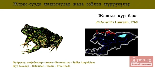
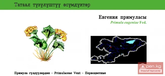
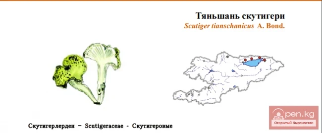
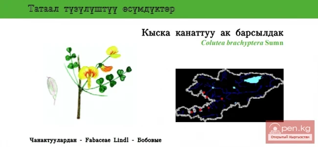
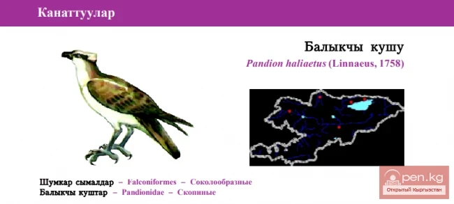
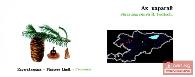
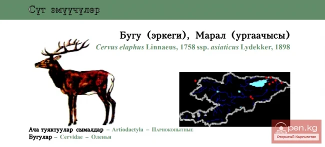
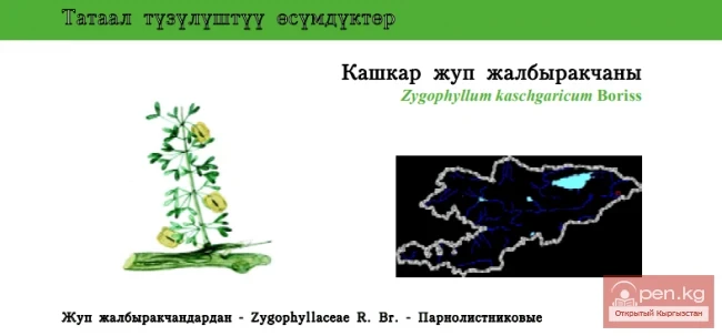
The Orto-Tokoy Zone encompasses the territorial foothills at the western end of the Terskey Ala-Too range, including the Kochkorka and Kara-Kudzhur valleys. The distance by road to the center of the zone — the district center of Kochkorka — is about 150 kilometers from the city of Naryn and 58 kilometers from the city of Balikchy.
The Kochkorka mid-mountain valley is framed by the Kyrgyz Ala-Too range (4234 m in this zone), Terskey Ala-Too (3600 m in this zone), Kara-Dzhorgo (3933 m), and Kara-Moynok (4281 m). The valley floor rises over 80 kilometers from 1900 to 2200 m above sea level.
The Kara-Kudzhur high-altitude valley is bordered by the Terskey Ala-Too, Kara-Dzhorgo, and Karagatty ranges. The valley floor rises over 80 km from 2500 to 3200 m.
The Chu and Kara-Kudzhur rivers flow through the valleys. The Chu River is remarkable. Its sources are located at cloud-high elevations; it is formed by the confluence of the Joon-Aryk River (in the upper reaches of Kara-Kudzhur) and the Kochkor River (from the confluence of Eastern Karakol and Eastern Seok) and flows into the Orto-Tokoy Reservoir. After that, the river persistently makes its way toward Lake Issyk-Kul, but just three kilometers short, it sharply turns toward the Boom Gorge. Quenching the thirst of the fields in the Chui Valley, it loses its channel in the scorching sands of Muyun-Kum.

At the beginning of the zone, the Chu River stretches the Orto-Tokoy Reservoir, which is 18 kilometers long, surrounded on three sides by cliffs and by a dam to the north. The reservoir has a capacity of 4700 million cubic meters, with a water temperature of 14 degrees, a mirror area of 24 square kilometers, and a water level of 1762 m. The dam height is 52 m, and its length along the crest is 362 m. Water is released through a pipeline in a tunnel drilled into the rocks, which is 576 m long. The turquoise color of the water is complemented by the reddish and yellow slopes of the mountain ranges. The area is desolate, with only the floodplain of the Chu River overgrown with shrubs and cozy bright green meadows. The scorching silence is interrupted by gusts of cool wind from the surrounding mountains. Majestic stone debris (korum) approaches closely to the river's floodplain, with cracked rocks bearing dark brown spots of "sunburn."
The rocky gorge narrows and then opens into wide valleys, cut by rocky outcrops. The surrounding landscape leaves an indelible impression. Above the yellow, sun-scorched hills rise bare red rocks. In the distance, the green slopes of the ridges shine through, and in the ghostly blue, majestic glaciers sparkle.
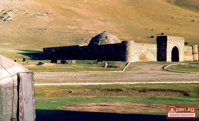
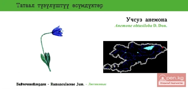
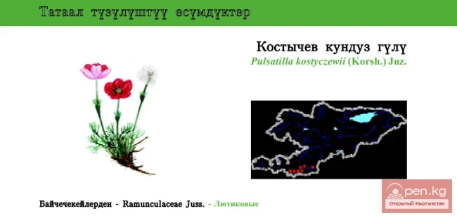
In the Kochkorka valley, we are surrounded by a harsh desert landscape. The vegetation is dominated by wormwood, with patches of feather grass, saltwort, ephemeral plants, and xerophytes. On the mountain slopes bordering the valley, subalpine meadows are well developed. The slopes are practically treeless, due to the significant aridity of the valley's climate. Groundwater outcrops can be found here and there. Along the road, colorful mausoleums are scattered, surrounded by intricately laid adobe walls.