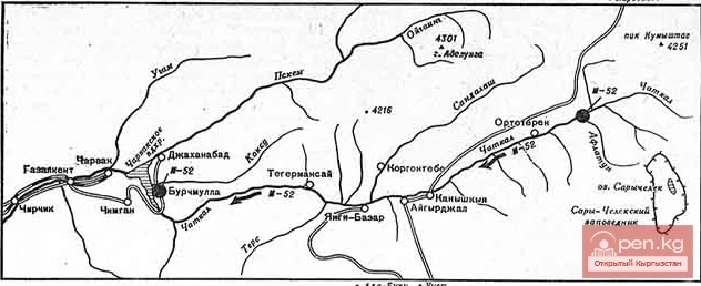
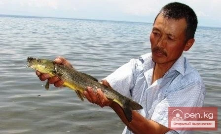
River Karakulja

admin Rivers
VK X OK WhatsApp Telegram
Karakulja River

Karakulja


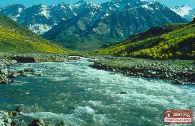
The Chatkal River in its upper reaches is called Karakulja (translated - Black Ram), which is formed by the confluence of Kara-su and Ak-su. It flows through the territory of the Osh region of Kyrgyzstan. The two main sources of Kara-su originate from small glacial lakes at the foot of the ridge connecting the Chatkal Range with the Uzun-Akhmat and Talas ranges.

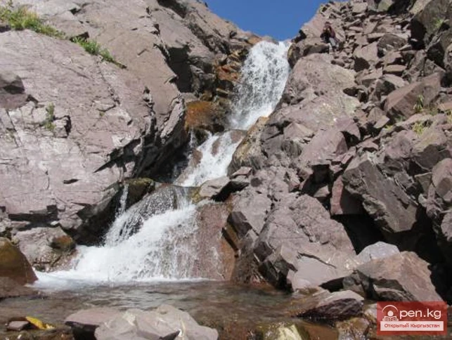
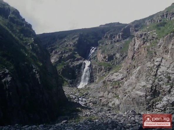
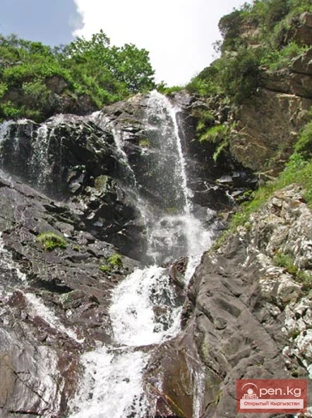
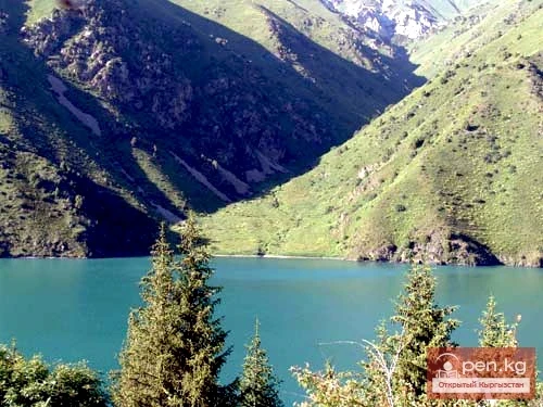
The more water-rich Ak-su River originates from a valley-type glacier flowing down from the Chatkal Range. This glacier, discovered by expedition members, is about 3-4 km long and is the largest in the Chatkal Range.
Karakulja River

Below the confluence of Ak-su and Kara-su, the Kukuysu River flows into Karakulja from the left. Several minor tributaries from the slopes of the Talas Range flow into Karakulja from the right.

The length of the river is 104 km.

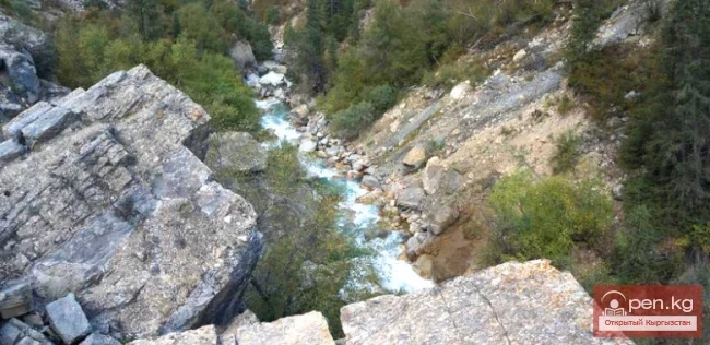
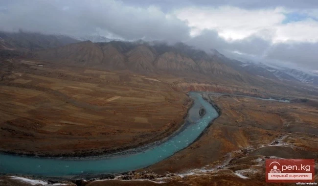
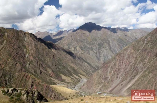
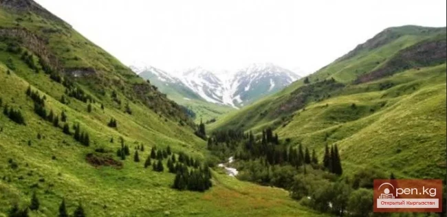
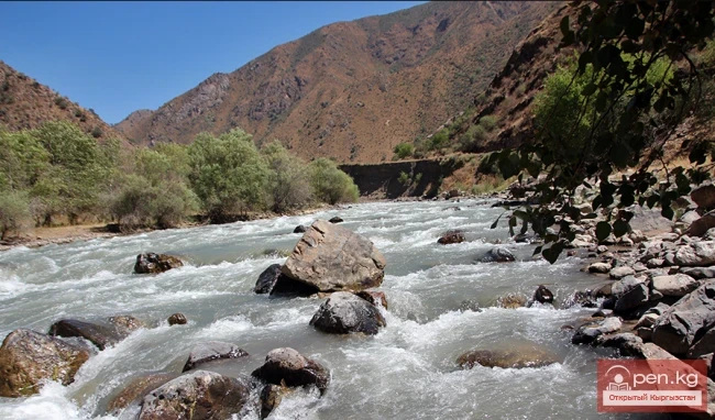
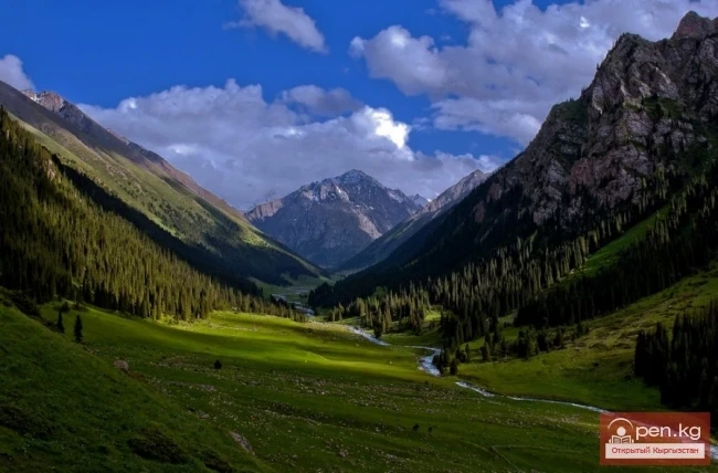
The valley of the Karakulja River at the confluence of the Kara-kasmak, Kara-toku, and Kukuysu rivers has a character typical of the middle reaches of the Chatkal. On the left bank of the valley, three terraces are clearly visible, the upper one gradually transitions into the foothills and then into table mountains; below the first terrace is the river's floodplain, covered with sparse deciduous forest and bushes. On the right bank of Karakulja, terraces are poorly developed. Essentially, there is only one distinctly expressed terrace opposite the Kara-toku River, corresponding in height to the first terrace of the left bank. There are no terraces on the right bank opposite the Kukuysu River, and a powerful spur of the Talas Ala-Too approaches directly to the river.
Karakulja River

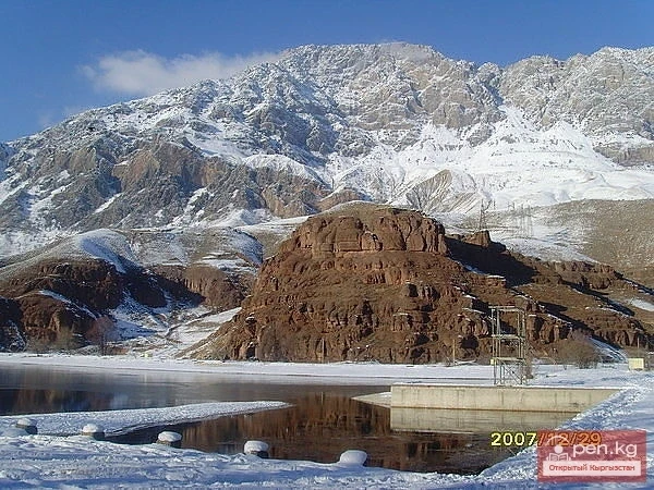
A few kilometers upstream from the mouth of the Kukuysu River (about 3-4 km), the forest ends, and the valley of the Karakulja River sharply narrows, forming a wild gorge surrounded by dark cliffs. It is possible that the name Karakulja ("Black Wild Goat") comes from these dark cliffs. About 2-3 km later, the gorge noticeably widens, especially at the confluence of the Ak-su and Kara-su valleys, where a large glacier once ended. From this point, the Kara-su valley has an eastern direction, while the Ak-su valley has a southeastern direction.

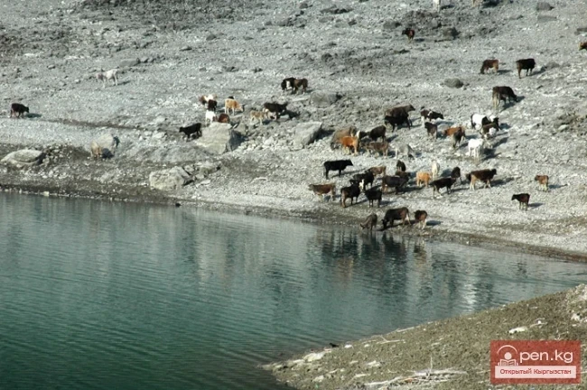
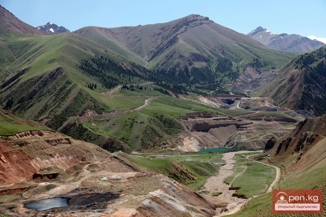
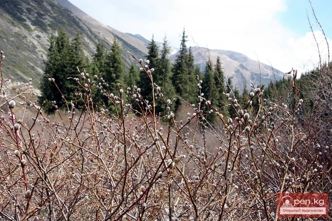
The upper reaches of the Karakulja valley and its sources are rich in pastures used by the Kyrgyz in the summer.

Therefore, there are many well-trodden paths in the valleys. Good paths lead through the side spurs of the ridge, connecting the valleys of the tributaries of Karakulja in the shortest way.

All these paths can be successfully used by climbing groups and expeditions.

In the river basin, there is the village of Kara-Kulja.
VK X OK WhatsApp Telegram

Read also:

Kara-Shoro

Kara-Shoro

In the upper reaches of the Yassy River, on its right bank, there is a whole series of mineral...

Kara-Suu

Kara-Suu

The "Kara-Suu" Zone is located in the eastern part of the southern slope of the Chatkal...

Kara-Tor Waterfall

Kara-Tor Waterfall

Kara-Tor Lower Waterfall In the Naryn region of the Kochkor district, in the upper reaches of the...

Waterfall Kara-Chyn

Waterfall Kara-Chyn

Waterfall in the Grigorievsky Gorge Kara-Chyn Waterfall (at least, that's how local kumys...

The River Aflatun

The River Aflatun

Aflatun River – the largest right tributary of the Kara-Suu River in the Jalal-Abad region. The...

Kara-Archa Waterfall

Kara-Archa Waterfall

Kara-Archa Waterfall - left tributary of Kegety (Chui region) Coordinates: 42.504977, 75.069273...

Kara-Balta

Kara-Balta

Kara-Balta, which translates as "Black Axe," is one of the youngest cities in the Kyrgyz...

Chatkal River

Chatkal River

Chatkal - a mountain river in Kyrgyzstan and Uzbekistan, Before the formation of the Charvak...

Zone "Isfayram-Sai"

Zone "Isfayram-Sai"

Zone "Isfayram-Sai". The left tributary of the Isfayram-Sai River is the Surme-Tash...

Lake Kara-Suu

Lake Kara-Suu

Lake Kara-Suu is located in the Toktogul district. It is a dam-type lake, and its level depends on...

River Ak-Suu

River Ak-Suu

The main channel of the Ak-Suu River is at least 20-22 kilometers long. The lower part of the...

"Upper Naryn Zone"

"Upper Naryn Zone"

The "Upper Naryn Zone" includes the upper part of the Naryn River basin from the...

Kara-Balta Gorge

Kara-Balta Gorge

Kara-Balta Gorge is located on the northern slope of the Kyrgyz Ala-Too. The Kara-Balta Gorge...

Diving at Lake Kara-Suu

Diving at Lake Kara-Suu

Geographical Information: Lake Kara-Suu is located in the area of the Taktalyk ridge, at the lower...

Kyzyl-Unkyur

Kyzyl-Unkyur

The "Kyzyl-Unkyur" Zone is located 15 km northeast of the village of Arslanbap in the...

Kara-Shoro Field

Kara-Shoro Field

Kara-Shoro Deposit includes 3 areas of carbonated mineral water distribution — namely Kara-Shoro...

River Kyzyl-Suu

River Kyzyl-Suu

Kyzyl-Suu (Kyzyl-Suu River, Красная река) - a river in Kyrgyzstan and Tajikistan, the right source...

Natural Park "Besh-Tash"

Natural Park "Besh-Tash"

Besh-Tash Nature Park is located south of the city of Talas on the northern slopes of the Talas...

Talas Ridge

Talas Ridge

Talassky Ala-Too A mountain range located in the Western Tien Shan system. Most of it is situated...

Kara-Kul

Kara-Kul

Kara-Kul is a city in the Jalal-Abad region of Kyrgyzstan. According to the 2009 census of...

Zone "Aflatun"

Zone "Aflatun"

Aflatun Zone is located on the southeastern slopes of the Chatkal Ridge and occupies the basin of...

Small Naryn

Small Naryn

Small Naryn encompasses the valley of the river of the same name, located between the ridges of...

Upper Naryn

Upper Naryn

Upper Naryn includes the upper part of the Naryn River basin from the vicinity of the town of...

Zone "Tar"

Zone "Tar"

The "Tar" zone includes the valley of the river of the same name and its tributaries. In...

Kursheb River

Kursheb River

Kursheb, Kursheb River, in the upper reaches — Gulcha, A river in Kyrgyzstan, flowing through the...

Carbonated waters

Carbonated waters

Currently, there are 28 known deposits and occurrences of carbonated waters in Kyrgyzstan,...

Naryn-Too Ridge

Naryn-Too Ridge

Naryn-Tau The area is hard to access and rarely visited. Due to the low glaciation and modest...

Write a comment: