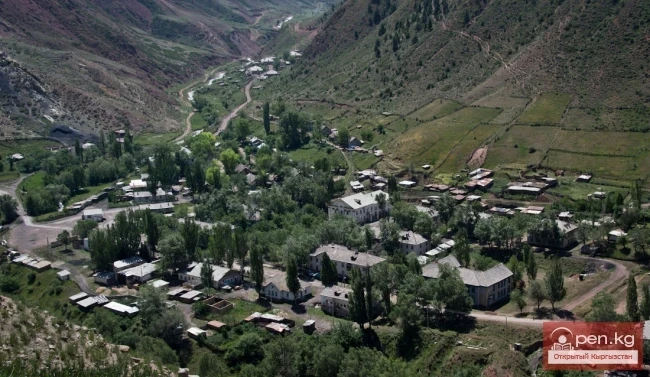
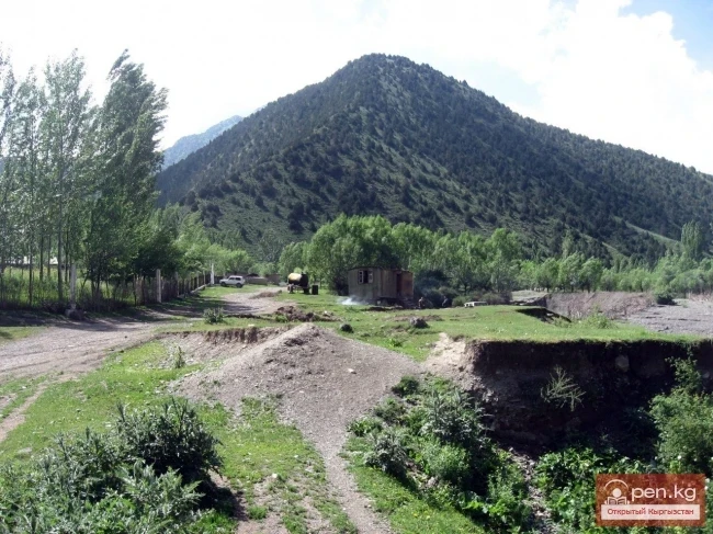
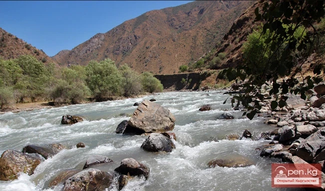
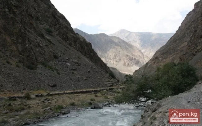
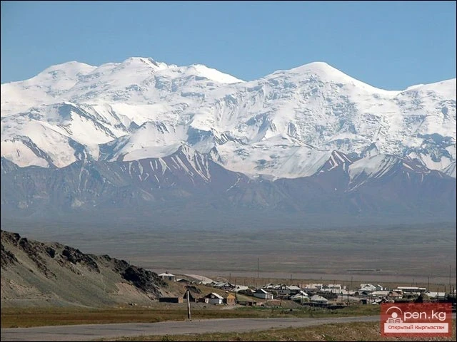
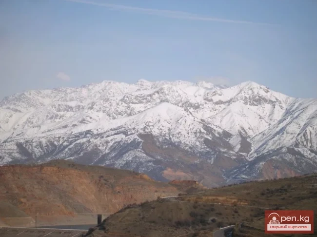
The "Tar" zone includes the valley of the river of the same name and its tributaries. In this area, the river changes its name four times — Aлай-Куу, Ой-Тал, Tar, and then becomes Карадарья. The valley is bordered by the Fergana Ridge to the north and the Alai Ridge to the south. A road runs along the river from the city of Uzgen to the village of Kashka-Suu.
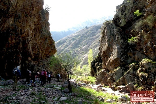
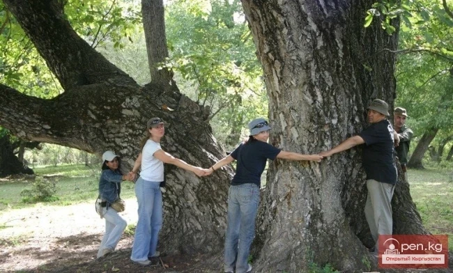
The valley, with its large and turbulent Tar River, is surrounded on all sides by steep rocky slopes. For many thousands of years, the river has carved its way between the eastern end of the powerful Alai Ridge and the southwestern slopes of the Fergana Ridge. As one moves upstream along the Tar River, one encounters thickets of pistachio trees, mighty walnut trees with sprawling branches covered in green walnut fruits, as well as low wild apricot trees. The thickets extend up to the Kok-Kel and Kara-Tash areas.
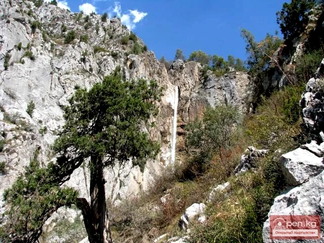
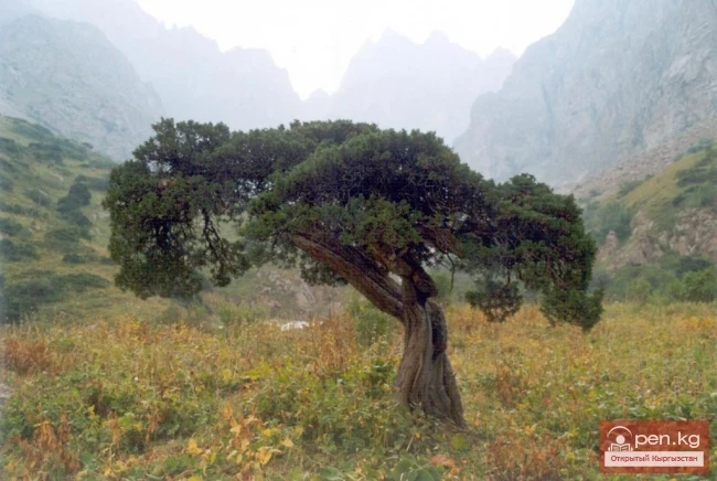
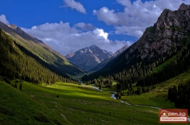
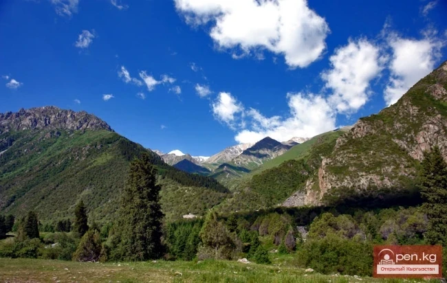
In the mid-mountain region, large masses of juniper forest cover the nearby slopes like a curly green carpet. Individual juniper trees climb high up the slopes to the gravelly scree.
In the remote side gorges and branches, narrow paths lead into the shady coolness of the slender Tien Shan spruces. The sprawling branches of rowan trees, the healing beads of sea buckthorn strung on thorny branches, bushes of black currants, and the black-blue, pollen-covered berries of barberry, as well as thickets of raspberries and blackberries, all beckon invitingly.
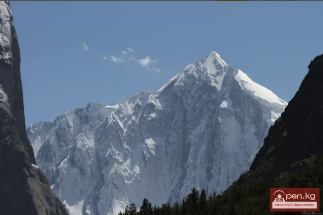
The singing of birds fills the secluded places with life. Each gorge and area has a local name that accurately reflects the character of the landscape. The picturesque valley of the right tributary of Kara-Kuldja, after which the Tar River becomes Kara-Darya, deserves special attention. The jagged ridge of the Fergana Ridge with its towering peak (4692 m) separates the valley of the river from the harsh surroundings of the Arpin Valley.
In the floodplain of the Oй-Tал River and its tributaries Kunduq and Kainyda-Bulak, dense birch forests grow. Individual trunks of old birches reach one meter in diameter. The flow of the Kunduq River in the lower reaches is gentle. The gently sloping banks are densely overgrown with shrubs of sea buckthorn and rose hips. The thickets are filled with the varied chirping of birds.
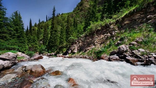
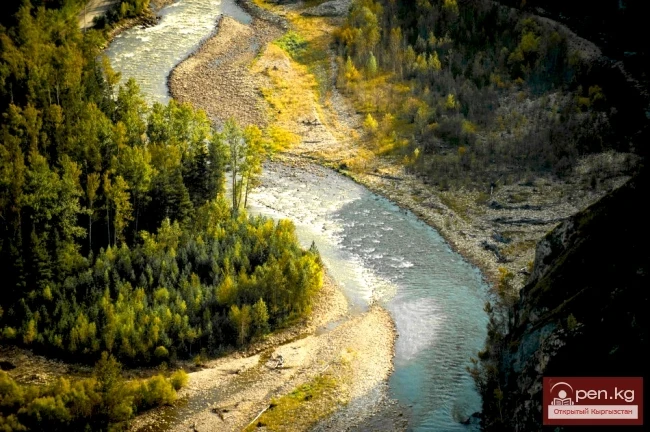
The turbulent streams of the mountain rivers Kashka-Suu and Kainyda-Bulak rush swiftly. The floodplain of the rivers is densely covered with spruce forests, while individual trees and groves are scattered across the slopes. The sprawling branches of the slender spruces sway slightly in the cool breeze. The spruces are adorned with garlands of brown cones filled with tasty seeds.
In the mid-mountain valley of Aлай-Куу ("pale mountains"), the rivers Aлай-Куу, Kyzyl-Djar, Terek, and Iri-Suu merge to form the Oй-Tал River. The bottom of the Aлай-Куу valley rises from 2000 to 3000 m. It is framed by ridges — the Fergana and Aлай-Куу (Seget, 4754 m). In the lower reaches of the valley, steppe areas are mixed with meadow vegetation. Numerous small lakes, mountain streams, and rivulets enliven the landscape. In the valley of the turbulent river, birch groves spread out with thickets of berry shrubs. Higher up on the northern slopes of the Fergana and Alai ridges, there are spruce forests.
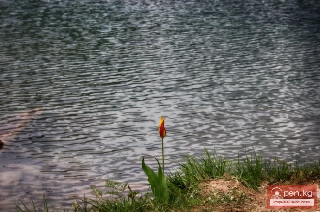
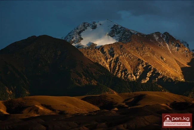
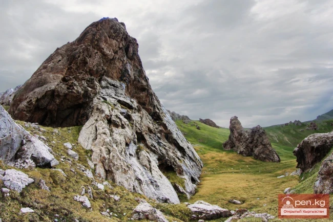
The lush subalpine meadows are adorned with colorful attire. Here, asters, daisies, red and yellow poppies, blue forget-me-nots, and white-pink flowers of tall eremurus are on display. The green sea of alpine meadows, dotted with white, soulful edelweiss, is cut through by rocky outcrops and ribbons of stony scree. Among the mighty rocks, the boundary of the snowfields is visible. Small streams flowing from under the glaciers give rise to rivers.

The zone is home to numerous predatory animals, ungulates, and game birds (pigeons, chukars, and wild turkeys). In the secluded gorges, one can find roe deer, mountain goats (taks), wild rams (argali), leopards, wolves, and lynxes, while bears inhabit the dense spruce forests. The shrub thickets in the floodplain of the Terek River conceal numerous hares.
Narrow paths wind among the rocks. Sometimes, a melodic whistle reaches the ears — the call of mountain turkeys (ulars) and the chatter of marmots. On the elevated distant rocky outcrops, the chiseled silhouette of a mountain goat sometimes appears. By the quiet pools, on the banks of turbulent rivers, one can sit with a fishing rod and catch osman and marinka. On hot days, it is nice to swim in the cool water and sunbathe under the rays of the mountain sun.
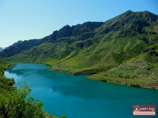
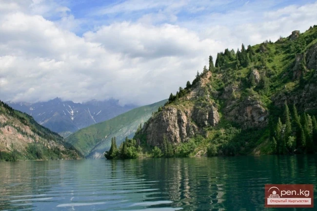
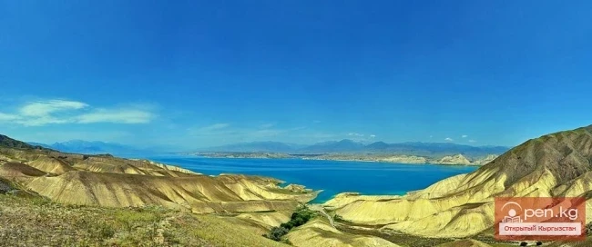
A small right tributary flows into the Tar, in the upper part of whose gorge the evergreen Turkestan juniper reigns over the slopes. In the middle of the gorge, at an altitude of about 2856 m at the upper forest boundary, lies a large high-altitude lake Kулун ("foal"), and below it is another smaller lake — Kулун-Малый. They were formed as a result of a massive landslide that blocked the swift water flow with a powerful dam. The upper lake is about 5 km long and up to 700 m wide. Its surface area is approximately 3.3 km². The lake is quite deep with fresh water. In its transparent blue depths, the surrounding rocky shores dissolve.
The secret of Kулун-Малый is that it does not freeze even in winter. A legend is associated with the formation of the lake: "In ancient times, there lived a mare of unparalleled beauty with a foal. In winter, when a lot of snow fell, they were attacked by wolves. They had to run for a long time, and the foal became exhausted. The mother prayed with tears to the mountains, and they unleashed rocky slopes upon the wolves..." These lakes are classified as water bodies of the republic that have scientific and cultural value.
Among the other most attractive sites in the zone is the easily accessible cave Kara-Unkyur, located on the left bank of the Tar River amidst a vast karst plateau. The total length of its passages is 910 m, and its width is up to 10 m, making it suitable for sports speleotourism. This cave is the largest gypsum cave in Kyrgyzstan. In the 1930s, it served as a refuge for bandit groups.
The zone has many sources of mineral water. In the upper reaches of the Kara-Kuldja River basin, there are three sources — "Sur-Tash," "Kara-Kuldja," and "Karakol." Five kilometers from the shore of Lake Kулун, there is a source of carbonated water of the same name. In the floodplain of the Terek River, a right tributary of the Oй-Tал River, there are two sources named "Terek." On the left bank of the Aлай-Куу River, above the village of Kek-Art, is "Tyuz-Ashuu." Another source, "Seok," is located in the upper reaches between the Terek and Aлай-Куу rivers.
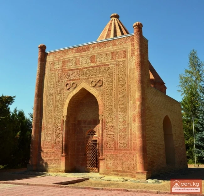
The historical site "Kyz-Mazar" deserves attention. It is located on the left bank of the Tar River in the territory of the V. I. Lenin collective farm and consists of scattered stones and bricks. Some of the stones bear Arabic and Arab-Persian inscriptions. There is a legend that there was once a settlement here with beautiful mausoleums. Another historical site is the burial ground "Kara-Djar," located on the right bank of the Kara-Kuldja River. More than 10 burial mounds have been excavated here, yielding interesting finds.