Zone "Toguz-Toroo" ("Nine Chestnuts")
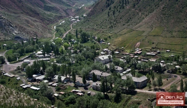
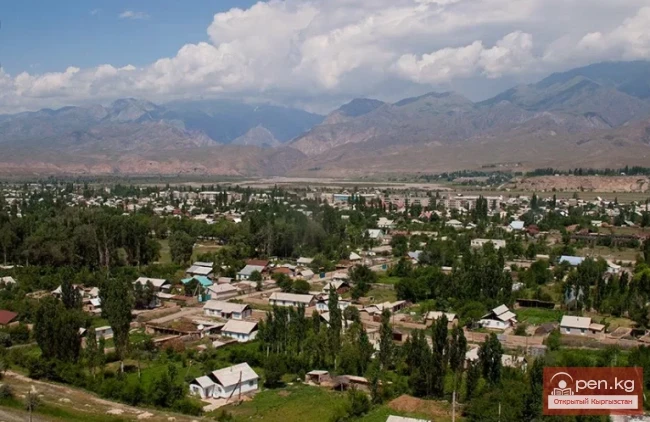
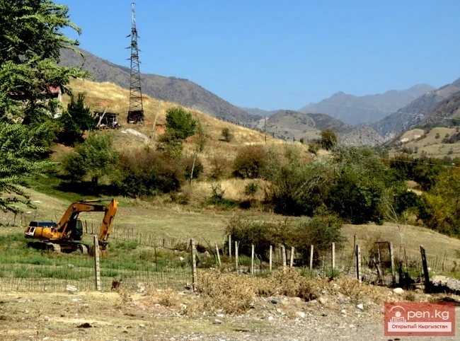
The zone "Toguz-Toroo" ("nine bays") includes the valley of the same name, the southern slopes of the Moldo-Too ridge (eastern part), and the valley of the Naryn River up to the mouth of the Kekemerena tributary. The center of the zone, the district center of Kazarman, is located 200 kilometers by road from the city of Naryn. The settlement got its name from the barracks of the cavalry unit of the Red Army that were stationed here during the fight against the Basmachi.
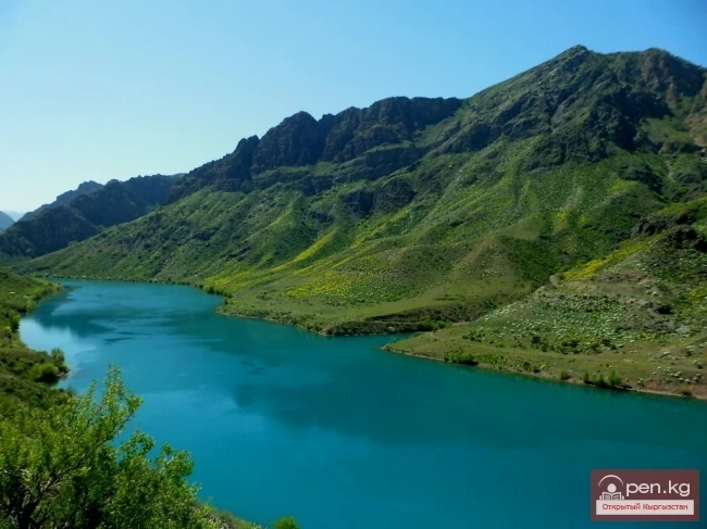
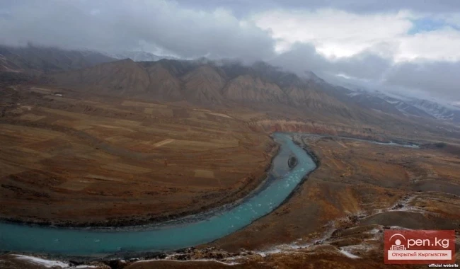
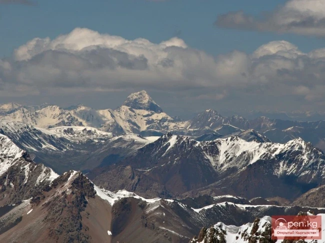
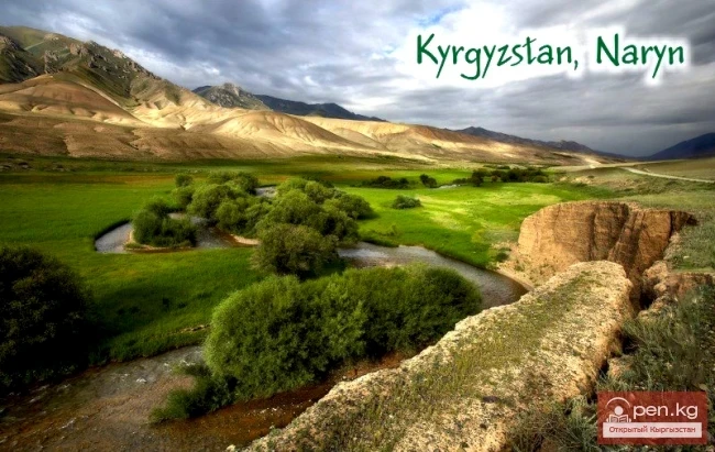
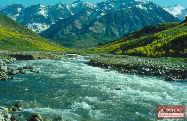
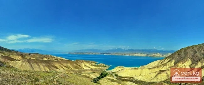
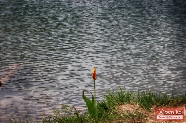
The characteristics of the southern slopes of the Moldo-Too ridge and the valley of the Naryn River mainly correspond to the "Ak-Talaa" zone. At the confluence of the left tributary Kek-Irim, the Naryn River has the widest floodplain, reaching 1.5 km. Terraces are formed by pebble deposits. The valley of Kek-Irim with its tributaries rises from 1200 to 2000 m above sea level. The boundaries of the valley are formed by ridges — Fergana (average height 3600 m), Kekirim (peak Kek-Irim 4351 m), Ak-Shiyrak (average height 3400 m). This zone has the most favorable natural conditions in all of the Inner Tien Shan. Here, precipitation is nearly a third more than in other zones. The valley is heavily dissected by terraces several tens of meters high. Caves are often found in the coastal cliffs. The surface of the valley is gently undulating. In its lower part, there are marshy areas, while higher up, the colorful steppe expanses prevail. In summer, the green carpet of grass is particularly pleasing. Against this backdrop, the white flocks of sheep are a delightful sight.
In the floodplain of the streams, poplar-willow forests and thickets of rosehip, honeysuckle, barberry, meadowsweet, dogwood, and sea buckthorn spread out. There are especially many shrubs of multi-leaved and Kyrgyz caragana. Among the thickets of shrubs, cozy glades can be found.
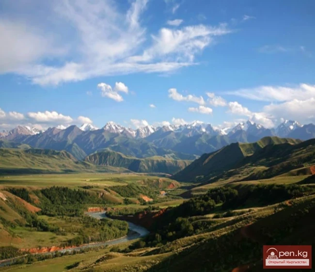
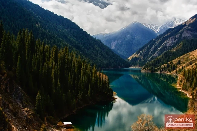
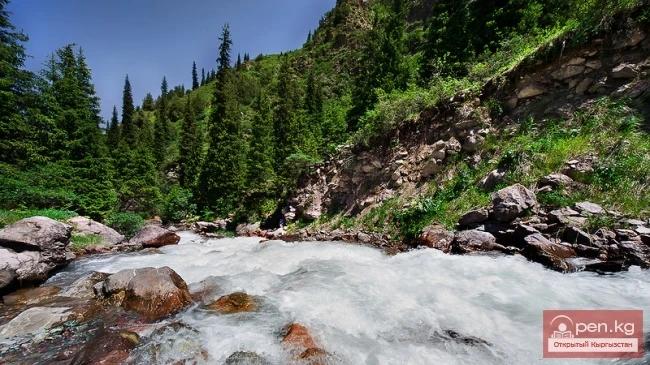
The gentle slopes of the surrounding ridges are cut by numerous gorges, where small rivers flow. The pure cold water, cascading over rocks and tumbling down cliffs in small ringing waterfalls, rushes further into the valley to impart its strength to the majestic Naryn.
In the side gorges of the Fergana ridge, mixed groves of birch, maple, and ash grow. Juniper clings to rocky slopes. On the edges of forested areas, thickets of wild black currant and hawthorn spread out. The trunks of birches present an unusual picture. They have a golden hue to their bark and are heavily bent in different directions or lie flat along the slope. Powerful roots cling to the sparse rocky soil and the slightest cracks in the rocks. The birch forest in the Congur-Tebe area looks particularly enchanting. Care should be taken with fire in the forest. Campfires should be made away from trees, but it is better to use a compact gasoline stove "Shmel." Do not break trees. After all, there are always many dry branches to be found in the thickets.
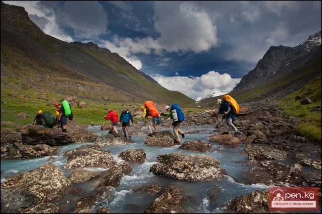
In the subalpine zone, you are immersed in grass up to your head, and to move forward, you have to carve out a corridor. In the tall grass meadows, you can find meadow fescue, kobresia, and eremurus. The latter can reach a height of 2 meters and have huge beautiful flowers. Fresh leaves of these plants can be consumed like cabbage.
The tall grass gradually gives way to alpine meadows, strewn with flowers and stones, covered with colorful lichens and moss.
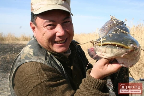
In the steppe, there are ground squirrels, hares, ferrets, wolves, chukars, and foxes. Thickets of low caragana shrubs shelter wild boars, porcupines, roe deer, martens, and pheasants. In the belt of subalpine and alpine meadows, you can find marmots, grouse, wild goats, argalis, shaggy horned yaks, and snow leopards. In the Kanachuu area, there is the Toguz-Torouz zoological reserve covering an area of 59.6 thousand hectares, intended for the protection of rare and endangered animals.
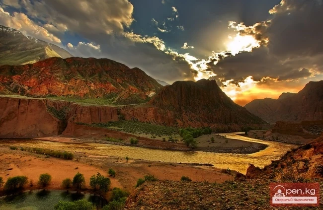
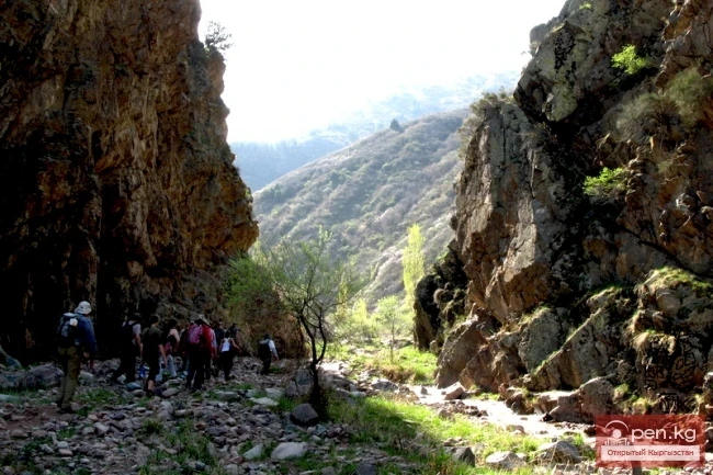
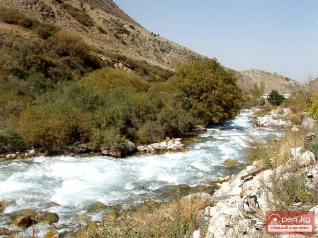
Over many millennia, the Naryn has carved a narrow gorge between the western end of the Moldo-Too ridge and the Kekirim ridge. The river swiftly carries its waters through a narrow canyon with steep reddish-gray walls. The powerful current, twisted into coils, is filled with white foams and frothy whirlpools, assaulting the cliffs. Its gigantic energy moves huge boulders, and the collisions create a constant noise in the gorge. The described gorges may sometimes seem similar to each other, but each has its unique face and character.
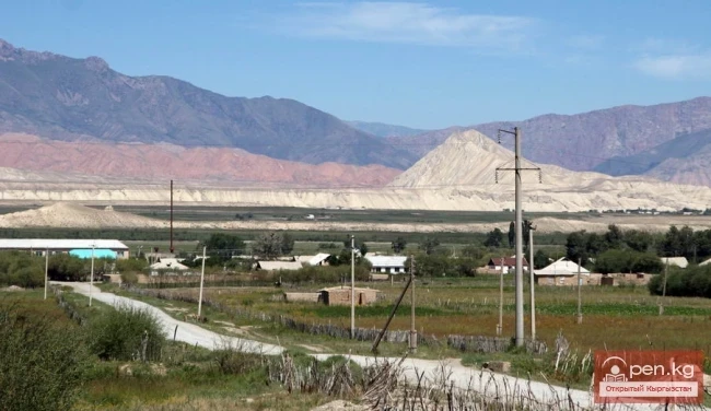
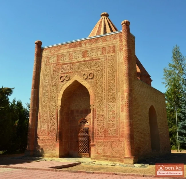
Many attractions are concentrated along the ring road, creating good conditions for sightseeing. This includes a stone gallery with tens of thousands of black-and-white rock paintings in the upper reaches of the Saymaluu-Tash area, dating back to the 2nd millennium BC to the 8th century AD. The gallery is located 30 km south of the village of Kazarman. The variety of subjects in the paintings is striking: depictions of animals and people, hunting scenes, ritual signs, and labor and military activities. A stream of the same name flows through the area. On the outskirts of the village of Kazarman, the ruins of a settlement reminiscent of a city from the 10th to 12th centuries have been preserved. Monuments from the era of the Saka and Usun peoples are represented by scattered burial mounds 3 to 5 meters high, which contain burial sites.
Through the passes of the Fergana ridge, one can reach the zones of the Osh region. There is a road from the village of Kazarman to Jalal-Abad, but there is no bus service.
Read also:
Small Naryn
Small Naryn encompasses the valley of the river of the same name, located between the ridges of...
Zone "Ak-Talaa"
The "Ak-Talaa" zone includes the valleys of the Ala-Buka, Arpa, and Terek rivers, as...
Zone "Min-Kysh" (a thousand birds)
The zone "Min-Kysh" (a thousand birds) includes the fabulously beautiful valley of the...
"Suusamyr Zone"
The Suusamyr Zone includes the eponymous high-altitude valley stretching 155 km. To the north, it...
Zone "At-Bashi"
The At-Bashi Zone includes the Atbashi-Karakoyun Valley. The center of the zone, the village of...
Ak-Talaa
Ak-Talaa includes the valleys of the Ala-Buka, Arpa, and Terek rivers, as well as the southern...
"Upper Naryn Zone"
The "Upper Naryn Zone" includes the upper part of the Naryn River basin from the...
Upper Naryn
Upper Naryn includes the upper part of the Naryn River basin from the vicinity of the town of...
Zone "Chatyr-Kel"
The Chatyr-Kel Zone includes a significantly elevated intermountain basin with a lake of the same...
Kara-Suu
The "Kara-Suu" Zone is located in the eastern part of the southern slope of the Chatkal...
"Orto-Tokoy Zone"
The Orto-Tokoy Zone encompasses the territorial foothills at the western end of the Terskey...
The Village of Kazarman
KazarMan – a village in central Kyrgyzstan, the administrative center of the Toguz-Toro district....
Suusamyr Valley
The length of the valley is 155 km. It is bordered on the north by the Kyrgyz Ala-Too, on the...
Zone "Maly Naryn"
The "Maly Naryn" zone encompasses the valley of the river of the same name, located...
Naryn
This area includes the city of Naryn — a transport and distribution tourist center — and its...
The Valley of Eki-Naryn
The name of the Eki-Naryn Valley translates from Kyrgyz as "two Naryn." Eki Naryn (Two...
Kekemeren River
Kekemeren River is one of the most amazing and beautiful rivers in Kyrgyzstan. The Kekemeren is...
"Chon-Kemin Zone"
Chon-Kemin Zone includes the valleys of the Chon-Kemin and Kichi-Kemin rivers between the high...
Inner Tian Shan
It is precisely about this region that famous travelers such as Semenov-Tian-Shansky, Mushketov,...
The Valleys of Alamedin and Issyk-Ata
Ala-Medin. The Ala-Medin Valley is located 25 km from Bishkek. The valley opens up through the...
Photo - A City with an Interesting "Highlight" in the Mountains of Kyrgyzstan
This year, Naryn is celebrating its 156th birthday. The correspondent of Turmush discovered...
Zone "Isfayram-Sai"
Zone "Isfayram-Sai". The left tributary of the Isfayram-Sai River is the Surme-Tash...
Fishing Spots (Updated Article)
Naryn...
Naryn Region
The Naryn Region is located in the southeast of Kyrgyzstan and was first established on November...
Naryn-Too Ridge
Naryn-Tau The area is hard to access and rarely visited. Due to the low glaciation and modest...
Talas Ridge
Talassky Ala-Too A mountain range located in the Western Tien Shan system. Most of it is situated...
River Karakulja
Karakulja The Chatkal River in its upper reaches is called Karakulja (translated - Black Ram),...
The title translates to "Ak-Shiyrak Ridge."
Ak-Shiyrak The Ak-Shiyrak Ridge is a watershed between the Naryn and Sary-Jaz rivers in the Tian...
The Tauşkandarya River
Tauskandarya - "Raging River" A river in Kyrgyzstan and the Xinjiang Uygur Autonomous...
Zone "Padsha-Ata"
The "Padsha-Ata" zone includes the gorge of the same name and is located near the...
"Alamedin Zone"
Alamedin Zone is located 25 km from Bishkek in the valley of the same name and the surrounding...
The River Aflatun
Aflatun River – the largest right tributary of the Kara-Suu River in the Jalal-Abad region. The...
The title "Хребет Джетим" translates to "Djetim Ridge" in English.
Djetim A mountain range in the Tian Shan, in Kyrgyzstan, south of the Terskey Alatau. The length...
Valley of the Chatkal River
Chatkal Valley is 30 to 50 km wide and stretches from the southwest to the northeast for 150 km....
Zone "Kety"
Kegety Zone is located 75 km from Bishkek in the gorge of the same name on the road to the village...
The title translates to "Kainyda-Katta Ridge."
Kainyda-Katta In the Central Tien Shan in Kyrgyzstan, extending west from the peak of the Red Army...
River Kyzyl-Suu
Kyzyl-Suu (Kyzyl-Suu River, Красная река) - a river in Kyrgyzstan and Tajikistan, the right source...
Zone "Toktogul"
The Toktogul Zone includes the Ketmentebin intermountain basin in the lower reaches of the Naryn...
Kainyndy Glacier
Kainy Between Kokshaal-Tau and Kainy-Katta lies the powerful Kuyakap Glacier, and between...
Kuylytau Ridge
Kuylytau A mountain range in the Central Tien Shan, in Kyrgyzstan. It is located between the...
Kyzyl-Unkyur
The "Kyzyl-Unkyur" Zone is located 15 km northeast of the village of Arslanbap in the...
River Ak-Suu
The main channel of the Ak-Suu River is at least 20-22 kilometers long. The lower part of the...
Zone "Aflatun"
Aflatun Zone is located on the southeastern slopes of the Chatkal Ridge and occupies the basin of...
Glaciers of the Kyrgyz Range
Glaciers of the Kyrgyz Ala-Too The highlands of the Kyrgyz Range feature a deeply dissected alpine...
Zone "Yassy"
The Yassy Zone occupies the valley of the same name, located near the city of Uzgen, 80 km from...
Zone "Talas"
The "Talas" zone is located in the central part of the Talas River valley and includes...
Mayluu-Suu (Mayli-Sai)
The "Maili-Sai" Zone is located in close proximity to one of the major industrial...
"Issyk-Ata Zone"
Issyk-Ata Zone is located 80 km from Bishkek and includes two gorges — Issyk-Ata and Tuyuk...