Kainyndy Glacier

admin Glaciers
VK X OK WhatsApp Telegram
Kainy Glacier

Kainy


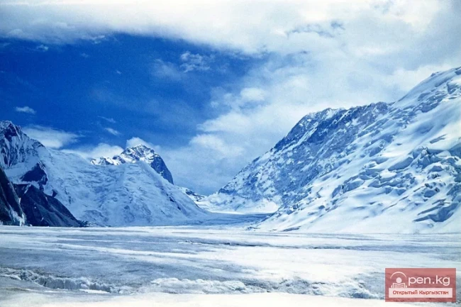
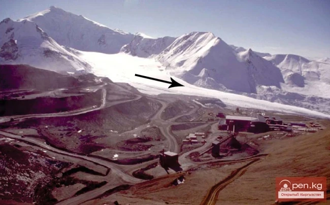
Between Kokshaal-Tau and Kainy-Katta lies the powerful Kuyakap Glacier, and between Kainy-Katta and Inylchek-Tau lies the enormous Kainy Glacier, the younger sibling of Inylchek, the second largest glacier in the region.

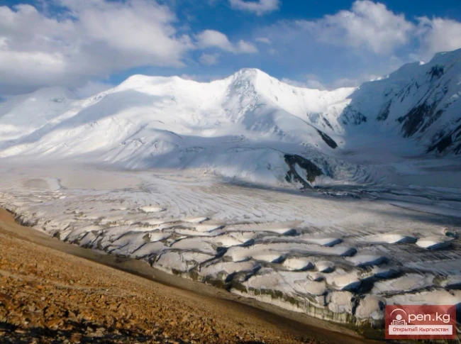
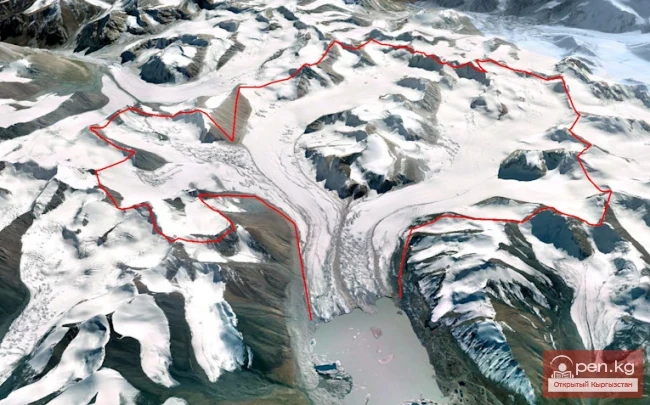
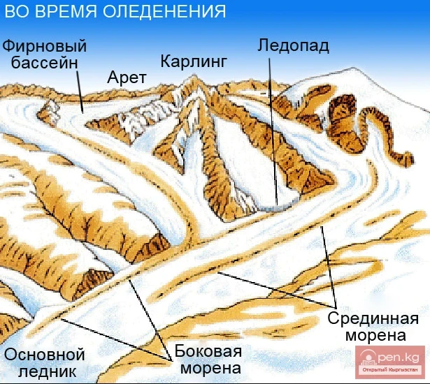
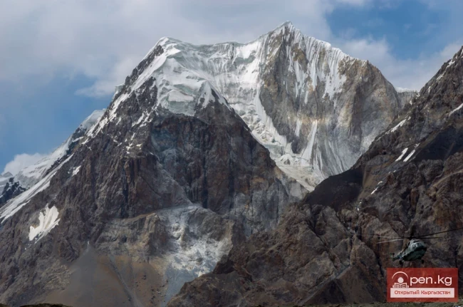
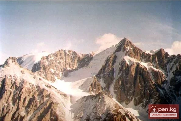
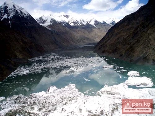
The glacier is located on the southwestern edge of the Kan-Tenir ridge. It is bordered to the north by the Enilchek-Tuu ridge and to the south by the Kainy ridge of the same name. The length of the glacier is 25.8 kilometers, and its area is 107.5 square kilometers, of which 68.3 square kilometers is allocated for the accumulation of this glacier, while 39.2 square kilometers is the ablation zone of the glacier, of which 4.9 square kilometers is covered by a continuous layer of moraines.
Kainy Glacier

The highest point of the firn zone is located at an altitude of 5420 meters above sea level, the snow line of the glacier is at 4440 meters above sea level, and the lowest point of the glacier's end is at an altitude of 3270 meters above sea level.

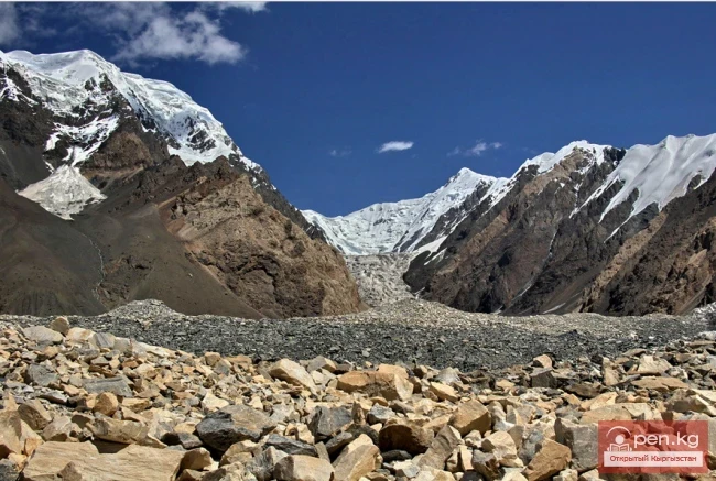
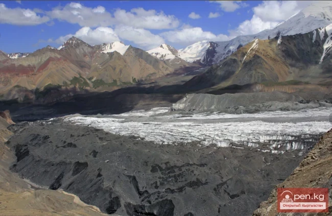
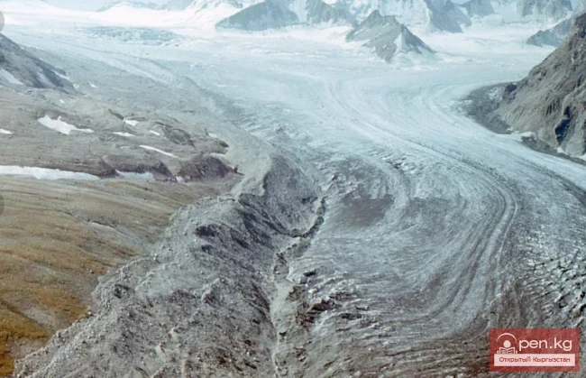
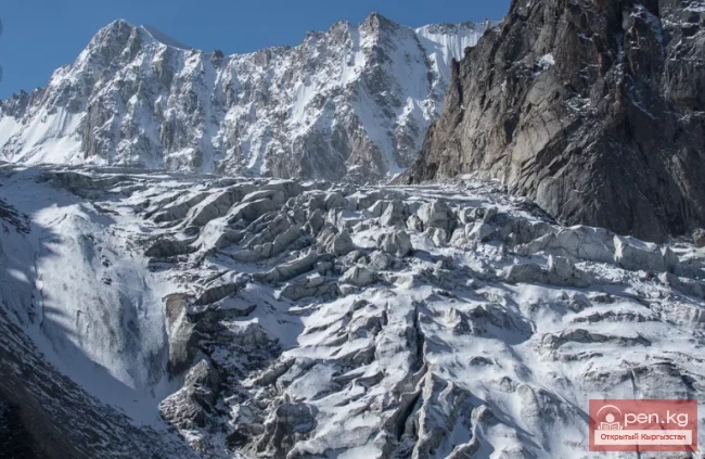
The overall flow of the glacier is quite calm, except for the very upper reaches, with no sharp drops or heavily fragmented sections. At the level where the Powerful Glacier flows into it, lateral moraines begin. The middle section consists of a strip of clean open ice, with quite a few ice rivers, but crossings are simple. Below the confluence of the Powerful Glacier, the glacier rises for 2-2.5 km, with relative height differences of 20-30 meters. The strip of clean ice narrows due to the development of lateral moraines. After 6-7 km from the confluence, the Powerful Glacier is completely covered by moraines. The surface of the glacier is hilly, with relative height differences of up to 50 meters.
Kainy Glacier

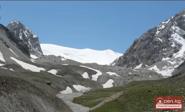
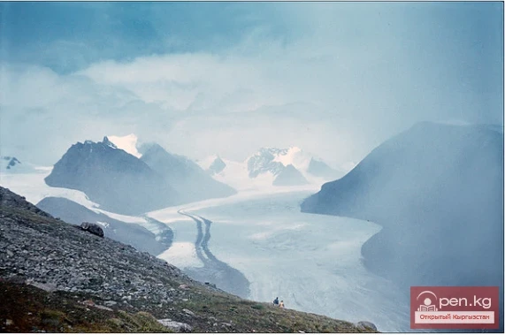
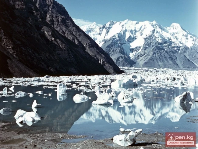
The end of the glacier tongue is covered by a moraine blanket. The river flows out from under the glacier closer to the right bank of the valley. Below the end of the glacier, the valley of the Kainy River has an extensive sandur area, where a powerful water flow winds and splits into branches.

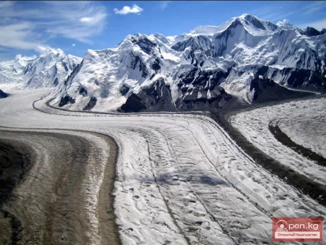
The Kainy Glacier system includes more than 20 tributary glaciers and 14 independent glaciers that have detached from the main trunk. The largest tributaries are Schmidt and Powerful. It belongs to the type of dendritic (tree-like) glaciers, receiving dozens of tributaries, some of which are independently complex glaciers.

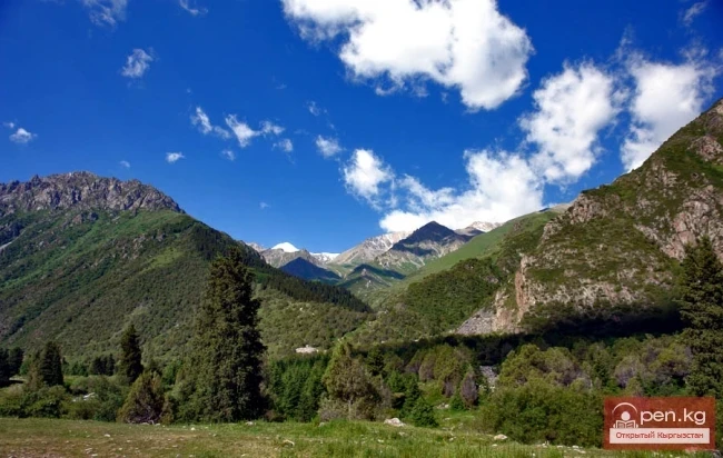
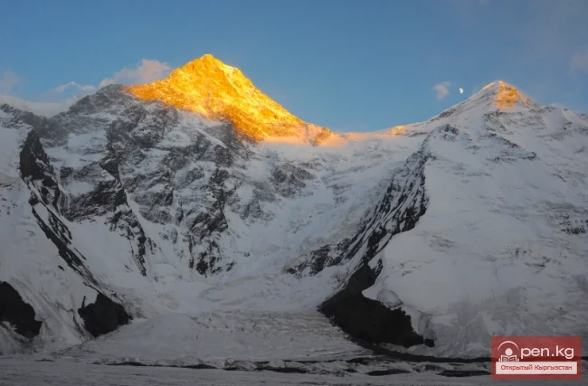
The feeding area is a vast multi-chamber glacier cirque. It belongs to the pulsating glaciers. The Kainy River, which flows through the territory of the Aksuu district of the Issyk-Kul region, originates from the Kainy Glacier.

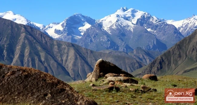
The Kainy River is a left tributary of the Sary-Jaz River. It begins at the Kainy Glacier, located on the southwestern periphery of the Kan-Tenir massif. The length of the river is 50 kilometers, and the catchment area of the river is 599 square kilometers.

The tributaries of Kainy include the rivers At-Jailoo, Uch-Chat, Karagatti, and other rivers in the region. The basin of the Kainy River contains 73 glaciers with a total area of 158 square kilometers. The main source of water for the river is meltwater from snow and glaciers.
Kainy Glacier

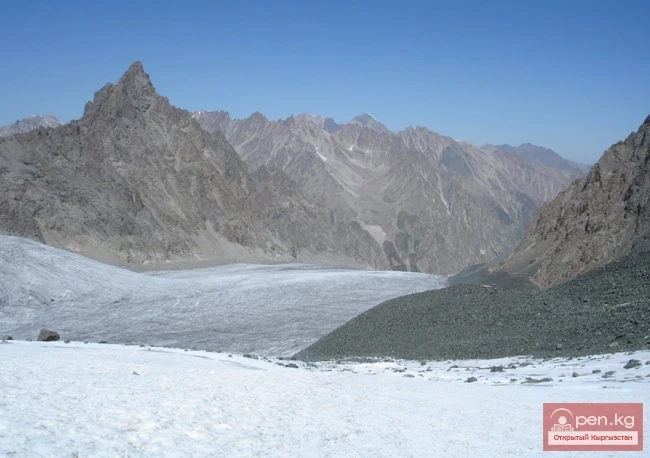
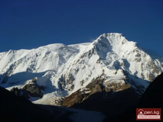
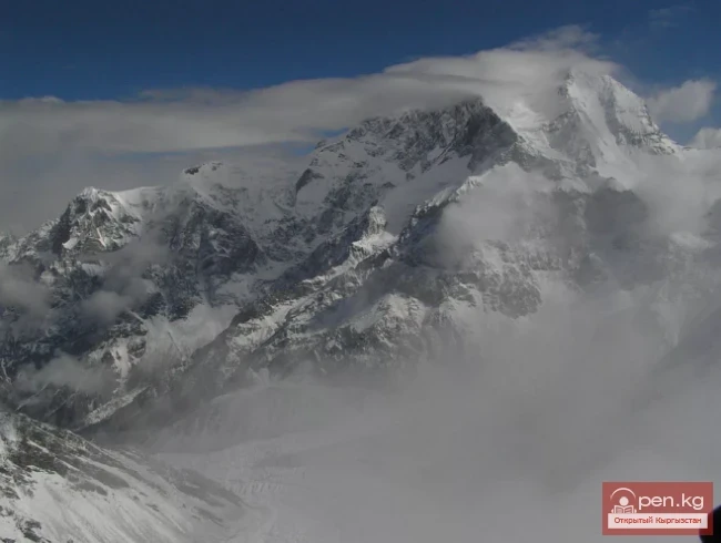
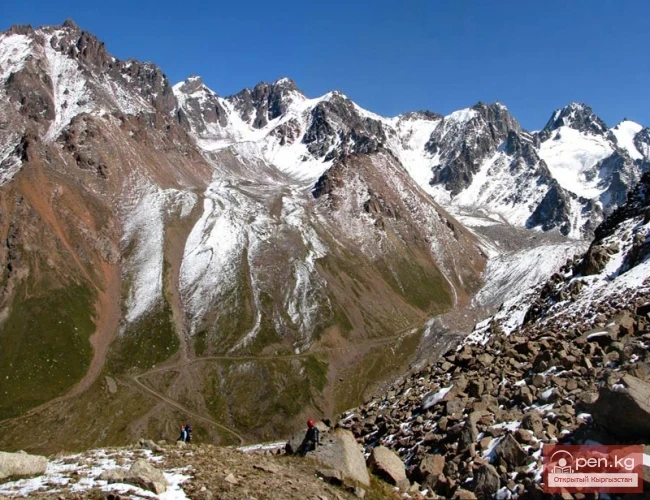
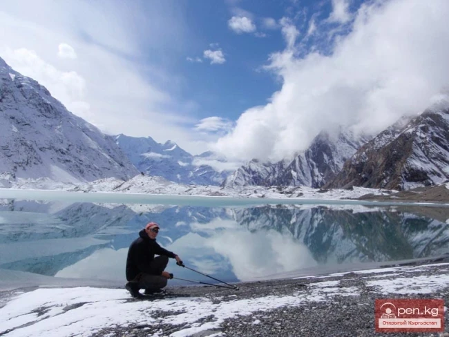
The flood season on the river occurs in the summer. The average water flow in the Kainy River is 10 cubic meters per second. The area of the Kainy Glacier is often visited by mountain tourists and climbers, characterized by peak heights of up to 6073 meters above sea level.

In the area of the glacier, there are many unclimbed peaks. The routes here are combined, consisting of ice-snow and snow, with height differences of up to 1000-1500 meters. The first climbing expeditions visited here in 1995.
VK X OK WhatsApp Telegram

Read also:

The Ridge of Inylchektau

The Ridge of Inylchektau

Inylchektau A mountain range in the Central Tien Shan in Kyrgyzstan. It is located in the basin of...

Mushketov Glacier

Mushketov Glacier

Mushketov Glacier A valley tree-like glacier in the Central Tien Shan in Kyrgyzstan (Issyk-Kul...

Nalivkin Glacier

Nalivkin Glacier

Nalivkin Glacier. One of the right tributaries of the largest glacier in Pamir, Fedchenko Glacier....

Glacier Koy-Kap

Glacier Koy-Kap

Koy-Kap - Glacier in the Khan-Tengri Massif The Kaindy Ridge, which separates the valleys of the...

Nura Glacier

Nura Glacier

The Nura Glacier is located in the basin of the Eastern Kyzylsu River A large complex valley...

Glacier Starlet

Glacier Starlet

Zvezdochka The Zvezdochka Glacier flows into the Inylchek Glacier, 40 km from the tongue of the...

Glacier Archa-Bashi

Glacier Archa-Bashi

Archa-Bashi Glacier on the Alai Range The Archa-Bashi Glacier is large and dendritic, located at...

Glacier Kyzylsu

Glacier Kyzylsu

Kyzylsu - Red Water The Kyzylsu Glacier (often referred to as the Eastern Kyzylsu) is a complex...

Lenin Glacier

Lenin Glacier

Lenin Glacier — a mountain valley glacier on the northern slope of the Zaalai Range (Pamirs), in...

Semenov Glacier

Semenov Glacier

Semenov Glacier - the basin of the upper reaches of the Sarydjaz River. This basin includes the...

Abramov Glacier

Abramov Glacier

Slow Retreat of the Abramov Glacier The Abramov Glacier in the Pamir-Alai mountains is one of the...

Petrov Glacier

Petrov Glacier

Petrov Glacier - a glacier in Central Tien Shan On a small area of the Ak-Shiyrak mountain range,...

Glacier Golubina

Glacier Golubina

Golubina Glacier The Golubina Glacier is of the valley type and is located on the northern slope...

Kolpakovsky Glacier

Kolpakovsky Glacier

The Kolpakovsky Glacier is the most significant glacier of the Terkey-Ala-Too range. Its length is...

Komarov Glacier

Komarov Glacier

Komarov Glacier (Ak-Sai), Kokshaalsky Ridge The first survey of the glaciation in this area was...

Aksai Glacier

Aksai Glacier

Ak-Sai Glacier The glacier is located 40 km from Bishkek in the picturesque Ala-Archa gorge at an...

Peak Karakol

Peak Karakol

Peak Karakol (5281 m) Located in the Oguz Bashi massif on the southern shore of Lake Issyk-Kul;...

The Peak of Gorky

The Peak of Gorky

Pik Gorkogo (6050 m) - located in the Central Tien Shan in the Tengri-Tag ridge. The southern...

Peak Djigit

Peak Djigit

Peak Djigit - height 5170 meters. It is located in the main watershed ridge of the Terskey Alatau...

Glacier Korzhenevskogo

Glacier Korzhenevskogo

The Greatest Glacier of Pamir On August 22, 1953, eight climbers from the Pamir expedition of the...

Glaciers of Kyrgyzstan

Glaciers of Kyrgyzstan

The territory of Kyrgyzstan is predominantly mountainous, with peaks almost everywhere reaching...

"Ala-Archa Zone"

"Ala-Archa Zone"

Ala-Archa Zone is located 30 km south of Bishkek in the central part of the Kyrgyz Ala-Too range...

Upper Naryn

Upper Naryn

Upper Naryn includes the upper part of the Naryn River basin from the vicinity of the town of...

River Karakulja

River Karakulja

Karakulja The Chatkal River in its upper reaches is called Karakulja (translated - Black Ram),...

Meridional Ridge

Meridional Ridge

Meridional Ridge The main nodal uplift of the Central Tien Shan on the border of Kyrgyzstan and...

Peak Adygene

Peak Adygene

Peak Adygene. It is located at the top of the gorge of the same name on the northern slope of the...

Lake Merzbacher

Lake Merzbacher

Before your eyes stretches the unrestrained blue of the water, which sharply contrasts with the...

Talas Ridge

Talas Ridge

Talassky Ala-Too A mountain range located in the Western Tien Shan system. Most of it is situated...

Write a comment: