Kolpakovsky Glacier

admin Glaciers
VK X OK WhatsApp Telegram
Kolpakovsky Glacier

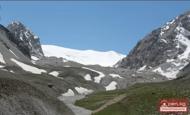
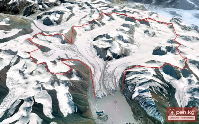
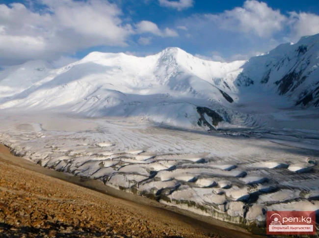
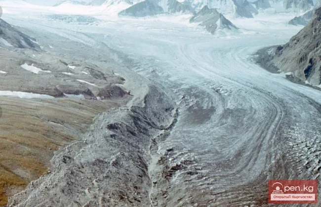
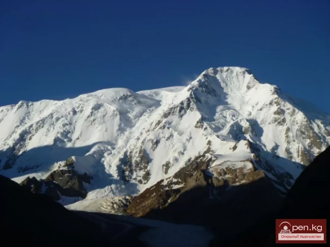
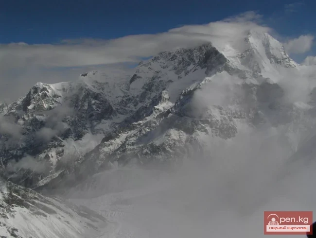
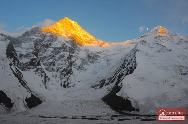
The Kolpakovsky Glacier is the most significant glacier of the Terkey-Ala-Too range.


Its length is about 12 km, consisting of three branches with separate powerful accumulation areas, which represent extensive snow plateaus at an altitude of 4300-4400 meters, dropping to the north with elongated walls. To the south, the glacier gently descends to the moraines, making it wide and mostly calm, forming a small icefall only in the middle part. Right in the center of the glacier, about 20 meters apart, two narrow medial moraines stretch.

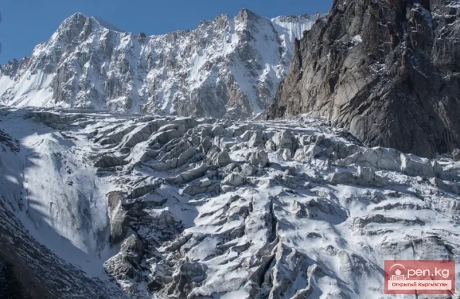
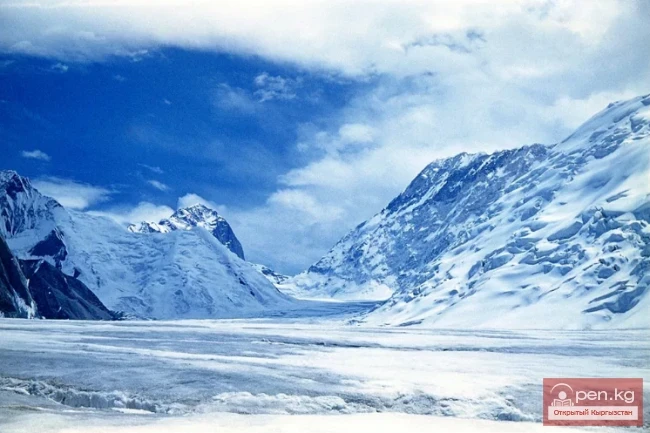
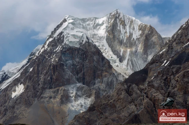
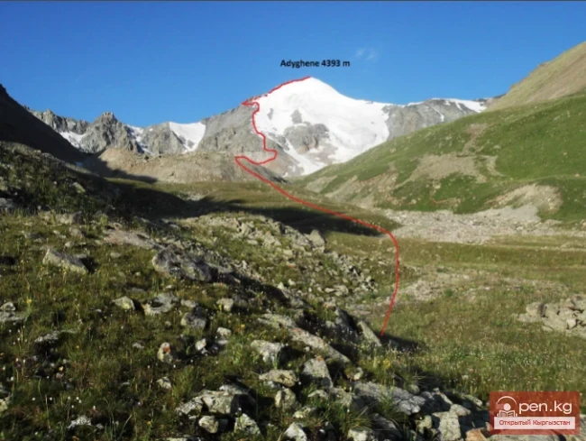
The description is given from the plateau of the Ulyanovtsy Pass to the tongue. Due to the large number of passes located in the cirques of the glacier, its description is provided separately for convenience. The path down from the plateau of the Ulyanovtsy Pass runs through the closed central part of the glacier. The saddles of the Karabaltyk East Pass, the Soviet Pedagogues Pass, and Barocco are clearly visible on the sides, with a steepness of 5-7. Crevasses appear before the central branch of the icefall. The icefall consists of two parts.

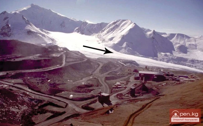
One is located at the right bank, the other at the left - slightly lower. It is possible to bypass either from the right, descending a 30° ice slope of 100 meters, or from the left, weaving between the crevasses. From under the icefall, the saddles of the Mysteries, the moraines, and behind them, Akshyrak, and the gorge of the Nameless Glacier are visible. Below the icefall, the glacier is open. In the lower part of the glacier, there is an icefall. The slopes of the ridges to the north and south, between which the glacier lies, are steep.

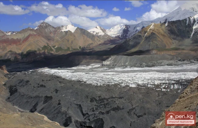
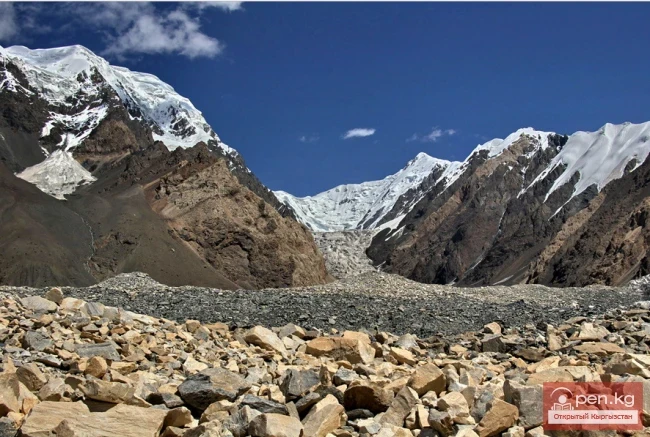
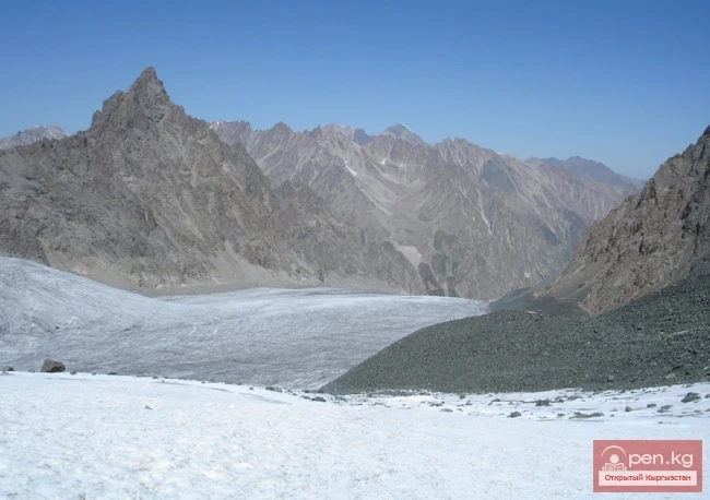
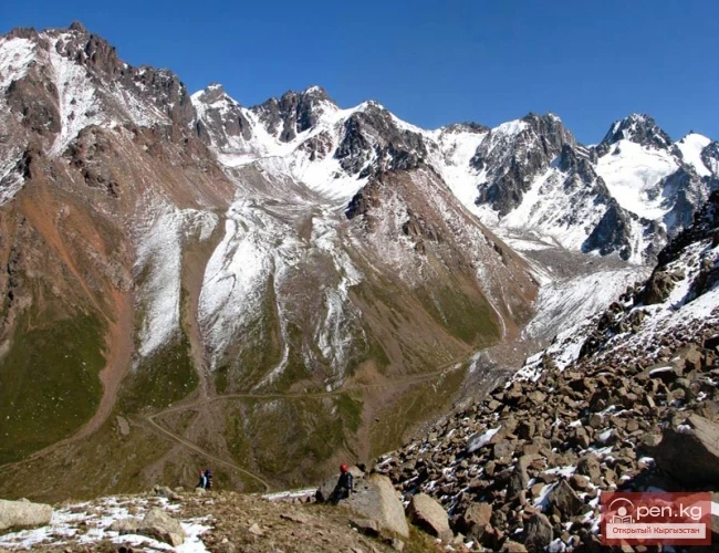
Glaciers are retreating everywhere, and their surfaces are cluttered with debris. The tongues of glaciers usually lie at altitudes of 3000-3500 m.

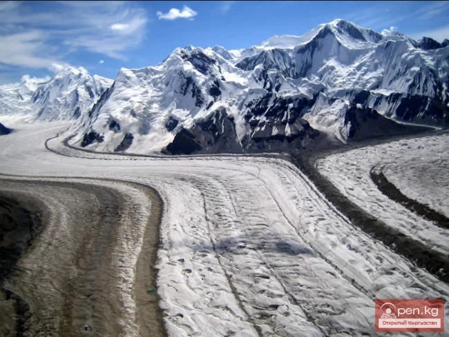
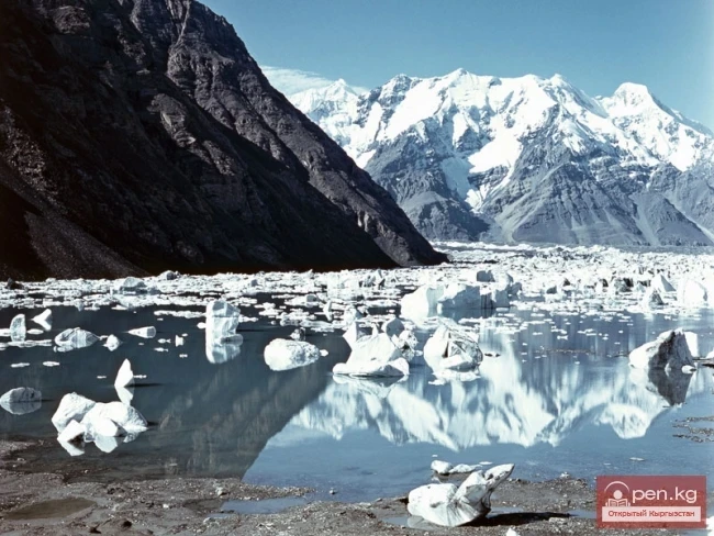
Significant changes in volume are observed for the Kolpakovsky Glacier (No. 317), which, along with tributary No. 319, lost 0.4 km³ of ice from 1977 to 2000.
Kolpakovsky Glacier

It is known that in the 1910s, many glaciers of the Inner Tien Shan were stationary (Solomina, 1999). The reason for this was apparently a brief favorable period of mass accumulation at that time. Then, a widespread retreat of glaciers began (Kalesnik, 1935), following a deterioration of conditions and a decrease in mass balance in the 1915-1920s. Some reduction in the rate of glacier retreat in the mid-1960s and the Kolpakovsky Glacier in the 1980s is apparently the result of relatively favorable conditions and mass accumulation in the accumulation areas of glaciers in the 1950-1960s. The subsequent reduction in the rate of retreat is associated with increased precipitation and mass balance in the 1990s. Thus, the response time for glaciers is from 5 to 15 years, and for the Kolpakovsky Glacier, about 25 years.

Glaciers
VK X OK WhatsApp Telegram

Read also:

Glacier Archa-Bashi

Glacier Archa-Bashi

Archa-Bashi Glacier on the Alai Range The Archa-Bashi Glacier is large and dendritic, located at...

Nura Glacier

Nura Glacier

The Nura Glacier is located in the basin of the Eastern Kyzylsu River A large complex valley...

Nalivkin Glacier

Nalivkin Glacier

Nalivkin Glacier. One of the right tributaries of the largest glacier in Pamir, Fedchenko Glacier....

Komarov Glacier

Komarov Glacier

Komarov Glacier (Ak-Sai), Kokshaalsky Ridge The first survey of the glaciation in this area was...

Aksai Glacier

Aksai Glacier

Ak-Sai Glacier The glacier is located 40 km from Bishkek in the picturesque Ala-Archa gorge at an...

Petrov Glacier

Petrov Glacier

Petrov Glacier - a glacier in Central Tien Shan On a small area of the Ak-Shiyrak mountain range,...

Mushketov Glacier

Mushketov Glacier

Mushketov Glacier A valley tree-like glacier in the Central Tien Shan in Kyrgyzstan (Issyk-Kul...

Glacier Starlet

Glacier Starlet

Zvezdochka The Zvezdochka Glacier flows into the Inylchek Glacier, 40 km from the tongue of the...

Semenov Glacier

Semenov Glacier

Semenov Glacier - the basin of the upper reaches of the Sarydjaz River. This basin includes the...

Kainyndy Glacier

Kainyndy Glacier

Kainy Between Kokshaal-Tau and Kainy-Katta lies the powerful Kuyakap Glacier, and between...

Glacier Kyzylsu

Glacier Kyzylsu

Kyzylsu - Red Water The Kyzylsu Glacier (often referred to as the Eastern Kyzylsu) is a complex...

Lenin Glacier

Lenin Glacier

Lenin Glacier — a mountain valley glacier on the northern slope of the Zaalai Range (Pamirs), in...

Peak Djigit

Peak Djigit

Peak Djigit - height 5170 meters. It is located in the main watershed ridge of the Terskey Alatau...

Abramov Glacier

Abramov Glacier

Slow Retreat of the Abramov Glacier The Abramov Glacier in the Pamir-Alai mountains is one of the...

Glacier Koy-Kap

Glacier Koy-Kap

Koy-Kap - Glacier in the Khan-Tengri Massif The Kaindy Ridge, which separates the valleys of the...

Glacier Golubina

Glacier Golubina

Golubina Glacier The Golubina Glacier is of the valley type and is located on the northern slope...

The Peak of Gorky

The Peak of Gorky

Pik Gorkogo (6050 m) - located in the Central Tien Shan in the Tengri-Tag ridge. The southern...

Peak Karakol

Peak Karakol

Peak Karakol (5281 m) Located in the Oguz Bashi massif on the southern shore of Lake Issyk-Kul;...

"Ala-Archa Zone"

"Ala-Archa Zone"

Ala-Archa Zone is located 30 km south of Bishkek in the central part of the Kyrgyz Ala-Too range...

Upper Naryn

Upper Naryn

Upper Naryn includes the upper part of the Naryn River basin from the vicinity of the town of...

Meridional Ridge

Meridional Ridge

Meridional Ridge The main nodal uplift of the Central Tien Shan on the border of Kyrgyzstan and...

The Ridge of Inylchektau

The Ridge of Inylchektau

Inylchektau A mountain range in the Central Tien Shan in Kyrgyzstan. It is located in the basin of...

Glacier Korzhenevskogo

Glacier Korzhenevskogo

The Greatest Glacier of Pamir On August 22, 1953, eight climbers from the Pamir expedition of the...

Terskey Alatoo Ridge

Terskey Alatoo Ridge

Terskey Alatau The Terskey Alatau Ridge is very beautiful in its variety of landscapes. In one...

River Karakulja

River Karakulja

Karakulja The Chatkal River in its upper reaches is called Karakulja (translated - Black Ram),...

Glaciers of Kyrgyzstan

Glaciers of Kyrgyzstan

The territory of Kyrgyzstan is predominantly mountainous, with peaks almost everywhere reaching...

Peak Adygene

Peak Adygene

Peak Adygene. It is located at the top of the gorge of the same name on the northern slope of the...

Talas Ridge

Talas Ridge

Talassky Ala-Too A mountain range located in the Western Tien Shan system. Most of it is situated...

River Ak-Suu

River Ak-Suu

The main channel of the Ak-Suu River is at least 20-22 kilometers long. The lower part of the...

Zailiysky Alatau Ridge

Zailiysky Alatau Ridge

Zailiyskiy Alatau A mountain range in the northwest of the Tian Shan (on the border of Kazakhstan...

Write a comment: