Terskey Alatau
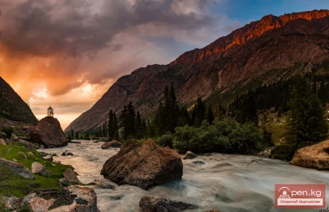
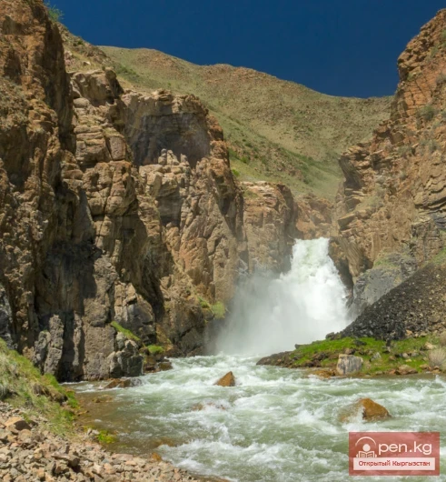
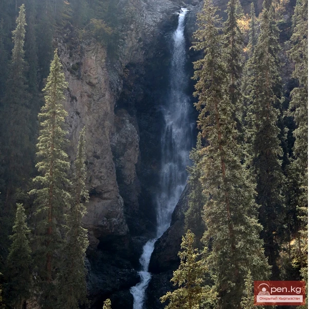
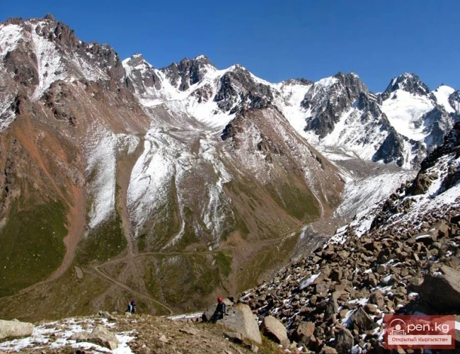
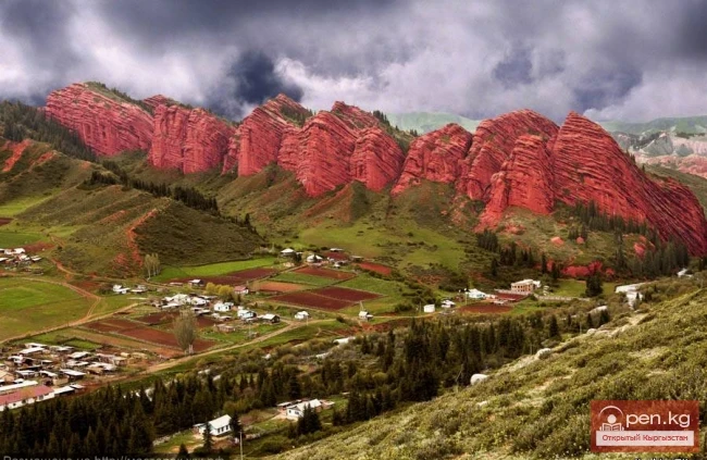
The Terskey Alatau Ridge is very beautiful in its variety of landscapes. In one day, you can see the beauty of red sandstone cliffs, wild forests, and snowy peaks, widely spread over the greatest lake, Issyk-Kul. Each gorge is unique and unparalleled in its execution.
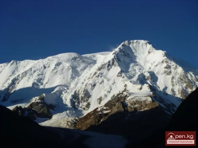
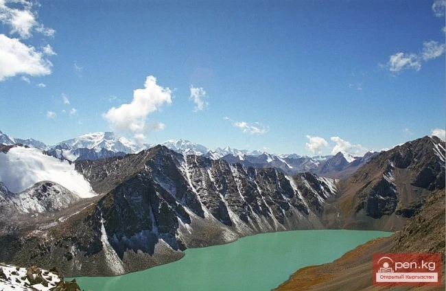
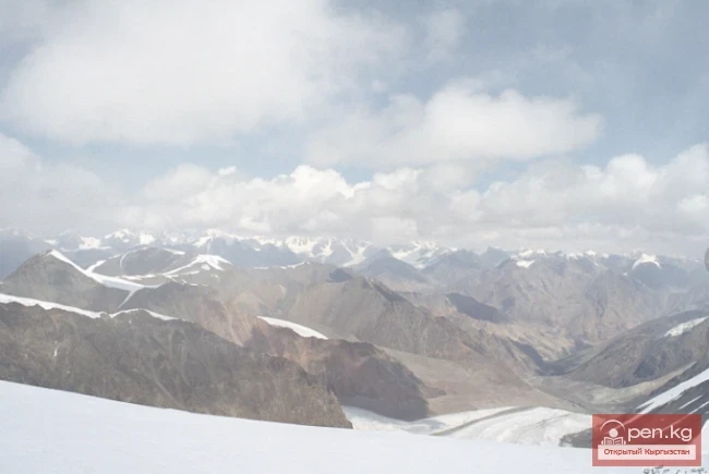
The Terskey Alatau Ridge ("colorful mountains turned away from the sun") is located latitudinally and frames the basin of Lake Issyk-Kul from the south. The length of the ridge is about 375 km, and in the east, it connects with the Kungoy Alatau Ridge, while beyond the Issyk-Kul basin, it adjoins the Sary-Jaz Ridge. The average height of the ridge is about 4500 m, with the highest point reaching 5216 m (Karakol Peak).

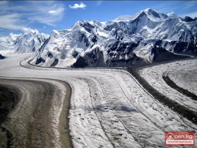
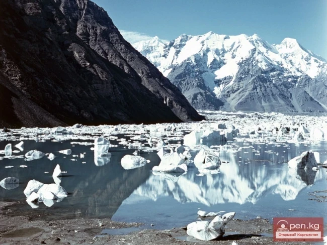
One major glacial node of the ridge is located in the upper reaches of the rivers Jetiyoguz, Karakol, Arashan, Ak-Suu, and Turgun-Ak-Suu, while another is in the upper reaches of Konurulen. The significant glaciation of the ridge is facilitated by its height, atmospheric circulation, and moisture evaporating from the surface of Lake Issyk-Kul.
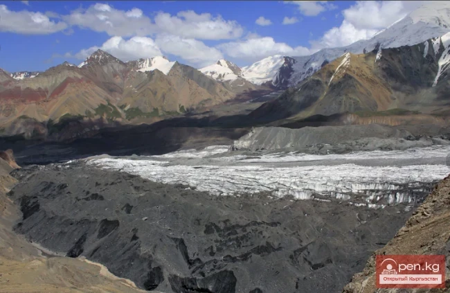
The total number of glaciers on the slopes of the Terskey Alatau is about 1100, with an area of glaciation of 1081 sq. km. The distribution of glaciation on the northern and southern slopes is almost the same.
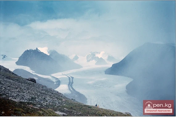
On the northern slope of the Terskey Alatau, the length of the valley glaciers reaches 5-7 km (Aylanysh and others). The length of the glaciers on the southern slope is significantly greater (for example, the Kolpakovsky Glacier reaches 10 km). Glaciers are retreating everywhere, and their surfaces are cluttered with debris. The tongues of glaciers usually lie at altitudes of 3000-3500 m.

The snow line in the western part of the northern slope of Terskey is at an altitude of 3900-4000 m, while in the east, due to a large amount of precipitation, it drops to 3700 m. On the southern slope, the snow line rises to 4000-4200 m.
From west to east, the amount of precipitation increases from 200 mm (Bokonbaevskoye) to 400 mm (Karakol - b. Przhevalsk) at the bottom and from 1000 to 2000 mm per year at altitude. The degree of glaciation also increases from west to east.
The Terskey Alatau Ridge is asymmetrical - it has a short gentle southern slope and a long northern slope.

Deeply dissected by gorges, the northern slope descends to Issyk-Kul in giant steps (the water level is 1609 m). The ridge itself is not much dissected, bearing flat surfaces inclined to the south, which sometimes imperceptibly transition into the southern slope.
The western part of the Terskey Alatau Ridge is very eroded, with many saddles accessible for passage.
Heights reach almost 4800 m, with passes at altitudes of 3500-4400 m, and the difficulty categories of the passes are up to 3A.
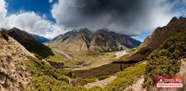
The northern slope is heavily dissected by longitudinal valleys into a system of short and low ridges. The extreme western part of the ridge is devoid of vegetation cover due to the low amount of precipitation; the landscape here is also barren, similar to the western shore of Issyk-Kul, where the Chu River turns into the Boom Gorge.

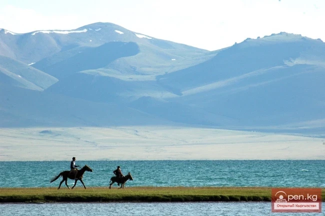
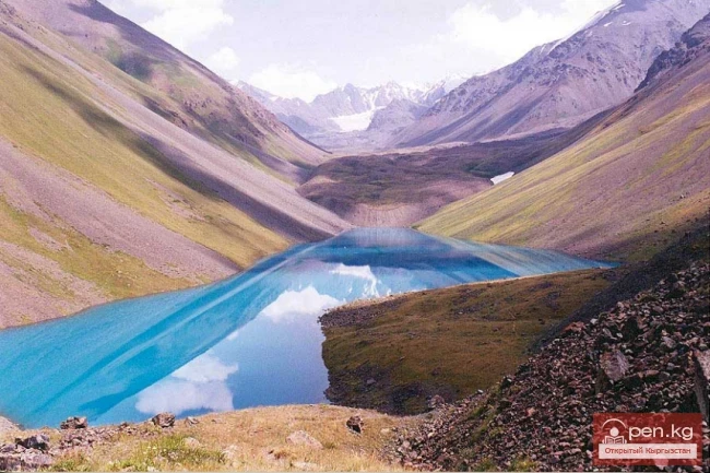
The rivers in the area are turbulent but mostly low in water, belonging to the basin of the Chu River (Kara-Kungay, Kelchkek, and the significantly larger Kara-Kudzhur River), feeding the Small Naryn (Chon-Karakoman, Uchemchek) or Lake Issyk-Kul (Tura Suu, Kongurleng, Ton).
The largest glaciers (up to 5-6 km) are concentrated in the upper reaches of the South Konurulen River (Kongurleng). Here, there are many glaciers with flat tops, resembling the ice caps of the Arctic. They lack significant rocky framing. The nourishment of such glaciers occurs due to atmospheric precipitation directly falling over their surface, most of which occurs from April to October. The Konurulen Valley itself stretches from west to east for almost 50 km and is protected from cold winds from the north and south by ridges, making it suitable for grazing from early spring to late autumn.
The weather in the western part of the Terskey Alatau during the summer period is characterized by instability and frequent winds.

Precipitation falls as rain and hail in the valleys and snow in the mountains. During winter, up to 1000 mm of snow precipitation accumulates on the surface of the glaciers, forming a snow cover of up to 2-3 m. The peak of summer is in August, when a significant part of the glacier body is freed from snow.
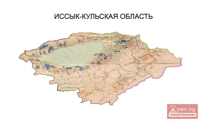
The western part of the Terskey Alatau is located in the Ton district of the Issyk-Kul region and the Kochkor district of the Naryn region. The main routes to the area are from the district centers Bokonbaevskoye and Kochkorka, which can be reached by bus from Bishkek. Quite good roads lead to the Konurulen Valley (bus to the village of Don-Tala) and to the upper reaches of Kara-Kudzhur (bus to Jer-Kechkyu), and there is a road further into the valleys of the tributaries of the Small Naryn and onward to the regional center of Naryn.
The highest and most frequently visited part of the Terskey Alatau Ridge is the central section, between the gorges of Barskaun and Turgun-Aksu. Here are the largest glaciers and the most technically complex and diverse passes.
Tourist routes often pass not only through the valleys and passes of the Terskey Alatau but also lead to the ridges of Kumtor and Arabeli, covering the mountain ranges of Kuilu and Akshyirak.

The passes of the Terskey Alatau Ridge in this area have heights ranging from 3600 to 4800 m and difficulty categories up to 3B. The vast majority of the passes of the main ridge and its southern spurs are snowy and snow-ice. The passes of the northern spurs of the ridge are more diverse, featuring rocky, ice, snow, and debris passes, with combined types being the most common.