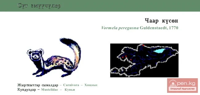
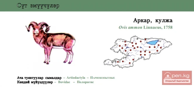
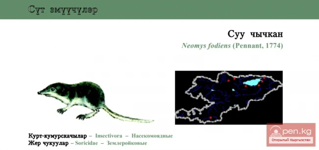
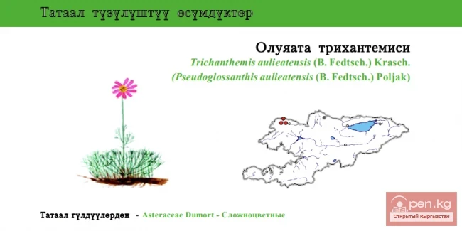
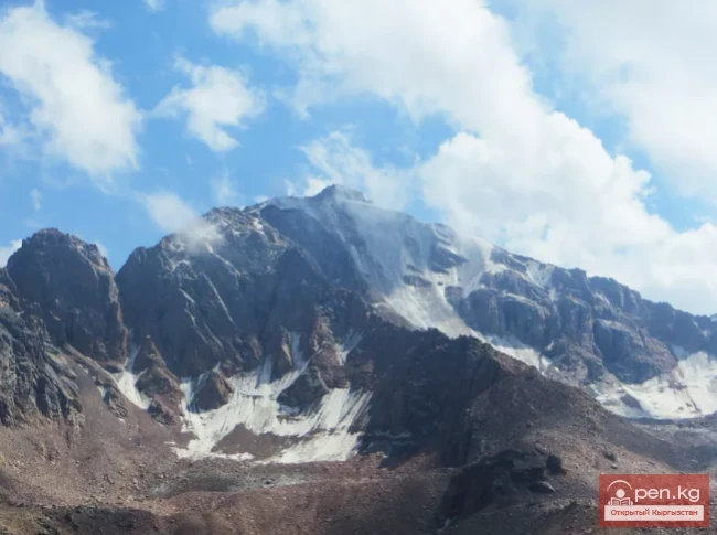
Zaalai Ridge
A ridge oriented in a latitudinal direction, separating the Pamir and the Alai Valley. The length of the ridge is 250 km, width – 40 km.
The average height (above sea level) is 5460 m.
The ridge has significant glaciation. From the peaks of the ridge, there are views of the Central Pamir, particularly of the peaks of Communism and Korzhenevskaya.

The Zaalai Ridge is the northernmost ridge of the Pamir, and therefore a large part of it lies on the border. Its easternmost part separates Kyrgyzstan and China, while another eastern section, the entire central part, and a bit of the western part mark the border between Kyrgyzstan and Tajikistan. The westernmost part extends into Tajikistan, with the border shifting into the Pamir-Alai. To the north of the Zaalai Ridge lies the Alai Valley – a unique high-altitude steppe and vast pasture.
The entire Zaalai Ridge can be divided into three parts – the Eastern part is the section of the ridge east of the Pamir Highway (Kyzylart Pass). Its main part stretches to the settlement of Irkeshtam and then continues into China, sharply descending there.

The highest point of this part is Mount Kurumdy, 6613 m (the first ascent was made under the guidance of A. Gubaev in 2001, with no repeat ascents so far). This section of the ridge from the settlement of Irkeshtam has a length of just over 60 km. From Kyzylart Pass to Altynmazar Pass stretches the central part of the Zaalai Ridge, the most frequently visited and therefore the most studied. The highest point is Lenin Peak at 7134 m. Further to the west lies the western part with the highest point being Mount Sat at 5900 m.