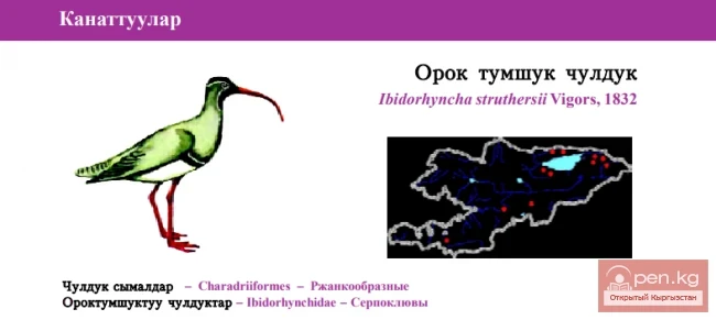
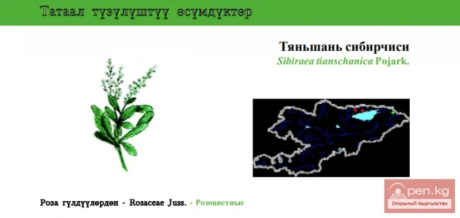
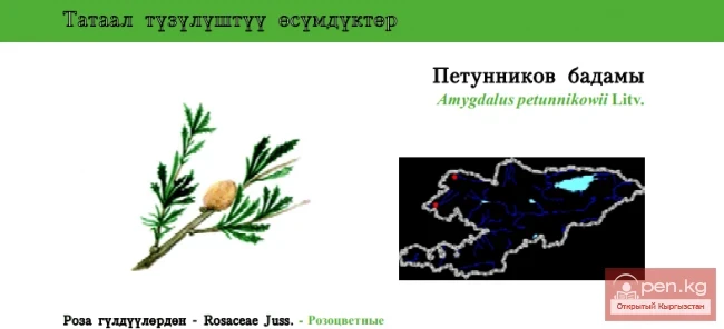
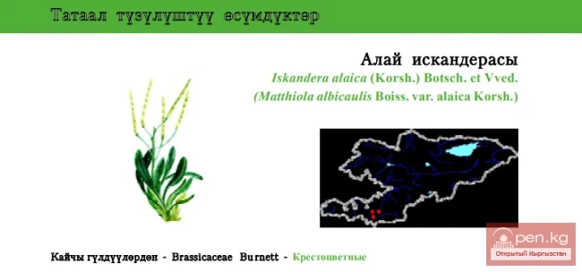
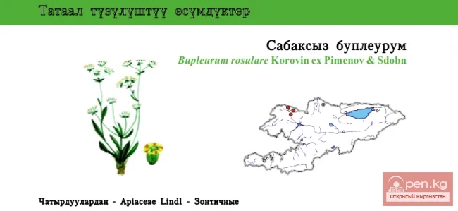
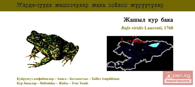
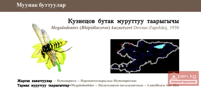
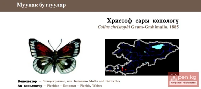
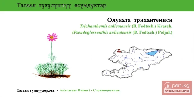
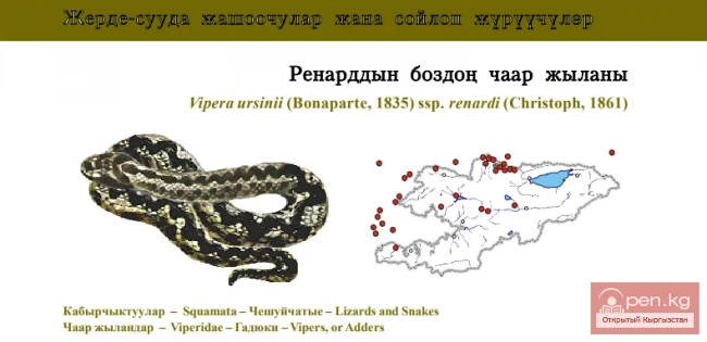
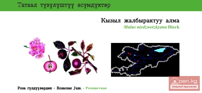
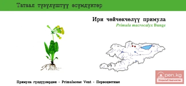
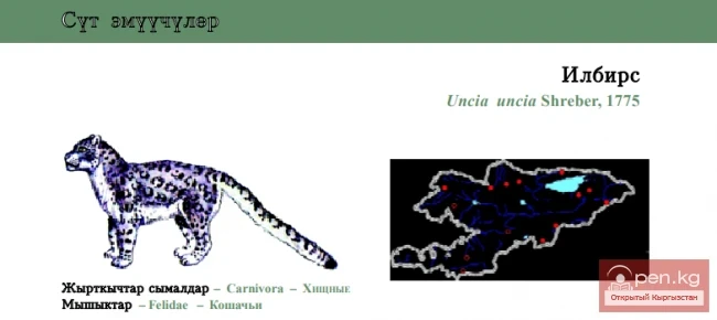
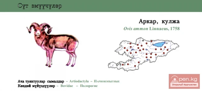
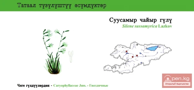
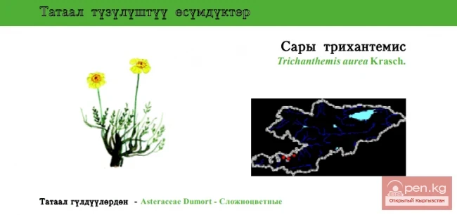
Zailiyskiy Alatau
A mountain range in the northwest of the Tian Shan (on the border of Kazakhstan and Kyrgyzstan). The prevailing heights are 4000–4600 m. The highest points of the Zailiyskiy Alatau, between the Kastek Pass in the west and the Amanzhol Pass in the east, belong to the central part of the ridge - the Talgar (Chilik-Kemin) mountain knot, where the highest point of the entire system rises - Talgar Peak or Talgar Peak (4973 m). The northern slope is relatively gentle, deeply dissected by the left tributaries of the Ili River, while the southern slope drops steeply into the valleys of the Chilik and Chon-Kemin rivers (the right tributary of the Chu).

The Zailiyskiy Alatau extends almost latitudinally. Its length is about 280 km along 43° N latitude, and its width is 40-60 km.
Morphologically, the Zailiyskiy Alatau is divided into western, central, and eastern parts. In the west, the Zailiyskiy Alatau splits into two branches. The northern branch beyond the Kastek Pass is called the Kindyktas Mountains, while the southern branch approaches the valley of the Chu River, beyond which lies the Kyrgyz Ridge. The eastern continuation of the Zailiyskiy Alatau consists of the parallel ridges of Syugaty, Bogatyr, and Turaygyr.

The Zailiyskiy Alatau (Ili Alatau) is the northernmost ridge of the Northern Tian Shan. The name of the mountains was given by the Russian geographer and traveler P. P. Semenov. When he arrived at the Iliyskiy checkpoint in 1856 and saw a high snow-covered mountain range across the river, he named it the Zailiyskiye Mountains. Subsequently, the name transformed into Zailiyskiy Alatau. The western border of the ridge is formed by the Chu River, and the eastern border is the Shilik River. To the south, beyond the deep longitudinal intermountain valleys of the Chon-Kemin and Shilik rivers, lies the parallel Kungey Alatau ridge. Both of these ridges are connected by a saddle, forming the Shilik-Kemin mountain knot.
In the east, the state border of Kazakhstan runs from the Kungey Alatau ridge along the Shilik-Kemin saddle to the main ridge of the Zailiyskiy Alatau. Further, the border follows the ridge in a western direction.
The central, highest section of the ridge, which is actually the Zailiyskiy Alatau, is situated between the Kastek Pass (N-2825 m) in the west and the Amanzhol Pass in the east and is about 180 km long.

In the central part of the Zailiyskiy Alatau, modern glaciation is well developed, with 370 glaciers covering a total area of 540 square kilometers. The snow line fluctuates between 3800 - 4100 m, being lower on the northern slopes (3800 - 3900 m) and higher on the southern slopes (4000 - 4100 m). The ends of the valley glaciers descend on the northern slope to 3200 - 3500 m.
The largest glaciers in the ridge and all of Kazakhstan currently are the Korzhenevsky Glacier with a volume of 6.32 km³ and an area of 38 km², and the Bogatyr Glacier with a volume of 4.5 km³ and an area of 30.3 km².
Numerous rivers originate from the glaciers of the Zailiyskiy Alatau. Cutting through the ridge with deep valleys, the northern slope drains the Uzun-Kargaly, Chemolgan, Kaskelen, Aksai, and the Big and Small Almaty rivers, Talgar, Issyk, and Turgen, which flow into the Ili. The southern slope is dissected by the valleys of small rivers. The river levels change sharply throughout the day.

The vertical profile of the Zailiyskiy Alatau is characterized by a tiered structure. The high mountain tier, which has an alpine form of relief, is distinguished by extremely deep dissection (the area of Talgar Peak, Komsomol Peak, etc.). This is a zone of steep, often vertical, and rocky slopes framing deep glacial valleys and extensive amphitheaters of snow cirques. Below lies a tier of deeply dissected mountain relief, characterized by steep river valleys with areas of poorly preserved terraces.
The low mountain relief is typical for the eastern and western spurs of the Zailiyskiy Alatau, where it is expressed in series of low hills separated by wide valleys. This tier of relief also includes the so-called "shelves" in the form of plateau-like elevations that descend to the foothill plain with a series of stepped ledges.

A characteristic feature of the central part of the ridge is the dried riverbeds of mudflow and debris flows (lahars) with powerful deposits of debris material. The slopes facing north are predominantly covered with snow and ice, while the southern slopes are covered with massive scree of heavily weathered bedrock. Many valleys of the Zailiyskiy Alatau in the upper and middle parts are blocked by powerful ancient and modern terminal moraines. The moraines on the glaciers occupy a relatively large area - up to 20% of the area of glaciation.