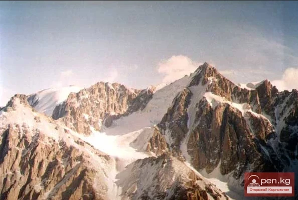
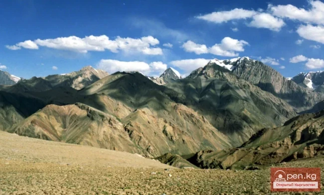
Muzdag Mountains, Khan Tengri Peak, and Victory Peak. The Muzdag mountain range (ice mountains) is located in the Central Tien Shan and occupies its highest area. For extreme tourism enthusiasts, this region, also known as the "Arctic," offers a wide variety of challenges. In the summer, a corporate climbing camp operates here, organized by various tour operators.
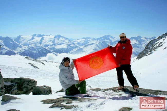
Climbers categorize these peaks into those already conquered and those yet to be conquered. Despite the numerous routes established by climbers, there are still many unclimbed and unnamed peaks and untraveled routes in this area.
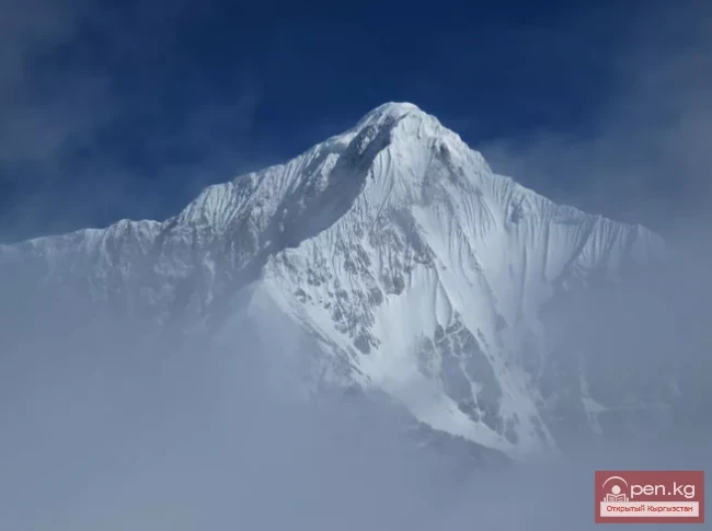
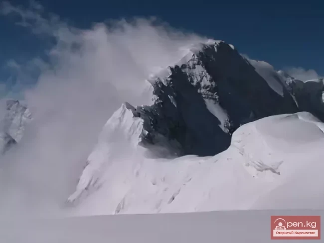
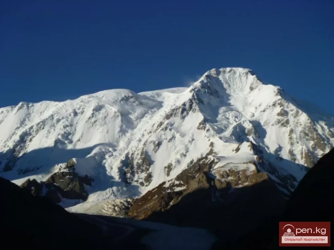
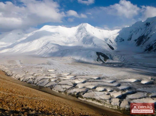
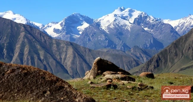
The main peak of the Tien Shan, Victory Peak (7435 m), rises 3.5 kilometers above the glacier.
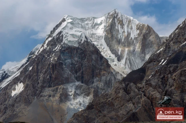
The beautiful Khan Tengri Peak (7010 m) - the second highest peak of the Tien Shan - is located opposite. Its marble base is surrounded by glacial streams on both sides, and when the day ends, the peak, sinking into blue twilight, ignites like a ruby in the illuminated blue of the darkening sky. The peak commands respect from even the most experienced climbers.

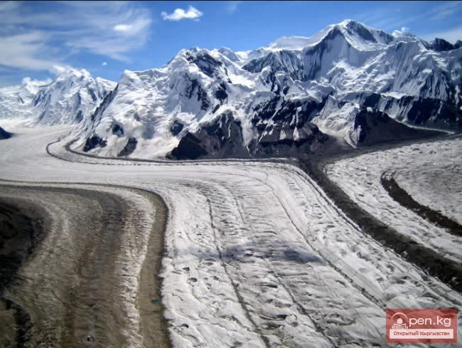
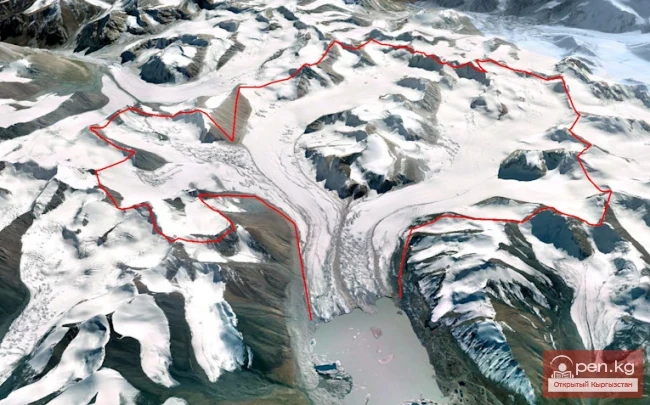
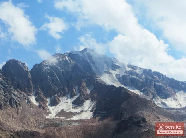
Inylchek Glacier and Merzbacher Lake. There are landscapes and natural features in nature that cannot be defined by a specific word. The grand mountain knot of Muzdag in the heart of the Tien Shan is a prime example of this.
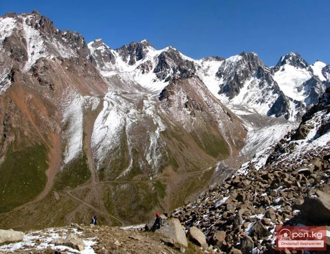
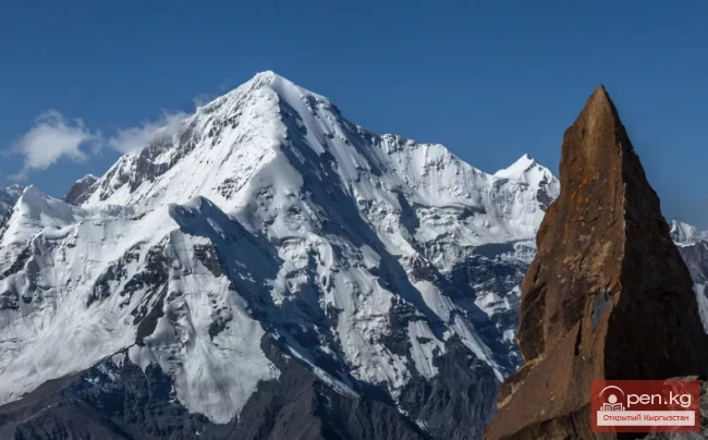
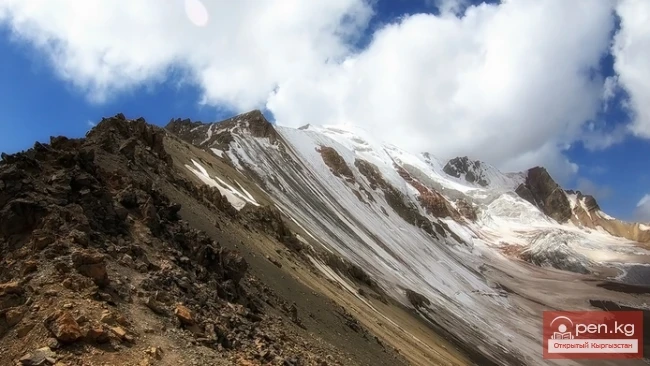
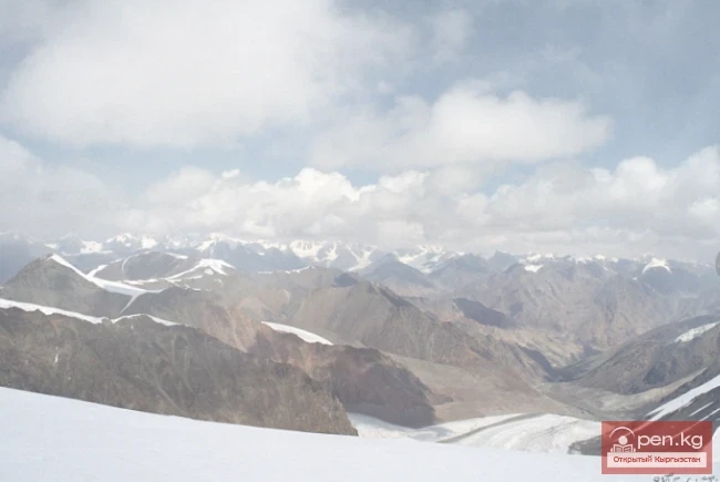
The impressive six-kilometer peaks, soaring above the clouds, present a captivating landscape of the symbiosis of heavenly mountains and the depths of space. Like an ancient dragon, the frozen flow of one of the largest high-altitude glaciers in the world, Inylchek, winds between the icy ridges. Its length is 60 km, thickness reaches up to 540 m, and the area of glaciation is 583 sq. km. The glacier descends more than 1.8 km in height.
At the bottom, the surface of the glacier is covered with a blanket of stones and earth, where edelweiss and Richter daisies grow. In the upper part of the glacier, summer frosts reach 30 degrees, hurricane winds blow constantly, and heavy snowfalls occur.
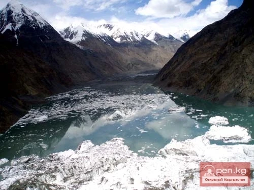
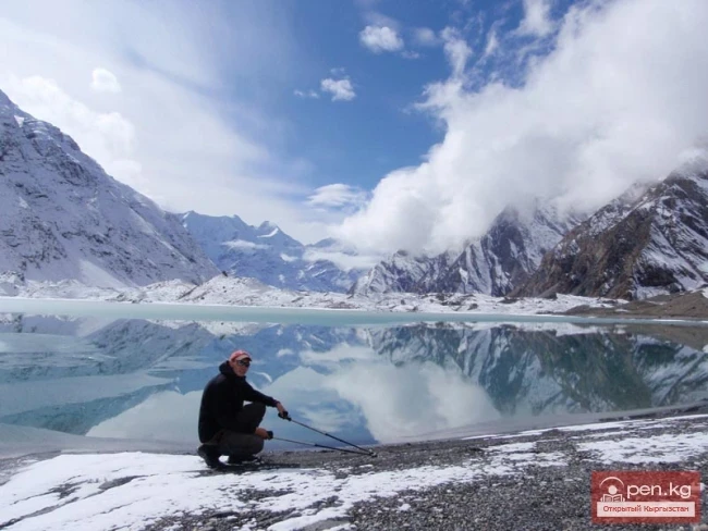
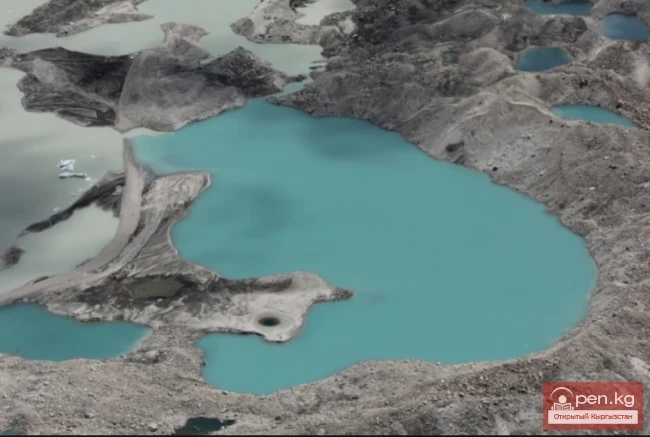
Of great interest is the Merzbacher Lake, named after the famous German traveler who discovered it in 1903. Here, one can observe a rare sight characteristic only of the Arctic regions of the world's oceans. Detached from the Inylchek glacier, chunks of greenish ice form bizarrely shaped icebergs.

Every August, Merzbacher Lake unexpectedly breaks through the glacier at the mouth of the Inylchek River. The reasons and mechanism of this breakthrough have not yet been established, adding to the lake's appeal for scientists, athletes, and simply curious people.
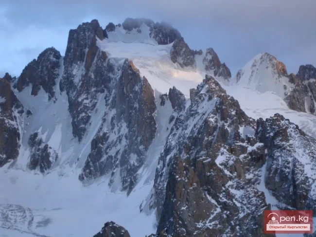
The surrounding nature resembles lunar landscapes. Picturesque, absolutely sheer mountains surround the lake basin on all sides. Low clouds cling to the unevenness of the ridges, exposing tongues of glaciers crawling out from under the snowy cornices of the ridge.
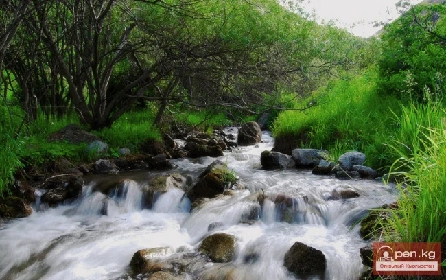
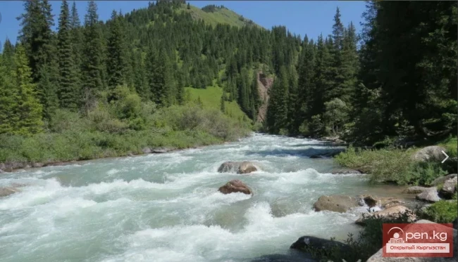
Sary-Jaz River - one of the largest mountain rivers in the region, fed by the meltwaters of the snow and glaciers of the highest Muzdag mountain range, flows through the country for 198 km and then goes into China. It has great potential for organizing extreme rafting. Due to the harsh natural and climatic conditions of the area and its wild nature, Sary-Jaz is recommended only for very experienced athletes. A special permit is required to visit this border zone. You can reach the Sary-Jaz Valley by car and see a beautiful canyon, the Ak-Chunkur cave with primitive human drawings, hot mineral springs with a temperature of 60°C, historical monuments, mountain lakes, and many other impressive sites.

Arabel Highlands - these are flat elevated spaces located at altitudes from 3500 to 4000 meters, representing transitional forms of landscapes from medium-mountain to high-mountain. The highland areas are characterized by ancient and modern forms of relief, shaped by active processes of frost weathering. Permafrost fills all spaces of the Arabel Valley. The hilly high-altitude cold desert plain seems lifeless, the landscapes are unusual, surrounded by snowy peaks. Slowly flowing streams and floods, patches of frozen ground, lakes, flat glaciers, like icy berets, cover the low dome-shaped peaks. Everything looks majestic and beautiful.
There are many remarkably beautiful lakes in the Arabel Highlands. Most of them are located at the southern foot of the Terskey Ala-Too, on the left bank of the Arabel-Suu River. Here, at an altitude of 3600-4000 m, there are up to 50 lakes. The lakes are spatially grouped into three groups: Arabel - at the namesake pass in the upper reaches of the Arabel-Suu source, Jashil-Kel - two kilometers south of the Barskaun pass, and Jukku - at the watershed of the namesake river, flowing into Lake Issyk-Kul, and the sources of the left tributary Chontor, which flows in a deep narrow canyon.
Syrty - is a landscape form found only in the Tien Shan. This factor is a strong motivation for choosing to visit the Arabel Highlands. Day trips can be organized to the syrty from the shores of Issyk-Kul or include crossing the syrty in jeep safari programs.