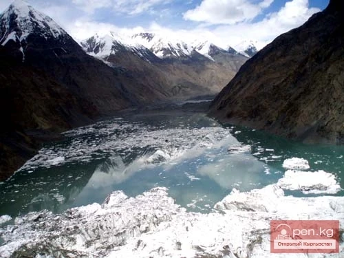
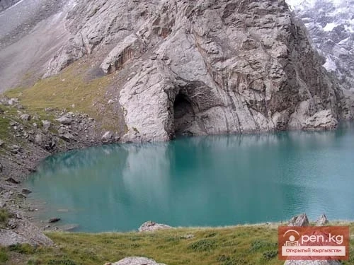
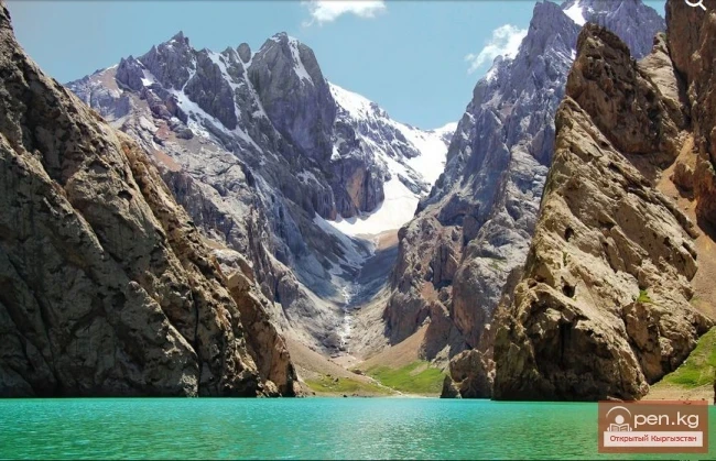
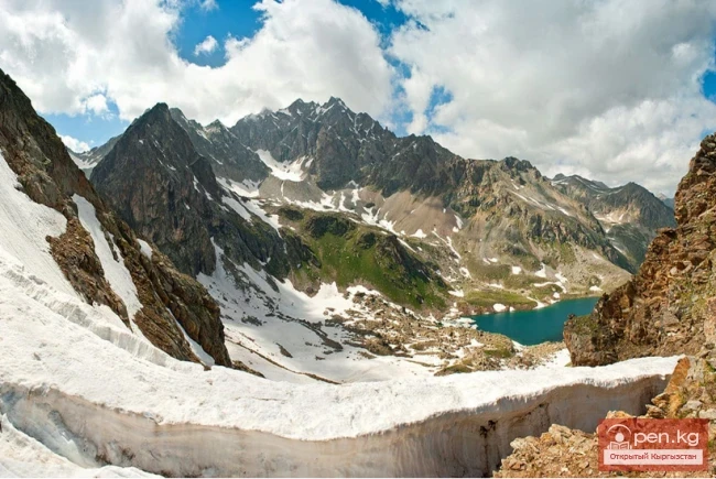
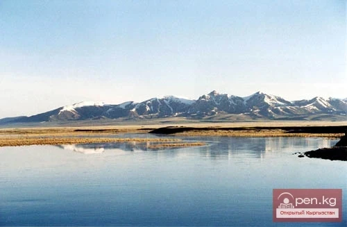
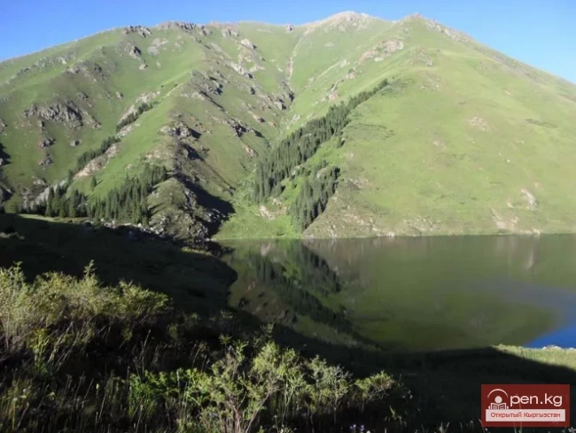
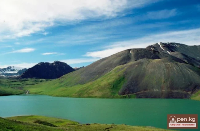
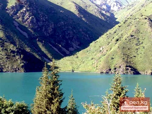
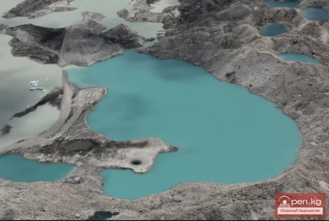
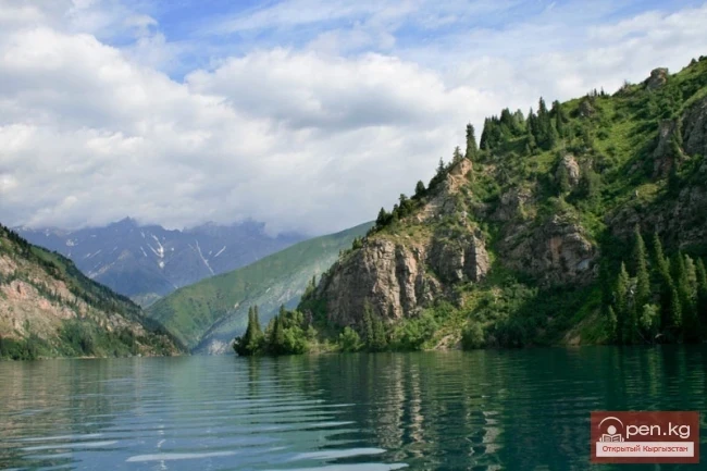
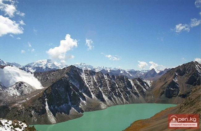
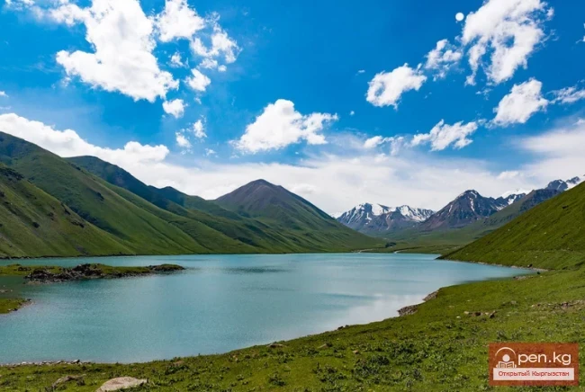
Before your eyes stretches the unrestrained blue of the water, which sharply contrasts with the gray-brown rocks, the whiteness of the snow on the peaks, and the boundless blue of the sky. This could be said about many glacial lakes. But Lake Merzbacher is remarkable not only for its beauty — it literally represents a world of icebergs. Here and there rise the whimsical outlines of towers, castles, ice mountains, and ice islands of various shapes. Some floating icebergs reach the height of a three-story house. They are sometimes composed of pure ice, and sometimes of ice with layers of dirt, which can be arranged even vertically, and at times appear completely black from the silt, sand, and stones contained in the ice. The icebergs either cover the entire surface of the lake or cluster at one of the shores depending on the direction of the wind.
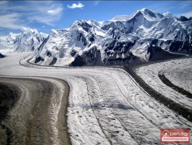
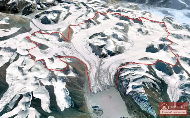
We are talking about Lake Merzbacher, which arose at the confluence of two enormous Asian glaciers in the upper reaches of the Engilchek River — the Northern and Southern Inylchek glaciers in Kyrgyzstan, near the border with China. The Northern Inylchek glacier is about 43 km long, while the Southern is nearly 65 km long. It is in the space formed between them that the bowl of the lake emerged. This is a so-called glacial-dammed lake, i.e., dammed by a glacier, in this case, the Southern Inylchek glacier. The glacier, which is up to 2 km wide, lies in a straight latitudinal valley. And in the side valley, approaching the main one almost perpendicularly from the north, the lake is trapped. It presses against the ice dam and cannot overcome it. And it is quite far to the "tongue" of the glacier — a whole 14 km. Thanks to this ice dam, the lake exists.
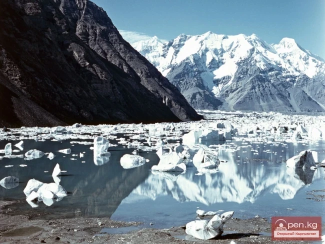
The glacier advances into the lake at a speed of more than 100 m per year. At first, the warmth of the water is enough to melt the smallest icebergs. But gradually they become so numerous that they do not have time to melt.
The most icebergs enter the lake when it is almost completely filled with water. It is then that the part of the glacier directly adjacent to the lake rises. The length of the section of the risen ice does not exceed 300–400 m. Due to the reduction of friction, the speed of the glacier's movement slightly increases, it begins to advance more quickly into the lake and break apart there, thus increasing the number of icebergs in the lake.
The lake is also interesting because, despite the mighty ice dam, the water from it completely disappears once a year, usually at the end of July — beginning of August. For a long time, it was difficult to find an explanation for the mechanism of this phenomenon. Some scientists thought that the water simply overflowed the edge and flowed along the edge of the glacier. Others suggested that the water was released through a layer of water-saturated ice, which was discovered inside the ice mass during special radar studies.
As the lake releases water, it changes its appearance. In the first day, the water level decreases slowly, and the view of the lake remains almost unchanged, but later, when the water level begins to drop more intensively, the area of the lake quickly shrinks. The departing water leaves behind icebergs that seem to be projected onto the drying bottom. A curious sight: an almost completely flat gray bottom of the lake with numerous ice blocks rising on it. The level of the maximum rise of the water can be easily determined by the icebergs lying on the slopes. Near each iceberg, a trace among the stones is noticeable, gouged by it when the water level fell.

When most of the lake basin is emptied, the bottom of the lake represents a jumble of icebergs, haphazardly piled on top of each other. A more wild and unique landscape is simply unimaginable. It is impossible to take a step on this icy mass. It is a mistake to think that the accumulation of ice blocks is dead: quite unexpectedly, without any reason, right before your eyes, a gigantic iceberg standing on the bottom, as tall as a 20-story building, slowly settles, instantly turning into icy rubble, and disappears among similar ice fragments. As if this giant had never existed. And only the echo of the collapse still lingers among the awakened rocks for some time. But then the echo gradually fades, and the pile of ice blocks at the bottom of the lake again seems dead.
For almost the entire year, a large number of ice blocks — former icebergs — remain lying on the bottom of the lake. Under the influence of sunlight, they melt and decrease in size. By spring — early summer, when the glaciers and snow cover begin to actively melt, when the basin of the lake is filled with meltwater, only the largest fragments resting on the bottom survive. By the time the lake basin is filled almost to the brim, all the unmelted icebergs become frozen to the bottom, and thus, gradually covered with water. Therefore, it is not surprising that sometimes icebergs unexpectedly rise to the surface. Previously, this phenomenon of ice blocks rising from the bottom could not be explained.
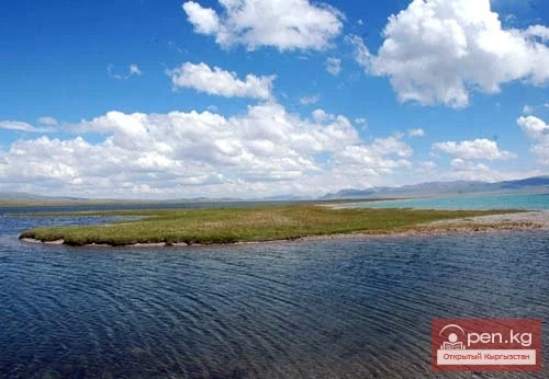
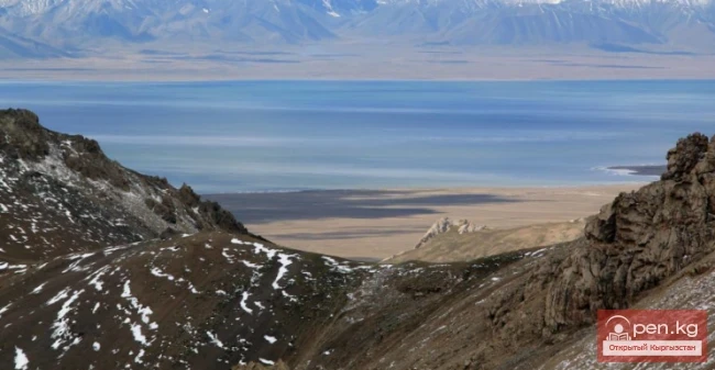
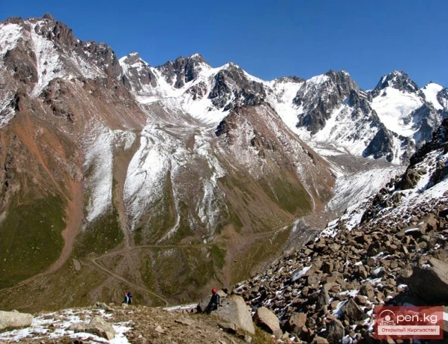
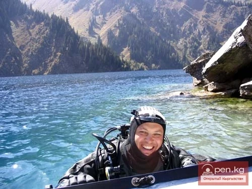
If you find yourself on the isthmus between Lake Merzbacher and Upper Lake, you get the feeling of being in a real desert. A flat plain stretches across the entire bottom of the valley, underfoot either stones or dust-like sand — the former lake silt. The landscape is disrupted by rare tufts of dry grass sticking out here and there. This desert is not simple — it is the former bottom of the lake. In the distant past, when the glaciers were much larger and therefore significantly thicker, the waters of the lake at its maximum filling reached here. The desert is also interesting because it lies on ice — on the dead ice of the "tongue" of the Northern Inylchek glacier, buried under a meter-thick layer of deposits. The age of the ice is unknown, but it is presumably significant, as it has not been renewed, at least since the time of the lake's discovery by the German geographer Merzbacher in 1902.
During this period, the ice on the isthmus has significantly melted, and numerous small lakes have formed in many basins and depressions. And that ice is indeed located beneath the dust-like deposits can be observed on the cliff of the river connecting Upper and Merzbacher lakes. Geophysical studies have shown that the ice on the isthmus is literally permeated with channels of water, therefore, after some time, it will completely melt in this place. In this case, the basin of Lake Merzbacher will expand, and possibly the two lakes will merge into one.
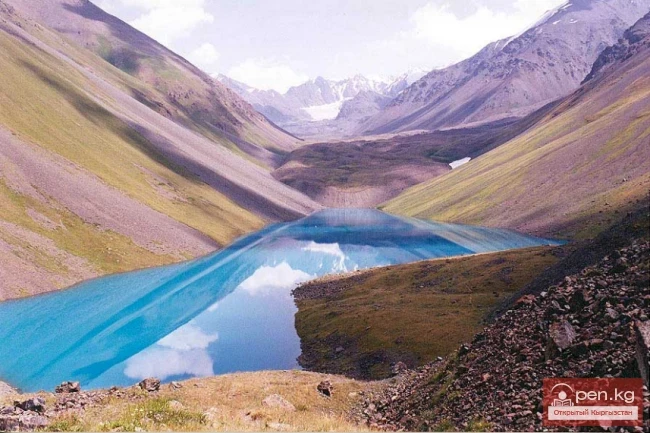
Upper Lake emerged quite recently. In aerial photographs from 1943, it is still absent, but on the "tongue" of the glacier, pits and depressions are discernible, in many of which lie small lakes. In photographs from 1956, one fairly large lake is already visible on the "tongue" of the glacier. In the early 1970s, a lake that stretched across the entire width of the valley was visible at the "tongue" of the glacier. Subsequently, it continued to grow due to the retreat of the glacier.
But Upper Lake could not increase indefinitely. The Northern Inylchek glacier, having likely lost the support of its "tongue" (which ended in the lake, and part of the "tongue" was afloat), quickly advanced forward, displacing the lake from its basin. In its place lay a body of the glacier, fragmented by numerous cracks. This happened in 1996, and how quickly it occurred is unknown, as no one recorded it. Usually, in such cases, glaciers move at a speed of up to 100 m per day. The rapid movement ended with Upper Lake being reduced to just a small piece — a pond only 200–300 m long. It turned out that Upper Lake disappears and reappears, just like Lake Merzbacher. But this happens not once a year, but approximately once every 100 years. So, Upper Lake existed, and now it is gone. And the current generation of people will not have the chance to admire the beauty of this unusual mountain lake.
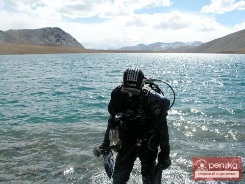
Despite the abundance of visits, serious scientific research on Lake Merzbacher has been almost nonexistent. Therefore, the mysteries of the lake remain hidden behind seven seals.
Source: geographyofrussia.com