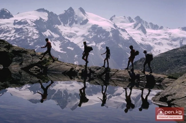
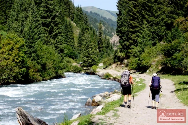
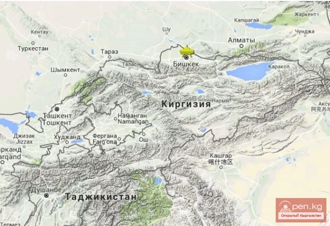
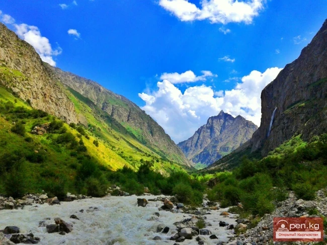
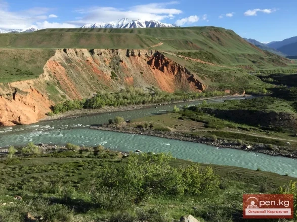
Ala-Archa Zone is located 30 km south of Bishkek in the central part of the Kyrgyz Ala-Too range in a picturesque gorge of the same name, which is over 35 km long. This gorge is the largest of all the gorges in the Kyrgyz range. On its territory lies the Ala-Archa National Park.
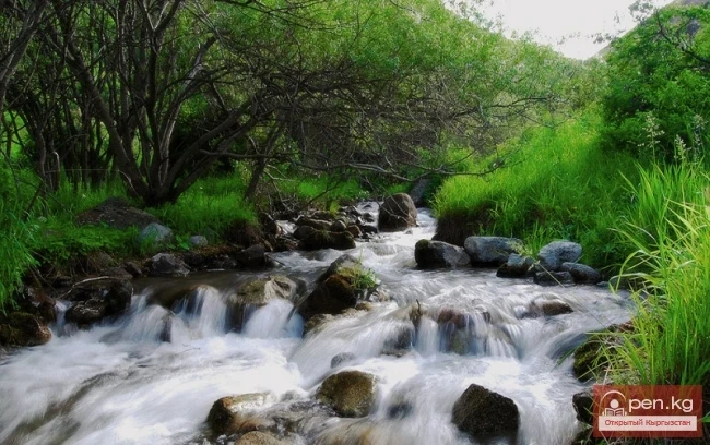
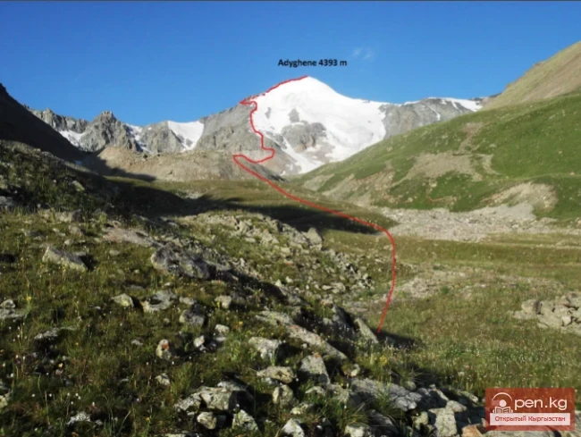
The Ala-Archa River originates from the Big Ala-Archa Glacier. From the upper reaches to the mouth of the gorge, several large tributaries flow into the river: Tuyuk-Suu, Top-Karagay, Teke-Tor, Ak-Sai, Adygene, Karagay-Bulak, Kadir-Berdy, Beru-Sai, Kashka-Suu, Ooruu-Sai.
The Kashka-Suu gorge rises to the foot of the peaks of Komsomolec (4140 m) and Pioneer (4050 m), which are clearly visible along the entire road from Bishkek.
In the lower part of the Ala-Archa gorge (1600 m), the terrain is soft. After the "first gates," the slopes become rugged, and the steepness and height of the ridges increase. In the upper part, the walls of the gorge form bizarre rocky teeth and towers several hundred meters high. Huge stone avalanches descend the slopes.
In the spruce forest zone at an altitude of 2100 m is the internationally renowned climbing base "Ala-Archa." Just above the base on the right begins a very beautiful Ak-Sai gorge, whose northern slope is overgrown with tall Tien Shan spruces. The mouth of the Ak-Sai River, where it flows into the Ala-Archa, forms a large alluvial cone of rounded boulders with a surviving patch of stripped Tien Shan spruces.
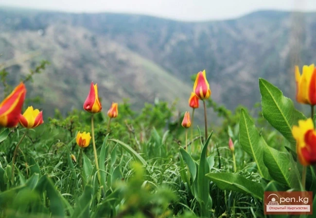
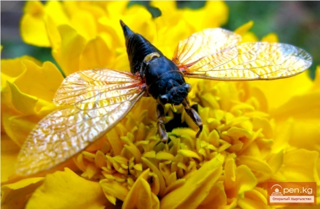
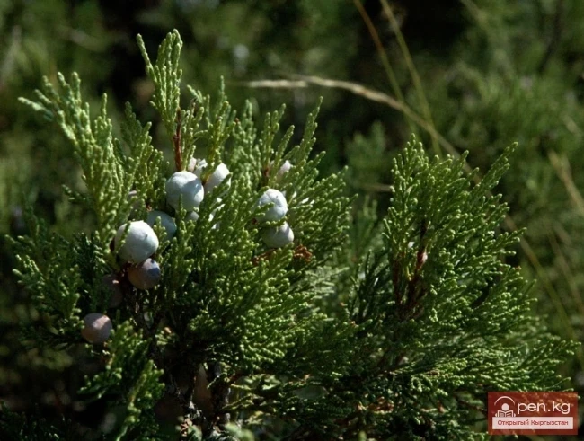
The climatic conditions are favorable for organizing year-round use of the natural park area. The plant world of the gorge is remarkably rich, with over 1100 species of plants, about a third of Kyrgyzstan's flora, including 70 species of trees and shrubs. In the middle part of the gorge, there are dense thickets of half-spherical juniper, honeysuckle, sea buckthorn, rose hips, barberry, and currants, which gradually mix with the spruce forest. Up to an altitude of 2800 m, tree species of juniper, spruce, rowan, and birch grow. Here, there are about 50 species of medicinal herbs: golden root, St. John's wort, thyme, Issyk-Kul root, yarrow, and others.

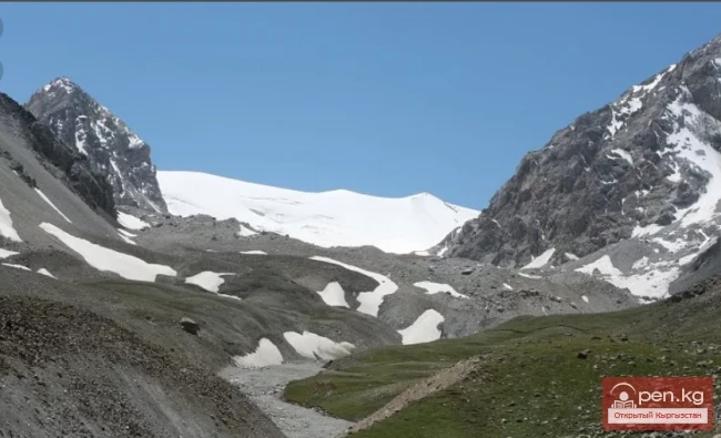
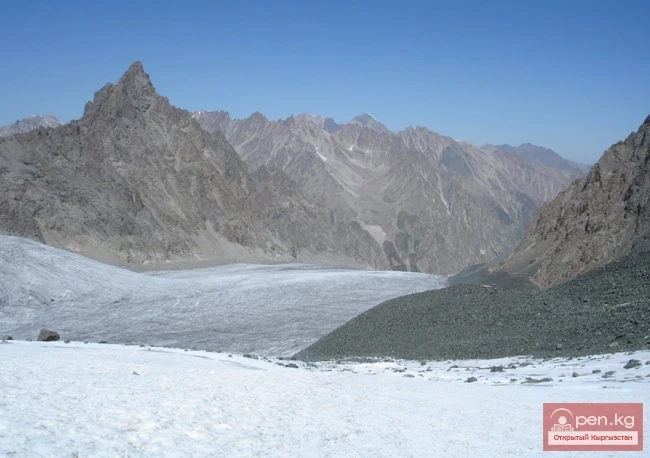
This zone has about 50 glaciers. Here are also the largest glaciers of the range: Golubina — 6 km long; notable for their size and shape are the glaciers Top-Karagay, Tuyuk, and Adygene; the Big Ala-Archa Glacier with glacial lakes; and the most beautiful glacier — Ak-Sai, which is 5 km long. The Golubina Glacier releases up to 10 million cubic meters of pure water during the summer. Tuyuk is completely covered with torn cracks, ice falls, and funnel craters — a real training manual for overcoming obstacles encountered on the glaciers of the Tien Shan. The Big Ala-Archa Glacier has a gentle and extensive surface suitable for laying ski trails in the summer. The Ak-Sai Glacier has a huge icefall in its middle section. On the glaciers, one can find many fascinating sights. Icefalls are an impressive spectacle of chaos from large glacier fragments. They form as the glacier descends the slope. At the cliffs, the more plastic lower layers flow over the obstacle, while the upper layers break into pieces of various sizes.
In calm areas of the glaciers, one can find "ice cups" and "stone-ice mushrooms." How do they form? Large and small stones fall onto the glacier surface. Small stones heat up faster than the ice. The ice melts, creating depressions in the shape of "cups" with stones lying at the bottom. Large fragments do not transmit heat. The ice around them melts, while the fragments remain on an ice leg up to two meters high, resembling large mushrooms. The surface of the glaciers is marked with grooves carved by streams of melting water flowing down to merge into one powerful flow at the end of the moraine.
In bad weather, the glaciers are covered with a blanket of snow. After a while, the snow surface melts, and water penetrates into the thickness of the snow. At night, it freezes, forming firn — ice grains that gradually compact into ice.
In the grottoes and cracks of the glacier, a deadly cold and majestic beauty reign. The nervous tension is heightened by fear, as it seems that the ice will collapse and crush those who dare to intrude upon the glacier's secrets. The greenish-blue mass of the glacier in cross-section is dotted with barely noticeable stripes of annual layers, allowing one to determine, as on a tree's cross-section, the processes that occurred many years ago.

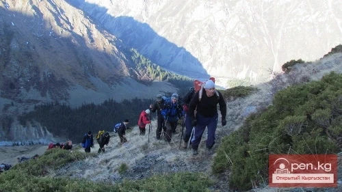
In the alpine and glacial-nival zones, there are small huts. In them, one can warm up and find small supplies of food, which, by an unwritten law of the mountains, should be replenished.
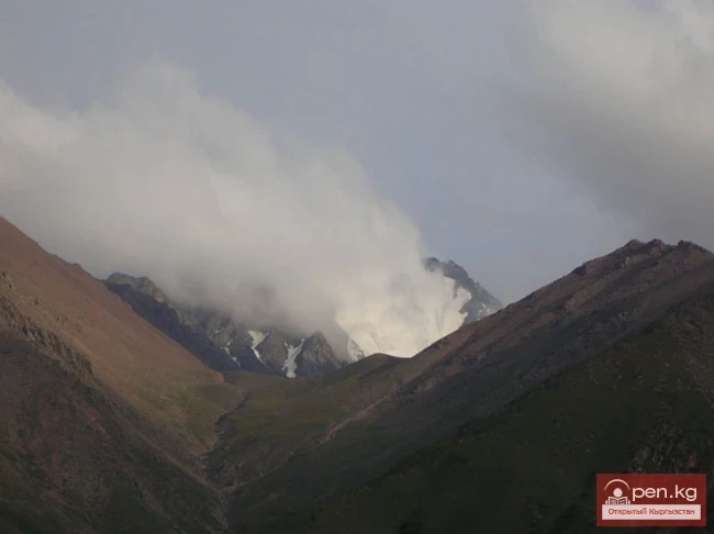
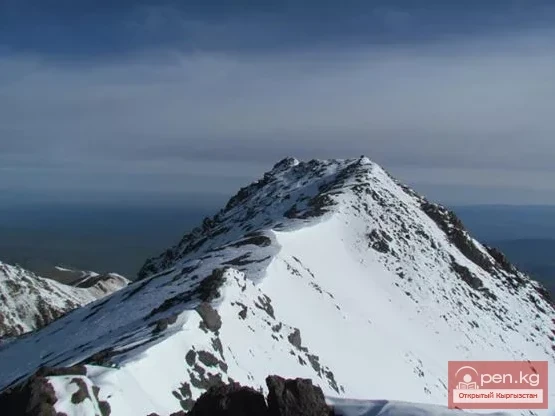
The glacial zone of this area is closed off by the high Ak-Sai ridge (Ak-Sai horseshoe). Its crest contains the highest points of the Kyrgyz Ala-Too: Semenov-Tyan-Shansky Peak (4874 m), Corona Peak (4860 m), Free Korea Peak (4640 m), Teke-Tor Peak (4441 m), Ak-Too Peak (4620 m). Within the gorge, there are many viewpoints from which a majestic panorama of the mountains can be seen, with eight to ten peaks rising above 4000 m.
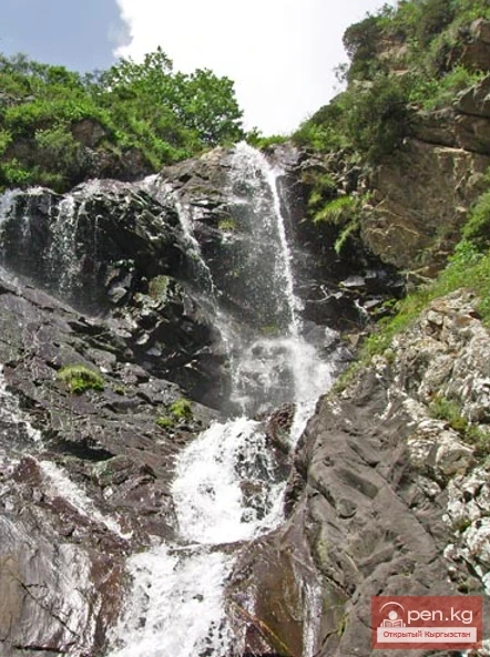
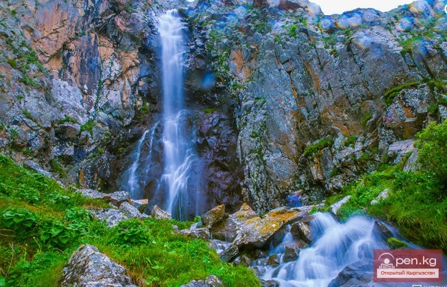
As interesting objects within walking distance, one can mention the moraine-dammed lake Ular-Kel — at the sources of Min-Dzhilki, a left tributary of the Ala-Archa River; the glacial lake Dinosaur; a three-tiered waterfall about 15 m high on the right tributary of Sharkyritma River Ak-Sai, which is a right tributary of the Ala-Archa River; the Ak-Sai waterfall 15 m high on the right tributary of the Ak-Sai River; the Teke-Tor waterfall 7 m high in the gorge of the right tributary of Teke-Tor River Ala-Archa; Tuyuk-Suu — a two-tiered waterfall on the edge of the gorge of the right tributary of Tuyuk-Suu River Ala-Archa; and the picturesque two-tiered waterfall Adygene in the large left tributary of Adygene River Ala-Archa.