The Greatest Glacier of Pamir
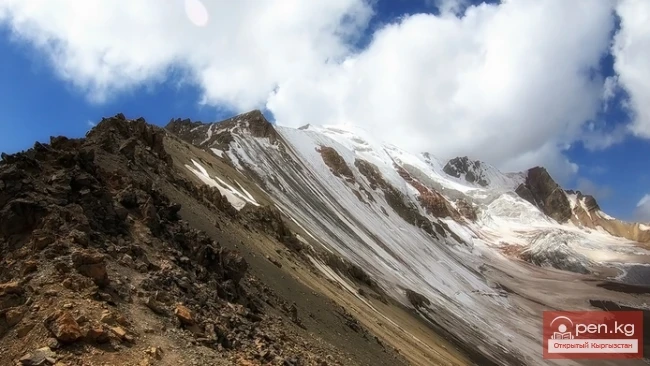
On August 22, 1953, eight climbers from the Pamir expedition of the All-Union Central Council of Trade Unions — A.S. Ugarov, A.S. Gozhev, L.M. Krasavin, P.K. Skorobogatov, B.D. Dmitriev, A.I. Kovyrkov, E.M. Ryspaev, and R.M. Selidjanov — reached the summit of Mount Evgeniya Korzhenevskaya — 7105 m. Soviet high-altitude climbers conquered the last, third highest seven-thousander of Pamir, following the peaks of Lenin and Stalin, the fourth highest peak in the USSR. This triumphantly concluded the struggle for the conquest of Mount Evgeniya Korzhenevskaya, which began 17 years earlier and drained much strength from the participants of two previous expeditions.
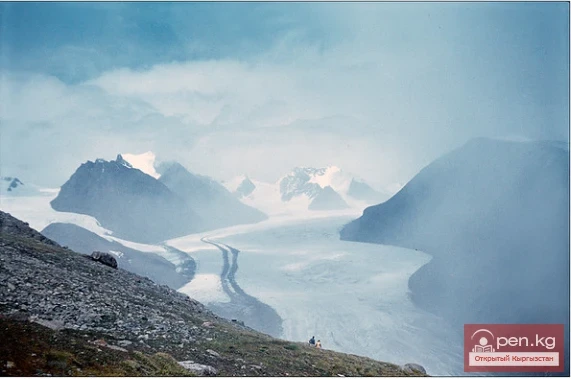
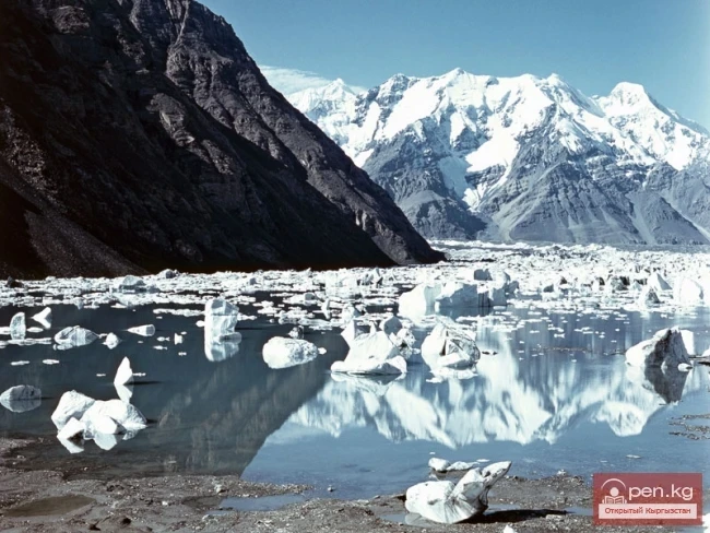
Mount Evgeniya Korzhenevskaya was discovered and mapped by the famous explorer of the mountainous regions of Central Asia, geographer and glaciologist N.L. Korzhenevsky in 1910. Back in 1904, aiming to explore the then mysterious Pamir, N.L. Korzhenevsky undertook his first journey to the upper reaches of the Muksu River. At that time, it was known that this powerful river, one of the sources of the water-rich Vakhsh, originates in the greatest glaciers of Pamir. The most significant of them was discovered in 1878 by entomologist and geographer V.F. Oshanin and named the Fedchenko Glacier in honor of the famous explorer of Pamir-Alai.
The narrow and deep valley of the Muksu River is bounded to the north by the slopes of the Zaalai Range. To the south rise the snowy giants of the Peter the First Range, also discovered by V.F. Oshanin in 1878. By the time of N.L. Korzhenevsky's first expedition, information about the orography of the Peter the First Range was quite scarce, and the traveler hoped to gather more complete data during his routes.

In September 1904, N.L. Korzhenevsky, along with his guide, the Kyrgyz Tohktur-bai, set out from the village of Altyn-Mazar in the upper reaches of Muksu downstream along the river. With great difficulty, they managed to traverse dizzying pedestrian paths through the wild gorges of the Muksu River until its confluence with the Kzylsu River near the Tajik village of Damburachi. In his travel report, N.L. Korzhenevsky provided a detailed description of the route, a scheme of the mouths of the right and left tributaries of Muksu, and information about traces of ancient glaciations in the basin.
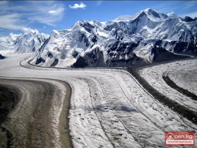
His reports on the powerful modern glaciers on the northern slopes of the Peter the First Range, which were unknown to science at that time, were of significant interest. One of these glaciers was discovered by the traveler 25 versts west of Altyn-Mazar. N.L. Korzhenevsky, observing the gorge that opened to the left, noticed the powerful terminal moraines and the tongue of a large glacier approaching the Muksu valley from the south. According to Tohktur-bai, this was the Karasel Glacier.
The researcher limited himself to a cursory examination of the glacier tongue from the Muksu River; he could not trace its continuation or examine its upper reaches due to bad weather and low cloud cover. Therefore, N.L. Korzhenevsky planned to survey the Karasel Glacier, which he later named the Mushketov Glacier. However, the difficulties of traveling down the Muksu valley weakened the traveler's strength, and the attempt to survey the newly discovered glacier had to be postponed for six years.
In August 1910, N.L. Korzhenevsky, along with his companion, Dr. M.P. Bogdanov, again penetrated to the upper reaches of Muksu. On August 21, they reached the tongue of the Fedchenko Glacier.
The next day, it was decided to attempt to inspect the Mushketov Glacier from the right slope of the Muksu valley together with the guide, the Uzbek Khalmet; crossing to the left bank, to the glacier tongue, proved impossible due to high water.

Unlike the first expedition, the weather was warm and sunny. Riding on horseback, the group reached the Dorradek area in two hours. Here stood two wintering stations, the last traces of Kyrgyz settlements in the upper reaches of the river. Soon the horse path ended, and further movement became possible only on foot, along a barely noticeable trail. Half an hour later, N.L. Korzhenevsky and Khalmet found themselves on the traverse of the Mushketov Glacier gorge.
The clear weather allowed them to look into the upper reaches of the glacier, revealing an unforgettable panorama of the foothills of the Peter the First Range, covered with a powerful snow-ice shell.
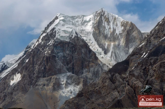
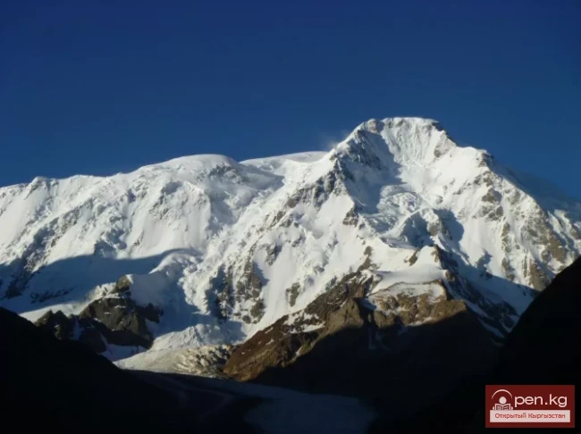
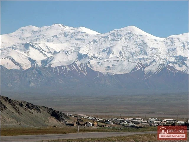
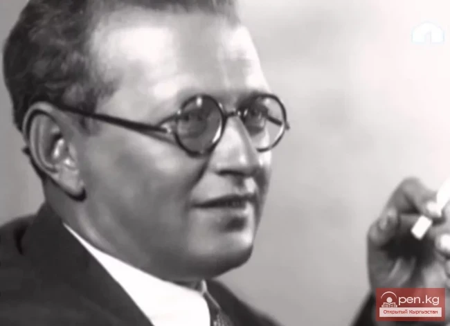
"The first thing that struck me," N.L. Korzhenevsky later wrote, "was the gigantic ice mass rising in the background of the Karasel Gorge. The flat surface of its ridge soared at least 20,000 ft (about 6100 m) high and sparkled brightly with powerful ice, which, most likely, feeds the Karasel Glacier. This peak was located about 20 versts from us, and it should be assumed that the glacier has approximately the same length. I dedicate this majestic peak to Evgeniya Sergeyevna Korzhenevskaya, whose name is intertwined with my feelings of gratitude for her heartfelt participation in my travels."
N.L. Korzhenevsky took bearings from the right bank of the Muksu River and determined the location of the Mushketov Glacier, which was no more than two versts to its tongue. The visible outlines of the glacier, the slopes of its gorge, and the Korzhenevskaya peak were plotted on the first map of this area, attached to the report.
Comparing N.L. Korzhenevsky's information about the location and height of the newly discovered peak with modern cartographic data shows that the original researcher was close to the truth in his main determinations. However, some of his assumptions about the orography of the area of the peak turned out to be incorrect; the assumption about the connection of the upper reaches of the Mushketov Glacier through passes with the basin of the Hingou River was also unfounded.
These errors and the limitations of the initial information about the Korzhenevskaya peak are natural. At that time, vast expanses of the high-altitude Pamir, lying many tens of kilometers south of Muksu, up to the Panj River, had not yet been explored and were marked on geographical maps of Central Asia as "white spots." As a result of Korzhenevsky's work in 1904 and 1910, only some data about the northern slopes of the giant peak were obtained; complete information about the glaciers of this knot, the location of the Korzhenevskaya peak, and the arrangement of its ridges could only be obtained through excursions into the depths of the "white spot." However, this work under the conditions of the tsarist regime was too much for even such a bold and persistent researcher as N.L. Korzhenevsky. It was only during the years of Soviet power that a new generation of geographers and explorers of high-altitude Pamir, relying on the experience of their predecessors, managed to fully resolve it.

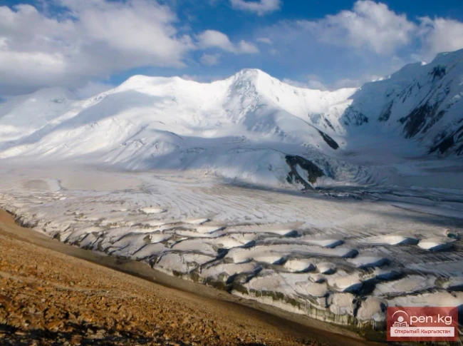
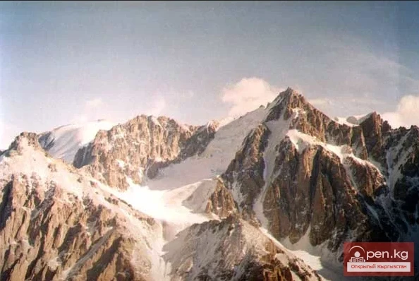
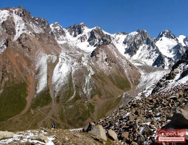
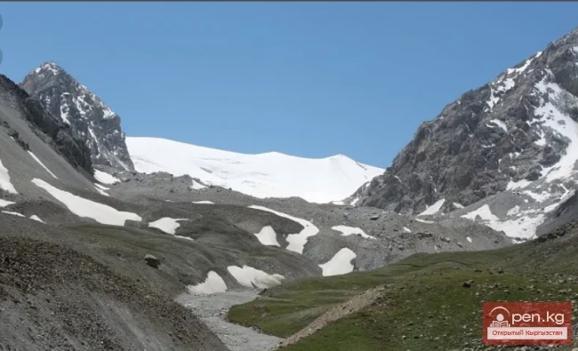
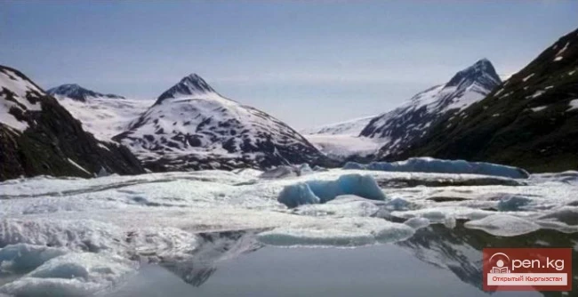
The Korzhenevsky Glacier is the largest in the Zailiyskiy Alatau. It occupies a vast area at the sources of the Southern Issyk River between the Southern Issyk Range and the main ridge, which encircles the glacier from the rear and left side.
The Korzhenevsky Glacier, northern basin. The Korzhenevsky Glacier is a valley glacier, fed by the snows of the highest part of the main ridge, where the Talgar Peak is located almost in the center of its rear.
The average height of the mountains bearing the firn fields of the glacier is approximately 4500 meters above sea level.
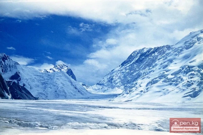
The open end of the tongue descends to an altitude of 3300 meters above sea level. The vertical distance between the highest and lowest points of the glacier reaches 1717 meters above sea level.
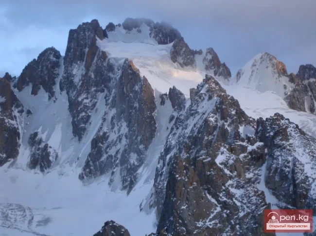
The length of the glacier is about 11.2 kilometers, and its area is about 38 square kilometers. The upper reaches of the glacier are located in four firn basins, of which the outermost are the largest. Their view, along with the massive surrounding mountains, is the most majestic in all of Zailiyskiy Alatau.
All the rear walls of the cirques represent a continuous snowfield, inclined at an angle of 25 – 30 degrees and sometimes torn apart by the weight of heavily settled masses.

Each of the firn basins gives its branch to the glacier. The two middle branches originate from four basins at Talgar Peak. They are short and 300 - 350 meters wide. Both soon merge into one after exiting the cirques.
The left branch, which is up to 8 kilometers long and more than 1 kilometer wide, departs from the peaks of Kopyr and Metallurg.
Initially directed southeast, it gradually makes an arc-shaped turn and, with an exposure to the south, approaches the middle branch, from which it is separated in the upper reaches by a spur that detaches from the East Talgar peak.
From the end of this spur, the left medial moraine stretches along the glacier. The right branch, which is up to 5 kilometers long and up to 4 kilometers wide, originates from the eastern slope of the main ridge, where two completely snow-covered peaks stand out with heights of over 4600 meters above sea level: in the southwest corner is the Vseobuch peak (4650 meters above sea level), from which the Issyktikshoku spur begins, and in the center is the White Peak.

Initially, the branch flows east, where, upon encountering a lateral spur, it turns south. The width of the glacier at the confluence of all branches reaches 4 kilometers, then it gradually decreases.
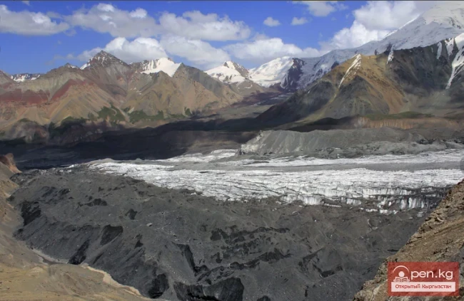
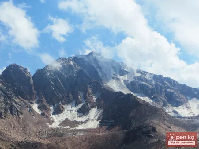
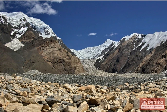
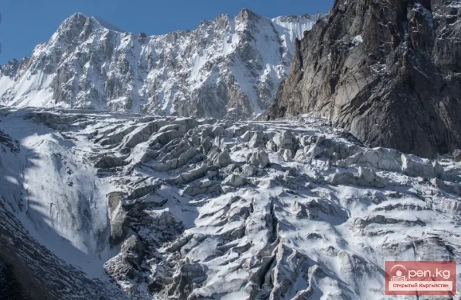
In the lower reaches of the tongue, it is already 700 - 800 meters wide, and the glacier has a slope of more than 7 degrees in the longitudinal direction. In places, especially near the firn line, it is cut by crevasses, which in the upper part of the right branch form a maze, while on the left branch there are icefalls.
Glacial mills and wells are found here and there. (Gorbunov, 1939). The glacier in the upper reaches carries four medial moraines. Two of them then merge into one. Along the glacier, in the deep canyon, the main flow of meltwater rushes violently.
At the end, which has a southern exposure, the tongue of the glacier becomes steep and breaks across its entire width into a series of steps. The remaining area of glaciation in the basin of the Southern Issyk is represented by 12 small glaciers with a total area of about 10 square kilometers. Of these, eight glaciers are located on the eastern slope of the Southern Issyk spur.

All of them belong to the cirque type, facing east and northeast, towards the right side of the Korzhenevsky Glacier. Two larger ones (up to 1.5 kilometers long) emerge from the cirques and enter narrow "hanging gorges," forming hanging tongues with very steep drops. Four glaciers are located on the western slope of the main ridge and its spur, located south of the Kokbulak peak.
They have southwest exposures and face the left side of the Korzhenevsky Glacier. All these glaciers are cirque glaciers, up to 1.5 kilometers long. Their ends, framed by moraine deposits, lie in short gorges on the slope and do not reach the main glacier.
The beginning of the glacier is in the highest part of the ridge at Talgar Peak, 4973 meters above sea level — the highest point of Zailiyskiy Alatau. The tongue of the glacier ends, bifurcating, at an altitude of 3450 meters above sea level, and the firn line passes at an altitude of 3950 - 4000 m.