Achyktash and Korumdy
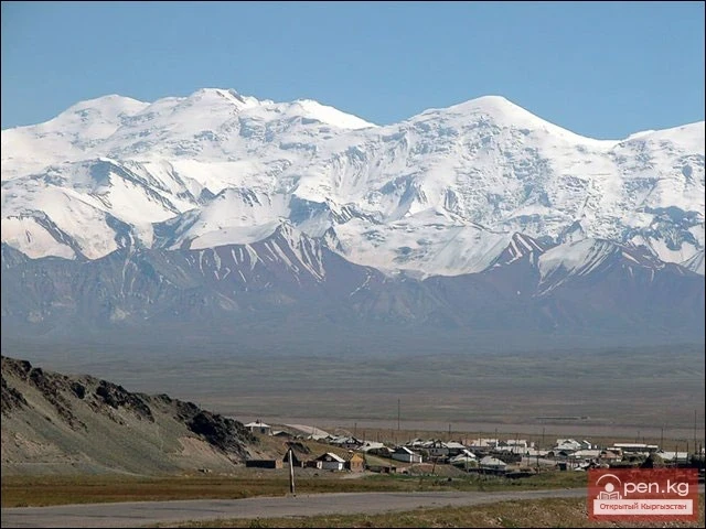
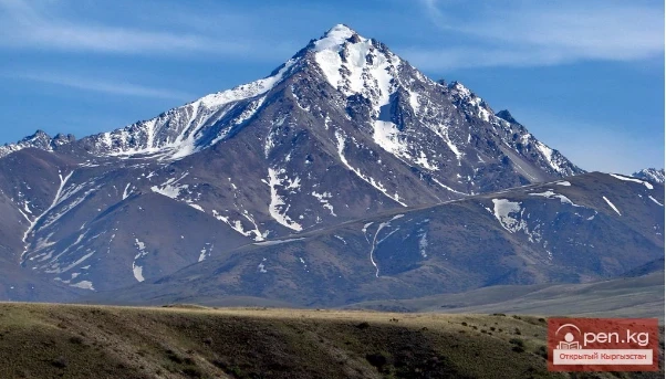
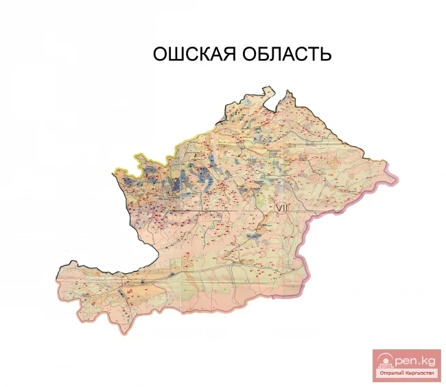
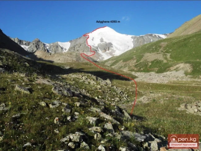
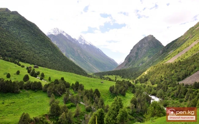
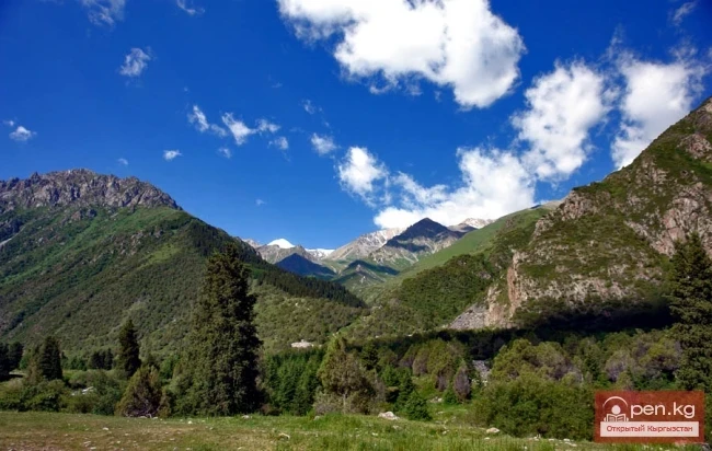
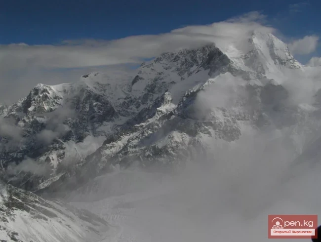
The mountain nodes Achik-Tash and Korumdy are the main and most popular areas for high-altitude mountaineering. Achik-Tash is located in the central highest part of the Zaalai (or Chon-Alaï) ridge. The mountain complex consists of powerful glaciers and peaks: Dzerzhinsky (6716 m), Kyzyl-Aga (6663 m), Estonia (6202 m). The highest and most popular point of the Achik-Tash mountain node is Lenin Peak, which is 7134 m high. From the edelweiss glade located in the Achik-Tash area, which serves as the starting point for all ascents to the seven-thousander, a wonderful panorama of the mountainous region opens up. Green alpine valleys are cut by ochre ribbons of rivers. In deep chasms are blue lakes, giant glaciers touched by cracks, and rivers flowing into the Alai Valley.
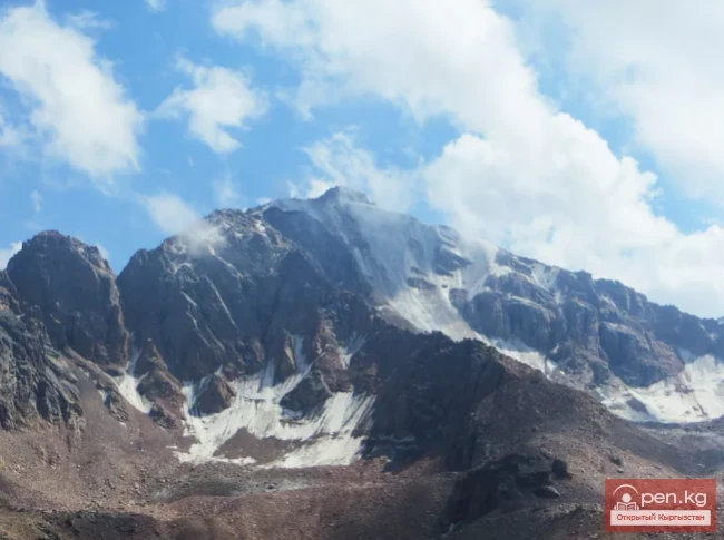
Korumdy Peak (6613 m) is located 60 km east of Achik-Tash. To the west, it is bordered by three unnamed peaks with heights of 6243 m, 6283 m, and 6080 m. One of the peaks with the beautiful name "Dawn of the East" (6349 m) is located right at the junction of the borders of Kyrgyzstan, Tajikistan, and China.
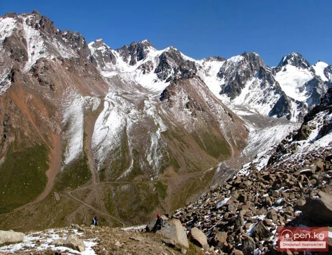
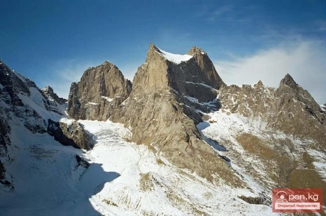
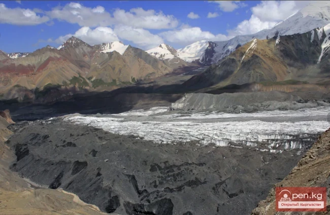
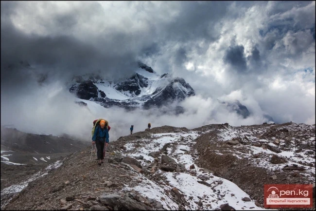
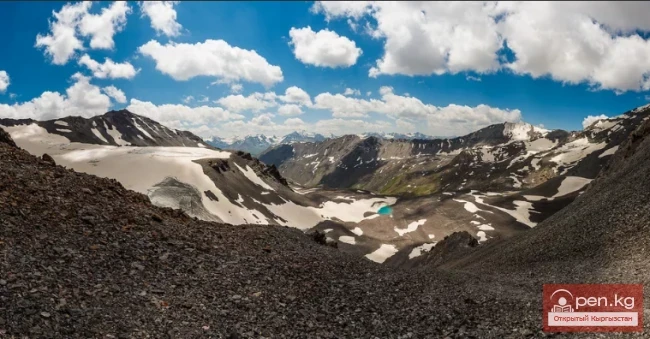
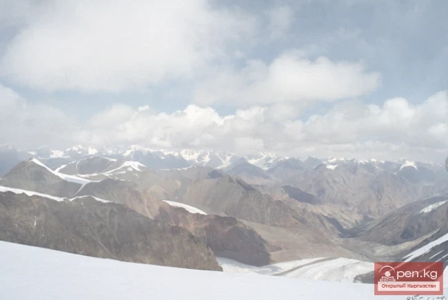
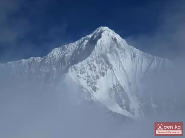
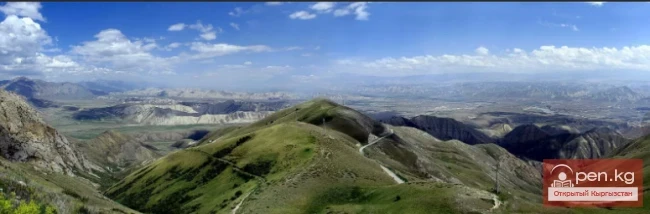
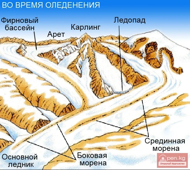
For a long time, this area was closed to visitors. This circumstance has likely allowed the region to retain a significant degree of obscurity. Several peaks over six thousand meters remain unconquered, which is a good factor for attracting climbers to this area. The entire territory is occupied by high-altitude, heavily dissected, and difficult-to-pass ridges. The crests of the ridges are narrow, rocky peaks are sharp, sometimes in the form of inaccessible summits. Glaciers descend in wide tongues, forming icefalls on steep sections.
Read also:
Mountaineering in Kyrgyzstan
Kyrgyzstan, as you know, is a mountainous country with many peaks of varying difficulty. It is...
Zhalay Range
Zaalai Ridge A ridge oriented in a latitudinal direction, separating the Pamir and the Alai...
Ak-Suu - Karavshin (Asian Patagonia)
The contrasts of nature in the mountain ranges of Matchi and Karavshin are astonishing, offering...
Shakarap Salad
Achik-Chuchuk (Shakarap) A delicious, simple salad made from tomatoes in Uzbek cuisine, served...
Lenin Glacier
Lenin Glacier — a mountain valley glacier on the northern slope of the Zaalai Range (Pamirs), in...
"Pamir-Alai Zone"
The Pamir-Alai Zone encompasses a section of the Alai Valley, which stretches along the major...
The title translates to "Ak-Shiyrak Ridge."
Ak-Shiyrak The Ak-Shiyrak Ridge is a watershed between the Naryn and Sary-Jaz rivers in the Tian...
Alay Ridge
Alay Range A mountain range of the Pamir-Alai mountain system in Kyrgyzstan and partially in...
Glaciers of Kyrgyzstan
The territory of Kyrgyzstan is predominantly mountainous, with peaks almost everywhere reaching...
Glaciers of the Kyrgyz Range
Glaciers of the Kyrgyz Ala-Too The highlands of the Kyrgyz Range feature a deeply dissected alpine...
Peak Manas
Peak Manas - is the highest point of the Talas Ala-Too (4482 m). This bare peak in the western...
The Saridzhaz Ridge
Sarydjaz The mighty snow-covered barrier of the Sarydjaz mountain range rises in the Central Tian...
The title "Хребет Какшаал-Тоо" translates to "Kakshaal-Too Ridge" in English.
Kakshaal-Tuu A mountain range in the Central Tian Shan system, on the border of Kyrgyzstan and...
Kokshaal-Too and Peak Dankov
Remoteness, wildness, and mystery are the concepts that characterize and give an idea of this...
Glacier Kyzylsu
Kyzylsu - Red Water The Kyzylsu Glacier (often referred to as the Eastern Kyzylsu) is a complex...
Kyrgyz Ridge
Kyrgyz Mountain Ridge A mountain range that borders the Chuy Valley and the Moyunkum Desert to the...
Peak of Military Topographers
Peak of Military Topographers, Height 6873 meters above sea level. Located in the Central Tien...
Osh Region
The Osh Region was established on November 21, 1939, replacing the former district. After numerous...
Natural Park Kyrgyz-Ata
Kyrgyz-Ata Natural Park is located in the basin of the river of the same name, which flows down...
Fergana Range
Fergana Ridge A mountain range in the Tien Shan that stretches from southeast to northwest,...
The Village of Gulcha
Gulcha – a village, the administrative center of the Aksy District. This is a comfortable,...
Peak Adygene
Peak Adygene. It is located at the top of the gorge of the same name on the northern slope of the...
Alaudin Gorge
The Alamedin Gorge is characterized by the exuberance of nature and diverse vegetation. The...
River Kyzyl-Suu
Kyzyl-Suu (Kyzyl-Suu River, Красная река) - a river in Kyrgyzstan and Tajikistan, the right source...
Kungey-Alatau Ridge
Kungey-Alatau To the south of the Zailiysky Alatau, beyond the deep longitudinal valleys of the...
Mountain Ranges of Kyrgyzstan
Mountains of Kyrgyzstan Akshiyrak A mountain range in the Tian Shan, located in Kyrgyzstan. It...
Terskey Alatoo Ridge
Terskey Alatau The Terskey Alatau Ridge is very beautiful in its variety of landscapes. In one...
Kara-Suu
The "Kara-Suu" Zone is located in the eastern part of the southern slope of the Chatkal...
Zone "Chatyr-Kel"
The Chatyr-Kel Zone includes a significantly elevated intermountain basin with a lake of the same...
Contrasts of Southern Kyrgyzstan
Have you ever, in a short span of time measured in hours, visited a hot valley, tasted sweet...
China (Xinjiang Uygur Autonomous Region of the People's Republic of China)
China is a vast country rich in tourist resources. The country is abundant in attractions and...
Zailiysky Alatau Ridge
Zailiyskiy Alatau A mountain range in the northwest of the Tian Shan (on the border of Kazakhstan...
Peak of the World
Peak Mira (4940 m) - located near Peak Lenin Mira I, in English Myra I, is a medium-height peak...
Three Kyrgyz Seven-Thousanders: Peaks of Victory, Lenin, and Khan Tengri
Three Kyrgyz Seven-Thousanders. 1. Peak Victory - 7439 m. – the highest peak of Kyrgyzstan, the...
The title translates to "Dzhomantau Ridge."
Jamanatau A mountain range in the Tian Shan, located in Kyrgyzstan, northwest of Lake Chatyr-Kul....
Meridional Ridge
Meridional Ridge The main nodal uplift of the Central Tien Shan on the border of Kyrgyzstan and...
Mountain Passes of Kyrgyzstan with Neighboring Countries
Roads in the Sky Irkeshtam Pass is located in the Osh region and stretches from Sary-Tash to...
"Ala-Archa Zone"
Ala-Archa Zone is located 30 km south of Bishkek in the central part of the Kyrgyz Ala-Too range...
Wildlife of Kyrgyzstan
Increasingly, Western travelers and tourists are seeking exotic vacation spots located "off...
Upper Naryn
Upper Naryn includes the upper part of the Naryn River basin from the vicinity of the town of...
Orography and Relief
Curl error: Operation timed out after 120001 milliseconds with 0 bytes received...
Glacier Korzhenevskogo
The Greatest Glacier of Pamir On August 22, 1953, eight climbers from the Pamir expedition of the...
Attractions of the Southern Shore of Issyk-Kul and the Terskey Alatau
Tamga-Tash. At an altitude of 1684 m, in a beautiful old park on a steep cliff by Lake Issyk-Kul,...
The Moldotau Ridge
Moldotau A mountain range in the Inner Tian Shan, in the central part of Kyrgyzstan, south of Lake...
"Chon-Kemin Zone"
Chon-Kemin Zone includes the valleys of the Chon-Kemin and Kichi-Kemin rivers between the high...
Tajikistan
If Kyrgyzstan is the country of the Tian Shan, then Tajikistan is the country of the Pamirs. The...
Glaciations in the River Basins of Kyrgyzstan
CHARACTERISTICS OF GLACIERS IN RIVER BASINS To provide a complete understanding of the glaciation...
Modern Glaciation in the Chuy Valley
Kyrgyz Ridge - the most glaciated area in the northern part of our republic. However, despite this...