Kyrgyz Mountain Ridge
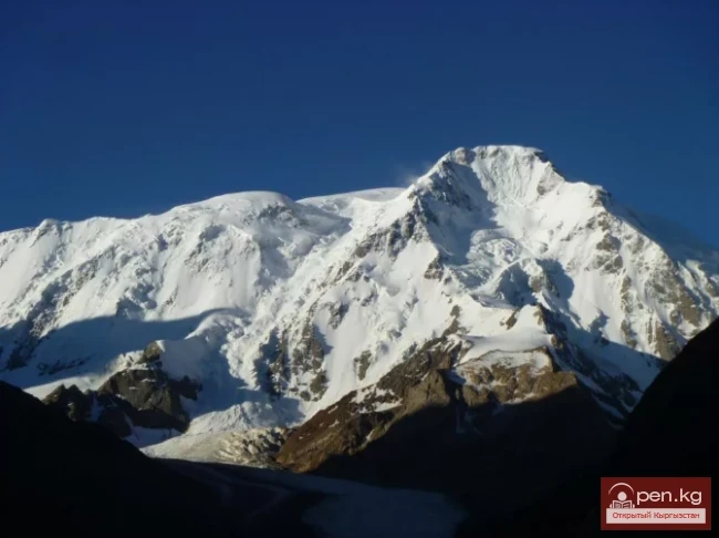
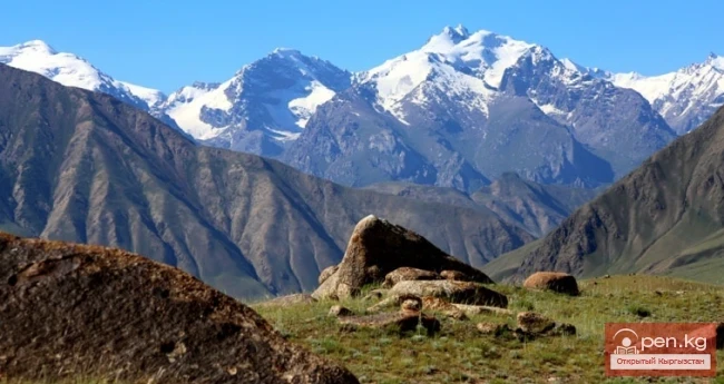
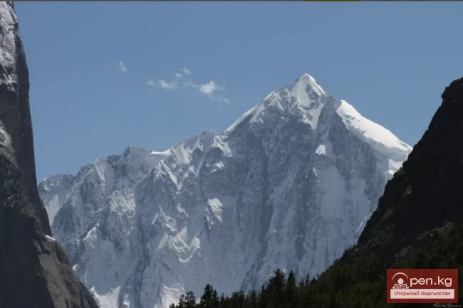
A mountain range that borders the Chuy Valley and the Moyunkum Desert to the south. It is located 40-60 km south of the capital of Kyrgyzstan. It is situated in the northwestern part of the Tien Shan within Kyrgyzstan and partially in Kazakhstan. The range extends 400 km from west to east - from the city of Jambyl to the Boom Gorge of the Chu River. In the northern part, it connects with the Talas Ridge, and through a watershed saddle of the Karakol West and Karakol East river basins, it connects with the short (about 70 km) Karamoink Ridge, located to the south and almost parallel to the Kyrgyz Ridge, which is part of the Jumgalatau system. The peaks of the Kyrgyz Ridge reach nearly 5000 m: the highest are Semenov-Tyan-Shansky Peak (4875 m) and Western Alamedin Peak (4856 m). The highest point of the Karamoink Ridge is Shnitnikov Peak (4281 m). The total area of glaciation in the region exceeds 500 sq. km.
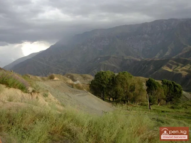
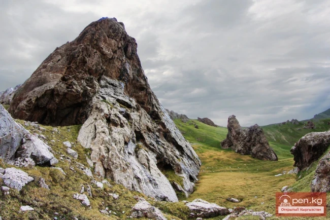
The formation of the modern relief of the area is the result of a two-sided process: powerful tectonic movements lead to mountain formation; on the other hand, erosion processes occur - washing by rivers and weathering. Rivers also create some positive forms of relief (for example, alluvial cones on the Ala-Archa and Alamedin rivers). As a result of weathering, powerful scree slopes have formed - a very characteristic element of the relief here. Some products of weathering are carried by glaciers and water into the valleys and deposited as moraines or extensive pebble floodplains along the riverbeds.

The climate of the area is strongly influenced by the circulation processes of the atmosphere over Western Siberia and Kazakhstan, as well as by altitude zonality and significant solar radiation. Mountain systems have a strong impact on the climate: powerful cyclones form over them, and they block the inflow of air from the Atlantic. The inflow of air masses mainly comes from Siberia and Kazakhstan: in winter, cold northeastern winds from Siberia prevail, while in summer, winds from Western Siberia and southeastern regions of the European part of the former USSR (northern and northwestern winds) dominate. In the south, warmer air masses form over Central Asia, but they rarely penetrate into the area due to the powerful mountain systems located south of the ridge.
In addition, there are local winds: föhn and mountain breezes. The warm and dry föhn occurs during high air pressure over the Susamyr plateau, located south of the Kyrgyz Ridge. It brings warmth and dryness to the northern slopes. Mountain breezes arise due to the daytime heating of the Chuy Valley. They determine the daily wind direction in the gorges of the ridge: it is northern during the day and southern at night. Wind speeds in the high-altitude zone reach 3 m/s, at the passes - 4 m/s and more. The valleys are characterized by mountain-valley winds, blowing from the mountains during cold hours and from the valleys during warm hours. Relative humidity is 60-70% and changes little throughout the year.

Overall, the climate of the area is continental; however, the complexity and fragmentation of the relief cause significant contrasts in temperatures and degrees of humidity. The amount of precipitation strongly depends on altitude and season.
In spring, fogs, rains, and snowfalls are common; the amount of precipitation is 80 mm per month. Summer is humid and cool; the average temperature in the summer months is +12°C. The warmest and driest month of summer is August.
Autumn is clear and warm; the driest and warmest month of autumn is September. November is a cold winter month. Over the three autumn months, 50 mm of precipitation falls, mainly in November. Winter is cold but not harsh: the valleys are protected by ridges from northern winds. In the high mountains, winter is colder - this is explained by the altitude and the fact that these places are open to the winds. The coldest month is February; the average temperature at an altitude of 2100 m is -7.5°C. The Kyrgyz Ridge experiences quite frequent impacts from warm föhns in winter, causing thaws; air temperatures rise to 0°C and above. Winter precipitation amounts to 80 mm, mainly falling as snow.

The total amount of precipitation is low (520-760 mm per year) and depends on altitude. In summer, their amount increases with altitude, while in winter, it decreases. The driest month for all zones is September. The wettest month is May. Summer in the mountains is humid; in July, the high-altitude areas receive 7-8 times more precipitation than the mid-altitude mountains.
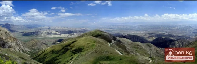
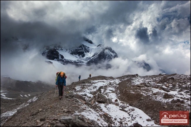
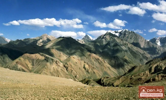
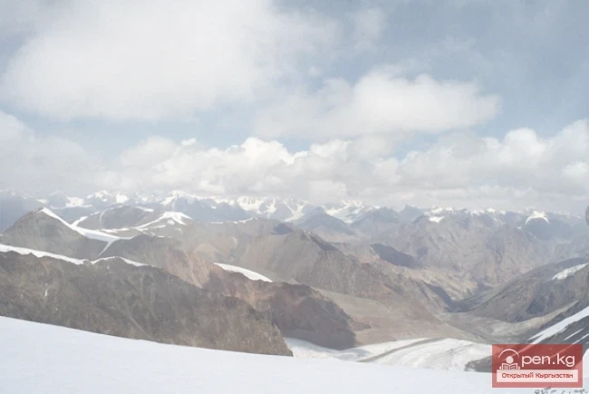
The dominance of northwestern winds in summer and northeastern winds in winter leads to uneven distribution of precipitation depending on the exposure of slopes; northern slopes are wetter than southern ones. The position of the snow line also strongly depends on exposure: on northern slopes, it descends to 3600-3800 m, while on southern slopes, it reaches 3900-4200 m. Permanent snows stretch for 200 km between the headwaters of the Merke and Kyndykty rivers in the west and the Shamsi pass in the east. This is where the main glaciers are located, along with the most interesting passes and peaks for tourism and mountaineering, with the northern spurs of the Kyrgyz Ridge being higher and more complex than the main watershed ridge.

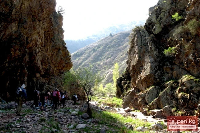
Most of the complex and interesting passes are located in two of these spurs - the Ala-Archa (Aksai Horseshoe) and Alamedin (Alamedin Wall). The area around the Ala-Archa River is the most developed, where the namesake climbing camp is located. The Karamoink Ridge is relatively less explored.
Both ridges exhibit strong asymmetry in the north-south direction. The northern slopes have significant glaciation, while the southern slopes have almost no glaciers, which are generally rocky and heavily eroded. The consequence of this asymmetry is a large number of one-sided passes, the tactics for crossing which and the equipment used depend heavily on the direction in which the pass is traversed.
The high-altitude region of the Kyrgyz Ridge features a deeply dissected alpine relief, which accounts for the abundance of various glacial forms. The majority of glaciers belong to the cirque and valley types, with many hanging glaciers and various transitional forms. Many glaciers cover various areas with debris, and almost all have powerful modern moraines. Extensive zones of crevasses, icefalls, and ice tongues are common. The Karamoink Ridge is characterized by cirque glaciers, often "booked" by moraine covers. Icefalls are virtually absent here, and crevasses are generally few. The tongues of the glaciers in the area descend to 3000 m and lower. The speed of glacier movement is small - up to 30 m per year.

The rocks in the area are mostly heavily eroded; however, there are monolithic walls, buttresses, and ridges. The Kyrgyz Ridge has a significant amount of active scree slopes composed of debris of various sizes.
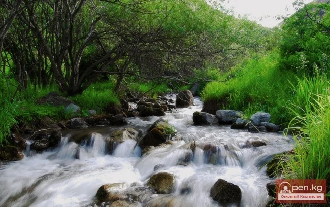
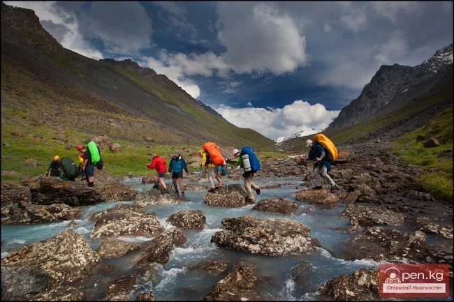
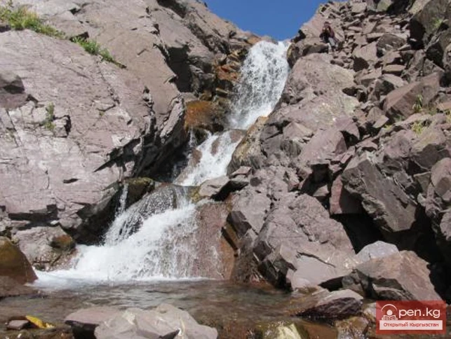
The rivers have a typical mountain character, with an average slope of 6 m/1 km in length. The rivers are fed by a mix of sources, i.e., they receive water from melting glaciers and permanent snows on one side, and seasonal snows on the other. Rainfall feeding occurs only in summer when floods can form with a significant increase in water levels. The river flow distribution by season is as follows: 10% in spring, 62% in summer, 19% in autumn, and 9% in winter.
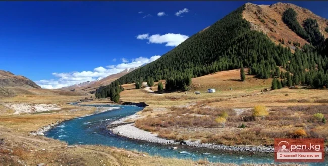
The lakes in the area are often small, shallow, and dammed by moraines (for example, Protsenko Lake, a lake under the southern slope of the Young Guard Peak). A very beautiful group of milky emerald lakes is located in the upper reaches of the Alamedin Gorge.
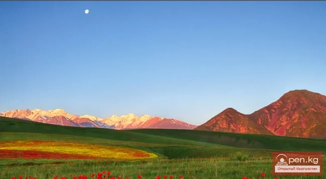
The change in climatic conditions with altitude determines the altitudinal character of the vegetation. Below, up to an altitude of 900 m, lies a steppe that has been developed for agriculture. Above, up to an altitude of 1600 m, there is a zone of small tree-like grasses. In the mid-altitude mountains (1600-2800 m), grasses, shrubs, juniper, and in some gorges, fir forests dominate, with juniper sparse forest at the upper limit of the forest. Even higher (2600-3700 m) is the zone of subalpine and alpine meadows, and creeping juniper. The subalpine meadows are rich in flowers and lush green grass. However, all this withers and dries out by mid-August, leaving only a few types of flowers: edelweiss, targhyl, cinquefoil, wormwood. Above 3700 m is the realm of stones, snow, and ice.

In the Ala-Archa River valley, a protected regime has been established, and a national park is located here. To enter and stay in the park, permission must be obtained from its administration. However, it is possible to descend down the Ala-Archa gorge almost unhindered.
The Kyrgyz Ridge is located a short distance from Bishkek and has quite convenient access routes. The valleys of major rivers are well developed and have roads sometimes leading to the very headwaters (Ala-Archa, Kegeti), and a road has been laid through the Kegety Pass to the valley of the Karakol East River. The valleys of all major rivers of the Kyrgyz Ridge are connected by convenient bus services with Bishkek. A road runs through the Karakol Pass along the valleys of the Karakol West and Karakol East rivers, connecting the villages of Susamyr and Kochkorka, which in turn are connected to Bishkek. A road from Susamyr to Kochkorka runs through the Suik West and Suik East river valleys via the Suik Pass, but it is used much less frequently than the road through Karakol.

Tourist development of the area began in the second half of the 1970s (not counting a few earlier expeditions), and to date, just over half of the known passes in the Kyrgyz Ridge and about a quarter in the Karamoink Ridge have been traversed; however, information about them is still scattered and not systematized. Descriptions for many, even well-trodden passes, are lacking.