Caves of the Kok-Kiya River

admin Caves
VK X OK WhatsApp Telegram
Caves of the Kok-Kiya River


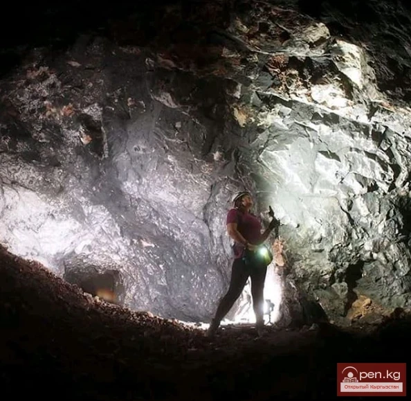
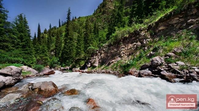
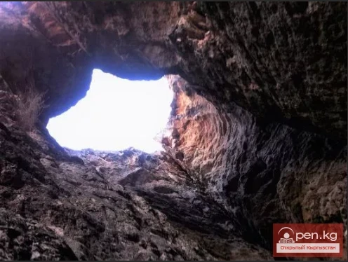
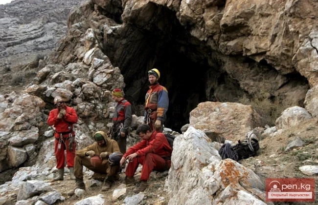
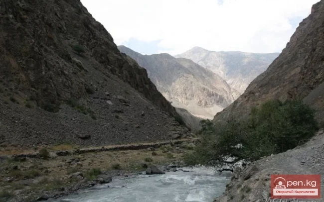
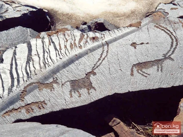
Kok-Kiya River (Green Slope) - the easternmost right tributary of Ak-Sai, flows down from the northwestern slope of the Kokshaala-Too ridge. In its middle course, the river runs through an impressive canyon, the walls of which show openings of caves and grottos. One of these openings, on the left side of the lower part of the canyon, leads to the Sports Cave, discovered by speleologists of Kyrgyzstan in 1973.

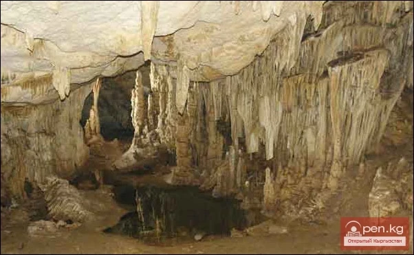
The cave is located 15 km south of the confluence of the Kok-Kiya and Ak-Sai rivers. The length of the cave is 600 meters, and its depth is 30 meters. Ten meters from the entrance, powerful ice stalactites block the way. The underground passage is narrow, but after a couple of dozen meters, it becomes spacious. The walls and ceiling are smooth and clean. On the right, there is a corridor along which a stream flows, winding away for about a hundred meters. Then the cavity splits into many narrow water-polished tubes, forming a complex labyrinth of circular passages. The main passage of the cave leads downward.

Kok-Kiya River (Green Slope)Kok-Kiya River (Green Slope)


The floor is a chaos of huge ice-covered boulders. Suddenly, the tunnel ends in a shallow vertical drop, beyond which it breaks into narrow vertical tubes, the formation of which was clearly influenced by thermal updrafts.

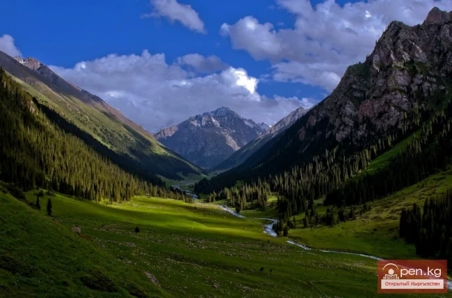
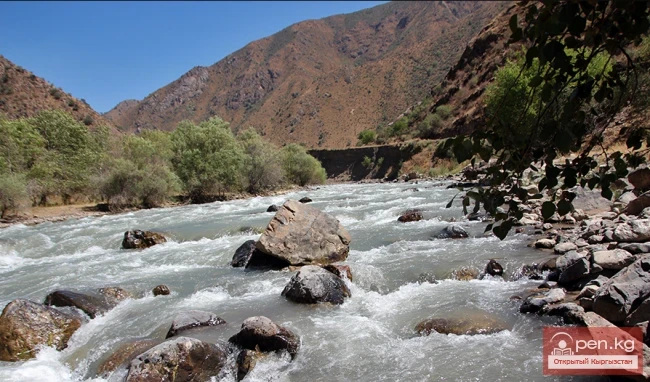
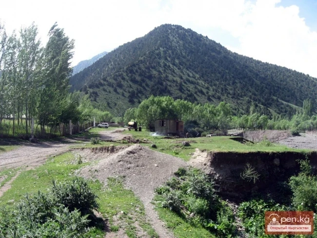
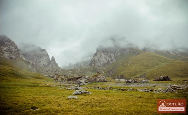
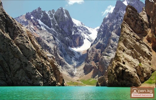
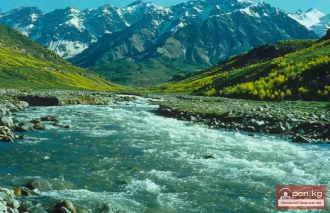
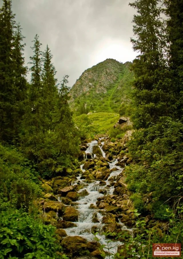
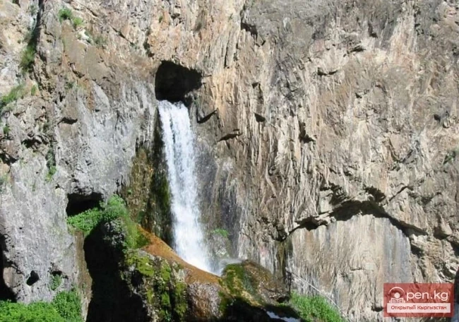
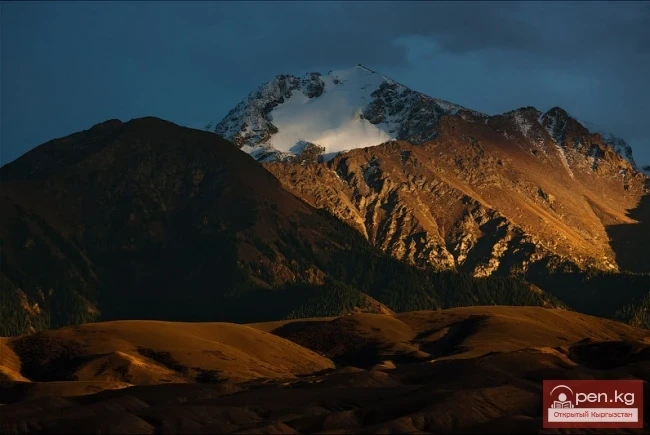
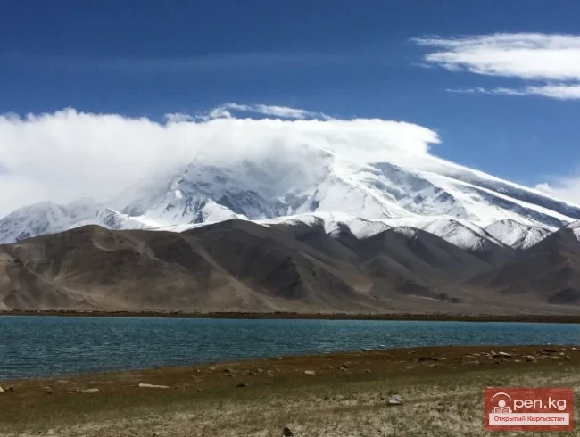
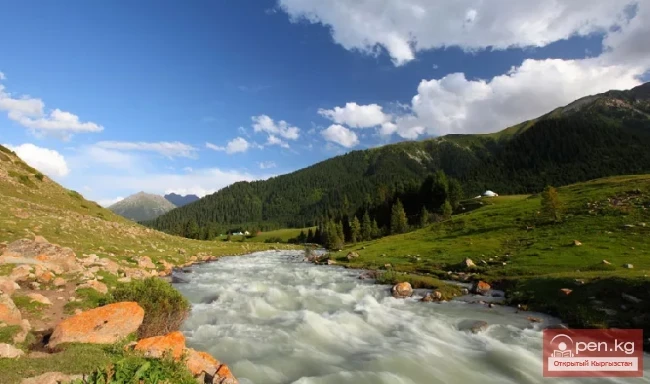
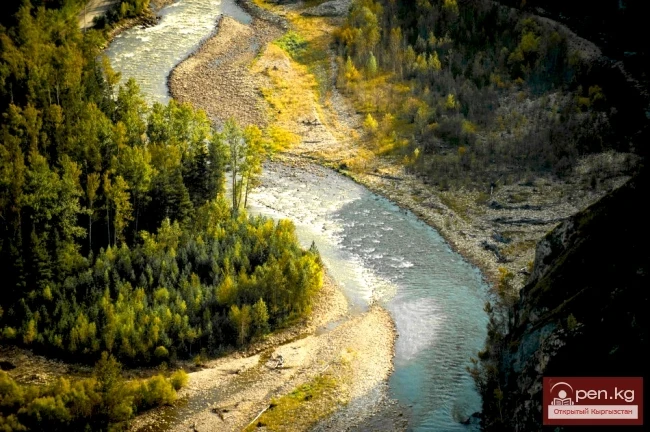
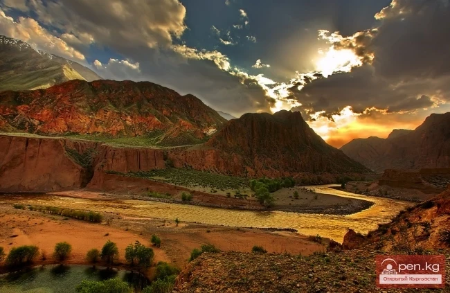
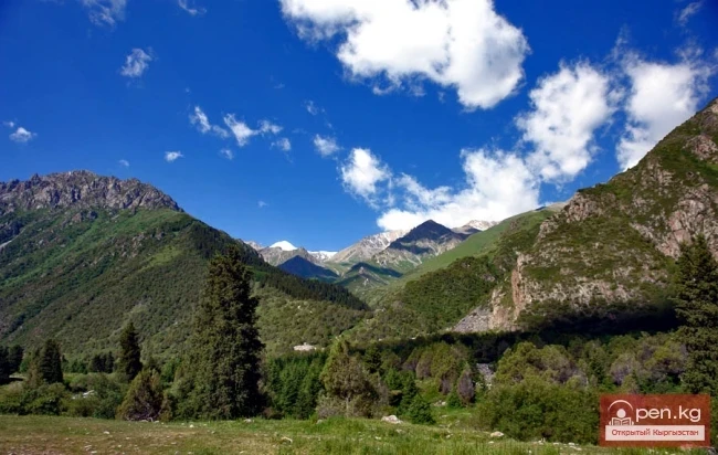
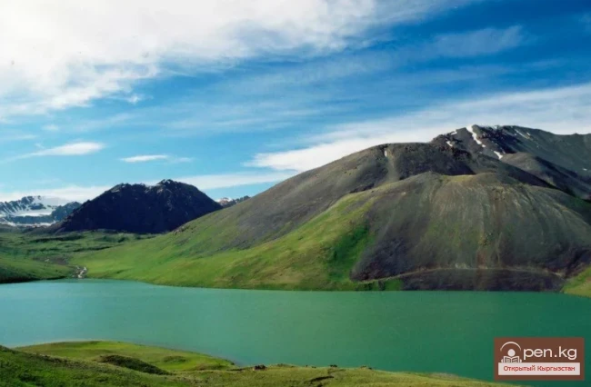
The area where the Sports Cave is located is characterized by the wildness of nature and unexplored speleology. According to specialists, the area has great potential for further search and research of caves. Additionally, the valley of the Kok-Kiya River and its tributaries is distinguished by the beauty of the surrounding nature. In the upper reaches of the right tributary Kël-Suu of the Ak-Sai River lies a unique periodically disappearing lake Kël-Suu, extending up to 10 km and up to 1 km wide. Water from the lake bursts out through the cave with a powerful roar. The shores are covered with magnificent alpine meadows, over which loom powerful glaciers that cover the Sary-Beles ridge.
VK X OK WhatsApp Telegram

Read also:

Fersman Cave

Fersman Cave

Cave Named After Academician A. E. Fersman About 20 km south of Chyl Ustun, in the Tuy-Moyun...

The River Aflatun

The River Aflatun

Aflatun River – the largest right tributary of the Kara-Suu River in the Jalal-Abad region. The...

River Kyzyl-Suu

River Kyzyl-Suu

Kyzyl-Suu (Kyzyl-Suu River, Красная река) - a river in Kyrgyzstan and Tajikistan, the right source...

Kursheb River

Kursheb River

Kursheb, Kursheb River, in the upper reaches — Gulcha, A river in Kyrgyzstan, flowing through the...

Kyzyl-Unkyur

Kyzyl-Unkyur

The "Kyzyl-Unkyur" Zone is located 15 km northeast of the village of Arslanbap in the...

Zone "Kety"

Zone "Kety"

Kegety Zone is located 75 km from Bishkek in the gorge of the same name on the road to the village...

Natural Park Kyrgyz-Ata

Natural Park Kyrgyz-Ata

Kyrgyz-Ata Natural Park is located in the basin of the river of the same name, which flows down...

Dugoba

Dugoba

This area is located 40 km from the village of Kadamjay, where the best antimony in the world is...

Valley of Kok-Kiya

Valley of Kok-Kiya

Rocky Canyons of the Kok-Kiya Valley Kyrgyzstan is rich in beautiful and unique places. In the...

The Valley of Chichkan

The Valley of Chichkan

The Chichkan River flows from the north into the Toktogul Reservoir. It is a small river with...

Lake Köl-Suu

Lake Köl-Suu

Lake Köl-Suu translates as "coming water" The lake is located in the Naryn region,...

Zone "Isfayram-Sai"

Zone "Isfayram-Sai"

Zone "Isfayram-Sai". The left tributary of the Isfayram-Sai River is the Surme-Tash...

River Ak-Suu

River Ak-Suu

The main channel of the Ak-Suu River is at least 20-22 kilometers long. The lower part of the...

The Cave of Kan-i-Gut

The Cave of Kan-i-Gut

Kan-i-Gut Cave is located on the southern slope of the Djaman-Chul range, approximately 18 km west...

Abshir-Sai

Abshir-Sai

Abshir-Sai (Waterfall Gorge) is located in the mountain valley of the river of the same name,...

"Chon-Kemin Zone"

"Chon-Kemin Zone"

Chon-Kemin Zone includes the valleys of the Chon-Kemin and Kichi-Kemin rivers between the high...

River Karakulja

River Karakulja

Karakulja The Chatkal River in its upper reaches is called Karakulja (translated - Black Ram),...

The River Kashgar

The River Kashgar

Kashgar Kashgar (Kyzyl-Suu, Uluu-Chat (Ulugchat), Kabaatsu, Kyzylsu, Aavatusten Canal, Kashgar,...

Glacier Kyzylsu

Glacier Kyzylsu

Kyzylsu - Red Water The Kyzylsu Glacier (often referred to as the Eastern Kyzylsu) is a complex...

Zone "Padsha-Ata"

Zone "Padsha-Ata"

The "Padsha-Ata" zone includes the gorge of the same name and is located near the...

Zone "Aflatun"

Zone "Aflatun"

Aflatun Zone is located on the southeastern slopes of the Chatkal Ridge and occupies the basin of...

Zone "Chatyr-Kel"

Zone "Chatyr-Kel"

The Chatyr-Kel Zone includes a significantly elevated intermountain basin with a lake of the same...

Caves of Kyrgyzstan

Caves of Kyrgyzstan

Caves of Kyrgyzstan Caves are rightly called the cradle of humanity. Primitive people took shelter...

Upper Naryn

Upper Naryn

Upper Naryn includes the upper part of the Naryn River basin from the vicinity of the town of...

Small Naryn

Small Naryn

Small Naryn encompasses the valley of the river of the same name, located between the ridges of...

Kara-Suu

Kara-Suu

The "Kara-Suu" Zone is located in the eastern part of the southern slope of the Chatkal...

Kek-Art

Kek-Art

The "Kek-Art" Zone encompasses the surroundings of the city of Jalal-Abad, as well as...

Kainyndy Glacier

Kainyndy Glacier

Kainy Between Kokshaal-Tau and Kainy-Katta lies the powerful Kuyakap Glacier, and between...

Kuylytau Ridge

Kuylytau Ridge

Kuylytau A mountain range in the Central Tien Shan, in Kyrgyzstan. It is located between the...

"Suusamyr Zone"

"Suusamyr Zone"

The Suusamyr Zone includes the eponymous high-altitude valley stretching 155 km. To the north, it...

Chatkal River

Chatkal River

Chatkal - a mountain river in Kyrgyzstan and Uzbekistan, Before the formation of the Charvak...

Kekemeren River

Kekemeren River

Kekemeren River is one of the most amazing and beautiful rivers in Kyrgyzstan. The Kekemeren is...

"Ala-Archa Zone"

"Ala-Archa Zone"

Ala-Archa Zone is located 30 km south of Bishkek in the central part of the Kyrgyz Ala-Too range...

Lake Teshik-Kul

Lake Teshik-Kul

Lake Teshik-Kul (also Teshik-Köl) — is a hard-to-reach high-altitude lake It is located at an...

Write a comment: