The Cave of Kan-i-Gut
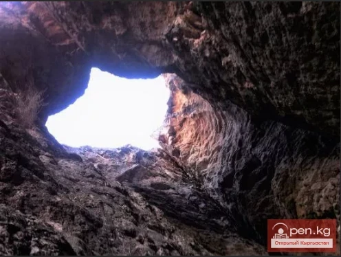
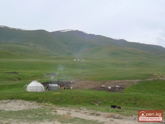
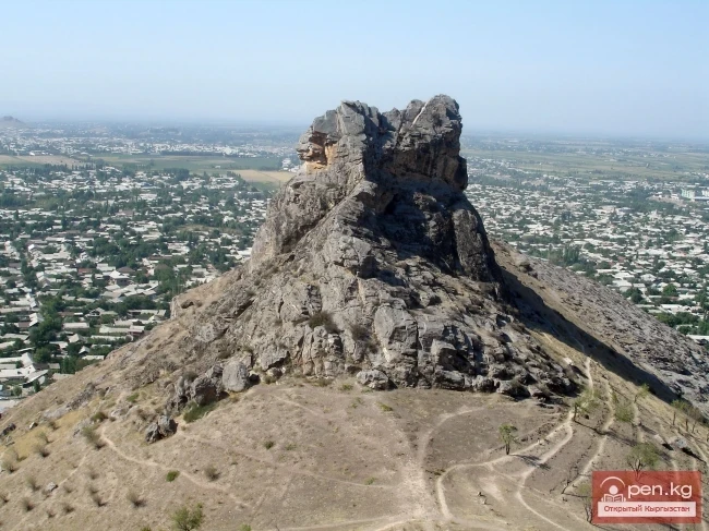
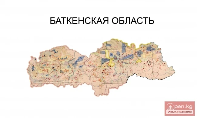
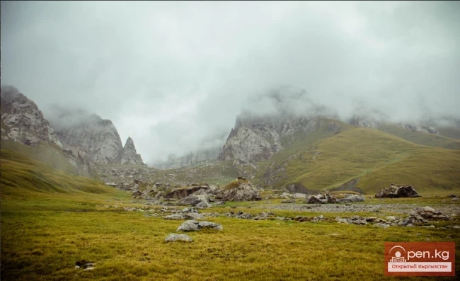
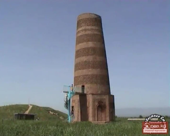
Kan-i-Gut Cave is located on the southern slope of the Djaman-Chul range, approximately 18 km west of the village of Samarkandyk in the Shadymir area. The local name is Zauk-Kur. It was formed by fissure-like separations of layers and active manifestations of ore karst processes. There are almost no dripstone formations. The cavity consists of numerous grottoes, deep pits (up to 40 m), chimneys, narrow interwoven passages, and corridors. Based on random archaeological finds, scientists conclude that the area adjacent to the cave was inhabited as early as the slave-owning period.
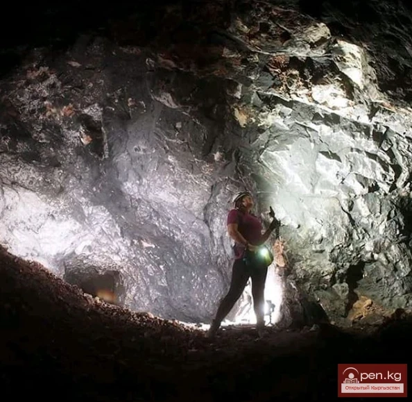
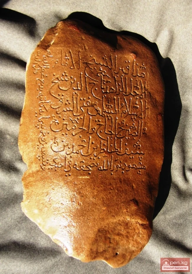
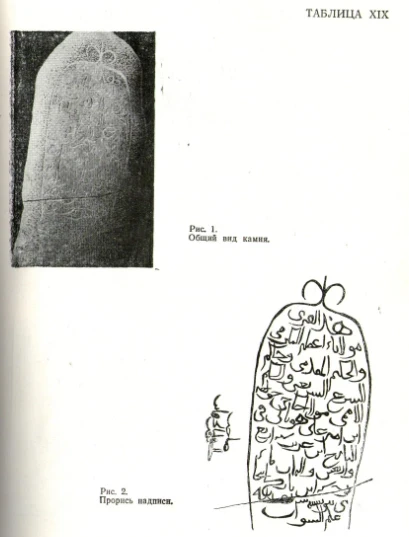
Lead and iron mining was conducted here from the 6th to the 11th centuries. The discovery of 23 copper Ferghana square coins indicates that ore extraction continued here in the late 18th to early 19th centuries. In 1850, the Kokand kurbashi visited the cave with several workers and saw an inscription at the cave entrance in a language unknown to him. Later, the entrance was destroyed, and the inscription disappeared. The name "Kan-i-Gut (Mine of Doom)" is associated with the Kokand khan Khudoyar, under whom those sentenced to death were lowered into the cave in search of mythical treasures and for silver extraction.
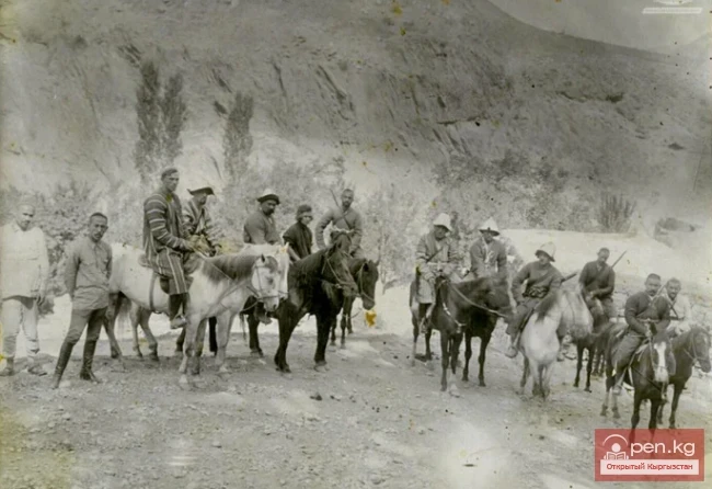
After the annexation of the Kokand Khanate to Russia in 1876, the famous Turkestan mining industrialist P.S. Nazarov visited the cave. He recognized the cave as a mine where iron and silver-lead ore could be extracted. Following him, Kan-i-Gut was explored in 1914 by a special expedition led by Professor A.A. Chernov, during which D.I. Shcherbakov and S.G. Alexandrov conducted a visual survey of the cave from the main entrance to the second pit. In 1917, the special commissioner for mining affairs under the Turkestan governor-general, mining engineer G.B. Leonov, concluded that the ore in Kan-i-Gut was rich in silver.
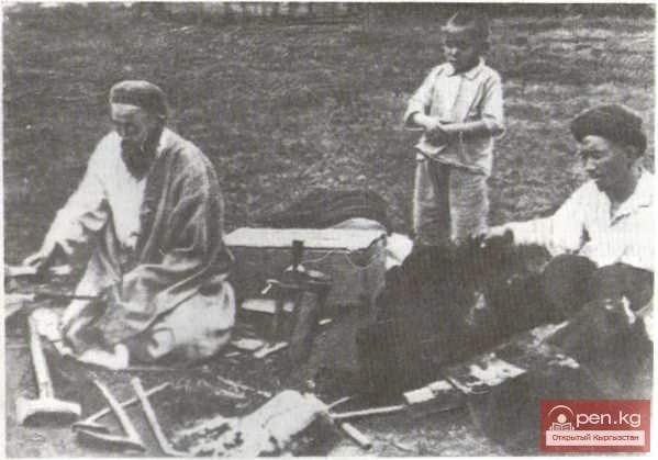
On a larger scale, scientific study of the cave began during the Soviet era. A special expedition studied the cave for 20 days. As a result, a second entrance was discovered, and a schematic profile was created from the main entrance to the left external exit, with a through main passage marked on the plan. The next expedition studied the cave in 1933. It was established that the cave consists of several tiers of underground passages connecting more than 30 chambers. The largest of them measures 68 m x 29 m and has a total volume of 100 thousand cubic meters.
As a result of recent speleological research, in which the author actively participated, knowledge about the Kan-i-Gut cave has significantly expanded. According to estimates, the length of the currently known part of the cave is about 30 km.
Four entrances to the cave have been established, with the shortest distance between them being over 1 km. It has also been confirmed that the large halls and a number of pits in Kan and Gut are of natural origin and their formation is related to karst processes. The cave's plan is significantly complicated by the activities of ancient miners who extracted lead and iron here from the 6th to the early 11th centuries. Despite all this, the study of Kan-i-Gut is not yet complete. The "Mine of Doom" is not only a remarkable object of historical and archaeological significance but also presents interest for speleological athletes and tourists, for whom it may be possible in the future to open and improve certain sections of the cave.
Read also:
Ancient Smelting Furnaces of the Shadymir Area (Photo by Vlad Ushakov)
In the Batken region, a few kilometers west of the village of Samarkandyk, in the Shadymir area of...
The title translates to "Alamyshyk Cave."
Ala-Myshyk Cave - Colorful Cat On the ridge of the mountain range rising above the surroundings of...
Fersman Cave
Cave Named After Academician A. E. Fersman About 20 km south of Chyl Ustun, in the Tuy-Moyun...
Caves of the Kok-Kiya River
Kok-Kiya River (Green Slope) - the easternmost right tributary of Ak-Sai, flows down from the...
"Chil-Ustun Zone"
The Chil-Ustun Zone includes the Chil-Ustun, Chil-Mayram, and Keklik-Too mountains located around...
Caves of Kyrgyzstan
Caves of Kyrgyzstan Caves are rightly called the cradle of humanity. Primitive people took shelter...
Naryn State Nature Reserve
Naryn State Reserve is located 50 km east of the city of Naryn on the left bank of the river. The...
Tajikistan
If Kyrgyzstan is the country of the Tian Shan, then Tajikistan is the country of the Pamirs. The...
Suleiman Mountain (Throne of King Solomon)
Suleiman Mountain (Throne of King Solomon) is located in the center of the city of Osh. The height...
The Territory of the Kyrgyz in the 18th to Early 20th Century
During the period under consideration, the Kyrgyz population occupied approximately the same part...
Lake Djidalik
Jidalyk - "breast berry" Jidalyk (Zhiydeli) is a famous lake in Kadamjay. It is a...
The title "Река Касансай" translates to "River Kasansay" in English.
Kasansay (Kyrgyz: Kasan-say, Uzbek: Kosonsoy) A river in Kyrgyzstan and Uzbekistan, a right...
The Tale of Good and Envy
THE GOOD MAN AND THE ENVIOUS MAN Once upon a time, a good man and an envious man set off together...
"The First Wave of Globalization": How Animals Paved the Great Silk Road
How Animals Paved the Great Silk Road “The ‘discoverers’ of the Great Silk Road were animals,” say...
Mining Industries of Kyrgyzstan
A more inaccessible area of Kyrgyzstan than Sary-Jaz was hard to imagine until recently. Here lies...
Collectible coins "Argali" and "Edelweiss," dedicated to the International Year of Mountains
Collectible coins "Argali" and "Edelweiss," dedicated to the International Year...
Kyzyl-Unkyur
The "Kyzyl-Unkyur" Zone is located 15 km northeast of the village of Arslanbap in the...
Batken Region
The Batken Region was established on October 12, 1999, from the Osh Region. It includes the...
Collectible Coin "Shanghai Cooperation Organization"
Since April 2, 2007, the National Bank of the Kyrgyz Republic has put into circulation a...
Naryn
This area includes the city of Naryn — a transport and distribution tourist center — and its...
Zone "Shakhimardan" (Shaimerden)
The Shakhimardan Zone (Shaimerden) encompasses the basin of the Shakhimardan-Sai River. There is a...
Kairak near the village of Yangi-Naukat
MONUMENT FROM KOK-TALGY-ATA The inscription on the kairak, located in the territory of...
The National Bank of Kyrgyzstan has issued a commemorative coin of the EAEU.
The National Bank of the Kyrgyz Republic has issued a commemorative collector's coin...
City of Aydarken
Aydarken – a small town and industrial center in the central part of the Batken region. The...
River Karakulja
Karakulja The Chatkal River in its upper reaches is called Karakulja (translated - Black Ram),...
Ski Resort "Too Ashuu"
The ski resort "Too Ashuu" is a modern complex for people who prefer a healthy and...
Famous Russian traveler Fyodor Konyukhov is preparing his expedition to Lake Issyk-Kul to search for an ancient monastery.
Famous Russian traveler Fyodor Konyukhov is preparing his expedition to Lake Issyk-Kul to search...
Glaciers of the Kyrgyz Range
Glaciers of the Kyrgyz Ala-Too The highlands of the Kyrgyz Range feature a deeply dissected alpine...
The title "Сох" translates to "Sokh" in English.
Narrow echoing gorges, through which in the gloomy depths flows a river bound by rocky jaws;...
Lake Köl-Suu
Lake Köl-Suu translates as "coming water" The lake is located in the Naryn region,...
Christmas Island
CHRISTMAS ISLAND Located in Oceania, in the southeastern part of the Indian Ocean, 2623 km...
Population of Kyrgyzstan from Ancient Times to the 6th Century
The first reliable traces of humans on the territory of Kyrgyzstan date back to the Paleolithic —...
Kyrgyz in the Mongolian Period
Usy, Han-Hena, and Yilanzhou In the "Yuan-Shi," in relation to the land of the Kyrgyz,...
Valley of Kok-Kiya
Rocky Canyons of the Kok-Kiya Valley Kyrgyzstan is rich in beautiful and unique places. In the...
Attractions of the City of Osh
Osh - one of the oldest cities in Central Asia, located on the southeastern edge of the Fergana...
The Territory of the Kyrgyz in the VI—XVIII Centuries
All political entities of the Middle Ages in the territory of Central Asia somehow affected the...
Protected Natural Areas of Kyrgyzstan
Categories of Protected Natural Areas in Kyrgyzstan Kyrgyzstan has established 83 special...
15 Interesting Facts About Deserts
About Deserts 1. Deserts cover about one-fifth of the Earth's land surface, with half of this...
Burana - Architectural Heritage of Kyrgyzstan
Burana - Architectural Heritage. Located 12 km southwest of the present-day town of Tokmak is the...
Collector's Coin "Khan Tengri," Dedicated to the 10th Anniversary of the Independence of the Kyrgyz Republic and the International Year of Mountains
Collectible coin "Han-Tengri", dedicated to the 10th anniversary of the independence of...
10 places in Crimea that you must see
10 Attractions in Crimea. The Crimean Peninsula is a unique historical and cultural reserve. For...
Preservation of the Waqf of Alimbek after the Fall of the Kokand Khanate
Attempts to Circumvent Legislation on the Expansion of Waqf The conversion of real estate into...
Batken
Batken is a city in Kyrgyzstan, the administrative center of Batken Region and District. The...
Mineralogy and Mining
The forge of the zergers. Mid-19th century. The photo is kept in the State Historical Museum...
Dwelling in the Mountains
An elderly man settled in a cave in the Jalal-Abad region of Kyrgyzstan. As 68-year-old Tolon...
The Valley of Kojo-Kelen
Kozho-Kelen – a true wonder of nature The Kozho-Kelen Valley (Kozhokelen, Khojo-Kelen,...
The Territory of the Kyrgyz from Ancient Times to the 6th Century
The Saka tribes were divided into three parts. In the southern regions of Kyrgyzstan lived the...
The Emergence of Bishkek
THE ORIGIN AND DEVELOPMENT OF BISHKEK Findings of stone tools by archaeologists during the...