Tajikistan
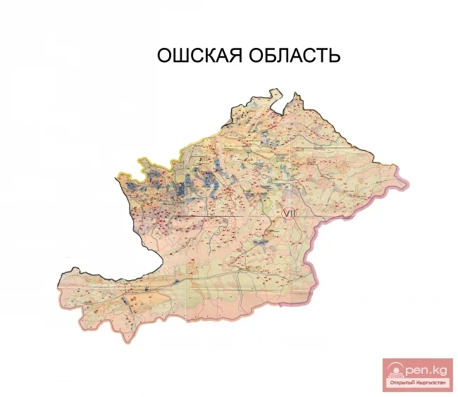
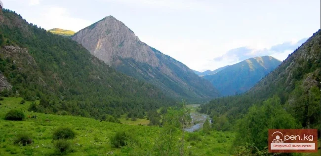
If Kyrgyzstan is the country of the Tian Shan, then Tajikistan is the country of the Pamirs. The grand mountain ranges of Central Asia converge in the Pamirs: Karakoram, Kunlun, and Hindu Kush. It is no wonder that it is called the "Roof of the World." The Western Pamir, or Gorno-Badakhshan, bordering Kyrgyzstan (Osh region, Alaï and Chon-Alai districts), has significant natural resources that can be utilized in joint tourism programs and tours.
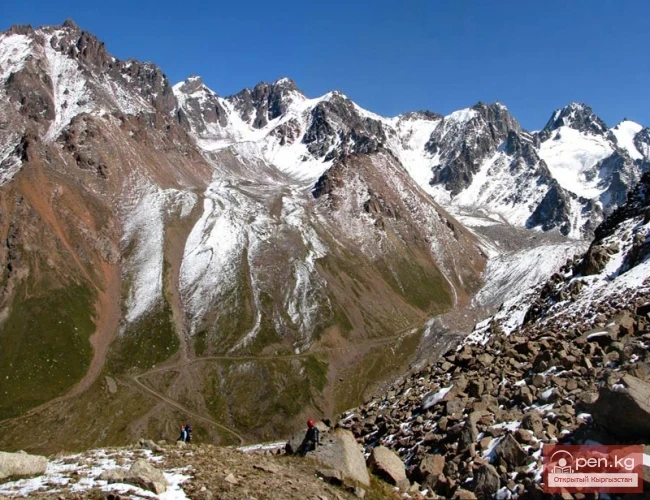
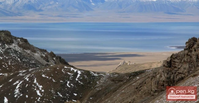
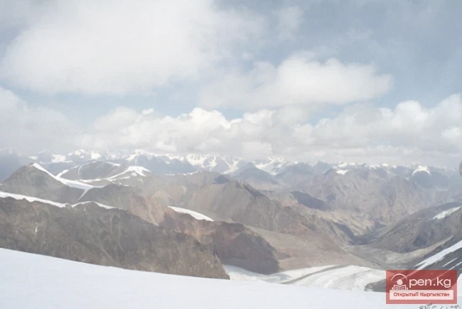
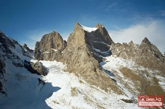
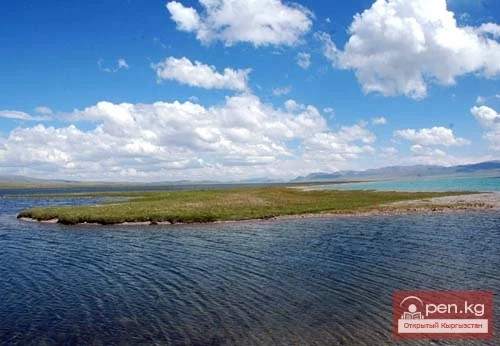
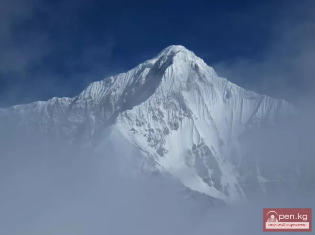
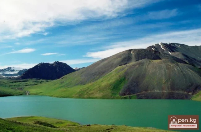
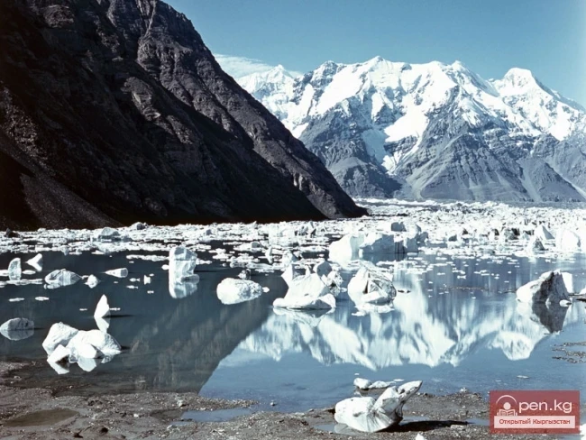
The harsh climate, complex mountainous terrain, and the highest ridges and peaks all represent valuable assets in the modern extreme-adventure tourism sector. At the top of this list are the famous and popular peaks among climbers: Somoni (7495 m) and Korzhenevskaya (7105 m), located near the borders of Kyrgyzstan. Additionally, in the far east of the Central Pamirs, in a vast and endorheic basin at an altitude of 3745 meters, lie two lakes: Rang-Kul and Shor-Kul. The surface of the lakes is characterized by an extraordinarily beautiful play of colors that changes several times throughout the day. It is likely that the name Rang-Kul, which translates from Kyrgyz as "lake of colors," originates from this phenomenon.
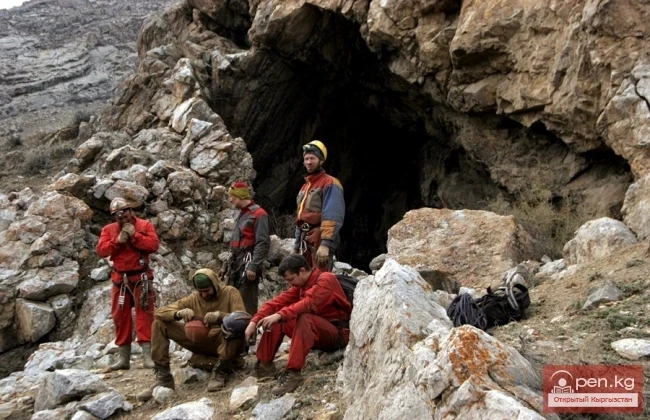
The Salaktash area, like other gorges in the southern slope of the Rangkul basin, abounds in karst formations. Here, at an altitude of 4400 meters, is the entrance to the Putnik Cave.
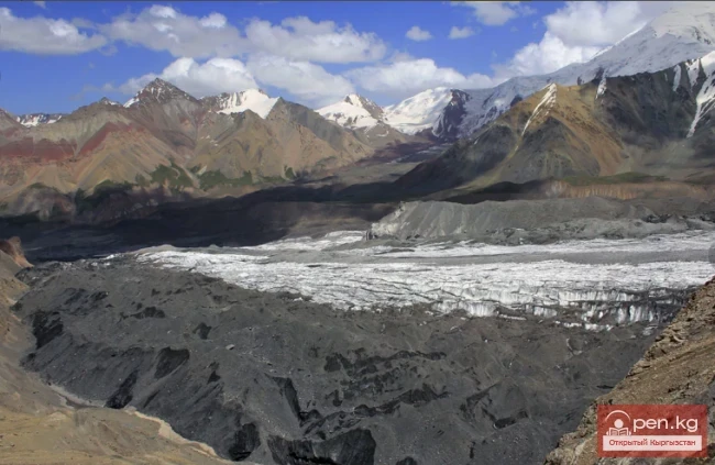
In the late 1980s, Moscow speleologists explored the cave. As a result of several expeditions, an unknown passage was discovered, leading to a grand underground system. The Putnik Cave turned out to be a very intricate underground system—horizontal labyrinths connected by sloping corridors weave together into a complex network of passages. The length of the explored part of the cave exceeds 10 km. To this day, the cave remains unexplored, and this fact can be quite appealing to scientists and speleologists from around the world. Other notable natural monuments include the high-altitude desert Markasu, located at an altitude of over 4000 meters; one of the greatest glaciers in the world, Fedchenko, which is 77 km long; Lake Karakul; and many others.
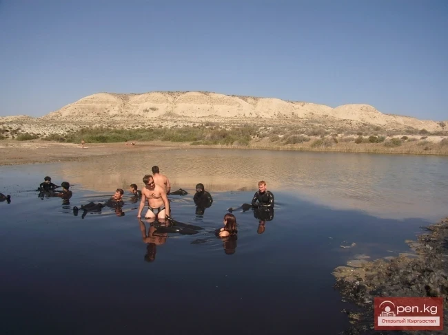
Currently, there are more than 70 mineral springs in the Pamirs. The most famous Garmchashma springs are located in Gorno-Badakhshan. Unique hot mineral water springs of complex composition are found in the Ishkashim district in a picturesque gorge at an altitude of 2800 meters. Experts describe these waters as carbonated with a very high content of hydrogen sulfide. Cascading down, the hot mineralized water has created whimsical multi-tiered steps, stalactites, and bizarre formations that shimmer in various colors.
The mountains and valleys of Tajikistan, as well as the peoples who lived in its territory, are mentioned in very ancient sources. About Sogdiana and Bactria—the ancestral homeland of the Tajiks—was written in the collection of sacred texts "Avesta" (the first half of the 1st millennium BC). Ancient authors (Herodotus and Eratosthenes, Pliny and Ptolemy), as well as Chinese travelers from the early era, wrote about the territory that now comprises modern Tajikistan. The main population of Gorno-Badakhshan consists of Pamiri Kyrgyz, which allows for hopeful prospects for successful cooperation and the organization of joint ethnographic programs with Tajikistan.
The cave city near the village of Yamg and the ruins of the ancient fortress of Kangha near the village of Mug in the Ishkashim district are also of interest.
In addition to the common border in the Pamirs, Kyrgyzstan and Tajikistan also meet in the western part of the Fergana Valley. Notable attractions in this area include the Kayrakkum Reservoir, the saline lake Ak-sukon, the Karamazar mine in the Nurata Mountains—a monument of ancient mining architecture from the 10th-12th centuries—and the ancient city of Khujand, where monuments from the era of the Great Silk Road have been preserved.
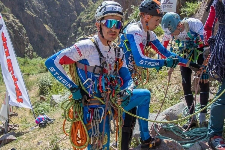
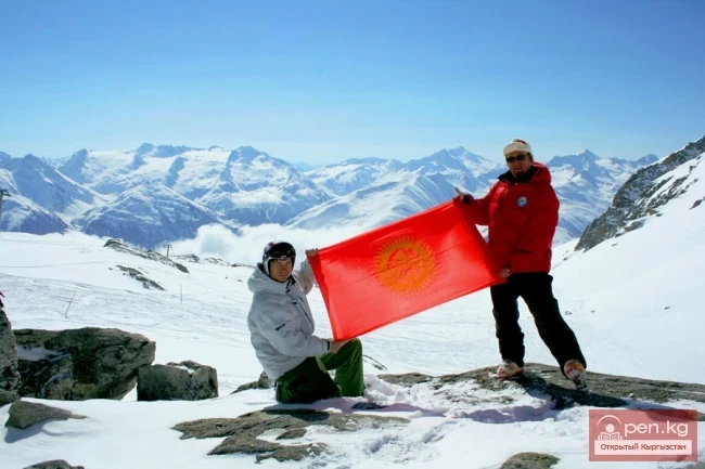
A very interesting program is envisioned for conquering three peaks: Somoni, Korzhenevskaya, and Lenin, which are relatively close to each other. It could be called "The Snow Leopard of the Pamirs."
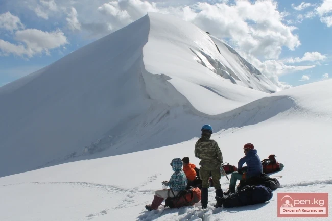
Here, in the Pamirs, there are also interesting proposals for organizing scientific and sports expeditions to little-explored territories. The starting point for these programs could be the Alai Valley.
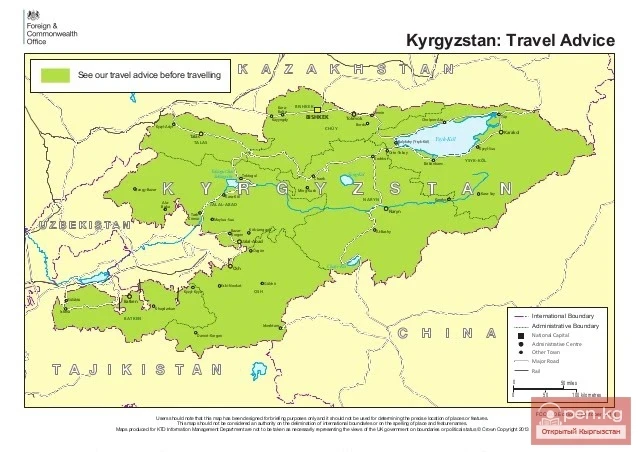
Osh is called the "Gateway to the Pamirs." All expeditions to the Pamirs departed from here. By this old tradition, Osh can be the gateway to the Pamirs now, not only for scientists and athletes but also for tourists and travelers.
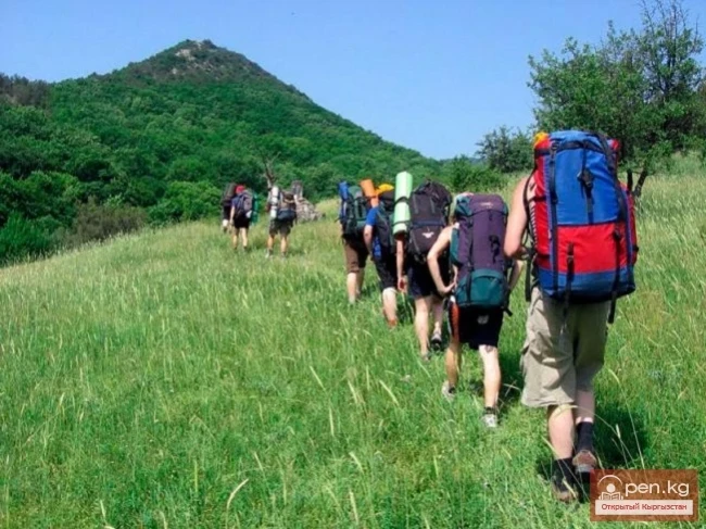
The Pamirs open up opportunities for organizing joint trekking of the broadest scope. Search-and-research speleological expeditions, ethnographic and historical-cultural tours including visits to ancient cities: Uzgen, Osh, Khujand—all of this is still untapped potential for two friendly neighboring countries.
Read also:
Wildlife of Kyrgyzstan
Increasingly, Western travelers and tourists are seeking exotic vacation spots located "off...
The Unknown Country of Kyrgyzstan
In Central Asia lies an amazing mountainous region, intersected by the powerful ridges of the Tien...
Natural Resources in 1917-1991
Kyrgyzstan is rich in natural resources, with rare metal deposits of gold and sulfur-containing...
China (Xinjiang Uygur Autonomous Region of the People's Republic of China)
China is a vast country rich in tourist resources. The country is abundant in attractions and...
Guide to Kyrgyzstan Through the Eyes of Tourists
One third of Kyrgyzstan is located at an altitude of 1000 to 3000 meters above sea level. In the...
Mountaineering in Kyrgyzstan
Kyrgyzstan, as you know, is a mountainous country with many peaks of varying difficulty. It is...
Lake Chatyr-Kul
“Chatyr-Kul” translates from Kyrgyz as “Heavenly Lake.” The high-altitude lake Chatyr-Kul is...
Mountain Ranges of Kyrgyzstan
Mountains of Kyrgyzstan Akshiyrak A mountain range in the Tian Shan, located in Kyrgyzstan. It...
Alay Ridge
Alay Range A mountain range of the Pamir-Alai mountain system in Kyrgyzstan and partially in...
Ak-Suu - Karavshin (Asian Patagonia)
The contrasts of nature in the mountain ranges of Matchi and Karavshin are astonishing, offering...
Lake Son-Kul
Geographical Information: Song-Kul (possible variants of Russian spelling: СОНКЁЛЬ, Сонг-Кёль,...
Naryn Region
The Naryn Region is located in the southeast of Kyrgyzstan and was first established on November...
Issyk-Kul - the most beautiful lake in Central Asia
The most beautiful and largest lake in Central Asia is Lake Issyk-Kul. For this reason, it is...
Wiskott's Yellow Butterfly - Wiskott's Yellow Moth
Wiskott's Sulphur - Colias wiskotti Stgr. The species name is given in honor of the...
Three Kyrgyz Seven-Thousanders: Peaks of Victory, Lenin, and Khan Tengri
Three Kyrgyz Seven-Thousanders. 1. Peak Victory - 7439 m. – the highest peak of Kyrgyzstan, the...
Osh Region
The Osh Region was established on November 21, 1939, replacing the former district. After numerous...
Lake Teshik-Kul
Lake Teshik-Kul (also Teshik-Köl) — is a hard-to-reach high-altitude lake It is located at an...
Issyk-Kul - the Mountain Pearl.
Issyk-Kul - the Mountain Pearl. The most beautiful and largest lake in Central Asia is Lake...
Unforgettable Mountain Kyrgyzstan
The Most Beautiful and Inexpressible Nature of Kyrgyzstan Kyrgyzstan has no access to the sea....
Lake Kel-Tor
One of the most beautiful lakes in Kyrgyzstan - the dead lake Kël-Tor It is located in the gorge...
Achyktash and Korumdy
The mountain nodes Achik-Tash and Korumdy are the main and most popular areas for high-altitude...
Asia - Blessed Land: Song-Kul
The high-altitude lake Son-Kul is one of the wonders of the Tian Shan. Here, on the shore of a...
Ala-Archa National Park
In the ridges of the Kyrgyz Ala-Too, there are 480 glaciers. The largest of them are located in...
The title "Хребет Какшаал-Тоо" translates to "Kakshaal-Too Ridge" in English.
Kakshaal-Tuu A mountain range in the Central Tian Shan system, on the border of Kyrgyzstan and...
Natural Regions and Occupations of the Population of Kyrgyzstan
The Population of Kyrgyzstan in the 19th - Early 20th Century Most of the country's territory...
Protected Natural Areas of Kyrgyzstan
Categories of Protected Natural Areas in Kyrgyzstan Kyrgyzstan has established 83 special...
Kyrgyzstan to Host the World Cup in Mountain Tourism
The competition, which will take place on the Kerme-Tuu rock massif near the city of Osh, will...
Lake Suttu-Bulak
Lake Suttyu-Bulak or "Milk Lake" The lake is located in the "Semenovskoye"...
The Cave of Kan-i-Gut
Kan-i-Gut Cave is located on the southern slope of the Djaman-Chul range, approximately 18 km west...
Express Reference on Kyrgyzstan
The Kyrgyz Republic is a mountainous country (average altitude 2750 m above sea level), located in...
Lenin Glacier
Lenin Glacier — a mountain valley glacier on the northern slope of the Zaalai Range (Pamirs), in...
Zhalay Range
Zaalai Ridge A ridge oriented in a latitudinal direction, separating the Pamir and the Alai...
Abshir-Sai Valley
Abshir-Sai, translated from Tajik, means water-milk source The Abshir-Sai area is a picturesque...
Bronislaw Ludvigovich Grombchevsky
B. L. Grombchevsky (1856-1926) Here is another figure, Bronislav Ludwigovich Grombchevsky...
The British Foreign Office named Kyrgyzstan a safe country for travel.
The British publication Telegraph has prepared a world map indicating whether it is safe to travel...
Kyrgyzstan - A Country of Adventure Tourism
The video is dedicated to the attractions of Kyrgyzstan - a country with unique opportunities for...
Natural Resources of the Kyrgyz in the Bronze Age
The main landscape of Kyrgyzstan consists of mountains. Enclosed mountain valleys are surrounded...
No precipitation, warm during the day up to +24 — weather forecast for October 21
Weather forecast for Kyrgyzstan on October 21. According to Kyrgyzhydromet, no precipitation is...
Mineral Waters, Healing Mud, and Resorts of Kyrgyzstan
Therapeutic Resources of Kyrgyzstan Currently, more than 120 natural mineral water springs have...
High-altitude Natural and Ecological Complex of Inylchek
Muzdag Mountains, Khan Tengri Peak, and Victory Peak. The Muzdag mountain range (ice mountains) is...
Mountains and Glaciers of Kyrgyzstan
Mountains and Glaciers The abundance of landscape resources or interesting geological features...
Natural Resources of the Kyrgyz in the 6th—18th Centuries
The territory of medieval Kyrgyzstan was home to numerous plant species, many of which are...
Waterfall Son-Kul
Son-Kul. Naryn Region. Before ascending to Lake Son-Kul, just before the 38 Parrots Pass, you can...
Peak Djigit
Peak Djigit - height 5170 meters. It is located in the main watershed ridge of the Terskey Alatau...
Caves of the Kok-Kiya River
Kok-Kiya River (Green Slope) - the easternmost right tributary of Ak-Sai, flows down from the...
The Atbashi Ridge
Atbash The mountain range belongs to the southern arc of the Inner Tien Shan in Kyrgyzstan. It...
Tourist Products and Markets of Kyrgyzstan
Types of Tourism in Kyrgyzstan Based on the diverse tourism resources available in Kyrgyzstan, the...
The Concept of "Tourist Resources" in Kyrgyzstan
Kyrgyzstan and Its Tourist Resources Tourism in the world is based on the targeted and reasonable...