China (Xinjiang Uygur Autonomous Region of the People's Republic of China)
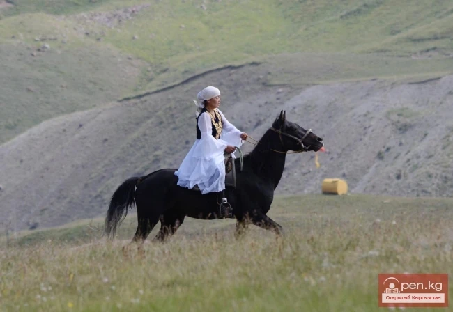
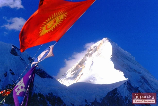
China is a vast country rich in tourist resources. The country is abundant in attractions and historical monuments, beautiful rivers and mountains, and is famous for its ethnographic diversity. National songs and dances, customs and traditions that have centuries of history are a treasure trove of tourist resources in China.
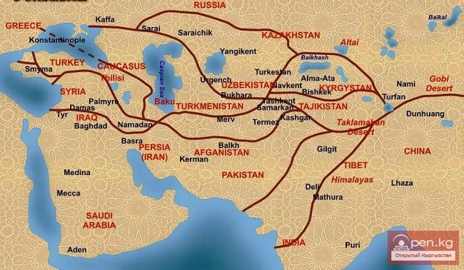
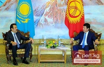
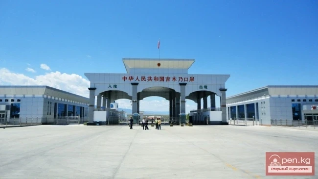
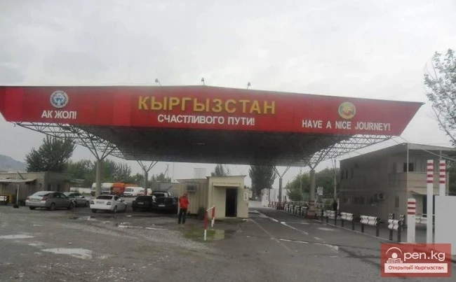
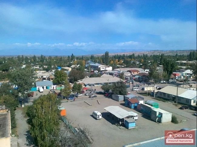
When we talk about the joint use of tourist resources in China, we mean the territory of the Xinjiang Uygur Autonomous Region (XUAR), which borders Kyrgyzstan to the south and east. The total length of the border with China is over 1100 km. Currently, there are two border crossing points along the entire Kyrgyz-Chinese border.
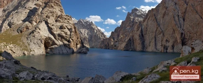
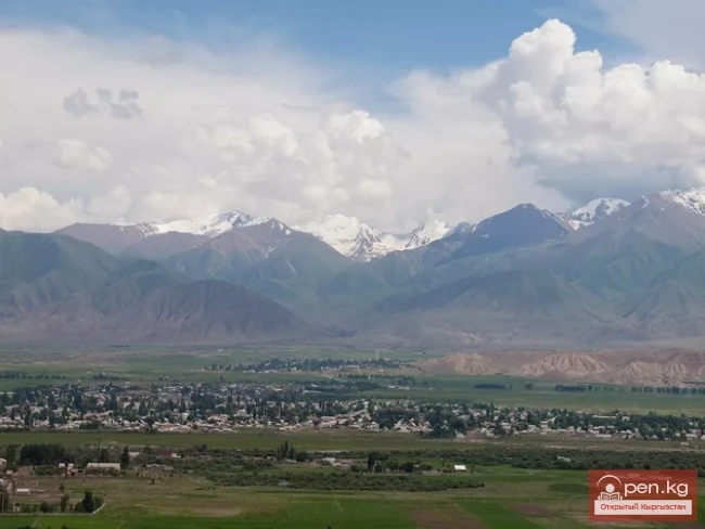
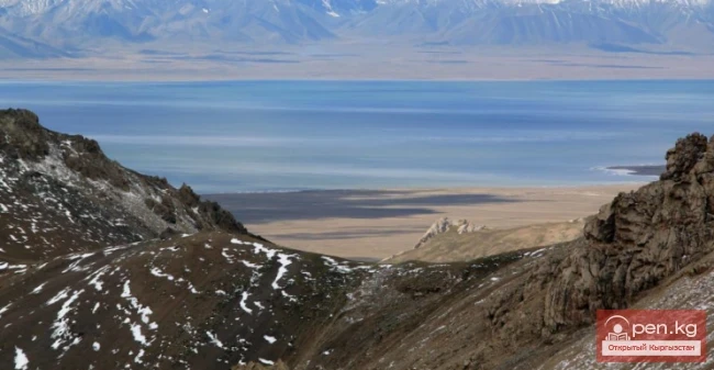
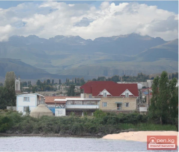
The border crossing point (BCP) Torugart is located at the Torugart Pass (3754 m), near Lake Chatyr-Kul. This route leads to the Naryn region to famous tourist sites: the lakes Son-Kul and Issyk-Kul, and further through the Boom Canyon to Bishkek, or through the city of Karakol to Kazakhstan. The distance to Bishkek is about 600 km.
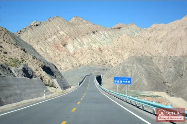
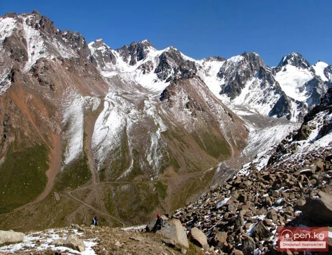
The border crossing point (BCP) Irkeshtam is located 30 km east of the Taun Murun Pass (3536 m). The Irkeshtam border post is situated in the middle course of the Nura River, 2 km from its confluence with the Kok-Suu River. The road leads to the Alai Valley to famous peaks popular among climbers: Lenin Peak, Korumdy, Somoni, Korzhenevskaya, and others. From the Alai Valley, the Pamir Highway opens the way for travel to the Pamirs or to the city of Osh and further into Uzbekistan. The distance to Osh is about 300 km.
For planning and organizing joint programs, it is important to know that the BCPs Torugart and Irkeshtam allow the passage of tourists five days a week from 10 AM to 3 PM, except for Saturdays and Sundays. The border crossings are also closed on public holidays. Since the public holidays in China and Kyrgyzstan do not coincide, the number of non-working days increases. There are periods when the border crossings do not operate for several days, for example, from October 1 to 8.
It is also necessary to remember that there are no accommodation facilities in the areas of the BCPs on the Kyrgyz side, and the time difference is four hours.
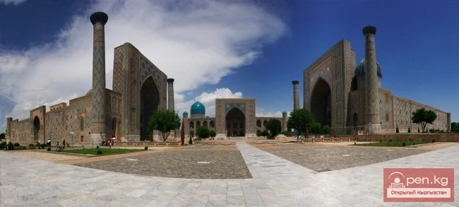
The center of all tourist routes leading to Central Asia is Kashgar, located approximately 200 km from the borders of Kyrgyzstan. It sprawls along the banks of the Kashgar River, in the center of a large oasis, squeezed between the Kunlun Mountains to the west and the Taklamakan Desert to the east. A must-visit place for tourists in Kashgar is the Old Town, located right in the center on a clay hill. Tourists enjoy wandering through its winding narrow streets—labyrinths in search of exotic shots. The streets of the Old Town lead to the famous Kashgar Bazaar, which is also a must-visit site for tourists. In addition to the aforementioned attractions, local guides show the Istighfar Mosque (16th century), the mausoleum of Apak Hoja (17th century), and the Bongo Memorial Park (18th century).
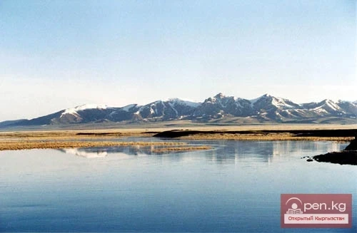
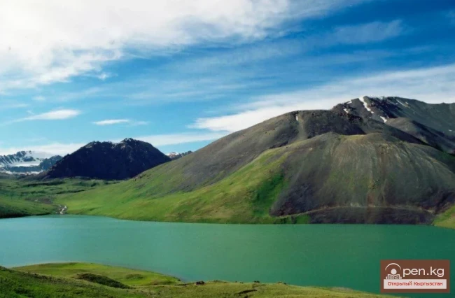
Via the Karakoram Highway, which connects the XUAR with Pakistan, one can reach popular natural sites: Lake Karakul, located at the foot of the seven-thousanders Muztagh Ata (7546 m) and Kongur Tag (7719 m).
Another point of interest is Urumqi - the main city of the XUAR. Regular flights are operated between Urumqi and Bishkek by Xinjiang Airlines.
Urumqi is a large modern city with a population of about 2 million residents. The main tourist attraction is the local history museum, at the entrance of which stands a huge meteorite weighing over 30 tons. The museum has many other interesting exhibits that tell the history of the XUAR. Two hundred kilometers from Urumqi lies the city of Turpan - the capital of ancient Xinjiang. In Turpan, there is a wonderful museum housing the largest dinosaur skeleton found in the sands of the Taklamakan Desert. In the vicinity of the city, one can see the Emin Mosque and Minaret (16th century); the "Flaming Mountains," which burn in the rays of the sunset over the desert; the Astana complex - the burial site of the Xinjiang emperors; the ruins of the city of Gaochang, founded in 2300 BC; and the Bozkilik Cave Monastery (2nd century).
Of course, the natural and historical-cultural resources of Xinjiang, which borders Kyrgyzstan, are more extensive, but even knowledge of the aforementioned sites will ensure a quality and professional approach to creating interesting joint Kyrgyz-Chinese programs.
There are very promising prospects for cooperation between tour operators from China and Kyrgyzstan after the opening of the Irkeshtam BCP, which connected Kashgaria with the Alai Valley and the city of Osh. The Great Silk Road has gained a short route from the Fergana Valley through the territory of Kyrgyzstan (Osh-Alai Valley) to Kashgar and further to Pakistan, or through the Taklamakan Desert to Turpan and Central China. Irkeshtam has opened up other opportunities as well.
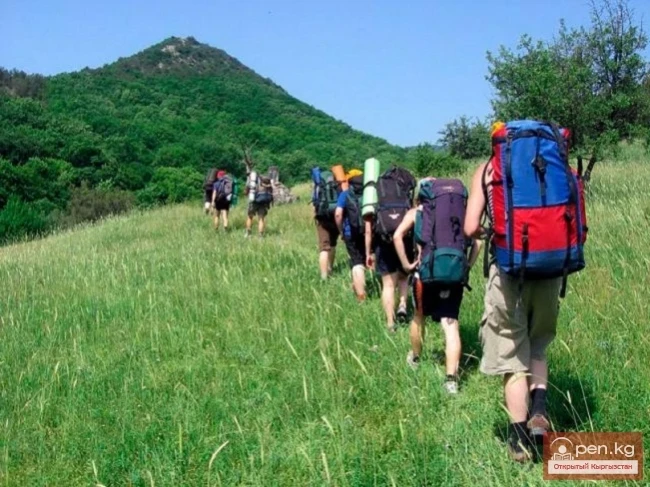
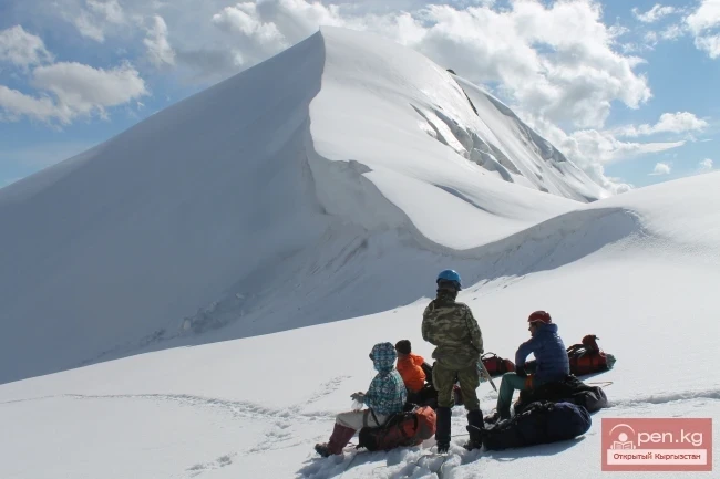
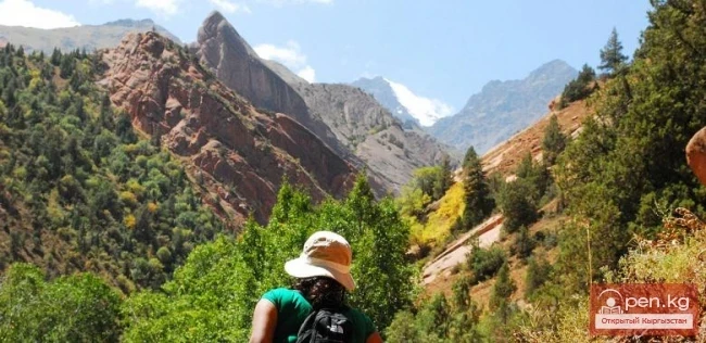
A circular route of the following direction could be very successful and popular: Bishkek - Osh - Irkeshtam - Kashgar - Torugart - Naryn - Issyk-Kul - Bishkek. The same scheme can be used to organize joint trekking programs, where part of the trekking takes place in Kyrgyzstan and the other part in China. In Kyrgyzstan, the sections are: Bishkek - Naryn - Torugart in the areas of Son-Kul and Chatyr-Kul, and Irkeshtam - Osh - Bishkek in the areas of Korumdy and Kojo-Kelen (Pamir-Alai). In China, trekking can take place in the area of the peaks Kongur Tag, Muztagh Ata, and Lake Karakul.
There is also potential for a program for climbers - ascents of the most famous peaks: in Kyrgyzstan - Lenin Peak, in China - Muztagh Ata. Their close proximity allows for the organization of such a program without significant difficulties.
Read also:
Mountain Passes of Kyrgyzstan with Neighboring Countries
Roads in the Sky Irkeshtam Pass is located in the Osh region and stretches from Sary-Tash to...
Uzbekistan
Uzbekistan is the homeland of the ancient civilizations of Bactria, Khorezm, Sogdiana, and...
Tajikistan
If Kyrgyzstan is the country of the Tian Shan, then Tajikistan is the country of the Pamirs. The...
Wildlife of Kyrgyzstan
Increasingly, Western travelers and tourists are seeking exotic vacation spots located "off...
Zhalay Range
Zaalai Ridge A ridge oriented in a latitudinal direction, separating the Pamir and the Alai...
Kyrgyzstan — China
On December 27, 1991, the Government of the People's Republic of China recognized the...
Chatyr-Kul Field
The Chatyr-Kul Deposit has the largest resources of carbonated water in Kyrgyzstan: they are...
Diving at Lake Chatyr-Kul
Geographical information: Chatyr-Kul (Chatyr-Köl) is a closed lake in the Central Tien Shan,...
Kyrgyzstan Sets an Example of International Engagement
Confidently taking its place in the Customs Union on its own terms, Kyrgyzstan has embarked on the...
Boom Canyon
Boom Canyon is located 112 km from the city of Bishkek and serves as a unique natural gateway...
The Concept of "Tourist Resources" in Kyrgyzstan
Kyrgyzstan and Its Tourist Resources Tourism in the world is based on the targeted and reasonable...
General Geographic Characteristics and Development of Tourism in the Kyrgyz Republic.
The Kyrgyz Republic is located in the northeastern part of Central Asia, in the very...
The Ministry of Transport of the Kyrgyz Republic commented on the statements of expert Andrei Belov
In his article, Belov pointed out that significant changes occurred in the freight transportation...
Kyrgyzstan and Kazakhstan agreed on the construction of the Almaty – Cholpon-Ata highway.
The Prime Ministers of Kazakhstan, Karim Massimov, and Kyrgyzstan, Temir Sariev, discussed issues...
Achyktash and Korumdy
The mountain nodes Achik-Tash and Korumdy are the main and most popular areas for high-altitude...
Passes in the Osh Region
Osh Passes Taldyk Pass - a pass in the Alai Range, oriented from north to south, connects the...
Tourist Products and Markets of Kyrgyzstan
Types of Tourism in Kyrgyzstan Based on the diverse tourism resources available in Kyrgyzstan, the...
The title "Село Кочкор" translates to "The Village of Kochkor" in English.
Kochkor - the charm of local fauna and the colorful traditions Kochkor village is located in the...
Lake Chatyr-Kul
“Chatyr-Kul” translates from Kyrgyz as “Heavenly Lake.” The high-altitude lake Chatyr-Kul is...
Kyrgyz-Chinese Border
The history of the formation of the modern Kyrgyz-Chinese border dates back to the second half of...
Lake Teshik-Kul
Lake Teshik-Kul (also Teshik-Köl) — is a hard-to-reach high-altitude lake It is located at an...
Two Motorcyclists Fined for Riding on Pastures in the Alamudun District
A raid was conducted in the Alamedin district, organized by inspectors from the Regional...
Zone "Chatyr-Kel"
The Chatyr-Kel Zone includes a significantly elevated intermountain basin with a lake of the same...
Guide to Kyrgyzstan Through the Eyes of Tourists
One third of Kyrgyzstan is located at an altitude of 1000 to 3000 meters above sea level. In the...
Geoecological Condition and Requirements for the Protection and Rational Use of Water Resources
Water resources are surface and groundwater that are suitable for use in a given territory. The...
A forum is being held in Bishkek for the Snow Leopard Day
On October 23, an international forum titled "Business, Ecology, and Sports — Ak-Irbis...
Zone "Osh"
The "Osh" zone introduces tourists to the attractions of the ancient city of Osh. The...
Kazakhstan
Kazakhstan ranks sixth in the world by area and stretches from Altai to the Caspian Sea. The...
Natural and Ethnographic Complex of Kojo-Kelen
Kojo-Kelen - a natural and ethnographic complex that is still little known to tour operators. Each...
China accuses the US of "double standards" over the threat of imposing tariffs
A representative of the Chinese Ministry emphasized that if Trump decides to carry out his...
A Border Checkpoint for Mountain Tourists Opened in Kyrgyzstan
A border checkpoint for mountain tourists has been opened in Kyrgyzstan. This was reported on...
Tourist Resources of Kyrgyzstan
Tourism in Kyrgyzstan Tourist resources are understood as a set of natural and artificial...
Inner Tian Shan
It is precisely about this region that famous travelers such as Semenov-Tian-Shansky, Mushketov,...
The Village of Sokuluk
Sokuluk – a large rural settlement It is the administrative center of the Sokuluk District. This...
House on Wheels
When traveling to distant cities and countries, people prefer different modes of transportation....
City of Bishkek and Surroundings
Usually, when you ask about the tourist resources of the city of Bishkek, it tends to lead to a...
The Nuances and Customs of Life in Kyrgyzstan
The Nuances and Customs of Life in Kyrgyzstan Sasha and Seryozha arrived in Bishkek and...
Mountaineering in Kyrgyzstan
Kyrgyzstan, as you know, is a mountainous country with many peaks of varying difficulty. It is...
Lakes in the Chui Region
There are relatively few lakes in the Chui Valley and its mountainous surroundings, and all of...
The title translates to "The Village of Kyzyl-Suu."
Kyzyl-Suu - "Red Water" The village of Kyzyl-Suu is located in the territory of the...
The title translates to "Recreation Center 'Aikоль'."
UNFORGETTABLE VACATION AT THE AIKOL REST HOUSE Incredibly cozy and homely, the Aikol Rest House is...
Carbon Dioxide Springs of Uselek
Uselik Carbonated Springs are the highest located outlets of carbonated mineral waters in...
The Unknown Country of Kyrgyzstan
In Central Asia lies an amazing mountainous region, intersected by the powerful ridges of the Tien...
Meeting of the Foreign Ministers of Central Asia
Foreign Ministers of Central Asia Discussed Security Issues in the Region The foreign ministers of...
The Great Silk Road
The Significance of the Great Silk Road. In the historical fate of the Kyrgyz and their state...
In the waters of Lake Issyk-Kul, 1000 meters of old nets have been removed
On October 18, in the waters of Issyk-Kul, employees of the regional office of the Ecological and...
General Information about Reservoirs in Kyrgyzstan
According to their morphometric data and regime, artificial water bodies—reservoirs—are similar to...
Peak Adygene
Peak Adygene. It is located at the top of the gorge of the same name on the northern slope of the...