A more inaccessible area of Kyrgyzstan than Sary-Jaz was hard to imagine until recently. Here lies the center of the Tien Shan with the powerful mountain knot of Khan Tengri, here are the highest peaks — Victory Peak (7439 m) and Khan Tengri Peak (6695 m), and here is one of the largest glacial masses — the gigantic Inylchek Glacier (57 km long). The absolute heights, the complex deeply dissected relief, numerous passes, sharply continental climate, and lack of communication routes hinder the development of the Sary-Jaz region, the conduct of geological work, and archaeological surveys. Nevertheless, even in ancient times, ore prospectors conducted searches and explorations for tin ore here, and possibly other minerals as well. This is evidenced by the traces of ancient mining operations, stone tools used for ore extraction, lamps, and heaps of slag found during geological exploration of the deposits of Lesistoe, Trudovoe, At-Dzhailoo, and Uchkoshkon.
In this region, rich in decorative stone and water, with ore deposits and fertile pastures, people have hunted animals and herded horses and sheep since time immemorial. Traces of the first inhabitants have almost disappeared. One of the subsequent glaciations and the centuries that followed erased them. However, reminders of humans from later epochs have survived in greater numbers.
From an archaeological perspective, the upper reaches of the Sary-Jaz River basin have been poorly studied. Information about Sary-Jaz, mainly about the paintings in the Ak-Chunkur Cave, has been available in literature, and there are occasional mentions of other monuments. But this is perhaps all there is. Meanwhile, the region was a center of mining operations in ancient times and was densely populated. This is indicated by the numerous burial mounds and traces of ancient miners' activities.
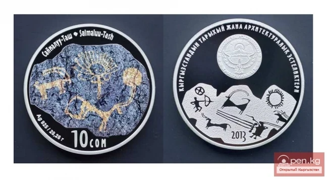
Here, high in the mountains, at the foot of the glaciers, humans first settled five to seven thousand years ago. Their dwelling was a cave. One of these caves (Ak-Chunkur) is located in the upper reaches of the Sary-Jaz River. Its walls are adorned with drawings of primitive humans that have survived the ages. Perhaps these were the ore prospectors. Or maybe our ancestors were attracted here by the lush pastures, despite the harsh climate?
The tool of ancient humans was initially stone, and later, according to geologists, chance helped them discover metal. Thus, the ancient discoverer of tin ore appeared in Sary-Jaz. Now there was only one step to bronze, but it was a long step spanning many centuries.
With the first extraction of native copper and, especially, gold, which was apparently found in small quantities in many places in the Sary-Jaz region and was relatively easy to extract from alluvial deposits, a true acquaintance with metal began for humans. By processing it at high temperatures, they already noticed one remarkable property — malleability, and subconsciously came to discover its new properties. Adding tin ore (cassiterite) to molten copper increased the hardness of the alloy compared to native copper. Thus, bronze was obtained.
Ancient people extracted tin using a hammer or a piece of stone. They chipped pieces of barren rock from the tin ore. After sorting, cassiterite was sent to casting workshops, where, by combining tin with copper, it was remelted into bronze.
The floodwaters of the Sary-Jaz have washed away the traces of ancient mining operations. Only trenches in the base of the second terrace in the Echkilitash area remain, filled with pebbles and boulders from the worked rock.
Strangely enough, the mountains did not divide but rather united the peoples inhabiting various regions of Central Tien Shan. Representatives of ancient civilizations had the opportunity to move along mountain trails. 30-60 km north of Sary-Jaz ran the most important trade artery. From this international silk road branched smaller trade paths of local significance. Sary-Jaz was connected to the Issyk-Kul basin by such a path, which was 140 km long. The closest, but very difficult caravan route to Eastern Turkestan passed through the Kok-Shal ridge via the valleys of the rivers Kain, Uchit, Kayukesh, and the passes Uchit, Chichar, Kara-Moynok, and Maibash, as well as the settlements of Aksu, Kashgar, or Yarkand. Travel along this route was only possible during limited times. In summer, water barriers interfered, and in winter, snowdrifts.
By the time of the discovery of bronze, trade had already begun to play a significant role in the life of society. Tin became a highly valued commodity in the market. It was directed to where the main raw material for obtaining bronze — copper ore — was available.