Tokmok
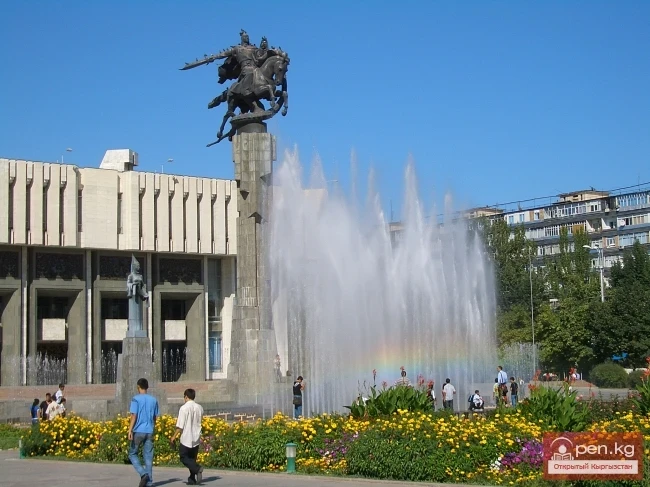
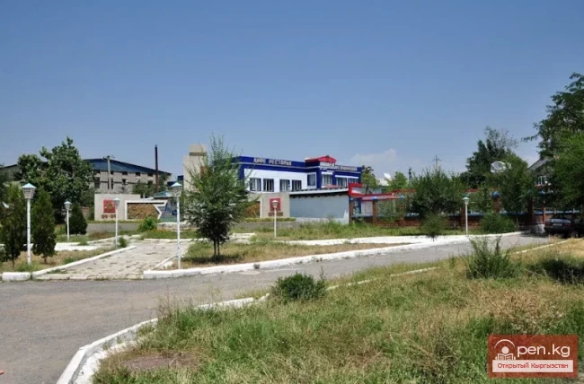
Tokmok (Kyrgyz: Токмок) is a city in Kyrgyzstan, the administrative center of the Chuy Region.
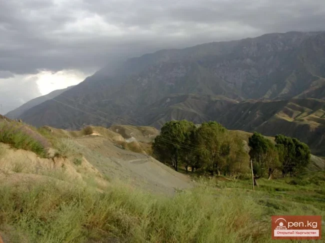
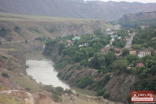
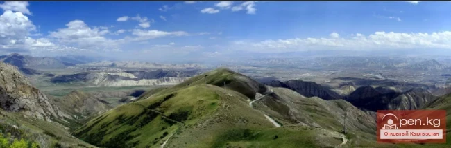
It is located in the north of Kyrgyzstan, between 43° N latitude and 75° E longitude, on the left bank of the Chu River, which forms the border between Kyrgyzstan and Kazakhstan. To the north and south of it stretch the Tien Shan mountain ranges. South of Tokmok lies the powerful Kyrgyz Ala-Too range. North of the Chu River is the Ili Ala-Too, extending into Kazakhstan.
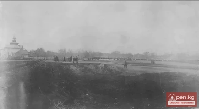
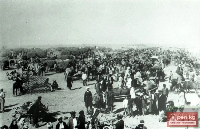
The combination of the topography of the Chuy Valley, which has a significant slope towards Tokmok and nearby areas in the eastern part, as well as the result of the unstable, wandering course of the water-rich Chu River, threatened the city with constant flooding. For instance, in the winter of 1878, an ice jam on the river created a natural dam upstream of the city, and the floodwaters inundated the city of Tokmok in just a few minutes, destroying many buildings. Around 1909-1914, a special dam was constructed on the Chu River, 1200 meters long and 800 meters in the eastern part, to prevent flooding. It is worth noting that this flooding was the main reason for the relocation of the district center from Tokmok to Pishpek in 1878.
The climate of Tokmok averages 180 days a year without precipitation and is abundant in sunlight. According to the city meteorological station data for 1945, the maximum air temperature was 37 °C (July), and the minimum was -26 °C (January). The average annual temperature is +8.7 °C.
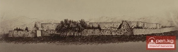
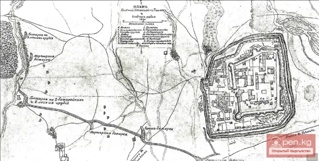
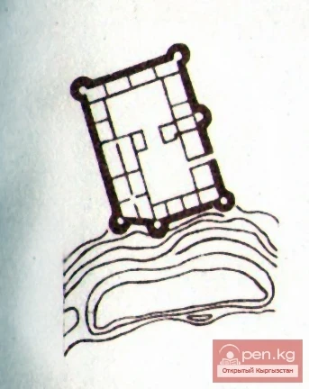
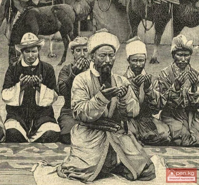
Modern Tokmok was founded as a Kokand fortress in the early 19th century (1825-1830). Later, by 1862, it was captured by Russian troops and destroyed.
During the conquest of the Tokmok fortress by Russian troops, they did not storm it, as the garrison of the fortress resisted fiercely, and ultimately the fortress was destroyed by artillery.
Later, Russian fortifications were established on the sites of the former Kokand fortresses. In early May 1864, a detachment of Colonel Chernyaev, arriving from Verny, settled at the ruins of the Tokmok fortress, where on May 13, 1864, they established the Russian fortification of Tokmok.
In 1867, Tokmok was granted city status and became the center of the Tokmok district of the Semirechye region of the Turkestan Governor-Generalship. The district center was moved to the city of Pishpek in 1878. After that, Tokmok lost its city status. In 1927, Tokmok again became a city.
The city is home to the 8th Guards Idritsko-Rezhitskaya Red Banner Order of Suvorov named after Hero of the Soviet Union Major General Ivan Vasilyevich Panfilov rifle division, which heroically distinguished itself in battles on the distant approaches to Moscow in the Volokolamsk area.
Since July 16, 2014, the city has had a sister city - Volokolamsk (Russia, Moscow Region). The decision for friendship between the cities was unanimously made at a meeting of the Council of Deputies of the Volokolamsk urban settlement.
Population - 53,231 people (2009).
According to the 2009 census of Kyrgyzstan, Kyrgyz people make up 24,910 individuals or 46.8%, Russians - 10,930 individuals or 20.5%, Dungans - 8,790 individuals or 16.5%, Uzbeks - 4,556 individuals or 8.6%, Tatars - 991 individuals or 1.9%, Uighurs - 923 individuals or 1.7%, Kazakhs - 598 individuals or 1.1%, Germans - 332 individuals or 0.6%.
Read also:
The Ridges of Sonkyoiltau and Susamyrtau
Son-Kul-Tau A mountain range in the Tian Shan, in the southeastern part of Kyrgyzstan. It arches...
From the Kokand Fortress to the City of Frunze. The Kokand Fortress
FROM THE KOKAND FORTRESS TO THE CITY OF FRUNZE KOKAND FORTRESS In the second quarter of the 19th...
The title translates to "Kainyda-Katta Ridge."
Kainyda-Katta In the Central Tien Shan in Kyrgyzstan, extending west from the peak of the Red Army...
City of Tokmok
...
Jumgaltau Ridge
Jumgaltau A mountain range in the northern part of the Tien Shan, in Kyrgyzstan. The ridge extends...
Zone "Talas"
The "Talas" zone is located in the central part of the Talas River valley and includes...
Kemin
Kemin is a city in Kyrgyzstan. It is the administrative center of the Kemin District in the Chuy...
The Siege of the Pishpek Fortress
Plan of the siege of the fortress of Pishpek by Russian troops The Capture of Pishpek In October...
1878: Transfer of the District Administration from Tokmak to Pishpek (Bishkek)
Transfer of the District Administration from Tokmak to Pishpek There is also information about the...
The Saridzhaz Ridge
Sarydjaz The mighty snow-covered barrier of the Sarydjaz mountain range rises in the Central Tian...
From the Kokand Fortress to the City of Frunze. The City of Pishpek
THE CITY OF PISHPEK In 1866, the first Russian settlers began to arrive at the ruins of the Kokand...
Zailiysky Alatau Ridge
Zailiyskiy Alatau A mountain range in the northwest of the Tian Shan (on the border of Kazakhstan...
Kyrgyzstan - Bishkek
Bishkek (Kyrgyz: Бишкек) is the capital of Kyrgyzstan and the largest city in the country. It...
The title "Река Аспара" translates to "Aspara River" in English.
Aspara A river in the Panfilov District of Chuy Region, Kyrgyzstan, and the Merken District of...
The title translates to "Cholok-Korgon Fortress."
Cholok-Korgon Fortress is located two and a half kilometers northeast of the village of Konorchok...
Kgety Waterfall
Big Kegety Waterfall The waterfall is located in the Kegety Gorge, which is in the Chuy region, 18...
Bishkek - the capital of Kyrgyzstan
Bishkek - the capital of Kyrgyzstan. In the center of the Chui Valley, at the northern foothills...
Shamsi Gorge
The Shamsi Gorge is located 120 km from the city of Bishkek and 60 km south of the city of Tokmak....
The Atbashi Ridge
Atbash The mountain range belongs to the southern arc of the Inner Tien Shan in Kyrgyzstan. It...
Act on the Temporary Allotment of Pasture Land for the City of Pishpek. Document No. 8 (June 1881)
ACT ON THE TEMPORARY ALLOTMENT OF PASTURE LAND FOR THE CITY OF PISHPEK, PREPARED BY THE COMMISSION...
Suusamyr Valley
The length of the valley is 155 km. It is bordered on the north by the Kyrgyz Ala-Too, on the...
The title "Река Касансай" translates to "River Kasansay" in English.
Kasansay (Kyrgyz: Kasan-say, Uzbek: Kosonsoy) A river in Kyrgyzstan and Uzbekistan, a right...
Fortress Jumgal
Jumgal Fortress is located in the Jumgal district in the middle reaches of the Jumgal River, on...
Kara-Balta
Kara-Balta, which translates as "Black Axe," is one of the youngest cities in the Kyrgyz...
Boom Canyon
Boom Canyon is located 112 km from the city of Bishkek and serves as a unique natural gateway...
Tash-Kumyr
The first settlements in the current location of the city of Tashkumyr appeared during the...
The Passes of the Chuy Region
Main Passes in the Chui Valley Shamsi Pass is located in the Chui region and stretches from Shamsi...
Batken
Batken is a city in Kyrgyzstan, the administrative center of Batken Region and District. The...
Tokmok has been the administrative center of the Chui Valley since 1825.
Kokand Fortress in Pishpek The natural and climatic conditions, along with the diverse riches of...
Passes in the Osh Region
Osh Passes Taldyk Pass - a pass in the Alai Range, oriented from north to south, connects the...
Kuylytau Ridge
Kuylytau A mountain range in the Central Tien Shan, in Kyrgyzstan. It is located between the...
The title translates to "Ak-Shiyrak Ridge."
Ak-Shiyrak The Ak-Shiyrak Ridge is a watershed between the Naryn and Sary-Jaz rivers in the Tian...
Talas Ridge
Talassky Ala-Too A mountain range located in the Western Tien Shan system. Most of it is situated...
Osh - "Southern Capital" of Kyrgyzstan
Osh - "The Southern Capital" of Kyrgyzstan. The city of Osh is the administrative center...
Chuy Region
The Chuy Region was established on December 14, 1990. Until 1939, various...
City of Bishkek and Surroundings
Usually, when you ask about the tourist resources of the city of Bishkek, it tends to lead to a...
Kokshaal-Too and Peak Dankov
Remoteness, wildness, and mystery are the concepts that characterize and give an idea of this...
Transfer of the Control Center from Tokmak to Pishpek. Documents No. 5-7 (May 1878 - February 1880)
REPORT OF THE HEAD OF TOKMAK DISTRICT TO THE MILITARY GOVERNOR OF SEMIRECHENSKAYA REGION ON THE...
The title "Хребет Джетим" translates to "Djetim Ridge" in English.
Djetim A mountain range in the Tian Shan, in Kyrgyzstan, south of the Terskey Alatau. The length...
The title translates to "The Village of Bazar-Korgon."
BAZARKORGON AND BAZARKORGON DISTRICT Bazarkorgon (Kyrgyz: Базар-Коргон) is a village in the...
The Moldotau Ridge
Moldotau A mountain range in the Inner Tian Shan, in the central part of Kyrgyzstan, south of Lake...
The Territory of the Kyrgyz from Ancient Times to the 6th Century
The Saka tribes were divided into three parts. In the southern regions of Kyrgyzstan lived the...
The Influence of Islam on the Kyrgyz People
The Influence of Islam on Kyrgyz Rituals On the map of the Liao era (916—1125) and Northern Song...
Peak Adygene
Peak Adygene. It is located at the top of the gorge of the same name on the northern slope of the...
Caves of the Kok-Kiya River
Kok-Kiya River (Green Slope) - the easternmost right tributary of Ak-Sai, flows down from the...
The title "Сох" translates to "Sokh" in English.
Narrow echoing gorges, through which in the gloomy depths flows a river bound by rocky jaws;...
Kainyndy Glacier
Kainy Between Kokshaal-Tau and Kainy-Katta lies the powerful Kuyakap Glacier, and between...
Valley of the Chatkal River
Chatkal Valley is 30 to 50 km wide and stretches from the southwest to the northeast for 150 km....