The title translates to "Cholok-Korgon Fortress."
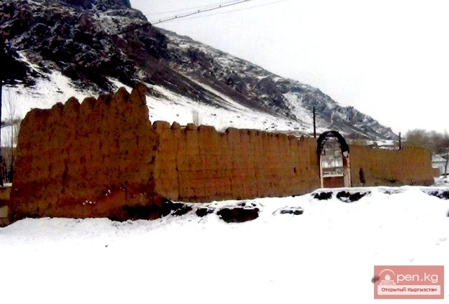
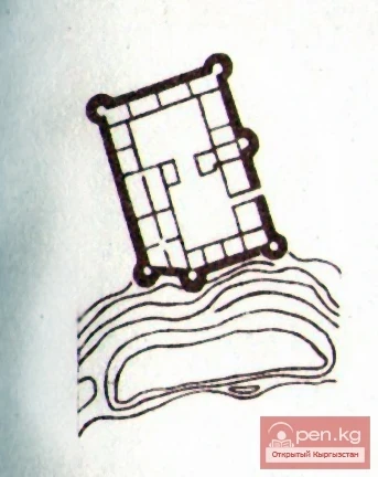
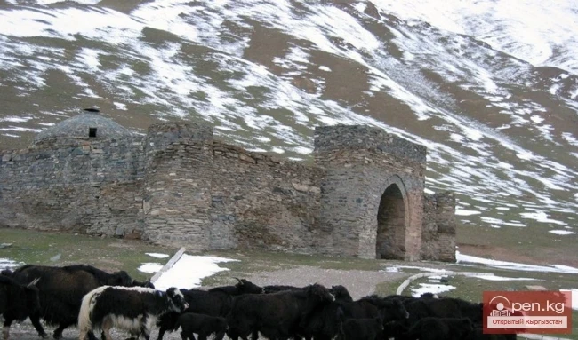
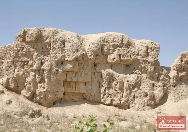
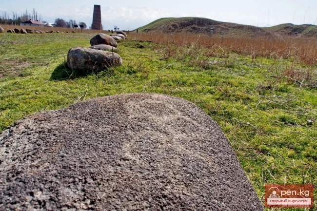
Cholok-Korgon Fortress is located two and a half kilometers northeast of the village of Konorchok in the Ak-Tal district. The fortress has a rectangular shape (35 X 40 m). Four towers protrude at the corners — oval in shape, appearing as truncated cones in plan. Remnants of two more towers can be seen on the eastern and western sides of the fortress. The fortress is divided into two unequal parts by a wall: the northern and southern sections. A row of loopholes runs along the entire wall and on the towers at a height of 2 m. Five structures adjoin the southern wall, while there are none in the northern part of the fortress. The entrance is located in the center of the western wall. The southeastern and northwestern towers have been destroyed, along with part of the northwestern and eastern walls. The height of the remaining walls is 3.3 m. The walls are built from stone blocks and, like the towers, have slit loopholes. Strategically, the fortress is situated in a convenient location, with the southern wall facing the bank of the Ala-Buka River. From the other walls of the fortress, the entire valley is clearly visible. The fortress practically covers the entire intermountain area.
Cholok-Korgon Fortress is located at a bend in the river. From its towers, which were up to 5 m high, the valley could be seen from afar. The southern part of the fortress presumably had a secret exit, as one could quickly ascend the slope of the mountain, which serves as an observation point, via a natural depression formed by the river (a distance of 400–600 m).
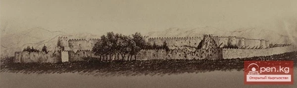
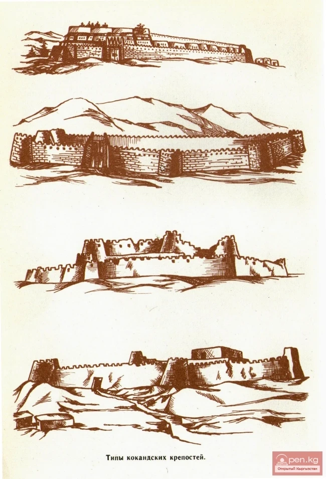
According to A. N. Bernshtein, “Cholok-Korgon Fortress is a typical example of 19th-century construction (the era of Kokand) and is one of the few fortresses of the beys and manaps that have survived to modern times in very small numbers.”
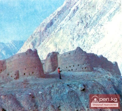
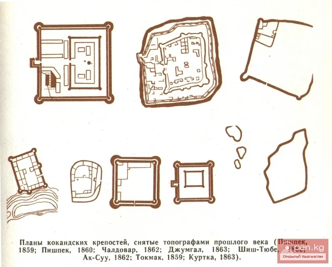
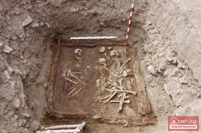
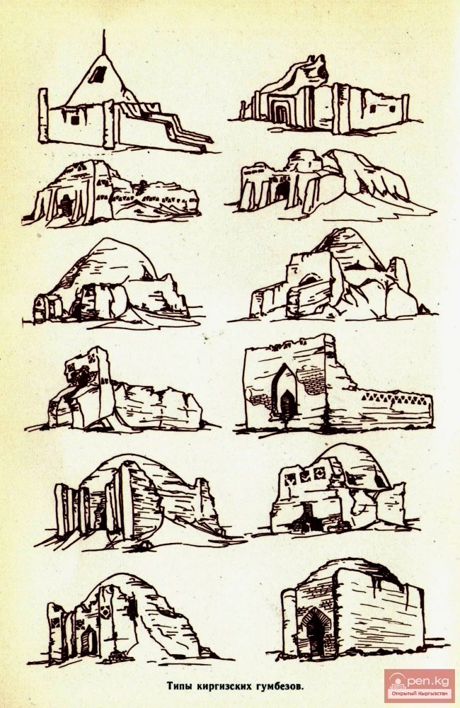
Today, we can confidently state that there are no longer any medium-sized Kokand and Kyrgyz fortresses in Kyrgyzstan, such as Daraut-Kurgan, Kan, and Cholok-Korgon; and if some have survived, they are shapeless ruins. Restoring their original appearance and determining their exact location can only be done through descriptions and drawings by researchers, local historians, and travelers of the last century. These include the fortresses of Tokmak, Jumgal, and Kurtka. Many fortresses have disappeared without a trace, and restoring their configuration, and sometimes even indicating their exact location, is impossible, as they are only mentioned briefly in the sources.
Read also:
The Fortress of Daraut-Kurgan
Daraut-Kurgan Fortress is located in the village of the same name on the left bank of the...
Fortress Jumgal
Jumgal Fortress is located in the Jumgal district in the middle reaches of the Jumgal River, on...
The Fortress of Kan
In the middle reaches, the Sokh River receives the tributary Abghol (a river from the lake), at...
Fortress Kurtka
There is particularly much information in the literature about the Kokand Fortress Kurtka, which...
From the Kokand Fortress to the City of Frunze. The Kokand Fortress
FROM THE KOKAND FORTRESS TO THE CITY OF FRUNZE KOKAND FORTRESS In the second quarter of the 19th...
Historical and Architectural Monuments of Kyrgyzstan
Please provide the text you would like me to translate....
The Fortress of Pishpek
According to Russian sources, the fortress was built in the eponymous area in 1825 by the Kokand...
Kyrgyz Fortifications
Kyrgyz Fortresses Archaeological studies of the Kokand fortresses and archival sources now allow...
Parables about Heroes
Mother's Milk It was a long time ago, during the time of the Kyrgyz war with the Dzungars....
The title translates to "The Village of Uch-Korgon."
Uch-Korgon – a large village (kishlak) in the northeast of the Batken region. The word...
Zone "Osh"
The "Osh" zone introduces tourists to the attractions of the ancient city of Osh. The...
The title translates to "The Village of Bazar-Korgon."
BAZARKORGON AND BAZARKORGON DISTRICT Bazarkorgon (Kyrgyz: Базар-Коргон) is a village in the...
Kokand and Kyrgyz Fortifications
Types of Kokand Fortresses For a whole century (from the second half of the 18th century to the...
Tokmok
Tokmok (Kyrgyz: Токмок) is a city in Kyrgyzstan, the administrative center of the Chuy Region. It...
Crown Peak
Peak Korona (4860 m) is located in the Ala-Archa National Park at the summit of the Ak-Sai glacier...
Tokmok has been the administrative center of the Chui Valley since 1825.
Kokand Fortress in Pishpek The natural and climatic conditions, along with the diverse riches of...
Medieval Osh
In the Darkness of the Ages The more scholars refer to the works of the founder of scientific...
Kokand Fortress of Pishpek
PREHISTORY OF THE CAPITAL OF KYRGYZSTAN For those who currently live in this beautiful city,...
The Siege of the Pishpek Fortress
Plan of the siege of the fortress of Pishpek by Russian troops The Capture of Pishpek In October...
Excavations in Kayragach
Temple Complex in the Village of Kayragach To the northwest of the village of Beshkent, on the...
Burials of the Bronze Age from the Kyzyl-Say and Kulan-Say Burial Mounds
Kyzyl-Say and Kulan-Say Burial Mounds in the Talas Valley The systematic study of Bronze Age...
Red Rocks of Kyzyl Korgon
The photos were taken from the Facebook page of the company "TRAVEL EXPERTS"...
10 places in Crimea that you must see
10 Attractions in Crimea. The Crimean Peninsula is a unique historical and cultural reserve. For...
The Peak of Gorky
Pik Gorkogo (6050 m) - located in the Central Tien Shan in the Tengri-Tag ridge. The southern...
Burana - Architectural Heritage of Kyrgyzstan
Burana - Architectural Heritage. Located 12 km southwest of the present-day town of Tokmak is the...
Street of Truth - formerly Kuznetskaya. S. Ibraimov St.
PRAVDY STREET - FORMERLY KUZNECHNAYA We will begin the story of this street with the remnants of...
Kara-Suu
The "Kara-Suu" Zone is located in the eastern part of the southern slope of the Chatkal...
Nuzket - The Center of Culture on the Great Silk Road in the 6th-7th Centuries
Nuzket (Kara-Balta) Various surviving Arab and Chinese sources indicate that along the Great Silk...
The title translates to "Gumbaz of Chirak-Bulak."
During the expeditionary work, excavations were carried out at a collapsed gumbaz — Niyazbek in...
Niyazbek-Korgon
Types of Kyrgyz domes Niyazbek-korgon. The mausoleum of the Kyrgyz feudal lord Niyazbek, or rather...
In the village of Ak-Korgon, Talas region, a 225-seat school will be built for 238 million soms.
In the village of Ak-Korgon, located in the Talas region, a tender has been launched again for the...
Tash-Rabat – a Medieval Caravanserai
Tash-Rabat – a medieval caravanserai The stone fortress Tash-Rabat is located 525 km southeast of...
Document No. 3. The Revival of Pishpek
CAPTURE OF THE PISHPEK FORTRESS BY THE IMPERIAL TROOPS AND THE ESTABLISHMENT OF THE PISHPEK...
Attractions of the City of Osh
Osh - one of the oldest cities in Central Asia, located on the southeastern edge of the Fergana...
Peak Djigit
Peak Djigit - height 5170 meters. It is located in the main watershed ridge of the Terskey Alatau...
Sultan Babur on Osh
Osh in the Book "Baburnama" In ancient times, the territory of Osh and the areas to its...
Monuments Found Near the Burana Tower
Burana Monuments MONUMENT NO. 1 Round, disc-shaped, gray stone measuring 30x35 cm. An unusual...
The title translates to "Ak-Shiyrak Ridge."
Ak-Shiyrak The Ak-Shiyrak Ridge is a watershed between the Naryn and Sary-Jaz rivers in the Tian...
The Legend of the Manap Baytik Kanaev
BAYTIK-BATYR In 1862, a rebellion erupted among the Kyrgyz in the Chuy Valley. It was led by the...
Order of Prince A. Vyazemsky on the Escort of Deputy Abdrakhman Kuchakov to the Fortress of St. Peter
ORDER OF PRINCE A. A. VYAZEMSKY TO THE ADJUTANT OF THE SIBERIAN DRAGOON REGIMENT SIPAYLOV...
Excerpt from "The Garden of Purity" by Mirkhond
Mirkhond. "Rawzat as-Safa" ("The Garden of Purity"). Materials from the fund...
City of Osh
Recent studies have shown that the city with this name is not about two thousand years old, as was...
Zone "Aflatun"
Aflatun Zone is located on the southeastern slopes of the Chatkal Ridge and occupies the basin of...
Batken Region
The Batken Region was established on October 12, 1999, from the Osh Region. It includes the...
Peak Free Korea
Peak Free Korea - located on the Ak-Sai ridge within the Ala-Archa National Park. In the past, one...
In Kyrgyzstan, the third earthquake in a day has been registered
Today, at 13:20, an earthquake with a magnitude of approximately 3.5 on the MSK-64 scale occurred...
The River Aflatun
Aflatun River – the largest right tributary of the Kara-Suu River in the Jalal-Abad region. The...