Fortress Jumgal

Юля Attractions of Kyrgyzstan
VK X OK WhatsApp Telegram
Jumgal Fortress


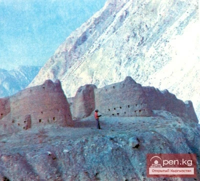
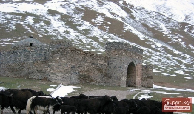
Jumgal Fortress is located in the Jumgal district in the middle reaches of the Jumgal River, on its right bank, in the Kar-Oy area, near the village of Kairma. Only traces of the once powerful fortress remain, with melted walls now crumbling due to rain, snow, and wind.

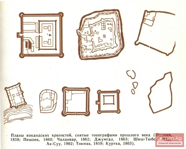
The fortress is rectangular (60 X 80 m). Fragments of the wall on the western and northern sides remain, currently no more than 3—5 m long and up to 1 m high. At one time, the fortress was surrounded by a moat, with a cliff on the southern side leading down to the Jumgal River. The walls were built on a foundation. In the southeast corner, traces of buildings can be seen. The area around the fortress is marshy. When the river flooded, access to it was virtually impossible. This likely served as additional protection for the fortification against raids by nearby nomads. However, the question arises as to why the Kokand rulers did not use the medieval fortress located 150—200 m away, which was strategically superior for their own fortification. Overall, the location was well chosen. The fortress controlled the migration routes in the Jumgal Valley and was situated on a trade route. It was also home to Kokand tax collectors and the khan's governor.

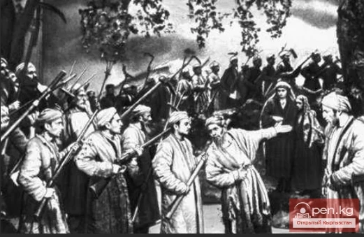
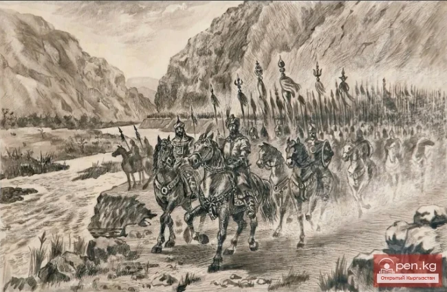
According to archival documents, the Jumgal fortification was built by the Kokand rulers in the 1830s and served as a collection point for zakat from nomads and small trade operations. A small garrison was stationed there. There was no artillery, and the garrison was only partially armed with cold weapons. The garrison numbered between 100 and 150 men. An overview of the area confirms this data: such a garrison could well be accommodated in the designated territory of the Jumgal fortification. However, at the time of the fortress's fall, the Jumgal garrison numbered less than 50 men and was poorly armed. A Russian detachment, arriving in 1862 in Central Tian Shan under the command of Captain Protsenko, unexpectedly attacked the garrison with the support of local Kyrgyz rebels, who were unable to offer any serious resistance. The Kokand forces were forced to flee, and the Jumgal Fortress was taken without a fight and destroyed.
VK X OK WhatsApp Telegram

Read also:

Jumgal Domes

Jumgal Domes

Dzhumgal Domes — nameless domes. There are many of them in the Dzhumgal district. They are now...

The Fortress of Kan

The Fortress of Kan

In the middle reaches, the Sokh River receives the tributary Abghol (a river from the lake), at...

Fortress Kurtka

Fortress Kurtka

There is particularly much information in the literature about the Kokand Fortress Kurtka, which...

Kokomerensky Baths

Kokomerensky Baths

Kokomerensky Thermal Springs are located 14 km upstream from the confluence of the Kokomerena...

The Fortress of Pishpek

The Fortress of Pishpek

According to Russian sources, the fortress was built in the eponymous area in 1825 by the Kokand...

Tokmok

Tokmok

Tokmok (Kyrgyz: Токмок) is a city in Kyrgyzstan, the administrative center of the Chuy Region. It...

Parables about Heroes

Parables about Heroes

Mother's Milk It was a long time ago, during the time of the Kyrgyz war with the Dzungars....

Kyrgyz Fortifications

Kyrgyz Fortifications

Kyrgyz Fortresses Archaeological studies of the Kokand fortresses and archival sources now allow...

Suusamyr Valley

Suusamyr Valley

The length of the valley is 155 km. It is bordered on the north by the Kyrgyz Ala-Too, on the...

The Village of Chaek

The Village of Chaek

Chayek – Agricultural Settlement The village of Chayek is the center of the Jumgal district in the...

Kara-Shoro

Kara-Shoro

In the upper reaches of the Yassy River, on its right bank, there is a whole series of mineral...

"Suusamyr Zone"

"Suusamyr Zone"

The Suusamyr Zone includes the eponymous high-altitude valley stretching 155 km. To the north, it...

Zone "Osh"

Zone "Osh"

The "Osh" zone introduces tourists to the attractions of the ancient city of Osh. The...

River Karakulja

River Karakulja

Karakulja The Chatkal River in its upper reaches is called Karakulja (translated - Black Ram),...

Medieval Osh

Medieval Osh

In the Darkness of the Ages The more scholars refer to the works of the founder of scientific...

City of Uzgen

City of Uzgen

This ancient city of Kyrgyzstan was founded by the Turks in the 8th-9th centuries in the center of...

The Legend of Bishkek

The Legend of Bishkek

Why is the city called Bishkek? Darytai, grunting, approached the hearth, leisurely adjusting the...

Small Naryn

Small Naryn

Small Naryn encompasses the valley of the river of the same name, located between the ridges of...

Zone "Aflatun"

Zone "Aflatun"

Aflatun Zone is located on the southeastern slopes of the Chatkal Ridge and occupies the basin of...

Kara-Suu

Kara-Suu

The "Kara-Suu" Zone is located in the eastern part of the southern slope of the Chatkal...

Write a comment: