Tash-Kumyr
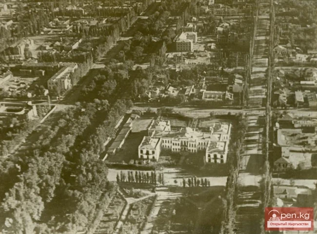
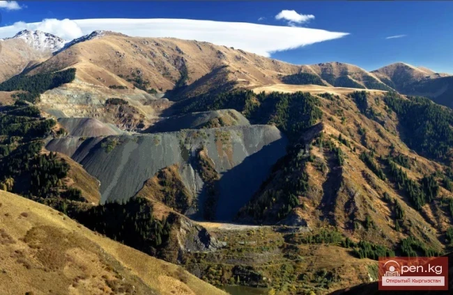
The first settlements in the current location of the city of Tashkumyr appeared during the pre-revolutionary period with the beginning of coal deposit exploration. The development of coal mining began in the 1930s after the construction of the Tashkumyr – Andijan railway. In 1933, a mining administration was established.
In 1930, when a coal basin opened in this region, a small mining settlement was established, which grew into a city in 1943.
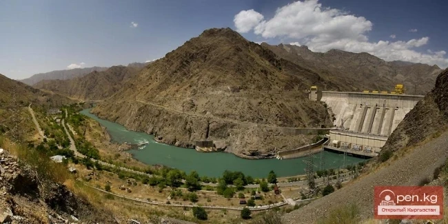
In the 1960s, with the start of construction of the Uchkurghan Hydroelectric Power Station, and later the Toktogul Hydroelectric Power Station, Tashkumyr became a city not only for miners but also for builders and energy workers (the city of Karakul was under the administrative jurisdiction of Tashkumyr as an urban-type settlement until 1968).
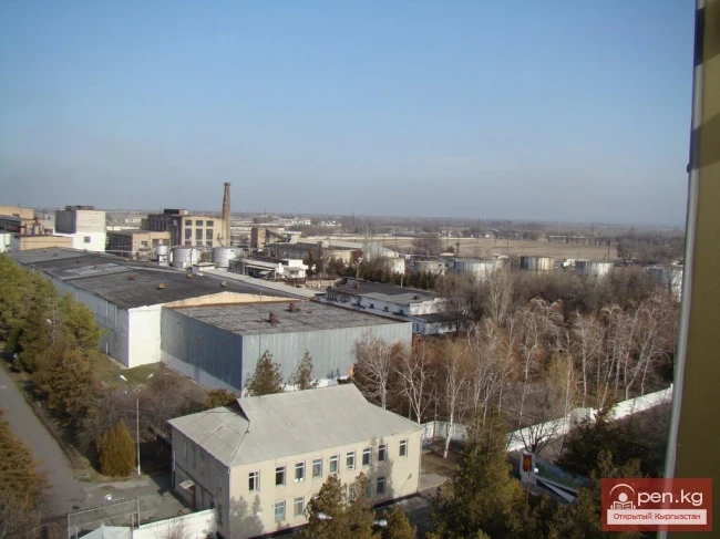
Subsequently, a tobacco fermentation plant and other industrial facilities were built. Since 1982, construction began on a semiconductor materials plant—one of the largest in the world’s silicon production.
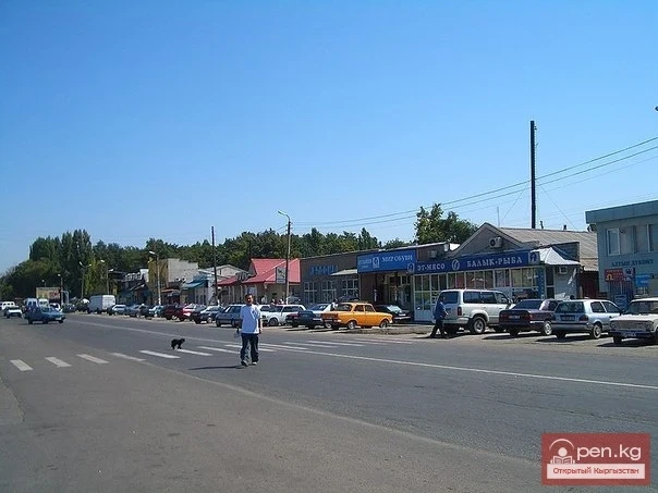
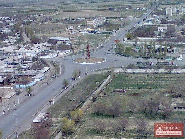
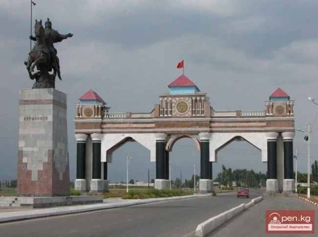
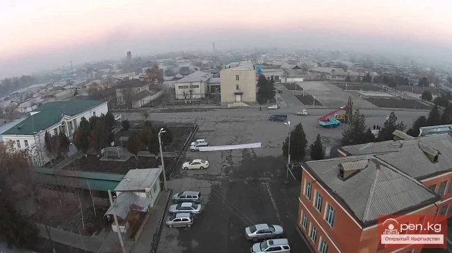
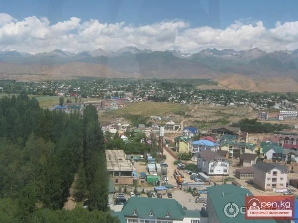
The city of Tashkumyr in the Jalalabad region is located in the northeastern part of the Fergana Valley, bordering the Aksy district to the northwest, the city of Karakul to the northeast, and the Nooken district to the east. The area of the city is 48.3 km² and is situated at an altitude of 585 meters above sea level. In summer, the average air temperature reaches +40°C, while in winter it drops to -15°C. The wind speed is 6-8 m/s. The population of the city is multinational: Kyrgyz - 65%, Russians - 12%, Uzbeks - 8%, Kazakhs - 1%, Tatars - 7%, Tajiks - 0.5%, Ukrainians - 1%, and other nationalities - 5%.
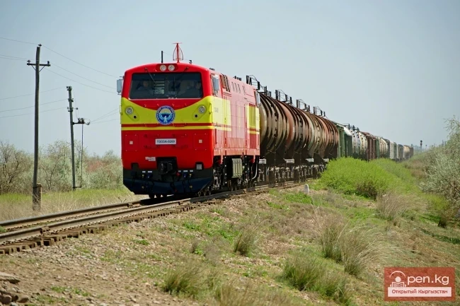
The city is located on the right bank of the Naryn River (Syr Darya River basin), near the Bishkek — Osh highway. The distance to Bishkek is 450 km, and to Jalalabad is 129 km. It is connected by a railway line (33 km) to the Uch-Kurghan station (Uzbek: Uchqurghon) (on the Andijan — Namangan line).
Currently, the city includes the settlements of Shamaldisay, Kyzyljar, and the village of Tendik. The center of the city is Tashkumyr. The city is situated on the right bank of the Naryn River, near the Bishkek–Osh highway. The distance to Bishkek is 450 km, and to Jalalabad is 129 km.
The industrial sectors of the city include coal mining, hydropower, chemical production, tobacco leaf fermentation, construction, transportation, and others.
In 1989, the Semiconductor Materials Plant was put into operation, intended for the production of trichlorosilane, silicon tetrachloride, polycrystalline silicon, and synthetic quartz crucibles.
Read also:
City of Kerben
The city of Kerben is located in the center of the Aksy district, at an altitude of 1200 meters...
Hero of the Kyrgyz Republic Akbaraly Kabaev
Akbaraly Kabaev, foreman of builders at JSC "Narynhydroenergoстрой" Born in Jalal-Abad...
Kant
The city of Kant is a city of district subordination. In Kyrgyz, "kant" means sugar; the...
Kyzyl-Kiya
Kyzyl-Kiya is a city of regional subordination in the Batken region of Kyrgyzstan. Population...
Photo - A City with an Interesting "Highlight" in the Mountains of Kyrgyzstan
This year, Naryn is celebrating its 156th birthday. The correspondent of Turmush discovered...
The City of Kainды
From the settlement Molotovsky - to the city of Kainды The city of Kainды is located not far from...
City of Shopokov
The city of Shopokov is located at the northern slope of the Kyrgyz Range at an altitude of 740...
City of Kadamjay
Kadamjay - "Holy Place". The emergence of the city of Kadamjay is linked to the...
Sulyukta
Sulyukta is a city of regional subordination in the Batken region of Kyrgyzstan. Population (2009)...
Bishkek - the capital of Kyrgyzstan
Bishkek - the capital of Kyrgyzstan. In the center of the Chui Valley, at the northern foothills...
Kyrgyz Railway
Based on the Resolution of the Ministry of Transport of the USSR No. 631 dated May 13, 1958, the...
From the Kokand Fortress to the City of Frunze. The City of Pishpek
THE CITY OF PISHPEK In 1866, the first Russian settlers began to arrive at the ruins of the Kokand...
Toktogul
The urban-type settlement Toktogul is located in the Toktogul district of the Jalal-Abad region of...
Kara-Balta
Kara-Balta, which translates as "Black Axe," is one of the youngest cities in the Kyrgyz...
Kemin
Kemin is a city in Kyrgyzstan. It is the administrative center of the Kemin District in the Chuy...
Kara-Kul
Kara-Kul is a city in the Jalal-Abad region of Kyrgyzstan. According to the 2009 census of...
Passport of the City of Frunze 1930 - 1933. Document No. 85
City of Frunze PASSPORT OF THE CITY OF FRUNZE 1930-1933 I GEOGRAPHICAL DESCRIPTION OF THE CITY...
City of Aydarken
Aydarken – a small town and industrial center in the central part of the Batken region. The...
The First Five-Year Plan of the Kyrgyz ASSR
Approval of the First Five-Year Plan for the Development of the National Economy In December 1929,...
The City of Orlovka
Orlovka — a city in the Kemin District of the Kyrgyz Republic. The status of a city was granted to...
BARAKANOV Baiysh Moldokasymovich
BARAKANOV Baish Moldokasymovich...
Attractions of the City of Osh
Osh - one of the oldest cities in Central Asia, located on the southeastern edge of the Fergana...
Kyrgyzstan - Bishkek
Bishkek (Kyrgyz: Бишкек) is the capital of Kyrgyzstan and the largest city in the country. It...
Tokmok
Tokmok (Kyrgyz: Токмок) is a city in Kyrgyzstan, the administrative center of the Chuy Region. It...
Territory, Geography, and Administrative Division of Kyrgyzstan
Territory, Geography, and Administrative Division of the Kyrgyz Republic The Kyrgyz Republic...
ABYKAIEV Bakyt Monoshevich
ABYKAEV Bakyt Monoshevich...
Osh - "Southern Capital" of Kyrgyzstan
Osh - "The Southern Capital" of Kyrgyzstan. The city of Osh is the administrative center...
The City of Kyok-Dzhangak
City of Kök-Jangak (Kyrgyz: Көк-Жаңгак) — a city of regional subordination in the Jalal-Abad...
Territory and Management of Kara-Balta
Administration and Territory of the City GEOGRAPHICAL LOCATION Kara-Balta is one of the youngest...
City of Nookat
The city of Nookat is located in Kyrgyzstan and is the center of the eponymous district of the Osh...
The Role of First Secretaries in the Development of the City of Osh
Creation of the Construction Industry Base in Osh Of course, the development of the city of Osh...
City of Bishkek and Surroundings
Usually, when you ask about the tourist resources of the city of Bishkek, it tends to lead to a...
Hydrocarbon Resources
The territory of the republic has discovered deposits of coal, gas, and oil. Among them, coal...
Development of Road Transport in Osh Region and the City of Osh
Development of Industry in the City of Osh. During the Great Patriotic War, hydroelectric power...
KOChetov Vladimir Grigoryevich
KOCHETOV Vladimir Grigoryevich...
Eternalizing the Memory of the Commander M. V. Frunze.
Renaming of the city of Pishpek by the decree of the All-Russian Central Executive Committee on...
Electric Power Industry of the City of Kara-Balta
Jaiyl Electric Network The first power station in our city was a diesel one, which appeared in...
Jalal-Abad
The city is located in the foothills of the Tien Shan mountain range at the foot of the small...
Frunze in 1938-1939
Development of Industry and Culture in the Capital The number of industrial enterprises and...
Two Cities with the Same Name — Osh
Legends about the Origin of the City of Osh There are two cities on earth with the same name —...
Cities of Moghulistan
Cities of Mogulistan Before the Mongol invasion, there were many cities of various sizes in the...
Valley of Ak-Tyuz
Ak-Tyuz - "White Valley" The Ak-Tyuz Valley is located on the southwestern slopes of the...
City of Kara-Suu
The city of Kara-Suu serves as the administrative center of the district of the same name. It was...
City of Osh. Kyrgyzstan. Kyrgyz Republic.
Osh is the second most populous city in Kyrgyzstan after Bishkek. According to estimates as of...
Maya Alexandrovna Lovushkina
Maya Alexandrovna Lovushkina...
SAIPIDINOV Azhatbek
SAIPIDINOV Azhatbek...
The City of Frunze in the 70s-80s
Frunze...
The construction of the "Almaty – Cholpon-Ata" road will be completed by the beginning of 2017.
The length of the new highway 'Almaty – Issyk-Kul' will be 280 kilometers. These figures...