The urban-type settlement Toktogul is located in the Toktogul district of the Jalal-Abad region of Kyrgyzstan and serves as its administrative center. It was previously known as Muztor. In 2012, the settlement of Toktogul was granted city status.
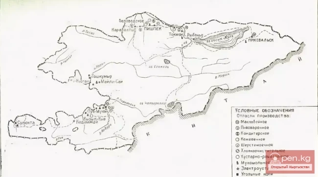
The population is 16.4 thousand residents (2009). In eleven villages and settlements of the Toktogul district, there are 86,306 people. The map of Toktogul shows that it is situated on the shore of the Toktogul reservoir. It was formed on the Naryn River by the Toktogul hydroelectric power station. It consists of two stations – the Toktogul station, with a capacity of 1200 MW, and the Kurpsai station, with a capacity of 800 MW. The area of the reservoir is 284 km², the volume is 19.5 km³, and the maximum height reaches 215 meters. Previously, there were 26 villages on its territory that were relocated. The Pamir Highway, passing by the eastern end of the reservoir, connects the settlement with the cities of Kara-Kul and Jalal-Abad. The settlement, established in 1926, was named after the famous Kyrgyz akyn Toktogul Satylganov. The city is the center of a livestock farming region. The majority of the population is engaged in animal husbandry.
In Toktogul, there is a vocational college, schools, branches of a savings bank, a medical and social expert commission, and a dairy plant.