Valley of the Chatkal River
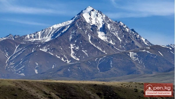
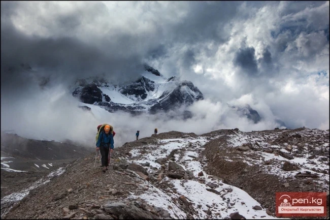
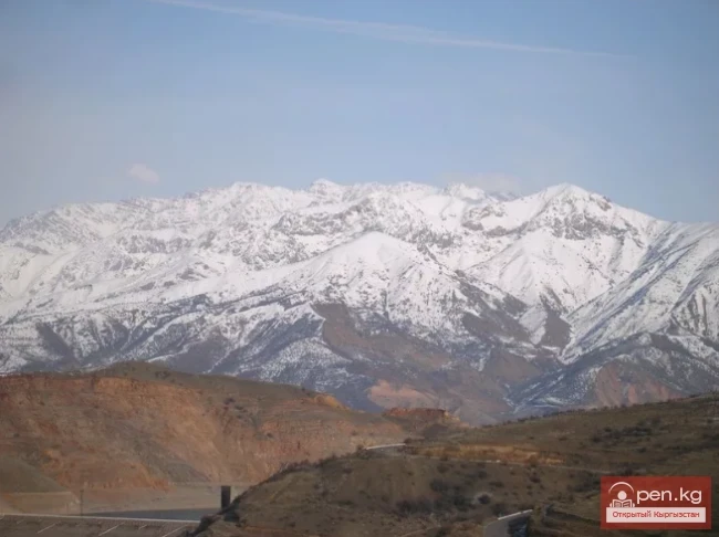
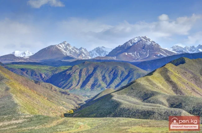
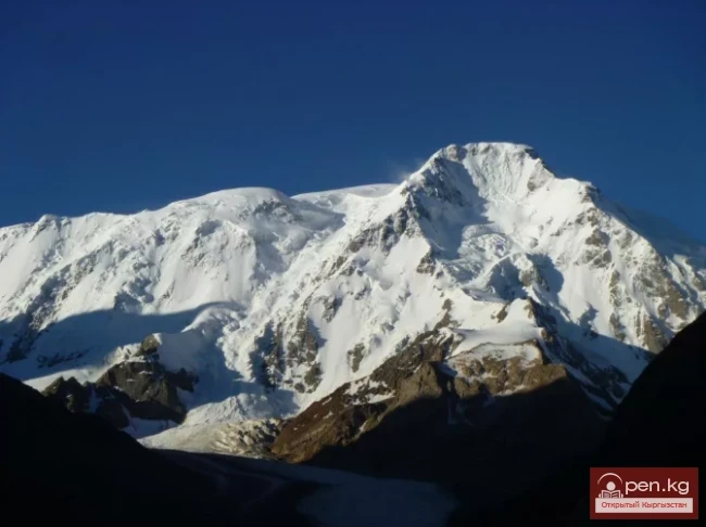
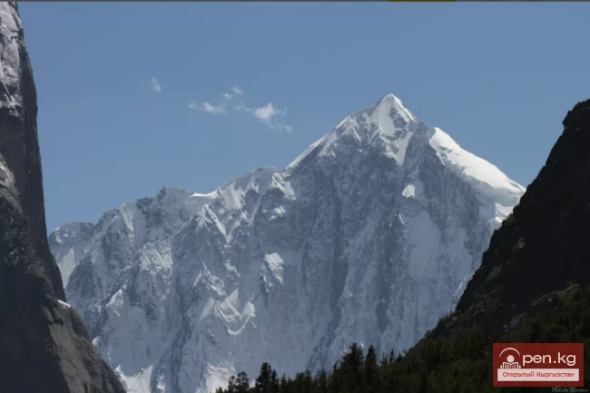
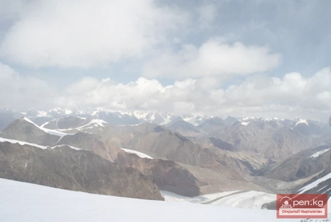
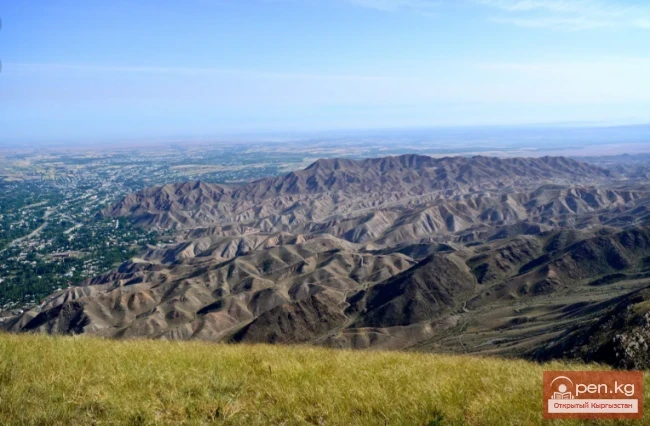
Chatkal Valley is 30 to 50 km wide and stretches from the southwest to the northeast for 150 km. The surrounding ridges: Pskem, Talas, and especially Chatkal are characterized by rocky peaks, deep gorges, rocky slopes, and canyons. The average height of the Pskem ridge is 3200 meters, with the highest point being Peak Beshtor (4299 m). The Talas Ala-Too and Chatkal ridges are more elevated, with Peak Chatkal reaching a height of 4503 meters.
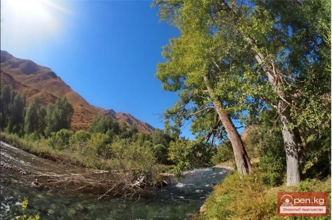
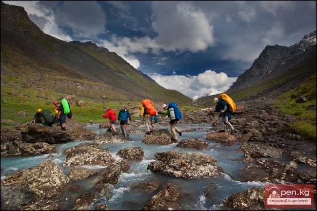
The valley is formed by the Chatkal River. There are 90 rivers in the Chatkal system. Major tributaries include Sandalash, Kara-Korum, Teroenti-sai, and others. The Chatkal basin represents a distinct area of the southwestern climatic zone of Kyrgyzstan. The unique orographic conditions played a key role in shaping the climate of the basin. The climate of the region is continental, with sharp temperature fluctuations between seasons and throughout the day.
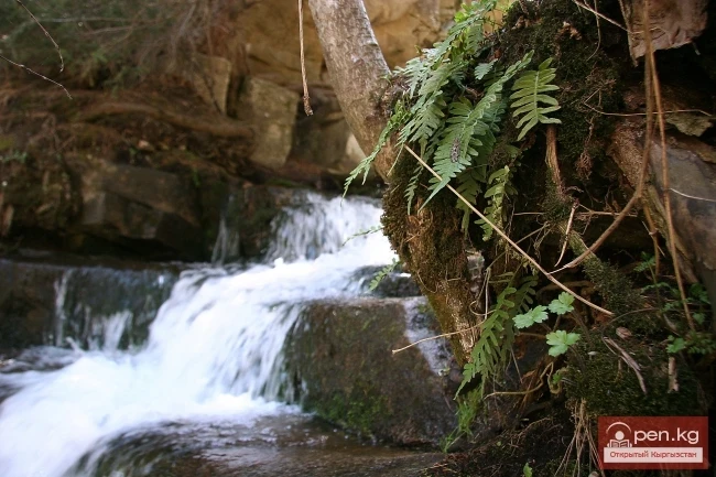
The vegetation in this area is exceptionally rich and diverse. It is home to a large part of the mountain flora of Central Asia, including endemic species.
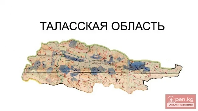
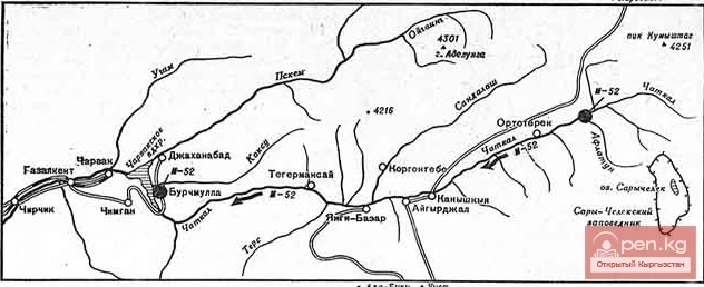
The territory contains historical monuments: Chan-charkhan, Kelbeskhan, the mausoleum of Idris the Prophet, and others. From the Chatkal Valley, a road through the Kara-Bura pass leads to the Talas Valley.
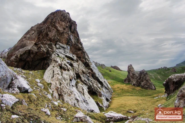
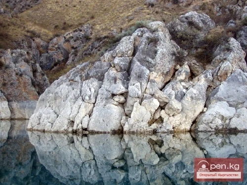
For tourism, the western part of the basin is of particular interest, where the Besh-Aral Nature Reserve is located. Here, the valley narrows, forming a narrow corridor through which the now turbulent Chatkal flows. After a few hundred meters, the mountains recede, creating a small valley in the center of which lies the village of Ak-Tash, while further down, the Pskem ridge approaches closely to the right bank of the Chatkal. Streams flowing from the mountains create short picturesque gorges - canyons. This part of the Chatkal River has good opportunities for rafting. Occasionally, Uzbek tour operators appear here, organizing rafting trips for foreign tourists down the river towards Uzbekistan.
Besh-Aral State Reserve was established in 1979, covering an area of 63,200 hectares to preserve the unique natural complexes of the Chatkal Valley. It is home to 1500 species of higher plants, 46 species of mammals, 150 species of birds, and 5 species of reptiles. The goal of the reserve is to protect the Menzbir marmot, an endemic species included in the Red Book of the Kyrgyz Republic and the International Union for Conservation of Nature (IUCN), as well as the habitats of Greig's and Kaufmann's tulips. The reserve's office is located in the village of Zhany-Bazar in the Chatkal district. Four tourist routes have been developed in the reserve. The fee for foreign tourists to visit the reserve is 10 dollars. Movement within the reserve is only possible on foot or on horseback.
Read also:
Peak Manas
Peak Manas - is the highest point of the Talas Ala-Too (4482 m). This bare peak in the western...
Besh-Aral State Reserve
Besh-Aral State Reserve is a true find for naturalists. Besh-Aral Reserve is located in...
River Karakulja
Karakulja The Chatkal River in its upper reaches is called Karakulja (translated - Black Ram),...
Talas Ridge
Talassky Ala-Too A mountain range located in the Western Tien Shan system. Most of it is situated...
Talas Region
The Talas Region is located in the northwestern part of the Kyrgyz Republic. It was established on...
Ak-Sai Valley
Ak-Sai Valley - the Kyrgyz Pole of Cold Located in the south of the Naryn region, it is bordered...
The Valley of Chichkan
The Chichkan River flows from the north into the Toktogul Reservoir. It is a small river with...
The Valleys of Alamedin and Issyk-Ata
Ala-Medin. The Ala-Medin Valley is located 25 km from Bishkek. The valley opens up through the...
Small Naryn
Small Naryn encompasses the valley of the river of the same name, located between the ridges of...
"Chon-Kemin Zone"
Chon-Kemin Zone includes the valleys of the Chon-Kemin and Kichi-Kemin rivers between the high...
Kokshaal-Too and Peak Dankov
Remoteness, wildness, and mystery are the concepts that characterize and give an idea of this...
Jalal-Abad Region
The Jalal-Abad Region was established on November 21, 1939. From January 27, 1959, it became part...
River Ak-Suu
The main channel of the Ak-Suu River is at least 20-22 kilometers long. The lower part of the...
Zone "Chatyr-Kel"
The Chatyr-Kel Zone includes a significantly elevated intermountain basin with a lake of the same...
The title translates to "Ak-Shiyrak Ridge."
Ak-Shiyrak The Ak-Shiyrak Ridge is a watershed between the Naryn and Sary-Jaz rivers in the Tian...
Chatkal River
Chatkal - a mountain river in Kyrgyzstan and Uzbekistan, Before the formation of the Charvak...
The Ridges of Sonkyoiltau and Susamyrtau
Son-Kul-Tau A mountain range in the Tian Shan, in the southeastern part of Kyrgyzstan. It arches...
Koksu Ridge
Koksu Ridge Located in the Western Tien Shan, on the border of Kyrgyzstan and Uzbekistan. Its...
Orography of the Chui Valley
The Chui Valley is located on the northern edge of the Kyrgyz Republic. The Kyrgyz part of the...
Passes in the Issyk-Kul Region
Mountain Passes of Issyk-Kul Region San-Tash Pass (height 2195 m) is located in the Issyk-Kul...
Passes in the Osh Region
Osh Passes Taldyk Pass - a pass in the Alai Range, oriented from north to south, connects the...
"Orto-Tokoy Zone"
The Orto-Tokoy Zone encompasses the territorial foothills at the western end of the Terskey...
Peak Karakol
Peak Karakol (5281 m) Located in the Oguz Bashi massif on the southern shore of Lake Issyk-Kul;...
The River Aflatun
Aflatun River – the largest right tributary of the Kara-Suu River in the Jalal-Abad region. The...
Suusamyr Valley
The length of the valley is 155 km. It is bordered on the north by the Kyrgyz Ala-Too, on the...
Kuylytau Ridge
Kuylytau A mountain range in the Central Tien Shan, in Kyrgyzstan. It is located between the...
Kainyndy Glacier
Kainy Between Kokshaal-Tau and Kainy-Katta lies the powerful Kuyakap Glacier, and between...
Glacier Kyzylsu
Kyzylsu - Red Water The Kyzylsu Glacier (often referred to as the Eastern Kyzylsu) is a complex...
Zone "Toguz-Toroo" ("Nine Chestnuts")
The zone "Toguz-Toroo" ("nine bays") includes the valley of the same name, the...
Zhalay Range
Zaalai Ridge A ridge oriented in a latitudinal direction, separating the Pamir and the Alai...
Express Reference on Kyrgyzstan
The Kyrgyz Republic is a mountainous country (average altitude 2750 m above sea level), located in...
"Suusamyr Zone"
The Suusamyr Zone includes the eponymous high-altitude valley stretching 155 km. To the north, it...
Turkestan Range
Turkestan Range A high mountain range oriented in a latitudinal direction, approximately 340 km...
Terskey Alatoo Ridge
Terskey Alatau The Terskey Alatau Ridge is very beautiful in its variety of landscapes. In one...
Orography and Relief
Curl error: Operation timed out after 120001 milliseconds with 0 bytes received...
Mountain Ranges of Kyrgyzstan
Mountains of Kyrgyzstan Akshiyrak A mountain range in the Tian Shan, located in Kyrgyzstan. It...
Naryn Region
The Naryn Region is located in the southeast of Kyrgyzstan and was first established on November...
The title "Сох" translates to "Sokh" in English.
Narrow echoing gorges, through which in the gloomy depths flows a river bound by rocky jaws;...
Zone "Padsha-Ata"
The "Padsha-Ata" zone includes the gorge of the same name and is located near the...
Chatkal Ridge
Chatkal Ridge of the Central Tien Shan The mountain range in the Western Tien Shan, which limits...
Kungey-Alatau Ridge
Kungey-Alatau To the south of the Zailiysky Alatau, beyond the deep longitudinal valleys of the...
Osh Region
The Osh Region was established on November 21, 1939, replacing the former district. After numerous...
Arslanbob - Unique Walnut Forests
The vast territories of fruit and nut forests in the Arslanbob valley are the largest in the...
Passes in the Naryn Region
Passes in Naryn Tash-Rabat Pass (height 3968) is located in the Naryn region and stretches from...
Kara-Suu
The "Kara-Suu" Zone is located in the eastern part of the southern slope of the Chatkal...
Fergana Valley
The Fergana Valley is popularly known as the "pearl" due to its rich oasis. The Fergana...
The title translates to "The Village of Kyzyl-Adyr."
Kyzyl-Adyr means "red foothills" Kyzyl-Adyr is a village in the Talas region, the...
Diving at Toktogul Reservoir
Geographical Reference: Toktogul Reservoir is formed by the dam of the Toktogul Hydroelectric...