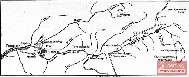
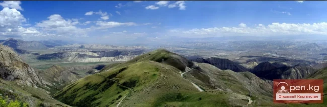
Koksu Ridge
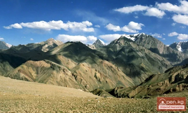
Located in the Western Tien Shan, on the border of Kyrgyzstan and Uzbekistan. Its length is about 70 km, with average heights around 2000 m. It bounds the valley from the southeast, through which the Koksu River flows into the Charvak Reservoir.
Here is how V.N. Popov describes the Koksu Ridge in his book: "Western Tien Shan".
At the headwaters of the Ichna River, a parallel ridge, the Koksu Ridge, branches off from the Pskem Ridge, stretching nearly 60 km. Between the ridges flows the Koksu River, which now enters the Charvak Reservoir near the village of Burchmulla.
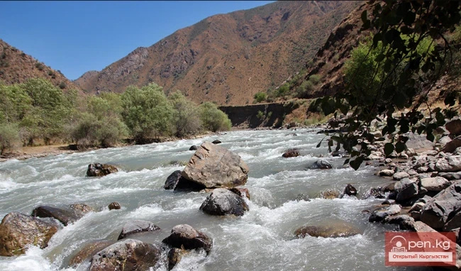
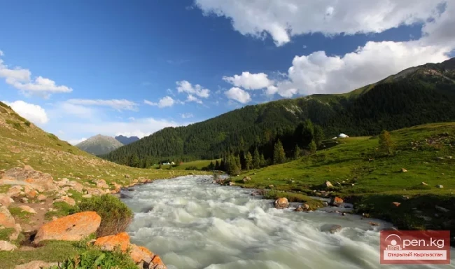
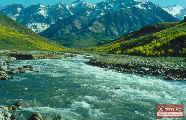
The slopes of both ridges facing the river are extremely steep and rocky, often almost vertical. Therefore, the Koksu flows in a deep gorge and is more than half impassable along its bed. Tourists from Tashkent were able to traverse the entire gorge in October when there was very little water, and in some places, they used... inflatable mattresses.
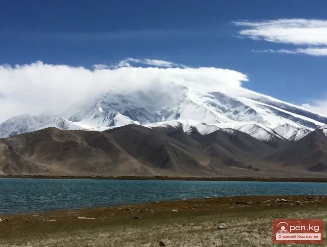
In some places, the valley is blocked by debris, forming four lakes. The most recent blockage occurred in the spring of 1969.
From the source to the Ayryk area, the Koksu Valley resembles a string of beads: sections expanded to half a kilometer alternate with narrow gorges carved by the river. This part of the river is rarely visited by tourists.
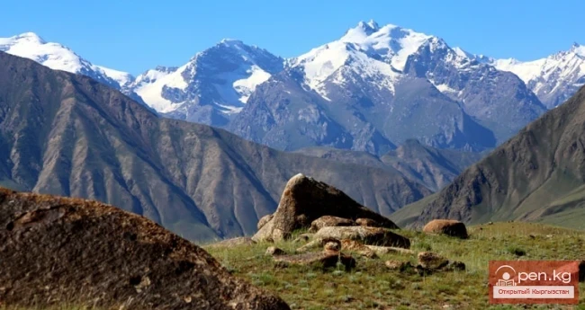
Here are the highest points of the Koksu Ridge - the peaks of Akhtash (3482 m) and Kazanbulak (3369 m).
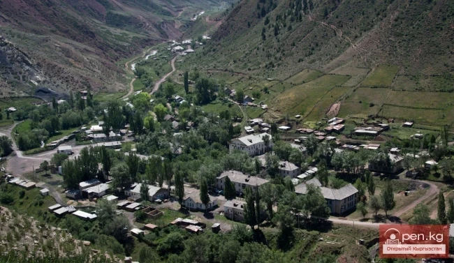
The Ayryk area is located near the confluence of the river of the same name into the Koksu (elevation - 1500 m). Here, in the shade of birches, poplars, and thawing snow, stand several houses, a large pen for livestock, and a number of beehives a little further away.
7-8 km from the area, a large tributary, Mynzhilki, flows into the Koksu from the right. Halfway along this distance, one can see the remnants of a lake formed in 1969. A huge landslide blocked the riverbed at that time, but over time, the water washed away the dam.

Below Mynzhilki, the trail rises far from the riverbed and then steeply descends to a grove where tourists usually camp for the night. Here, the Koksu is flanked on both sides by vertical cliffs 20-25 m high. The short canyon is no more than 5 m wide. But due to its great depth, the water flows calmly. This beautiful place is called the "gorge." Immediately after the "gorge," the riverbed widens, and it is possible to cross it by wading when descending from the crest of the Koksu Ridge.
Below the "gorge," the trail passes by large and small right tributaries of the Koksu: Zambat, Korumtor, Takhtor, Zakhtan, and others. The trail frequently ascends to the next foothill, only to descend to the river where birch groves mixed with poplars, and occasionally hawthorn and plum trees, spread out. The left bank of the Koksu is poor in tributaries, and most of them dry up in summer. The largest of the left tributaries is Sebak.
Soon the trail approaches the mouth of Chavatasai. From here, it is only 5-6 km to Burchmulla. The trail runs along scorched slopes far from the water, crosses the low-water Ustarasai, and merges with the road. Opposite, one of the few left tributaries, Kulasyai, flows into the Koksu. From Burchmulla, a regular bus can take you back to Tashkent.
Usually, tourists ascend along the Koksu when they need to traverse the crest of the Pskem Ridge up to the Arzanov Pass or when they are hiking the "Alyam Ring" through the Alyam Pass. Other passes of the Koksu Ridge are better approached from the side of Chatkal.
What do the slopes of the Koksu Ridge descending to Chatkal represent? First of all, it should be noted that from the southwest of the Koksubashi-P Pass to the Alyam Pass, the ridge has not been traversed by tourists. There were, however, attempts at one-way ascents from Chatkal, but most of them ended unsuccessfully.
Below the village of Akhtash, where a bridge crosses Chatkal, a poorly defined trail runs along the right bank of the river, sometimes disappearing. A good trail appears much lower down Chatkal, almost at the Nayzatugai area. Another trail descends to this area from the Alyam Pass, which we will describe before continuing our journey along Chatkal.
Above the Ayryk area, a bridge crosses the Koksu. From there, the trail leading to the Alyam Pass begins. It rises gently, goes through thickets of trees and bushes, crosses streams, and in spring and early summer - snowfields, and reaches the saddle. The entire ascent from Koksu to the Alyam Pass (2000 m, I A) takes approximately 2 hours.
From the ridge, there are two paths leading to Chatkal. The shorter trail descends to the right, bypasses the peak of 2200 m, and through the Joshosai gorge reaches the river 2 km above the Nayzatugai area.

The second path is longer (about 20 km), more difficult, but more interesting. To the left of the pass, a foothill descends, behind which lies the Kalibek River gorge. After 5 km, a 10-meter waterfall is encountered, which can be passed with the help of a rope. From here, it takes another hour to reach the Myntukum area on the right bank of Chatkal and 2 hours of walking to Nayzatugai.
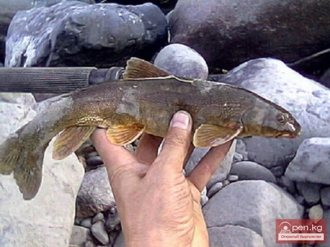
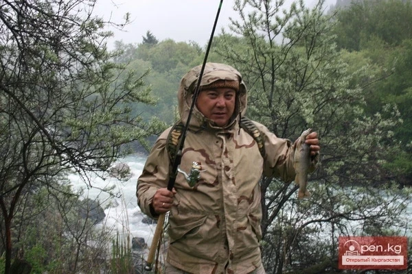
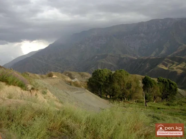
The surroundings of the area are picturesque. In the shade of trees (birch, tal, poplar, walnut, plum, apple, hawthorn), there is a small house where hydrologists lived. The marinka fish is well caught in Chatkal. Here, a cable with a suspended cradle is thrown across the river.
If you go down Chatkal, after 4 km you will encounter a new bridge over the river, nearby a cable with a cradle, and on the opposite bank - the village of Arob. On the right bank is the Olmayurt apiary. Before reaching it, the trail crosses a small right tributary of Chatkal - Maydanak. At the headwaters of the tributary is the Yanterek Pass (2400 m, I B). The ascent to the pass is complicated by the absence of trails, dense thickets of thorny bushes, significant elevation changes, and steep rocky slopes just before the ridge. The descent, similar to the ascent, leads without any trails to the Koksu near the "gorge."
2 km below the Olmayurt apiary is the Chopakmysh apiary. From it, the trail leads to the crest of the Koksu Ridge, to the Komarov Pass (2400 m, I B). Traversing the ridge here resembles crossing the Yanterek Pass. Only the descent to the Koksu is easier, as in some places the trail is visible, especially in the valley of the Sebak River. 2 km to the west is the Chopakmysh Pass, which the trail to the Komarov Pass leads to.
4 km below Chopakmysh, the trail leads to the Khargush area. There is also an apiary here. Khargushsai is larger than other tributaries of Chatkal in this area. The path reaches the confluence of the tributaries and disappears. From here, you need to ascend the left tributary, right along the stony riverbed, next to the water, sometimes crossing the river by wading or over stones. In some places, you will have to pass small waterfalls until you reach a new fork of the tributary (about 5 km from its mouth). Here, there is a noticeable landmark - a huge light stone, above which you need to go to the foothill that separates the tributaries. A little higher, a trail appears. On the foothill, huge junipers grow, and the trail rises along the slope of this foothill and leads to the Babayulgen Pass (2575 m) after 4-5 km.
To the right along the ridge, the trail goes into the Sebak tributary, the Yanterek area, and further to the Koksu River. This trail is poorly visible in many places, as it is rarely used. From the pass, the gloomy canyon of Kulosi is barely visible. Another trail leads to the left, to the Kungurbuka Pass (2498 m). Crossing both passes - in any order and direction - is rated I B.

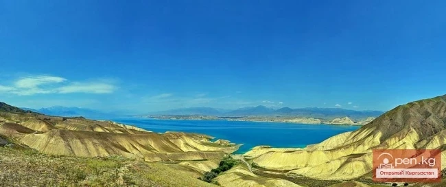
After passing the last pass, the trail reaches the right bank of the Paltasai. Along the way, you will encounter junipers, below - deciduous trees, a lot of rosehips and blackberries. In the birch grove area to the right, through a small pass, the trail goes into the Kulosi gorge, to the left - to Chatkal. In the valley of Paltasai, below the village, there is a cave of primitive man, where archaeologists conducted excavations for several years. Nearby is a damp gloomy gorge, where a stream falls from almost forty meters high. After an hour of walking, the trail leads to the road, and the road leads to the bridge over Chatkal; from here, the Charvak Reservoir is already clearly visible.
V.N. Popov. Book: "Western Tien Shan"
The ridge is located in the territory of the Tashkent region of Uzbekistan and the Jalal-Abad region of Kyrgyzstan. At the border of Uzbekistan and Kyrgyzstan is the Alyam Pass (~2000 m), which was once part of the popular tourist route "Alyam Ring." Currently, this tourist route does not exist due to its passage through the border.
Coniferous-broadleaf forests, juniper woodlands, and alpine meadows prevail.
The highest points of the Koksu Ridge are the peaks of Akhtash (3482 m) and Kazanbulak (3369 m), located in the upper, northeastern part of the ridge.