Ak-Sai Valley

admin Pastures and valleys
VK X OK WhatsApp Telegram
Ak-Sai Valley

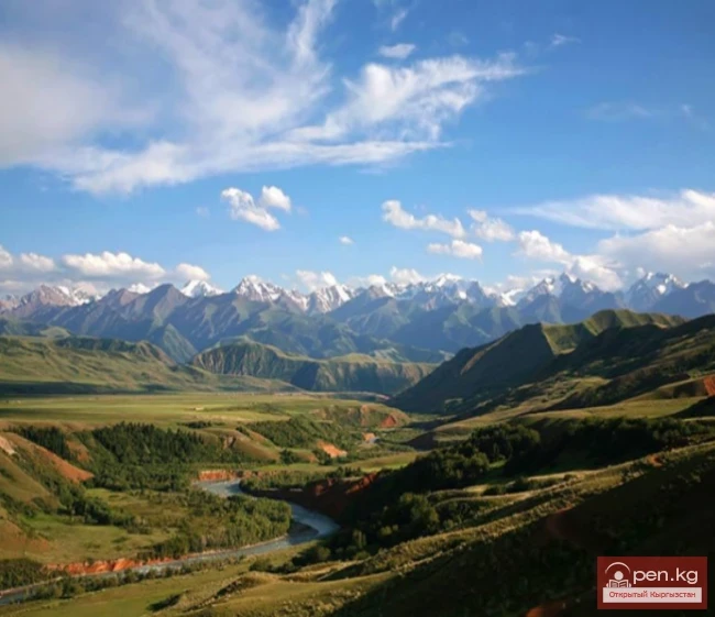
Ak-Sai Valley - the Kyrgyz Pole of Cold


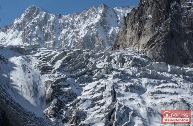
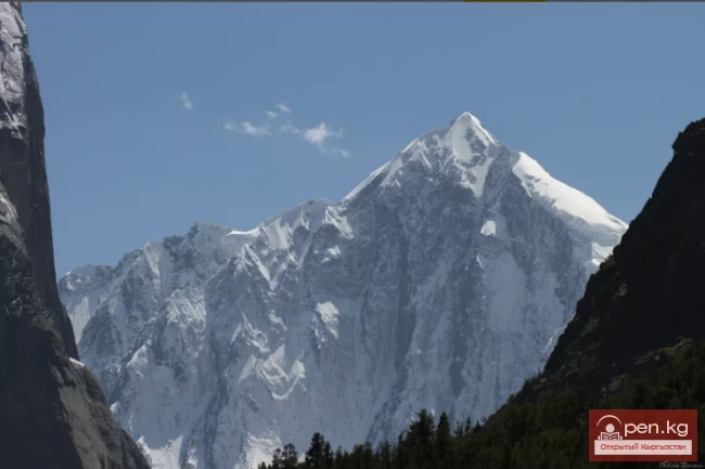
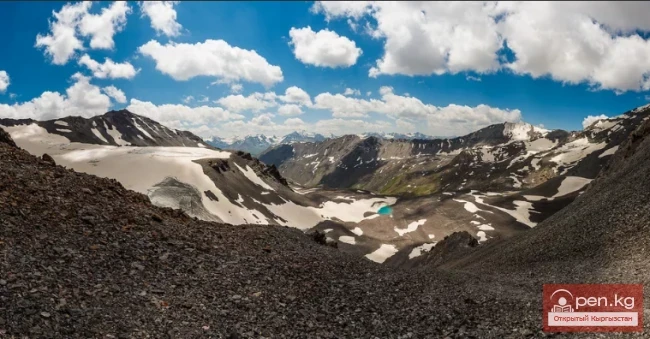
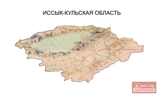
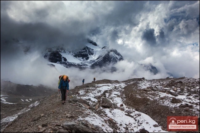
Located in the south of the Naryn region, it is bordered to the north by the At-Bashinsky and Jangi-Jer ridges, and to the south by the so-called Kak-Shaal-To ridge, specifically its western part. The state border with the People's Republic of China runs along the Kak-Shaal-To ridge. The Ak-Sai Valley itself is a wide high-altitude valley stretching from the southwest to the northeast. The valley floor rarely drops below 3000 meters above sea level, sometimes reaching nearly 4 kilometers in height in its upper reaches. The highest point of the Kak-Shaal-To ridge within the Ak-Sai Valley is the inaccessible peak at 4960 meters, located on the border with China.
Ak-Sai Valley

The climate of the valley is sharply continental. Frequent night frosts in summer are followed by a significant rise in temperature during the day. The valley is a kind of Kyrgyz pole of cold. The minimum temperature recorded here during observations has dropped to -56 degrees Celsius. At the same time, the maximum summer temperature reaches +33.
Ak-Sai Valley

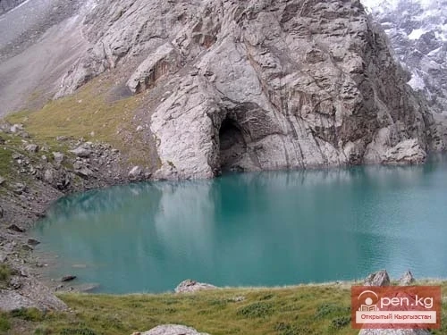
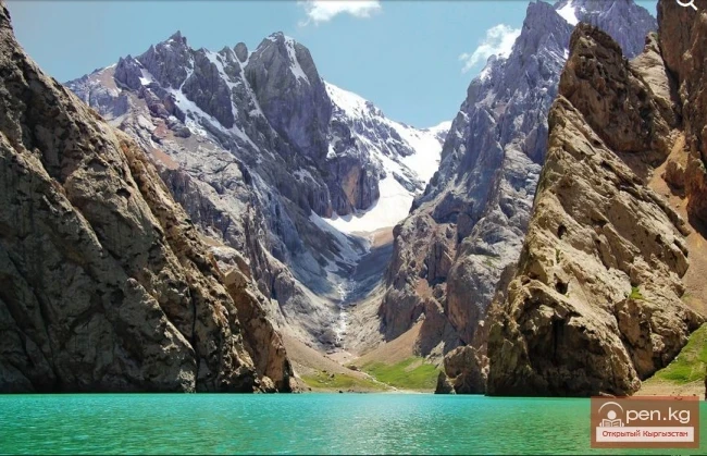
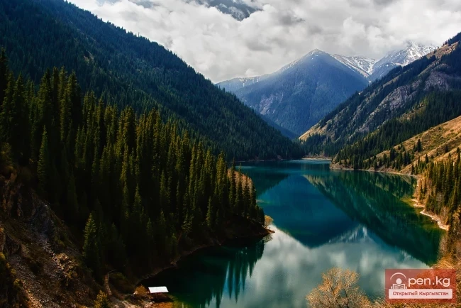
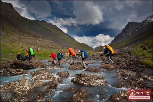
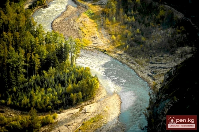
The valley is covered with short but very dense grass, abounding in small marshes and lakes, with huge boulders scattered throughout the valley. It is constantly windy and sunny here. The main rivers of the valley are Ak-Sai, Mydyryum, and Kyok-Kiya, which merge to form the river Kakshaal, cutting through the Western Kak-Shaal-To ridge and, after merging in China with two other rivers, Uzyongyu-Kuush and Sary-Jaz, which have also carved their way through this ridge in its central and eastern parts respectively, carry their muddy waters into the Tarim River. The Ak-Sai River is abundant in water, flows in a wide channel, often branching off, and has many tributaries. It does not belong to the Naryn basin.
Ak-Sai Valley

The valley is home to many birds: snow sparrows, red-breasted flycatchers, masked wagtails, saker falcons, ruddy shelducks, common kestrels, mountain larks, sandpipers, bearded vultures, black vultures, bearded vultures, and golden eagles.

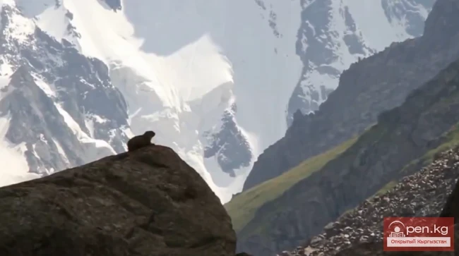
Among mammals are marmots, argalis, Siberian ibex, snow leopards, wolves, and also the snow leopard.
Ak-Sai Valley

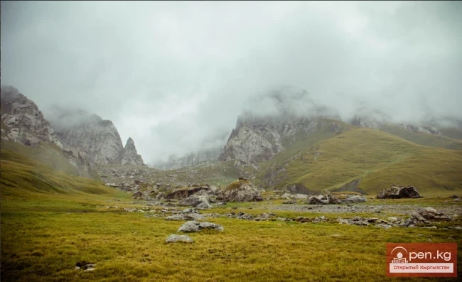
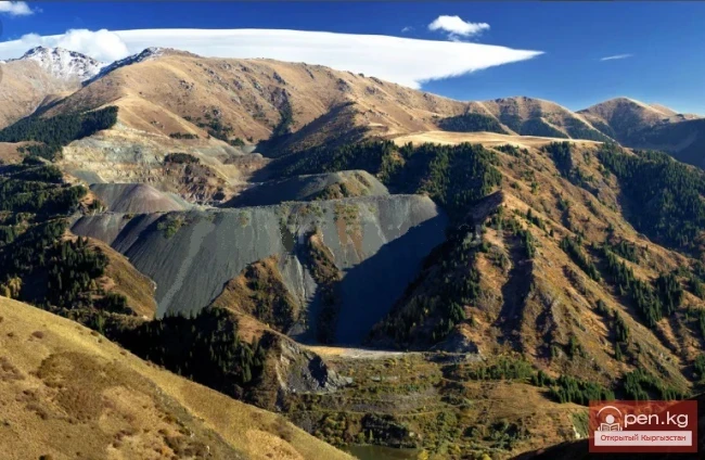
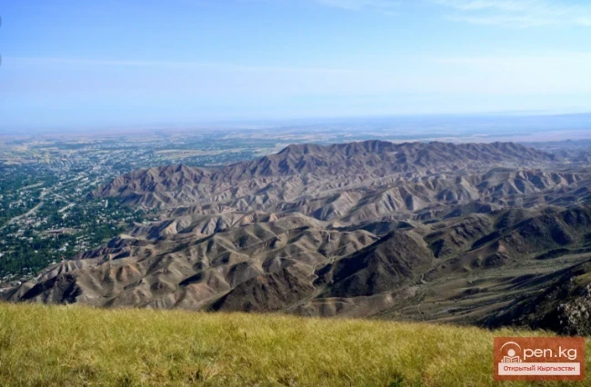
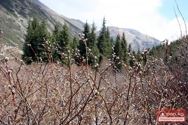
The Ak-Sai Valley represents a high-altitude hilly plain with small elevation changes (up to 100-150 meters). The average height of the ridges in this area is 3200-3300 meters. Due to the lack of moisture, vegetation is not very abundant. Only in some places are there patches of tall grass, with hidden unevenness.
Ak-Sai Valley

Additionally, in the valleys of the streams in the depressions, small marshy areas are sometimes found. These marshes are quite picturesque, where flocks of ruddy shelducks and sandpipers can be seen. In winter, such marshes become a "death trap" for argalis. Wolves, gathering in winter packs, drive the flock of argalis onto the ice of frozen marshes, where the "wolf work" begins...
Ak-Sai Valley

There is a settlement of ancient humans from the Neolithic period here.
VK X OK WhatsApp Telegram

Read also:

Zone "Chatyr-Kel"

Zone "Chatyr-Kel"

The Chatyr-Kel Zone includes a significantly elevated intermountain basin with a lake of the same...

Diving at Lake Kol-Suu

Diving at Lake Kol-Suu

Geographical Information: The lake is located in the Naryn region, Ak-Sai valley, on the border...

Suusamyr Valley

Suusamyr Valley

The length of the valley is 155 km. It is bordered on the north by the Kyrgyz Ala-Too, on the...

Valley of Kok-Kiya

Valley of Kok-Kiya

Rocky Canyons of the Kok-Kiya Valley Kyrgyzstan is rich in beautiful and unique places. In the...

Komarov Glacier

Komarov Glacier

Komarov Glacier (Ak-Sai), Kokshaalsky Ridge The first survey of the glaciation in this area was...

Terskey Alatoo Ridge

Terskey Alatoo Ridge

Terskey Alatau The Terskey Alatau Ridge is very beautiful in its variety of landscapes. In one...

Lake Köl-Suu

Lake Köl-Suu

Lake Köl-Suu translates as "coming water" The lake is located in the Naryn region,...

The Valley of Chichkan

The Valley of Chichkan

The Chichkan River flows from the north into the Toktogul Reservoir. It is a small river with...

Zhalay Range

Zhalay Range

Zaalai Ridge A ridge oriented in a latitudinal direction, separating the Pamir and the Alai...

Kuylytau Ridge

Kuylytau Ridge

Kuylytau A mountain range in the Central Tien Shan, in Kyrgyzstan. It is located between the...

"Suusamyr Zone"

"Suusamyr Zone"

The Suusamyr Zone includes the eponymous high-altitude valley stretching 155 km. To the north, it...

Inner Tian Shan

Inner Tian Shan

It is precisely about this region that famous travelers such as Semenov-Tian-Shansky, Mushketov,...

River Karakulja

River Karakulja

Karakulja The Chatkal River in its upper reaches is called Karakulja (translated - Black Ram),...

"Orto-Tokoy Zone"

"Orto-Tokoy Zone"

The Orto-Tokoy Zone encompasses the territorial foothills at the western end of the Terskey...

Valley of Ak-Tyuz

Valley of Ak-Tyuz

Ak-Tyuz - "White Valley" The Ak-Tyuz Valley is located on the southwestern slopes of the...

Zailiysky Alatau Ridge

Zailiysky Alatau Ridge

Zailiyskiy Alatau A mountain range in the northwest of the Tian Shan (on the border of Kazakhstan...

Naryn-Too Ridge

Naryn-Too Ridge

Naryn-Tau The area is hard to access and rarely visited. Due to the low glaciation and modest...

River Ak-Suu

River Ak-Suu

The main channel of the Ak-Suu River is at least 20-22 kilometers long. The lower part of the...

"Chon-Kemin Zone"

"Chon-Kemin Zone"

Chon-Kemin Zone includes the valleys of the Chon-Kemin and Kichi-Kemin rivers between the high...

Turkestan Range

Turkestan Range

Turkestan Range A high mountain range oriented in a latitudinal direction, approximately 340 km...

Small Naryn

Small Naryn

Small Naryn encompasses the valley of the river of the same name, located between the ridges of...

Kainyndy Glacier

Kainyndy Glacier

Kainy Between Kokshaal-Tau and Kainy-Katta lies the powerful Kuyakap Glacier, and between...

Fergana Valley

Fergana Valley

The Fergana Valley is popularly known as the "pearl" due to its rich oasis. The Fergana...

The Ridge of Inylchektau

The Ridge of Inylchektau

Inylchektau A mountain range in the Central Tien Shan in Kyrgyzstan. It is located in the basin of...

River Kyzyl-Suu

River Kyzyl-Suu

Kyzyl-Suu (Kyzyl-Suu River, Красная река) - a river in Kyrgyzstan and Tajikistan, the right source...

Rivers of Kyrgyzstan

Rivers of Kyrgyzstan

The formation of runoff and the hydrographic network in the territory of Kyrgyzstan is greatly...

Chuy Region

Chuy Region

The Chuy Region was established on December 14, 1990. Until 1939, various...

Kyrgyz Ridge

Kyrgyz Ridge

Kyrgyz Mountain Ridge A mountain range that borders the Chuy Valley and the Moyunkum Desert to the...

Open Kyrgyzstan

Open Kyrgyzstan

Nature of Kyrgyzstan Video recordings made in the area of the Terskey Alatau range, at Lake...

Issyk-Kul Region

Issyk-Kul Region

The Issyk-Kul Region is located in the eastern part of Kyrgyzstan. It was established on November...

Zone "Tar"

Zone "Tar"

The "Tar" zone includes the valley of the river of the same name and its tributaries. In...

Meridional Ridge

Meridional Ridge

Meridional Ridge The main nodal uplift of the Central Tien Shan on the border of Kyrgyzstan and...

Kek-Art

Kek-Art

The "Kek-Art" Zone encompasses the surroundings of the city of Jalal-Abad, as well as...

Talas Ridge

Talas Ridge

Talassky Ala-Too A mountain range located in the Western Tien Shan system. Most of it is situated...

Kara-Suu

Kara-Suu

The "Kara-Suu" Zone is located in the eastern part of the southern slope of the Chatkal...

Kungey-Alatau Ridge

Kungey-Alatau Ridge

Kungey-Alatau To the south of the Zailiysky Alatau, beyond the deep longitudinal valleys of the...

Write a comment: