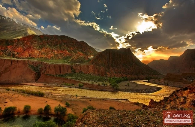
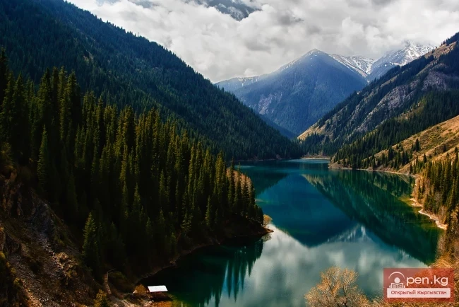
The formation of runoff and the hydrographic network in the territory of Kyrgyzstan is greatly influenced by the orographic structure and relief, climatic conditions, and the presence of glaciers. The mountain ranges of Kyrgyzstan act as barriers to moist air masses coming from the west, northwest, and north, and serve as natural accumulators of atmospheric moisture. The leading ridges and their corresponding slopes are better supplied with moisture than the opposite eastern, southeastern, and southern slopes. The distribution of atmospheric precipitation and river networks in the territory depends on the location of a particular area in relation to moist air masses and follows the patterns of altitude zonation. Most river systems belong to the Aral Sea basin, particularly the major rivers of Central Asia — the Syr Darya and Amu Darya. The basins of the Chui and Talas rivers, although part of the Aral basin, do not contribute their waters to the main water arteries and, together with the basin of Lake Issyk-Kul, form a closed hydrographic system. The southeastern part of the republic is the area of runoff formation for the Tarim River — a water artery of Western China, while a small area of the Karkyra River basin belongs to the basin of Lake Balkhash. Based on the nature of the water balance and the genesis of runoff, the territory of the republic is divided into two hydrological areas — the area of runoff formation and the area of runoff dispersion. The area of runoff formation is characterized by a positive water balance; these territories are the least affected by modern anthropogenic impacts. Here, the inflow of atmospheric moisture exceeds evaporation, and natural conditions are favorable for the formation of surface runoff. The area of runoff dispersion is located below the area of runoff formation, at the foot of the mountains and in the foothill valleys. Atmospheric precipitation is significantly less than on the mountain slopes, while evaporation, on the contrary, is greater. Therefore, the formation of surface runoff is limited and, in some places, absent. Moreover, runoff formed in the mountains is lost as it passes through these territories, seeping into loose deposits of foothill fans and plains, and is also diverted for irrigation. In the foothill plains, groundwater approaches the earth's surface and sometimes emerges at the surface as descending springs. Springs, in turn, contribute to the feeding of rivers. Groundwater outflows, sometimes in significant quantities, create independent streams, known as "kara-suu." For example, the Red River near the city of Tokmok is exclusively fed by groundwater.

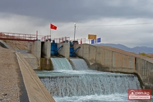
The area of runoff formation occupies 171.8 thousand km² of the territory of Kyrgyzstan, i.e., 87%, while the area of runoff dispersion covers only 26.7 thousand km² or 13%. Most of the area of runoff dispersion for major rivers is located outside the territory of Kyrgyzstan. Rivers in the area of runoff formation are generally characterized by rapid flow, steep longitudinal profiles, and significant reserves of potential energy. In the upper reaches, river gradients reach 100—200‰ (per mille) and gradually decrease to 20-30‰ towards the mouth and on the plain.
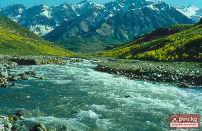
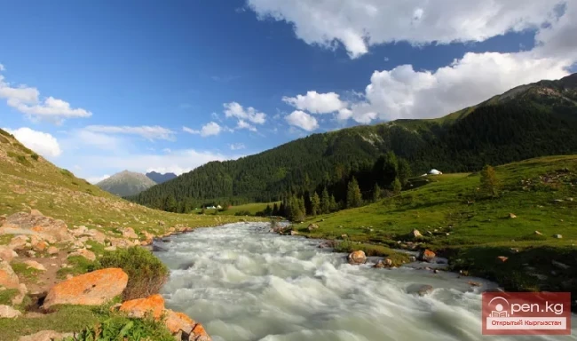
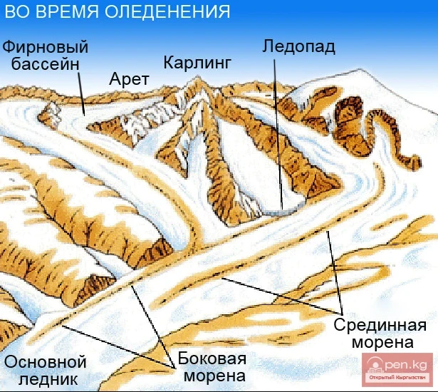
In the territory of Kyrgyzstan, 2044 rivers and streams longer than 10 km are formed, with a total length of about 35 thousand km. The main supply of rivers comes from melting snow and glacial waters, which account for up to 80%. Rainwater constitutes a minor part of the supply. The role of rainwater somewhat increases in the feeding of rivers on the southwestern slopes of the Fergana and northwestern slopes of the Chatkal mountain ranges. Flooding in the rivers of Kyrgyzstan mainly occurs in the spring-summer period due to melting snow and glacial waters. Rain floods and floods are possible on the Kögart, Kara-Kulja, and on the tributaries of Chatkal. Maximum runoff is observed due to the rapid melting of snow and ice in summer, due to the periodic bursting of high-altitude lakes, and torrential rains in the spring period. The maximum runoff module reaches 300—400 l/sec km². Sometimes maximum runoff turns into mudflows. Mudflows are a characteristic phenomenon for the Western Issyk-Kul region and for the slopes of the Fergana range.

Rivers.
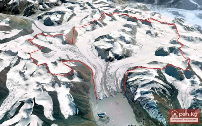
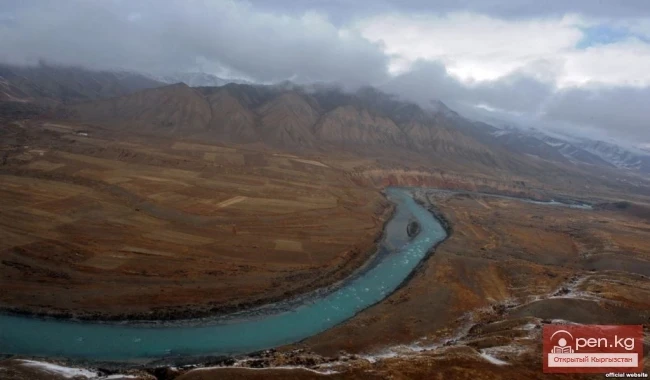
The largest river in Kyrgyzstan is the Naryn, the main component of the Syr Darya, belonging to the Aral basin. Its length within the republic is 535 km, and the basin area is 53.7 thousand km², formed by the confluence of the Big and Small Naryn (44 km east of the city of Naryn). The source of the Big Naryn and the entire system is the Kum-Tör River, which flows from the Petrov Glacier in the Ak-Shiyrak mountain knot. Kum-Tör, after merging with the Ara-Bel River, under the name Taragay, heads southwest and merges with the Karasay River, which also originates from Ak-Shiyrak. From the confluence of these rivers (Taragay and Karasay), the Big Naryn is formed. The source of the Small Naryn is the Burkhan River, which begins from the glaciers of Mount Chymchyk in the southern spur of the Teskey Ala-Too. Flowing through a narrow valley to the west, Burkhan receives a large tributary, Archaly, from the left and then, under the name Balgart, merges with the next left tributary, Zhylyanach, and already under the name Small Naryn flows into the Big Naryn. The Naryn River, flowing through the Middle-Naryn, Toguz-Toro, and Ketmen-Töbön basins, cuts through the Fergana range and exits into the Fergana basin. Merging outside of Kyrgyzstan with the Karadarya River, the Naryn forms the second-largest river in Central Asia — the Syr Darya. Major tributaries of the Naryn include On-Archa, Kazhyrty, At-Bashy, Kökömeren, Chychkan, Uzun-Akmat, Alabuga, Kök-Irim, and others.
The Naryn and its tributaries, according to V.L. Shultz's classification, are classified as rivers of snow-glacial feeding with flooding in the summer. The beginning of the flood season is at the end of May, and it ends at the beginning of September.

Kara-Darya is formed by the confluence of the Tar and Kara-Kulja rivers. Its length, including the main component (the Tar River), is 177 km, and the basin area is 12.4 thousand km² (within Kyrgyzstan). Major tributaries include Jazy, Kögart, Kara-Unkyur (Tentek-Say), Kurshab, Ak-Buura, Aravan-Say, and others. Merging with the Naryn River, it forms the Syr Darya. Within the Fergana Valley, numerous rivers flow from the surrounding ridges, many of which do not reach the Syr Darya due to water diversion for irrigation. Major rivers flowing from the Alaï and Turkestan ranges include Isfayram-Say, Sukh, Isfara, Kozho-Bakyrgan, Ak-Suu (Sardala). From the Chatkal range flow the Gava-Say, Pachata, Kasan-Say, and others. The rivers flowing from the northwestern slope of the Chatkal range, including the Chatkal River and its tributaries, belong to the Chirchik basin.
The rivers of the Fergana Valley are predominantly fed by snow and rain, and flooding occurs in spring and summer. Many rivers have a small weighted basin height but a fairly high runoff module — 14—23 l/sec km². Spring-summer floods are characteristic of the rivers on the northern slope of the Alaï and Turkestan ranges. The rivers of the Chatkal range are mainly fed by melting snow waters, with flooding starting in May and ending in late June. Some small rivers dry up in summer. The water yield of the basin territory is 5—6 l/sec•km². In the foothills and valleys of the Fergana Valley, temporary watercourses are developed, where water appears in spring during snowmelt or during torrential rains. Sometimes they turn into mudflow streams. The rivers of the Alaï Valley belong to the Amu Darya basin. The main water artery of the Alaï Valley is the Kyzyl-Suu River, which is a tributary of the Vakhsh River. Its length within Kyrgyzstan is 222 km, and the basin area is 7680 km². It begins at the confluence of the Ailama and Kara-Suu rivers. Major tributaries include Kyzyl-Agyn, Altyn-Dara, Achiq-Tash, Kaman-Suu, Kök-Suu. The main sources of water supply for the rivers are melting glacial and snow waters. Flooding occurs in summer, with an average long-term discharge at the exit beyond the republic being 56.5 m³/sec.

The largest river in Northern Kyrgyzstan is the Chui River, with a total length of 1030 km. Of these, 260 km passes through the territory of Kyrgyzstan. The basin area is 67.5 thousand km², of which 22 thousand km² is within Kyrgyzstan. The average long-term discharge, after merging with the Chon-Kemin River, is 53 m³/sec, and at the border with Kazakhstan, it is 71 m³/sec. The river begins in the Kochkor Valley from the confluence of the Joon-Aryk and Kara-Kuzhur rivers and initially flows into the western part of the Issyk-Kul basin, then, cutting through the Boom Gorge, exits into the Chui Valley. Major tributaries include Chon-Kemin, Kichi-Kemin, Kyzyl-Suu, Shamsy, Kegeti, Issyk-Ata, Alamyudun, Ala-Archa, Ak-Suu, Karabalta, and others.
The water regime of the rivers in the Chui basin is not uniform. Up to the Orto-Tokoy Reservoir, the rivers are formed in one climatic condition, and after it — in another. In the upper reaches, the rivers have a low runoff module (4—5 l/sec•km²) due to the arid climate and intermountain position, while the rivers on the northern slope of the Kyrgyz range have an increased basin water yield (11—20 l/sec•km²). The river with the highest runoff module is the Ala-Archa River (20 l/sec•km²). The rivers on the northern slope of the Kyrgyz range and the Chon-Kemin River primarily receive their supply from melting glacial and snow waters. Flooding is noted in the summer. Their average weighted heights are within 3000—4000 m.

The basin of the Talas River occupies the valley of the same name entirely. The source of the river is considered to be the confluence of the Karakol and Uch-Koshoy rivers, from where it flows through a wide valley (up to 15 km) to the village of Kara-Buura, receiving left tributaries: Kalba, Beshtash, Urmaral, Kümüştag, Kara-Buura, and others. On the right, it receives tributaries — Kenkol and Nylды. The left tributaries are fed by melting snow and glacial waters, while the right ones are exclusively fed by snow waters. Flooding occurs in the summer. In the upper reaches, the Talas River has an average discharge of about 15 m³/sec, while at the Kirov Reservoir, it is 33 m³/sec. In the lower reaches, it is diverted for irrigation and is lost in the sands of Moyun-Kum in Kazakhstan.
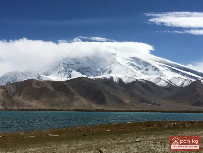
The southeastern part of the territory of Kyrgyzstan is occupied by rivers belonging to the Tarim basin — Sary-Jaz, Uzgönchü-Kuush, Ak-Say (Kakshaal), and East Kyzyl-Suu. The catchment area of all these rivers is located at elevations above 3500 m. The largest river in the Tarim basin is the Sary-Jaz, fed by glacial and snow waters in the area of Peak Pobeda and Khan-Tengri. The river starts from the Semenov Glacier under the name Kashka-Tor, and outside of Kyrgyzstan, it is called Ak-Suu. Its length within Kyrgyzstan is 167 km (total length 282 km), the basin area is 12900 km², and the average long-term discharge is 140 m³/sec. Major tributaries include Enilchek, Kainy, Koy-Kan, Zhaman-Suu, Küyme, Uch-Köl, Ak-Shiyrak, and others. By catchment area, the second place after Sary-Jaz is occupied by the Kakshaal River, which is formed by the confluence of the Ak-Say and Mydyryum rivers. The basin area within Kyrgyzstan is 7854 km², and the average long-term discharge is 32 m³/sec. Between the basins of the Sary-Jaz and Kakshaal rivers lies the catchment area of the Uzgönchü-Kuush River, which flows into the Kakshaal River outside of Kyrgyzstan. Its length to the border is 83 km, and the basin area is 2880 km². It begins at the confluence of the Kotor and Sary-Chat rivers. Major tributaries include Kichi-Uzgönchü-Kuush, Chon-Terek, Kichi-Terek, and others. Kyzyl-Suu (Eastern), one of the sources of the Kakshaal River, originates from the glaciers of the eastern part of the Chon-Alaï range. From the southern slope of the Alaï-Kuu range flows a large left tributary, which, after merging, heads east and leaves the republic's borders. Its length to the border is 33 km, and the average long-term discharge at the border is 28—30 m³/sec. The supply is mainly glacial-snow.

The rivers of the Tarim basin are fed by glacial-snow waters. Some rivers, like Enilchek and Kainy, are purely glacial. Flooding occurs in the summer. Rivers of glacial feeding have increased runoff (9—17 l/sec•km²). Where glaciers occupy a small area, the runoff is reduced (2—3 l/sec•km²).
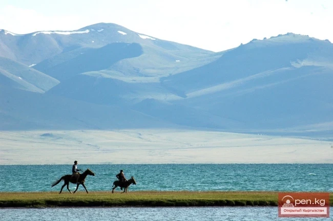
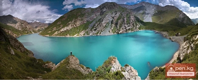
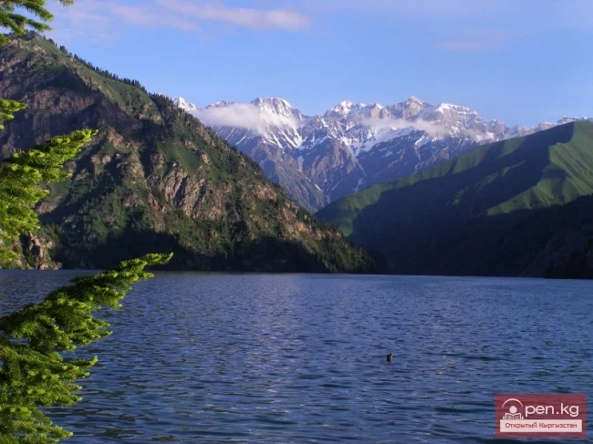
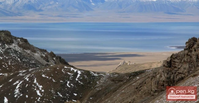
Around 80 rivers and streams flow into the closed Lake Issyk-Kul from 118 independent watercourses forming on the slopes of the Teskey and Kungey Ala-Too. The largest of them, the rivers Tyup and Jyrgalan, are located in the eastern part of the Issyk-Kul basin. Both originate from the northern slope of the Teskey Ala-Too and initially flow north, then turn west and flow into the lake. Major tributaries of Tyup include Ken-Suu, Chon-Tash, Taldy-Suu, and others; of Jyrgalan include Turgenev-Ak-Suu, Ak-Suu, and others. Other notable rivers flowing into the lake include Karakol, Jeti-Oguz, Chon-Kyzyl-Suu, Juu-Ku, Barskon, Chon-Ak-Suu, and others.
Most of the major rivers in the Issyk-Kul basin are of snow-glacial feeding, with flooding occurring in the summer.
The Balkhash Lake basin includes a small catchment area of the Karkyra River in the eastern part of the country. The length of the river within Kyrgyzstan is 69 km, the catchment area is 572 km², and the average long-term discharge is 15 m³/sec, with a runoff module of 8.5 l/sec•km².

Research in the basin of the Chon-Kyzyl-Suu River, as well as analyses by hydrologists of rivers in other regions of Kyrgyzstan, show that the high mountain zone located above 3200—3300 m above sea level plays the most significant role in the formation of runoff for many rivers. This zone typically concentrates glaciers and snowfields. Researchers (M. Bolshakov) have termed this zone the active zone of the runoff formation area. From this zone to lower elevations, the water yield of the territory decreases and reaches its minimum value in the foothill plains. For example, the active zone of the runoff formation area for the Chon-Kyzyl-Suu River constitutes 30% of the catchment area and provides, on average, 80% of the annual runoff. The identified patterns of runoff distribution according to vertical zonation in the basin of the Chon-Kyzyl-Suu River can be considered typical for rivers of glacial-snow feeding.
According to V.L. Shultz's classification, the rivers of Kyrgyzstan are divided into four types: glacial-snow feeding, snow-glacial feeding, snow feeding, and snow-rain feeding. Most rivers are of snow-glacial feeding. A characteristic feature of such rivers is a prolonged flood season in the summer and low water levels in the cold part of the year. For rivers of snow and snow-rain feeding, flooding occurs in spring, and low water levels begin in summer.

Kurshab River
Kugart River
Isfara River
Chatkal River
Aspara River
Isfayram River
Kekemeren River