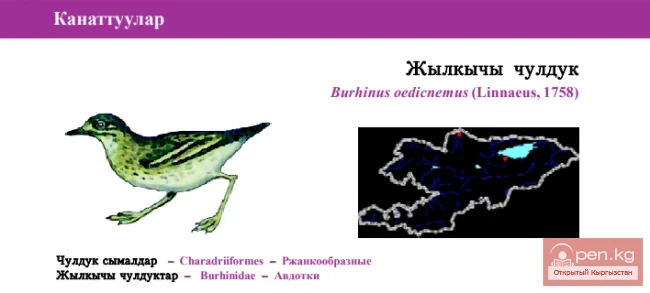
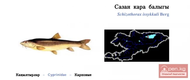
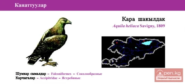
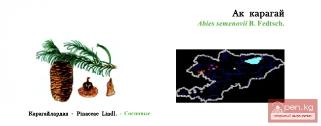
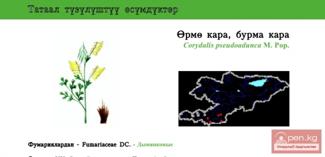
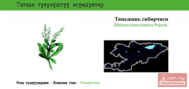
Mountain Passes of Issyk-Kul Region
San-Tash Pass (height 2195 m) is located in the Issyk-Kul region and stretches from Tyup to Jirgalen, in the eastern part of the Central Tien Shan. The road from the Issyk-Kul basin to Almaty (Alma-Ata) passes through San-Tash.

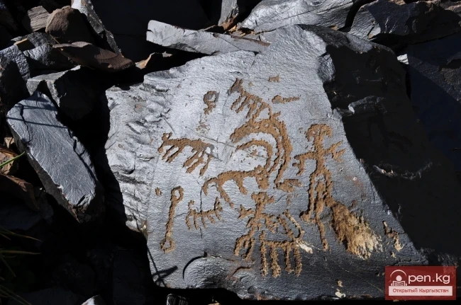
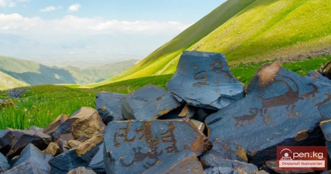
In the vicinity of the pass, there are numerous burial mounds dating back to the 7th-3rd centuries BC. A grand burial complex is located southwest of the beginning of the San-Tash Pass, at the foot of Adyr. The central feature of the complex is a large mound with a stone embankment, known as "San-Tash." Surrounding the burial site are mounds of other types: with earth, stone-earth, stone embankments, stone piles, and circular stone arrangements.
This pass is associated with one of the legends about Tamerlane. Before embarking on another campaign, the commander ordered each of his warriors to take a stone with them and then pile it up here.

Upon returning from the expedition, Tamerlane ordered each warrior to take a stone from the pile. The remaining pile became a monument to the fallen warriors. Indeed, stone mounds have been found at the pass, and the name itself translates as "counting stones."
To the south lies the Tyup State Zoological Reserve.
Chapchima Pass (height 2841 m) is located on the Chatkal Range in the Issyk-Kul region and stretches from Karakol to Enilchek. The Chatkal district has a single state road of national significance, Aala-Buka-Kanysh-Kiya, which is 152 km long, passing through the difficult mountainous terrain via Chapchima Pass and connecting the villages with the district center.

Kerege-Tash Pass (height 3684 m) is located in the Issyk-Kul region and stretches from Naryn to Barskoon. It was traversed by a group led by Isakov in 2002 and rated as 5KT. The Kerege-Tash Pass cannot be crossed dry - it is a watershed in a marshy valley.

Ala-Bash Pass is located in the Kongur-Olen Valley in the Issyk-Kul region and stretches from Balakchi to Bokonbaeva. The Ala-Bash Pass has an absolute height of 2366 m above sea level. It separates the Ala-Bash-Kongurleng depression, located to the east of the pass, from the Turasuy depression, extending to the west. A regional dirt road runs through the pass, connecting the two neighboring villages of Ala-Bash and Turasu, which are located 13 km apart. It is now possible to travel on it by car. However, thousands of years ago, caravans traveled here along one of the branches of the Great Silk Road, which were guarded by military units. The latter were stationed in fortresses and caravanserais along the trade route.