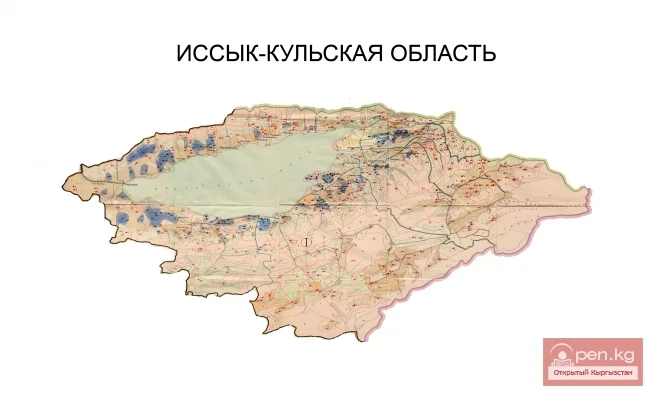
The Talas Region is located in the northwestern part of the Kyrgyz Republic. It was established on June 22, 1944. The region consists of 4 districts (Talas, Bakai-Ata, Kara-Buura, Manas), 1 city - Talas, and 90 villages, united into 35 ayil okmotu. It borders Kazakhstan to the northwest, Uzbekistan to the west, Jalal-Abad Region to the south, and Chui Region to the east. The area is 11.4 thousand square kilometers (5.7% of the republic's territory), with a population of 199.9 thousand (4.1% of the republic's population).
The Talas Valley is triangular in shape, marked by the Talas and Kyrgyz ranges, with the apex in the east (the Ak-Suu mountain knot). In the northwest, the valley expands and borders the semi-deserts and deserts of the Turan lowland. The region contains 281 glaciers (total area of 164.7 square kilometers), most of which are located on the northern slopes of the Talas range. The largest river, Talas, is formed by the confluence of the Uch-Koshoy and Karakol rivers, flowing west and disappearing into the sands of Muyunkum. There are few lakes in the region, the largest of which is Besh-Tash, of alluvial origin.
The climate of the Talas Region is dry continental. The average temperature in July is 15-25°C, and in January it is -6...-14°C. The frost-free period lasts 157-163 days. The average annual precipitation is 300-400 mm and increases from west to east, from the foothills upward along the slope. The summer is dry, and a permanent snow cover forms on the plain in December, and in the foothills in November.
The distribution of vegetation is subject to altitudinal zonation. At an altitude of 700-1200 m, desert vegetation predominates, with sagebrush being the most common. Steppe and meadow-steppe vegetation prevails at altitudes of 1300-2800 m. About 120 species of plants from this zone grow in the valley. On the steep slopes of the mountains at altitudes of 2800-3200 m, there are forests of spruce, juniper, and fir (Besh-Tash, Urmaral, Kalba). On the northern slopes of the mountains (2600-3800 m), there is a realm of subalpine and alpine meadows. Meadow vegetation forms small massifs (Besh-Tash, Kyumyushtak, Nylldy, Uch-Koshoy). High-altitude alpine steppes occur on the southern slope of the Kyrgyz range.
The economy of the region is based on sectors most suitable for this natural and climatic zone. Industry is poorly developed and mainly related to the processing of agricultural products. Over 90% of industrial output comes from the food, flour milling, and feed industries. Livestock farming plays a major role in agriculture. Crop production focuses on growing grains, tobacco, potatoes, beans, vegetables, and only in recent years, sugar beets and oilseeds.
In the Talas Region, road transport plays the primary role in the transportation of goods and passengers. A 17 km long railway runs along the western border of the region and is significant only for freight transport.
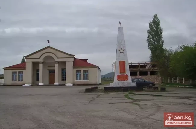
The region contains burial sites at Tash-Dyoboe, Kyzyl-Say, Besh-Tash, Zhol-Dyoboe, Tash-Aryk, dating back to the Bronze Age, the ancient burial ground at Ken-Kol (3rd-2nd centuries BC), and the settlement at Nush-Zhan (near the Uch-Bulak station). Among the epigraphic monuments, ancient inscriptions carved on stones in the Old Turkic language have been found in the Ayyrtam-Oy river valley. Among the architectural monuments, the "Manas Ordo" complex is particularly well-known, which includes the Mausoleum of Manas, the Manas Museum-Reserve, the Manas Museum, a mosque, and others.
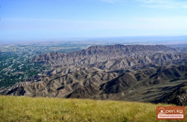
Manas Peak, the Mausoleum of Manas, the Manas District... Much in this region is connected to the name of the legendary hero of the Kyrgyz people. Numerous legends dedicated to Manas are associated with this fairy-tale land. It occupies the northwestern part of the republic's territory, including the Talas and Chatkal valleys and the Ketmen-Tyubin intermountain basin, bordered by the slopes of the Talas, Kyrgyz, Chatkal, Chandalash, and Fergana ranges. The Talas Valley, the largest in the region, stretches 230 kilometers from west to east between the Kyrgyz range to the north and the Talas Ala-Too to the south. These ranges converge in the east at a mountain knot, where the glaciers feed the Karakol and Uch-Koshoy rivers, which merge to form the main river of the region - Talas. The length of the Talas river flowing through the Talas Valley is 290 kilometers within the republic. In the Chon-Kapka gorge of the Echikili-Too range, a dam has obstructed its path, forming the Kirov Reservoir. In the Talas Valley, it often splits into channels, forming small islands. Turning north, the Talas disappears into the expanses of the plain, never reaching the Chu River.
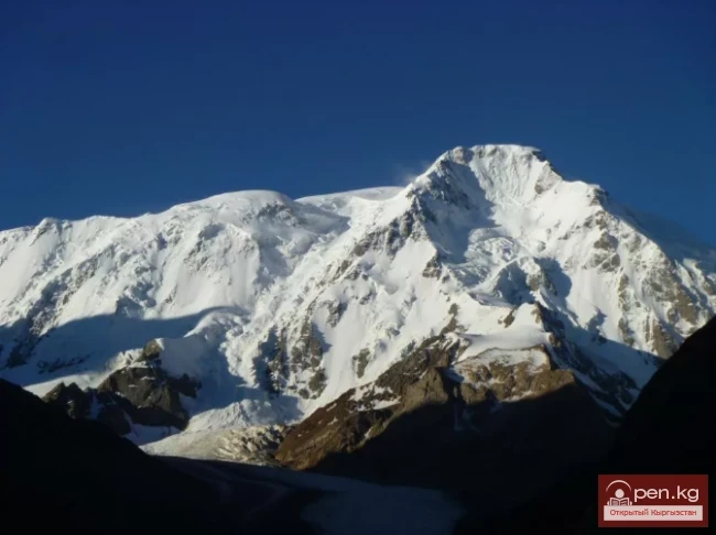
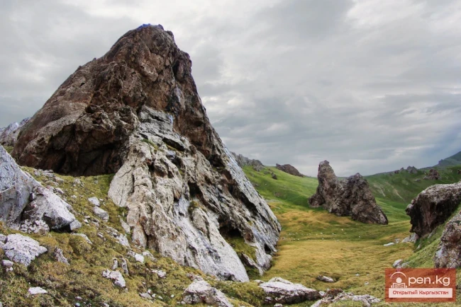
The ranges surrounding the Talas Valley are very different from each other. The ridge of the Kyrgyz Ala-Too seems to have been leveled by someone, preventing it from rising above three thousand meters and becoming covered with glaciers; only in the eastern part of the ridge do the peaks rise above the snow line. The Talas Ala-Too, on the contrary, has a narrow rocky shore and its peaks soar above the 4000-meter mark. The highest point of the Talas range is Manas Peak (4482 meters above sea level). In the pre-crested zone, there are significant glaciers, the slopes are heavily dissected by gorges, and from the southern slope, powerful ridges extend - Chatkal, Chandalash, Pskem.

Most of the flat territory of the Talas Valley and the foothills belong to a zone with moderately hot summers and warm winters. The snow cover here is small and unstable. These are vast expanses by our standards with very sparse vegetation, represented by ephemerals, sagebrush, and grasses, where reptiles and rodents reign. The largest animal is probably the tolai hare, while there are many snakes, tortoises, relic gophers, and jerboas.
On the mountain slopes, steppes are most common. There are many diverse shrubs, and the animal world is richer and more representative: wolves and foxes, badgers and porcupines, especially many birds - quails, partridges, owls, and harriers. Steppe landscapes often reach the highlands, where they alternate with alpine meadows, which is particularly characteristic of the Chatkal range. In spring and the first half of summer, the vegetation cover of the steppes is marked by freshness, picturesque colors, and high phytoncide content - it is during this time that it is a delight for travelers. In those areas where the optimal wind and temperature regime is maintained, as well as a sufficiently thick snow cover, skiing and snowboarding can be enjoyed.
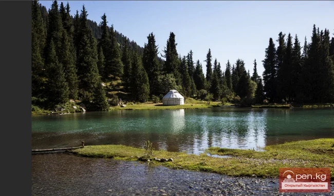
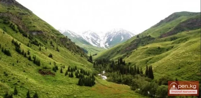
However, the most suitable for the development of various types of tourism is, of course, the meadow-forest zone, which encircles the slopes of the Kyrgyz and Talas Ala-Too at altitudes of 1600-2800 meters above sea level. A local feature is the presence of groves of Semenov's spruce and fir, which, as is known, only grow in Kyrgyzstan. In the floodplains of the Talas and Chatkal rivers and their numerous tributaries, there are small areas of forests of juniper, birch, willow, and poplar, while there are many thickets of rose hips, honeysuckle, sea buckthorn, and black currants everywhere. Specialists in medicinal plants can gather a large harvest. In the forested areas, bears, lynxes, and roe deer are found. Unfortunately, encounters with them are becoming increasingly rare, and to preserve and increase the numbers of these and other animals, many places in the Talas Valley have been designated as reserves.
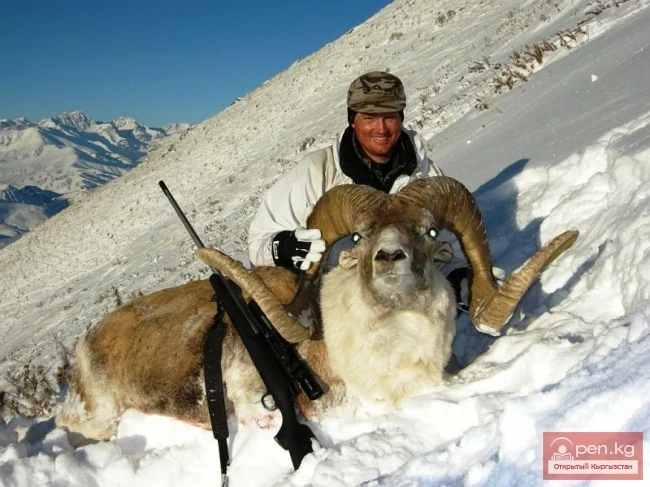
The highlands of the ranges up to 3600 meters have a typical alpine appearance. Only in summer, when the carpet of alpine vegetation delights the eye with its multitude of colors, and the weather is sunny and moderately cool, can beginner tourists be brought here. Here, in places inaccessible to humans, you may be lucky enough to see a snow leopard or stoat, a red marmot, or a chamois, soaring in the sky are golden eagles or vultures.
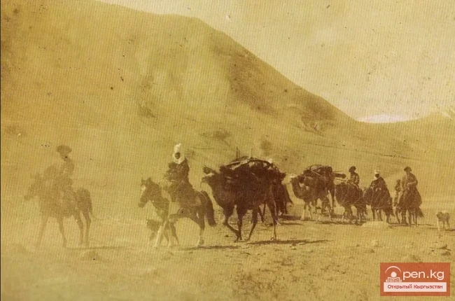
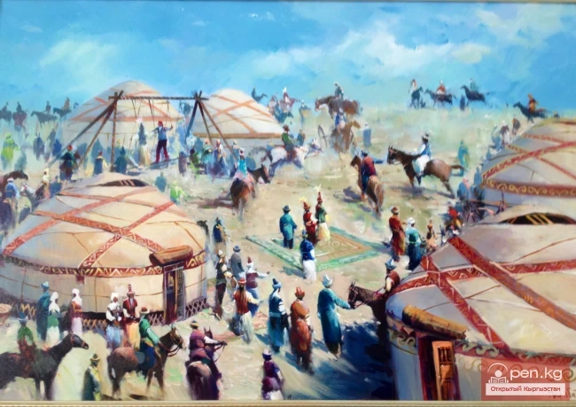
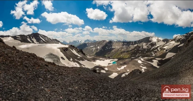
Even higher, where alongside bare rocks, glaciers, and scree, patches of alpine and tundra vegetation are occasionally found, only climbers and the most prepared tourists can ascend, even in summer. Only they can admire the endless sea of ridges above the clouds, the contrasts of white fields of snow and black rocks. But do not be discouraged: for those who are not welcomed by high mountains, there is plenty of interesting things below. The Talas Valley became a permanent place of residence for nomads even before our era, and many unique testimonies of ancient times have been preserved here.
In the green area of Ayyrtam-Oy, for example, there lies a huge stone resembling an egg, and on the stone are inscribed lines of Turkic runic signs dating back to the 7th-10th centuries. On separate rocks, much older people left their "autographs": you will be shown rock paintings that date back at least to the first century BC.
In the 11th-12th centuries, agriculture and mining developed here, which contributed to the formation and development of settled settlements. Along the caravan route through the valley, many medieval cities arose, traces of which are still found today. However, in the 13th century, Mongolian hordes broke through here, and their destructive invasion halted the development of this once vibrant region for a long time.
The valley of the Chatkal River was no less developed and populated in ancient times. In this area, which is quite far from major highways today, several dozen burial mounds and settlements have been discovered. Tourists can get acquainted with many architectural monuments here, mainly mausoleums.
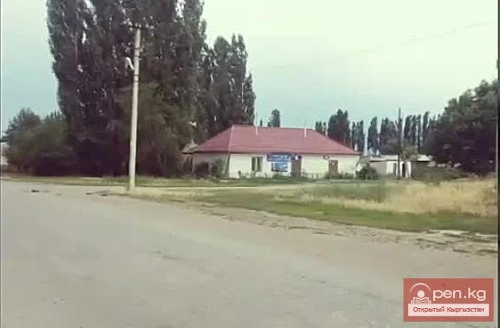
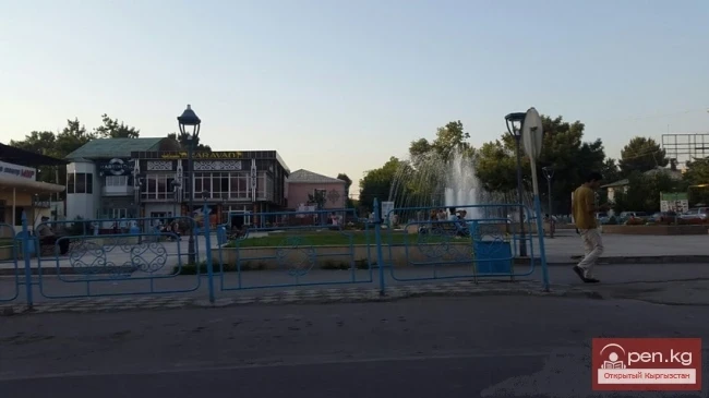
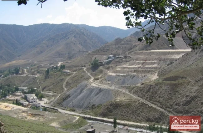
Modern settlements are located in the river valleys. Among them are two cities: Talas - the administrative center of the Talas District and the cultural center of the region, and Kara-Kul - an industrial center that has recently emerged due to the construction of the Toktogul Hydroelectric Power Station, as well as several industrial towns: Sumsar, Terek-Sai, Maymak. The settlement of Toktogul is known as the birthplace of the outstanding Kyrgyz akyn-democrat Toktogul Satylganov.
All tourist zones in this area have unlimited opportunities for tourism and exciting recreation: Besh-Tash, Manas, Kirov, Chatkal, Chandalash.
Cities
Talas
Architectural Monuments:
Ken-Kol Burial Ground
National Parks and Reserves:
Besh-Tash Natural Park
Valleys:
Chichkan Valley
Attractions:
Mausoleum of Manas