Zone "Ak-Talaa"

admin Natural ecological complexes
VK X OK WhatsApp Telegram
Zone "Ak-Talaa"

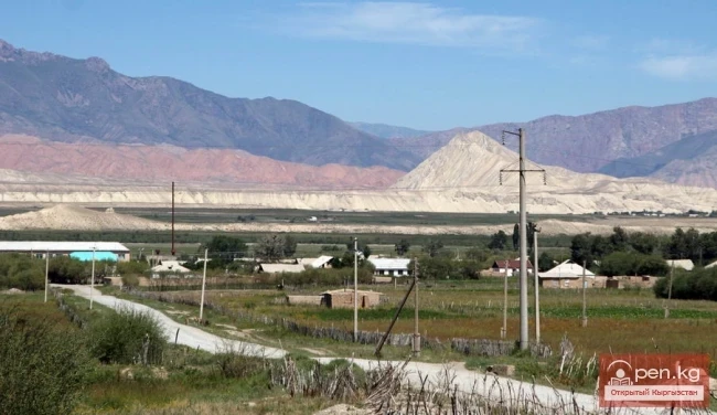
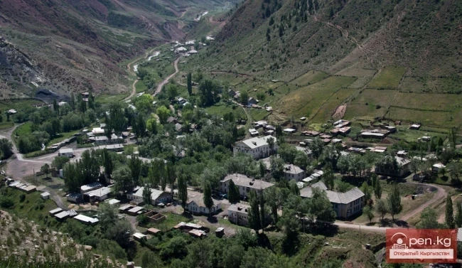
The "Ak-Talaa" zone includes the valleys of the Ala-Buka, Arpa, and Terek rivers, as well as the southern slopes of the Moldo-Too ridge within the middle reaches of the Naryn River. The center of the zone, the district center of Bayetovo, is located approximately 120 km from the city of Naryn.
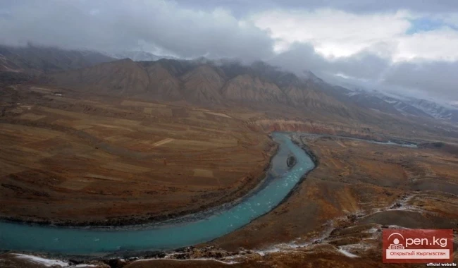
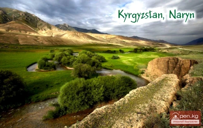
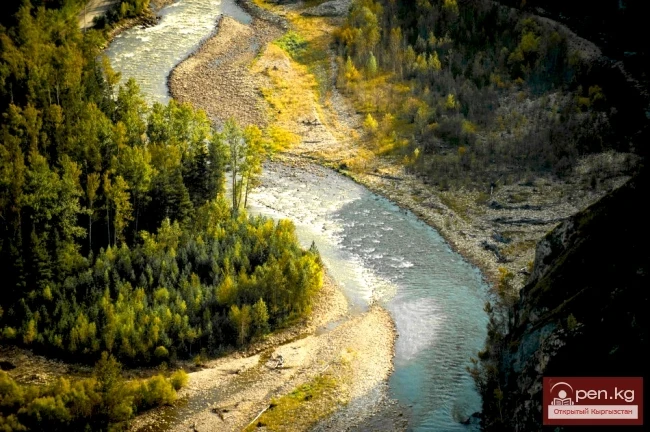
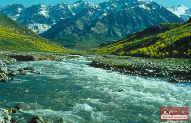
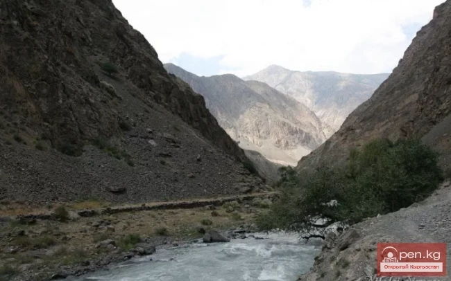
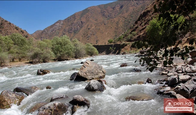
Within the zone, the Naryn River collects numerous large and small tributaries, becoming turbulent and full-flowing, comparable to a mighty hero bringing warmth and light to people. Over many millennia, the river has carved a huge canyon between the northeastern end of the Ak-Shiyrak ridge and the foothills of the Moldo-Too ridge, rivaling the grandeur and beauty of the famous American Grand Canyon. Its steep layered banks are separated by many kilometers in some places. Due to the fairly steep gradient, the water in the river rushes at speeds of up to 60 km per hour. In some areas, the riverbed narrows to a dozen meters, and the height of the water column reaches 30 m.
In the floodplain of the Naryn River, between the mouths of the At-Bashi and Ala-Buka rivers, there is the hunting economy "Ugyut," where licensed hunting for certain animals, mainly ibex and grouse, is organized.
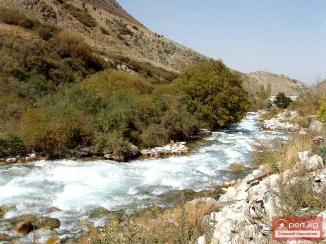
The riverbanks of the Naryn are used for agricultural land. The foothill landscapes of the southern slopes of the Moldo-Too ridge are represented by wormwood semi-deserts. Higher up, the steppe is characterized by feather grass and fescue.
Zone "Ak-Talaa"

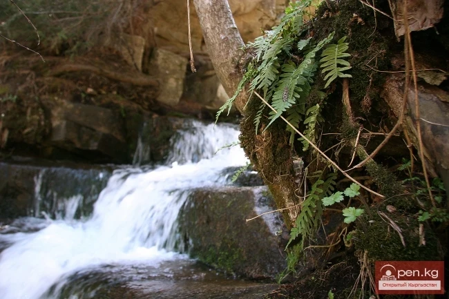
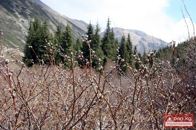
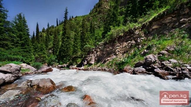
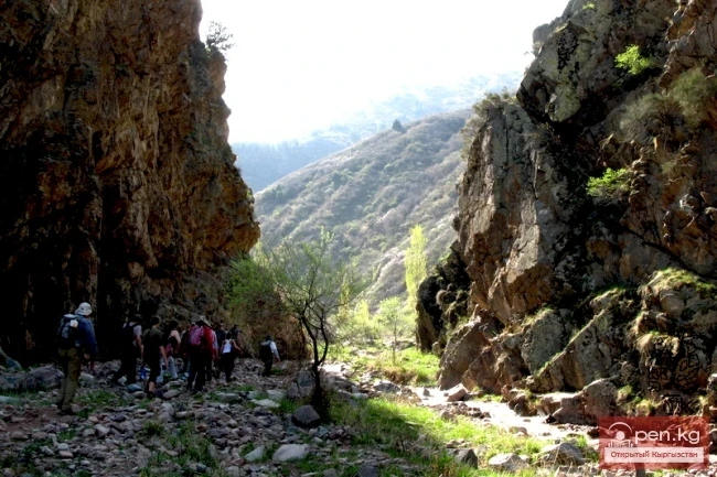
Wide, sometimes forested gorges rise steeply to the ridge, narrowing at the top to tight rocky corridors. Cold-water streams flow through the gorges, cascading down picturesque cliffs in waterfalls in some places. In the ridge zone, the gorges open into wide valley expanses covered with meadows and small groves of Tien Shan fir and juniper. The water in the streams flows smoothly and majestically down the gentle slopes. From elevated spots, one can see the valley and floodplain of the Naryn River, shrouded in a blue haze, the ribbon of the road stretching from Naryn to Kazarman, and the distant chains of surrounding ridges. The color of the sky plays in half-tones from blue to whitish.
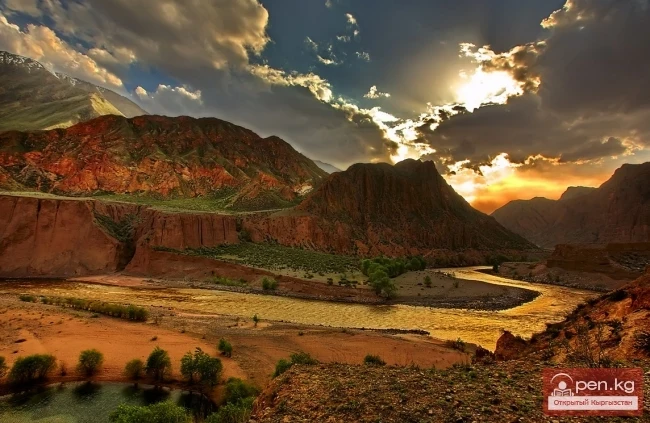
The left tributaries of the Naryn — Ala-Buka and Terek — flow through a valley that is 170 km long and 50 km wide. The valley floor rises from 1500 to 2600 m. It is framed by the Djaman-Too ridge (4718 m), the Baibiche-Too ridge (4066 m), and a small ridge (about 40 km) Ak-Shiyrak (average height 3400 m). The river floodplains are green with poplar-willow forests mixed with birch and thickets of shrubs. The predominant tree species in the floodplain forest is indicated by the name of the river — Terek ("poplar").
Zone "Ak-Talaa"

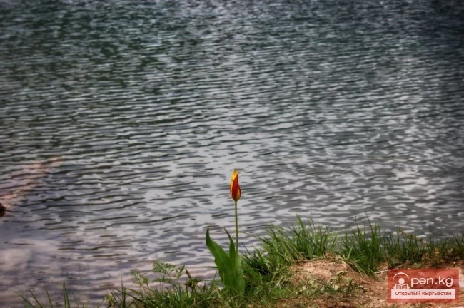
In the valley, steppe vegetation is represented by bluish wormwood, fescue, and feather grass, while higher up, there is a rich variety of herbs (geranium, yarrow, buttercup, snakehead, scabious). In early summer, the steppe blooms with numerous flowers of iris, onion, saffron, sedge, buttercups, and tulips, followed by flowering cornflowers, ziziphora, thyme, sage, and yellow buttercups. In the foothills, thickets of chiy and low shrubs — caragana — can be found.
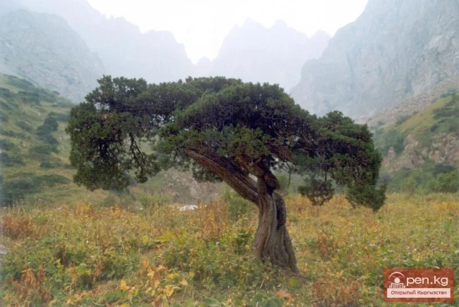
The slopes of the Ak-Shiyrak, Baibiche-Too, and Djaman-Too mountain ridges with northern and western exposure are better hydrated, and they are covered with masses of tugai thickets of juniper and other tree species. From the springs, white streams rush down steeply, gaining strength. At the waterfalls, the roaring column of water scatters the finest water mist, which shimmers with rainbow hues in the sunlight.
Birch groves green the banks. Mountain birches are unlike their plain counterparts. Their bark has a golden hue from "mountain tanning," darker than the color of the leaves. The trunks are bent and thickened. The forest of mountain birches is very beautiful. Individual trees grow in clusters from one spot, spreading upward. The trunks of others initially lie flat on the ground, then arch upward. On a moonlit windy night, it seems that "ghosts" come alive in the grove, endowed with the voice of the wind, the rustle of leaves, and the cries of night birds. Cheerful thickets are replaced by piles of reddish rocks, cozy emerald meadows, and the flickering of flowers.
VK X OK WhatsApp Telegram

Read also:

Ak-Talaa

Ak-Talaa

Ak-Talaa includes the valleys of the Ala-Buka, Arpa, and Terek rivers, as well as the southern...

Zone "At-Bashi"

Zone "At-Bashi"

The At-Bashi Zone includes the Atbashi-Karakoyun Valley. The center of the zone, the village of...

"Upper Naryn Zone"

"Upper Naryn Zone"

The "Upper Naryn Zone" includes the upper part of the Naryn River basin from the...

Small Naryn

Small Naryn

Small Naryn encompasses the valley of the river of the same name, located between the ridges of...

Upper Naryn

Upper Naryn

Upper Naryn includes the upper part of the Naryn River basin from the vicinity of the town of...

Kyzyl-Unkyur

Kyzyl-Unkyur

The "Kyzyl-Unkyur" Zone is located 15 km northeast of the village of Arslanbap in the...

Zone "Chatyr-Kel"

Zone "Chatyr-Kel"

The Chatyr-Kel Zone includes a significantly elevated intermountain basin with a lake of the same...

Kara-Suu

Kara-Suu

The "Kara-Suu" Zone is located in the eastern part of the southern slope of the Chatkal...

Zone "Yassy"

Zone "Yassy"

The Yassy Zone occupies the valley of the same name, located near the city of Uzgen, 80 km from...

Zone "Tar"

Zone "Tar"

The "Tar" zone includes the valley of the river of the same name and its tributaries. In...

"Chon-Kemin Zone"

"Chon-Kemin Zone"

Chon-Kemin Zone includes the valleys of the Chon-Kemin and Kichi-Kemin rivers between the high...

Zone "Toktogul"

Zone "Toktogul"

The Toktogul Zone includes the Ketmentebin intermountain basin in the lower reaches of the Naryn...

Zone "Isfayram-Sai"

Zone "Isfayram-Sai"

Zone "Isfayram-Sai". The left tributary of the Isfayram-Sai River is the Surme-Tash...

Zone "Maly Naryn"

Zone "Maly Naryn"

The "Maly Naryn" zone encompasses the valley of the river of the same name, located...

River Karakulja

River Karakulja

Karakulja The Chatkal River in its upper reaches is called Karakulja (translated - Black Ram),...

Naryn

Naryn

This area includes the city of Naryn — a transport and distribution tourist center — and its...

"Orto-Tokoy Zone"

"Orto-Tokoy Zone"

The Orto-Tokoy Zone encompasses the territorial foothills at the western end of the Terskey...

Zone "Aflatun"

Zone "Aflatun"

Aflatun Zone is located on the southeastern slopes of the Chatkal Ridge and occupies the basin of...

The Village of Massy

The Village of Massy

Massy – a village, the center of the Nooken district. It is located 60 kilometers northwest of the...

Kek-Art

Kek-Art

The "Kek-Art" Zone encompasses the surroundings of the city of Jalal-Abad, as well as...

Zone "Talas"

Zone "Talas"

The "Talas" zone is located in the central part of the Talas River valley and includes...

Kekemeren River

Kekemeren River

Kekemeren River is one of the most amazing and beautiful rivers in Kyrgyzstan. The Kekemeren is...

Zone "Kety"

Zone "Kety"

Kegety Zone is located 75 km from Bishkek in the gorge of the same name on the road to the village...

Kainyndy Glacier

Kainyndy Glacier

Kainy Between Kokshaal-Tau and Kainy-Katta lies the powerful Kuyakap Glacier, and between...

River Ak-Suu

River Ak-Suu

The main channel of the Ak-Suu River is at least 20-22 kilometers long. The lower part of the...

"Issyk-Ata Zone"

"Issyk-Ata Zone"

Issyk-Ata Zone is located 80 km from Bishkek and includes two gorges — Issyk-Ata and Tuyuk...

"Alamedin Zone"

"Alamedin Zone"

Alamedin Zone is located 25 km from Bishkek in the valley of the same name and the surrounding...

Semenov Glacier

Semenov Glacier

Semenov Glacier - the basin of the upper reaches of the Sarydjaz River. This basin includes the...

Rivers of Kyrgyzstan

Rivers of Kyrgyzstan

The formation of runoff and the hydrographic network in the territory of Kyrgyzstan is greatly...

"Manas Zone"

"Manas Zone"

The "Manas" zone is located 63 km from the city of Talas, south of the village of...

Kursheb River

Kursheb River

Kursheb, Kursheb River, in the upper reaches — Gulcha, A river in Kyrgyzstan, flowing through the...

Naryn-Too Ridge

Naryn-Too Ridge

Naryn-Tau The area is hard to access and rarely visited. Due to the low glaciation and modest...

Inner Tian Shan

Inner Tian Shan

It is precisely about this region that famous travelers such as Semenov-Tian-Shansky, Mushketov,...

River Kyzyl-Suu

River Kyzyl-Suu

Kyzyl-Suu (Kyzyl-Suu River, Красная река) - a river in Kyrgyzstan and Tajikistan, the right source...

Kuylytau Ridge

Kuylytau Ridge

Kuylytau A mountain range in the Central Tien Shan, in Kyrgyzstan. It is located between the...

Write a comment: