The "Maly Naryn" zone encompasses the valley of the river of the same name, located between the ridges of Jetim-Bel, Kapkatap, Karadjorgo, Jetim-Too, Uch-Emchek, and Terskey Ala-Too.
Approximately 25 km from the mouth, where the Maly Naryn flows into the Naryn (2253 m), the river valley makes a sharp turn at a right angle against the southern slopes of the Kapkatash ridge and stretches almost 100 km strictly to the east. On the right bank of the river in the area of the bend and on the northern slopes of the small Nura ridge (length 45 km), park-type spruce forests can be found. Upstream, about 45 km from the bend, the left tributary Archaluu flows into the Maly Naryn. It runs through the valley of the same name, formed by the southern slopes of the Jetim-Bel ridge (Seok - 4620 m) and the northern slopes of the Jetim-Too ridge (4931 m). The slopes are covered with thickets of juniper. The surrounding mountainous elevations are mainly composed of granites, durable gneisses, crystalline schists, and marbles, creating cosmic landscapes among the rocks. The impression is intensified by the evening rays of the sun flooding the frozen stone "cities" with fantastic light. Against the backdrop of the pale sky, the peaks are first painted in yellowish tones, then in orange, and finally ignite with a ghostly garnet light. In the morning, this picture is repeated in reverse order. The pale sky turns blue, and everything around is flooded with bright sunlight.
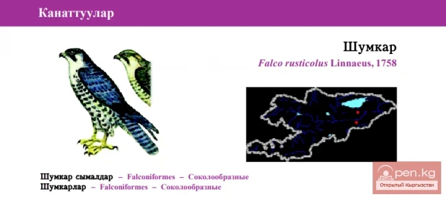
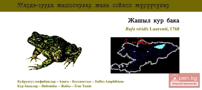
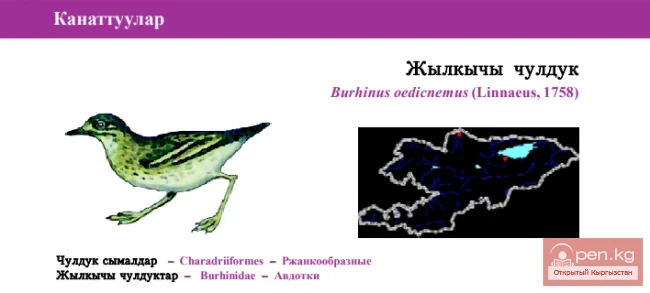
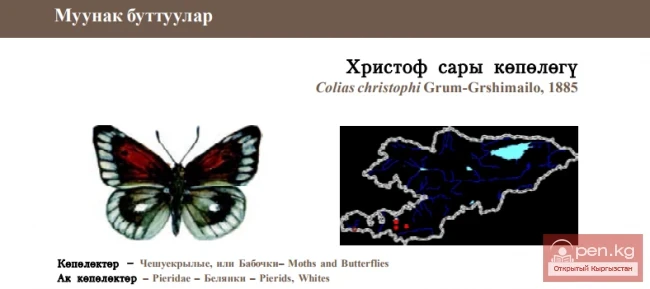
Cliffs, crags, and alpine meadows are a favorite habitat for the ulars (mountain turkeys), which do not descend below 2000 m above sea level.

Ulars emit a melodic whistle reminiscent of flute sounds. They are the largest bird in Kyrgyzstan from the order of galliformes, weighing up to 3 kilograms. Their meat is excellent in taste and, as people say, has healing properties. Ulars are very freedom-loving; they cannot stand captivity and are therefore rarely found in zoos.
The Maly Naryn is known in its upper reaches as Buurkan. It changes its name after the confluence with Uch-Emchek (a right tributary of Jyluu-Suu). The valley of the Buurkan River, surrounded by the Uch-Emchek and Jetim-Bel ridges, crosses vast areas of gravel plains. Here, a high-altitude cold desert prevails. The harsh climate, the mirrors of small lakes, and the tundra-like vegetation covering the hilly-moraine formations and ancient glacial valleys resemble the landscapes of the distant tundra near the Arctic Ocean. The only difference is the difficulty in breathing and the awareness that one can quickly descend to warmer zones or to the "golden beach" of Issyk-Kul.
Shoulder to shoulder, the peaks are covered with patches of gray clouds. Snow spots whiten on the scree slopes (kuru) of reddish sandstone and ash-gray rocks. The view opens up to lateral hanging valleys that exit into the main valley somewhat higher than the bottom level, and to the glacier-carved depressions—cirques, which have a rounded shape.
Steep snow-covered slopes are crossed by traces of recently fallen avalanches with characteristic cones on the gentle sections. "White death" is how the locals refer to snow avalanches. When an avalanche occurs, clouds of white dust are raised, and along with the snow, a powerful roar is released, accompanied by a ringing echo.