Natural Park "Besh-Tash"

Юля National parks and reserves
VK X OK WhatsApp Telegram
Besh-Tash Nature Park


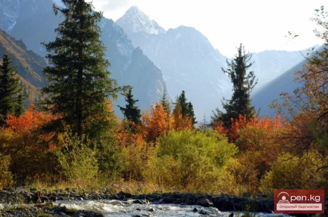
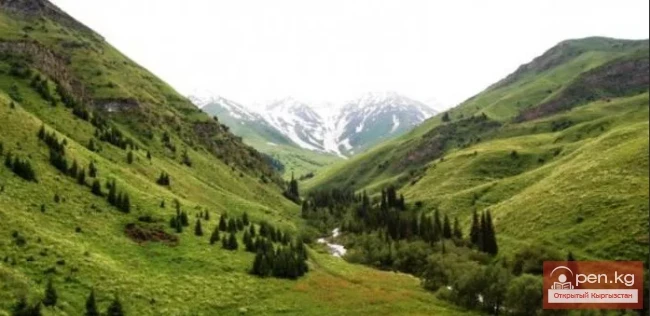
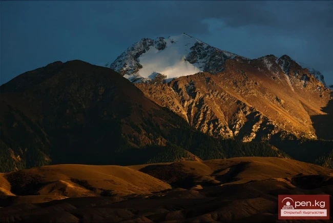
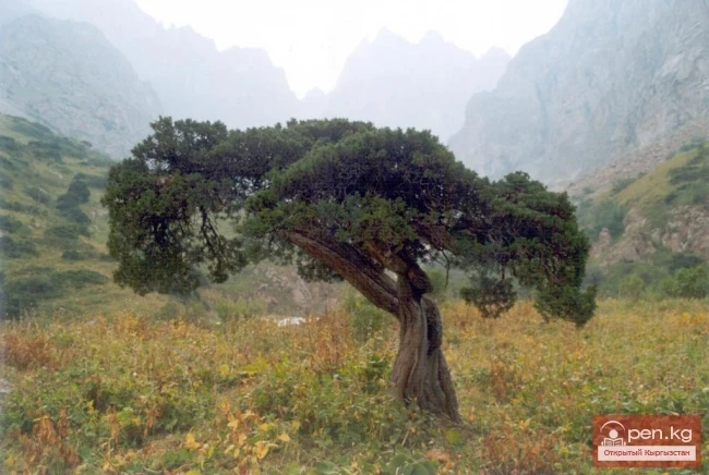
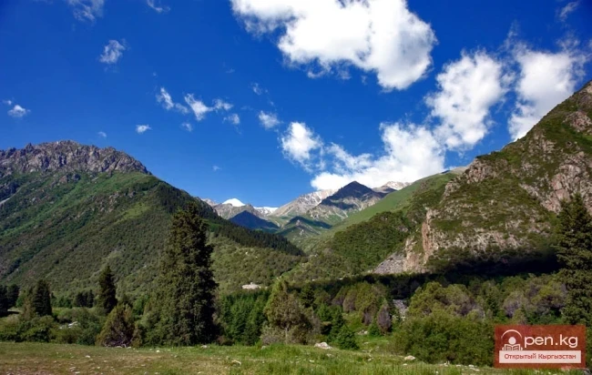
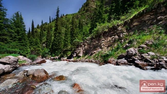
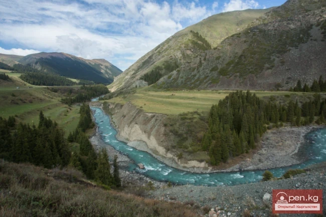
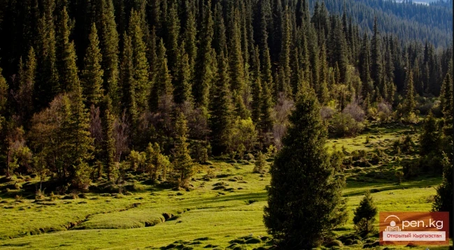
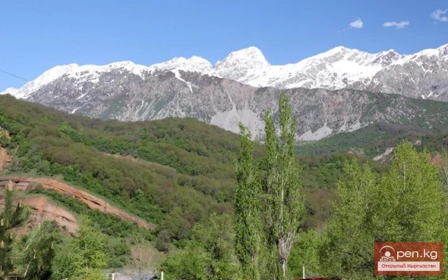
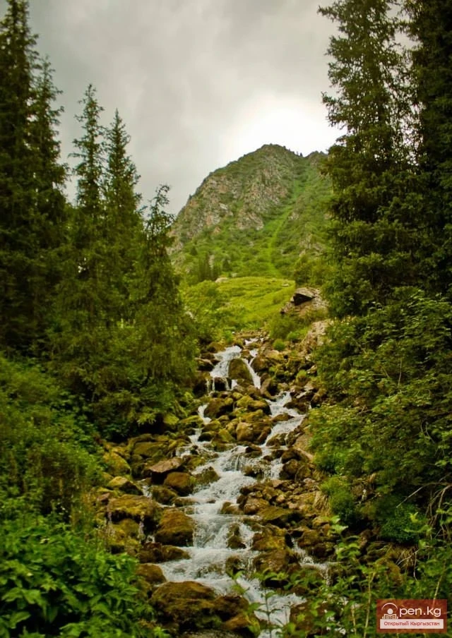
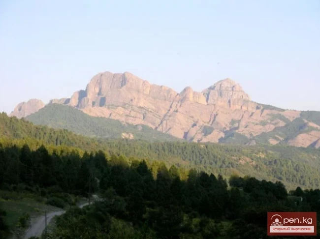
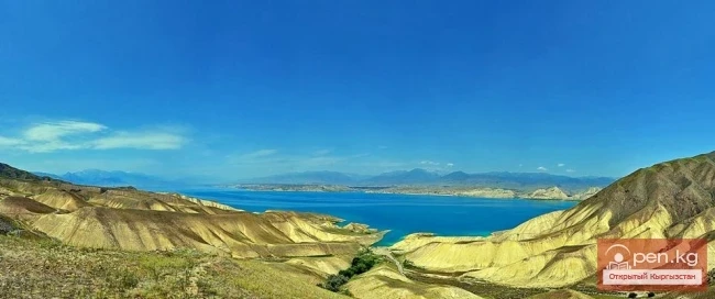
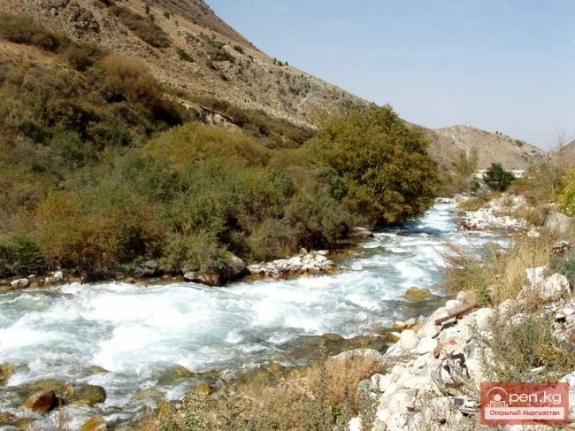
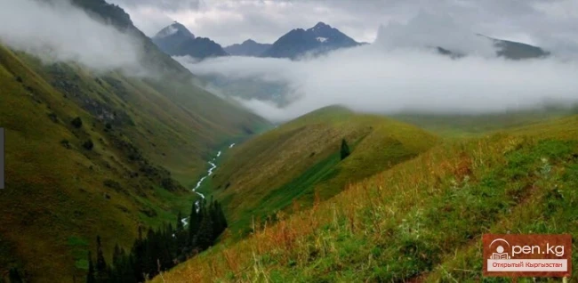
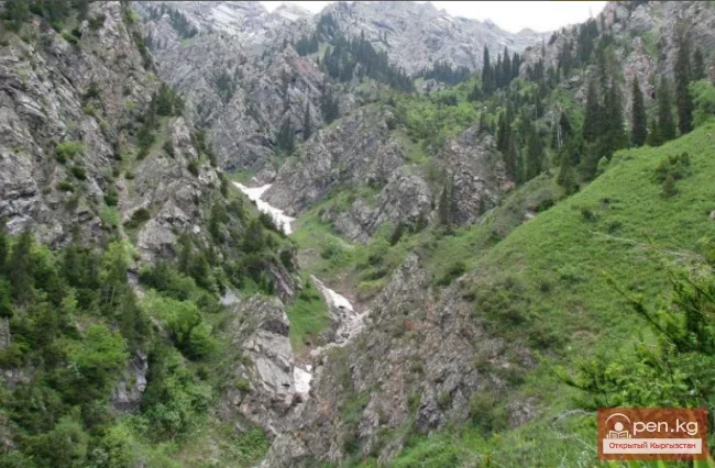
Besh-Tash Nature Park is located south of the city of Talas on the northern slopes of the Talas Ala-Too and includes the gorges: Kolba, Besh-Tash, Urmaral, and Kumush-Tag with their branches. In these gorges, rivers of the same name flow with a widely branched network of tributaries. The territory is cut by deep ravines. In summer, the gorges look very beautiful. Juniper thickets are scattered along the slopes. In the upper reaches of the gorges, on the right slopes, there are sparse forests of spruce and juniper. Above the boundary of the forest-meadow zone, bright green alpine meadows begin. In this zone, the cool breath of glaciers is felt. In the ridge part of the range lies the Chiyim-Tash pass (3575 m), connecting the Urmaral basin with the valleys of Kara-Kulja and Chatkal.

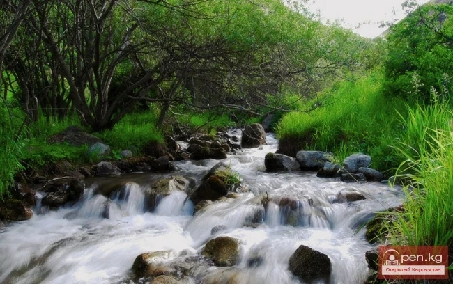
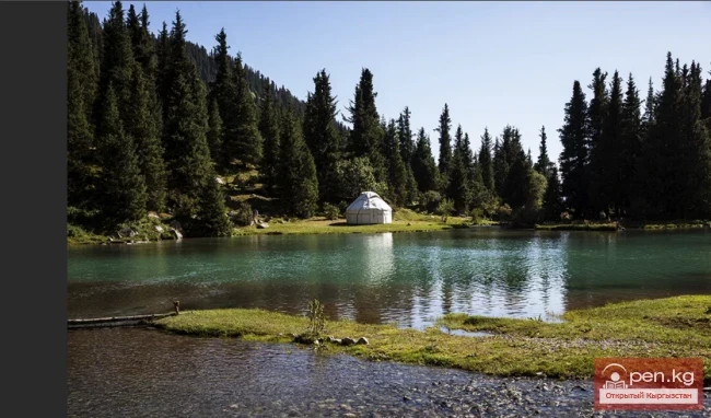
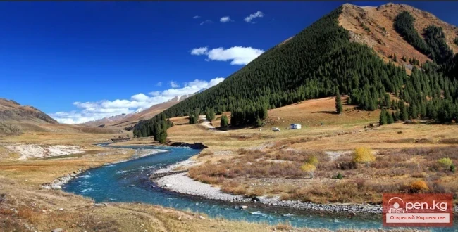
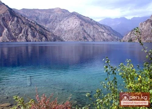
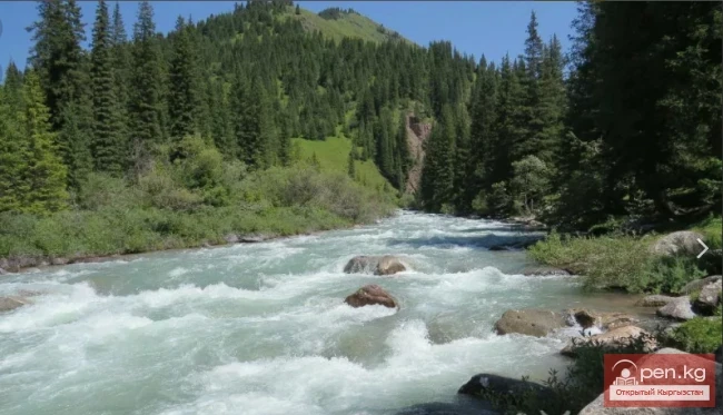
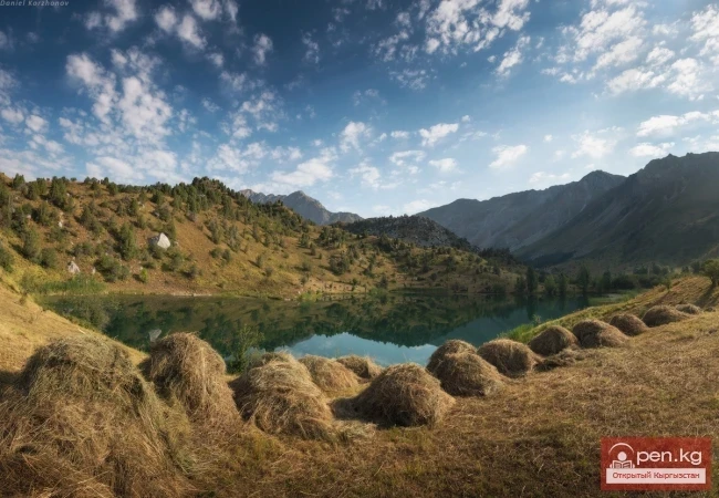
In 1996, a nature park was established in the Talas region over an area of 32,411 hectares to preserve unique natural forests and high-altitude meadows. The plant world is represented by more than 800 species of flowering plants, of which about 28 species are woody-shrub. Among the representatives of the Red Book, the snow leopard, the Turkestan lynx, the golden eagle, the kumai, the saker falcon, and the bearded vulture inhabit this area. The Besh-Tash River flows through the park, where rainbow trout can be found. At an altitude of 2997 m, there is an elongated moraine-dammed lake Besh-Tash, 28 m deep and covering an area of 0.5 sq. km. The water in it is turquoise. In the Besh-Tash gorge, beautiful forests of Tien Shan spruce mixed with Semenov fir have been preserved.

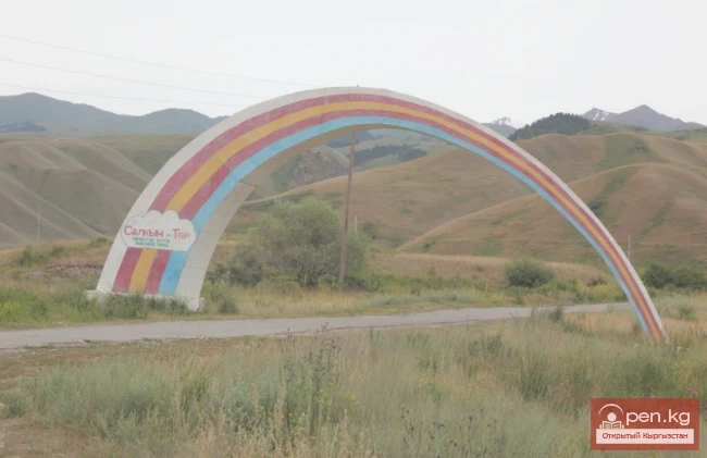
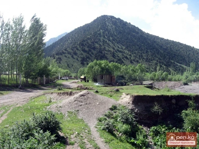
The administrative building is located in the city of Talas. The distance to the reserve is 13 km, and you can drive another 30 km into the park. The fee for foreign tourists for vehicle entry is 20 dollars, and for visiting the park, it is 10 dollars.
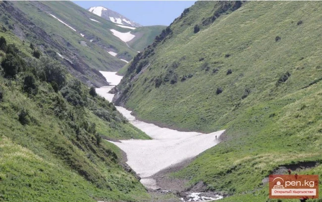
Chiyim-Tash

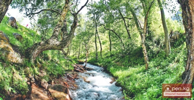
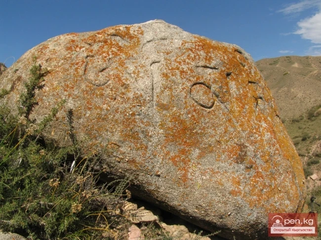
A picturesque birch grove at the mouth of Chiyim-Tash (a left tributary of the Urmaral River) serves as a wonderful place for recreation. In the middle reaches of the Urmaral, ancient Turkic rock paintings from the 6th to 8th centuries can be found. On the right bank of Besh-Tash, bizarre stone sculptures of Kesken-Debe, a cultural monument from the 6th to 8th centuries, have been preserved to this day. You can visit three mausoleums dated to the 18th-19th centuries, located at the intersection of the Urmaral River with the Talas - Taraz highway.
VK X OK WhatsApp Telegram

Read also:

Ala-Archa National Park

Ala-Archa National Park

In the ridges of the Kyrgyz Ala-Too, there are 480 glaciers. The largest of them are located in...

Zone "Isfayram-Sai"

Zone "Isfayram-Sai"

Zone "Isfayram-Sai". The left tributary of the Isfayram-Sai River is the Surme-Tash...

"Manas Zone"

"Manas Zone"

The "Manas" zone is located 63 km from the city of Talas, south of the village of...

"Ala-Archa Zone"

"Ala-Archa Zone"

Ala-Archa Zone is located 30 km south of Bishkek in the central part of the Kyrgyz Ala-Too range...

Zone "Kety"

Zone "Kety"

Kegety Zone is located 75 km from Bishkek in the gorge of the same name on the road to the village...

Kara-Suu

Kara-Suu

The "Kara-Suu" Zone is located in the eastern part of the southern slope of the Chatkal...

Zone "Aflatun"

Zone "Aflatun"

Aflatun Zone is located on the southeastern slopes of the Chatkal Ridge and occupies the basin of...

Natural Park Kyrgyz-Ata

Natural Park Kyrgyz-Ata

Kyrgyz-Ata Natural Park is located in the basin of the river of the same name, which flows down...

"Chon-Kemin Zone"

"Chon-Kemin Zone"

Chon-Kemin Zone includes the valleys of the Chon-Kemin and Kichi-Kemin rivers between the high...

Kyzyl-Unkyur

Kyzyl-Unkyur

The "Kyzyl-Unkyur" Zone is located 15 km northeast of the village of Arslanbap in the...

Talas Ridge

Talas Ridge

Talassky Ala-Too A mountain range located in the Western Tien Shan system. Most of it is situated...

Chuy Region

Chuy Region

The Chuy Region was established on December 14, 1990. Until 1939, various...

Small Naryn

Small Naryn

Small Naryn encompasses the valley of the river of the same name, located between the ridges of...

Lake Sary-Chelek

Lake Sary-Chelek

Geographical Information: An astonishingly beautiful corner of nature in southern Kyrgyzstan at an...

Zone "Toktogul"

Zone "Toktogul"

The Toktogul Zone includes the Ketmentebin intermountain basin in the lower reaches of the Naryn...

"Issyk-Ata Zone"

"Issyk-Ata Zone"

Issyk-Ata Zone is located 80 km from Bishkek and includes two gorges — Issyk-Ata and Tuyuk...

Ala-Archa National Park

Ala-Archa National Park

The longest gorge, bearing the same name, is located just 30 km from the city. Immediately behind...

Zone "Tar"

Zone "Tar"

The "Tar" zone includes the valley of the river of the same name and its tributaries. In...

"Suusamyr Zone"

"Suusamyr Zone"

The Suusamyr Zone includes the eponymous high-altitude valley stretching 155 km. To the north, it...

Aksai Glacier

Aksai Glacier

Ak-Sai Glacier The glacier is located 40 km from Bishkek in the picturesque Ala-Archa gorge at an...

Kungey-Alatau Ridge

Kungey-Alatau Ridge

Kungey-Alatau To the south of the Zailiysky Alatau, beyond the deep longitudinal valleys of the...

Upper Naryn

Upper Naryn

Upper Naryn includes the upper part of the Naryn River basin from the vicinity of the town of...

Tyup Nature Reserve

Tyup Nature Reserve

Bountiful Tyup The Tyup district is located 20 kilometers from Karakol. It is situated in the...

River Ak-Suu

River Ak-Suu

The main channel of the Ak-Suu River is at least 20-22 kilometers long. The lower part of the...

Write a comment: