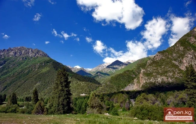
State Natural National Park "Salkyn-Tor" - a wonderful place for ecotourism
The State Natural National Park Salkyn-Tor was established in accordance with the resolution of the Government of the Kyrgyz Republic dated May 25, 2001, in the Naryn region, with the aim of improving the overall ecological situation and preserving unique corners of nature and natural sites. The length of the territory from north to south is about 15 km, and from east to west is 30 km. The area of the State Natural National Park "Salkyn-Tor" is 10,448 hectares, including forest lands - 3,270 hectares, of which forest-covered lands amount to 2,069.1 hectares.

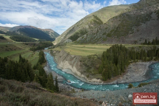
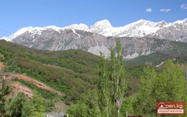
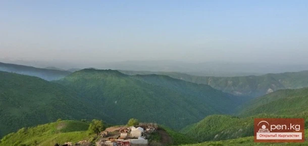
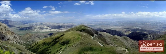
The State Natural National Park Salkyn-Tor is located in the central part of the Tien Shan and its territory is situated on the northern macro-slope of the high mountain range Naryn-Tuu, which borders the medium Naryn basin from the south. In general, the Naryn-Tuu range represents a powerful mountain structure, significantly elevated, with a complex combination of ridges - tectonic uplifts and intermountain basins - tectonic depressions.
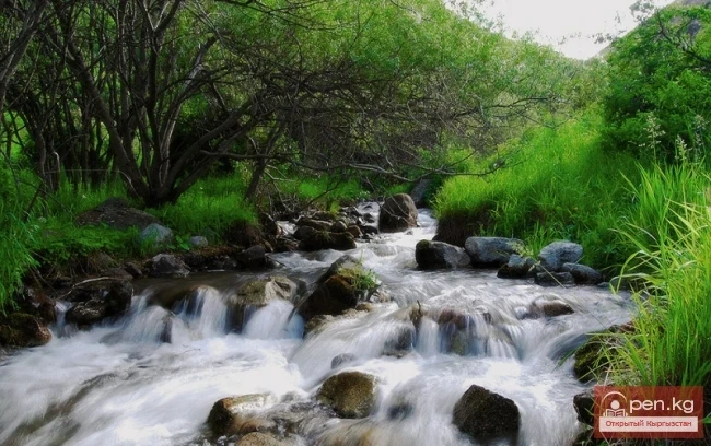
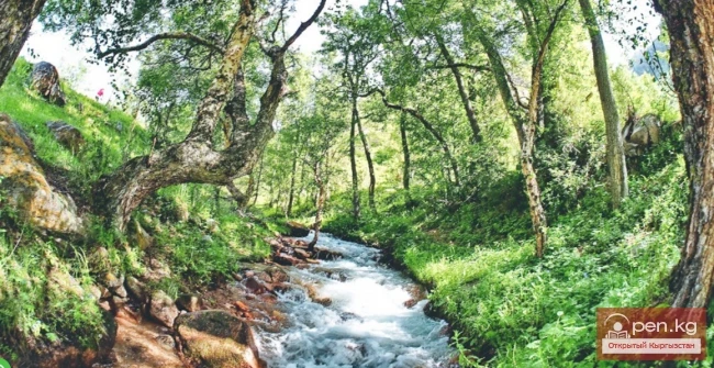
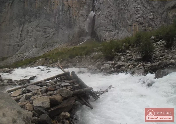
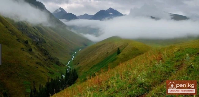
The hydrogeographic network of the park's territory is formed by numerous rivers originating from glaciers and snowfields formed from snow avalanches of Naryn-Tuu. These include rivers and streams: Teke-Sekirik, Alysh, Kur-Say, Kurgak, Doboluu, Kuu-Dongoch. There are also about 30 springs on the territory of the park.

The climate of the area where the park is located, like that of the entire Inner Tien Shan, is harsh, sharply continental, with large temperature fluctuations both by seasons and during the day. The surrounding high mountain ranges of Central Tien Shan hinder access to western and northwestern air currents that bring moisture. The average annual precipitation ranges from 200 to 300 mm. The majority of it (up to 65%) falls in spring and summer.
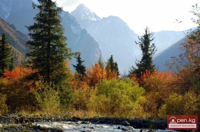
Summer is warm, with rainy weather in the first half, while autumn is short, dry, and cool. The spring period begins in April and is accompanied by a rapid increase in air temperature. The first autumn frosts occur at the end of September. The frost-free period lasts 4-5.5 months and averages 150-160 days, with a growing season of 145 days.

In the distribution of vegetation cover, there is a well-defined vertical zonation, determined by the hypsometric heterogeneity of the territory. Four main phytocenotic belts are clearly traced: 1) steppe, 2) forest belt, 3) alpine, 4) glacial-nival.
Steppe belt is located at an altitude of 2100-3000 m above sea level, mainly occupying the southern slopes of the ridges. The vegetation cover of the steppes is formed by grass-sagebrush communities. The grass stand is usually two-tiered and sparse. The projected cover is 30-40%.
Forest belt, subalpine shrubs, and meadow-steppes are located in the middle mountain zone at an altitude of 2200-3100 m above sea level, characterized by dense and diverse vegetation. On steep northern slopes, coniferous forests grow, formed by Tien Shan spruce (Picea shrenkiana). Their distribution across the territory is patchy. On slopes of different exposures, in the form of "spots" and narrow intermittent strips, there are thickets of creeping Turkestan juniper (Juniperus turkestanica). Among deciduous shrubs in this belt, the most common are Tien Shan rowan (Sorbus tianshanica); Altman's honeysuckle (Jonicera altmanni); Albert's rosehip (Posa alberti); Meyer’s currant (Pibes meerii); multi-leaved caragana (Caragana pleiophylla); St. John's wort-leaved spiraea (Spiraea huperesifolia); willow (Salix); less frequently found are laurel-leaved poplar (Populus Jaurifolia) and sea buckthorn (Hippophae rhamnoides); black-fruited cotoneaster (Cotoneaster melanocarpus). Shrub formations are associated with the slopes of various exposures and are widely distributed in sparse spruce plantations, valleys, and river floodplains. In open areas, they do not sharply form dense thickets, being displaced by the vegetation of subalpine meadows and meadow-steppes.

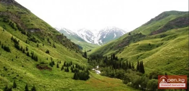
Subalpine meadow vegetation in this belt is dense, tall, multi-layered, and characterized by a large variety of compatible species. The projected cover is 90-100%. Subalpine meadows are mainly located on northern, northeastern, and northwestern slopes. Large areas in this belt are occupied by mountain meadow-steppes, located on slopes of various exposures and steepness. Unlike subalpine, meadow-steppe vegetation is lower and sparser, formed by sagebrush-grass diverse communities.
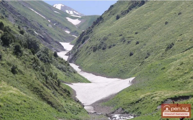
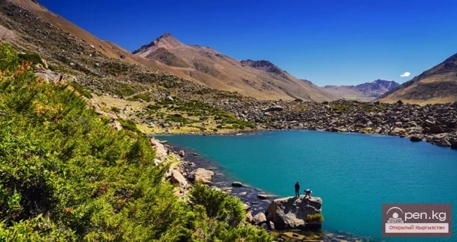
Alpine low-grass meadow belt is located at an altitude of 3000-3500 m above sea level. It occupies the upper reaches of river valleys, reaching the boundary of the nival belt. Tree vegetation is usually absent here. The grass stand of the meadows is dense, low-growing, and prostrate. Its projected cover is 50-70%. In this belt, the growth of plants is influenced by low air temperatures and the constant influence of cooled permafrost soils underlying the moraine thickness. In the soil cover of alpine meadows, the dominant species are crested fescue (Fistuca sulcata); snow cinquefoil (Potentilla nivea); pale yellow edelweiss (Leontopodium ochroleucum); mountain phlomis (Phlomis oreophila); cold gentian (Gentiana algida); high mountain ligularia (Ligularia alpigena); Albert's buttercup (Ranunculus alberti); hill geranium (Geranium collinsum); and others.

Nival belt of modern glaciation, dominated by glaciers, snowfields, rocky ridges, and scree, is located in the southern part of the park's territory at an altitude of over 3800 m above sea level. Here, the plant cover is completely absent. Only in the lower part of the belt can single plants or groups be found. Among them, one can find mountain onion (Allium oreopzasum); Bunge's chorispora (Chorispora bungeana); pale-scaled colpodium (Colpodium leucolepis); lichens and cushion plants.

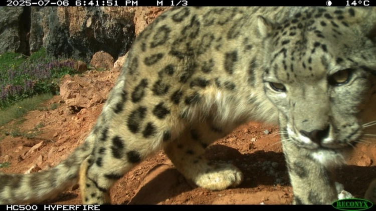
The park is home to bears, lynxes, stone martens, mountain goats, roe deer, wolves, foxes, rock partridges, snowcocks, squirrels, hares, badgers, marmots, etc. The flora of the park includes about 300 species of plants, including medicinal plants such as golden root, mint, ginseng, and others.
Among the species listed in the Red Book of the Kyrgyz Republic, there are 4 species of mammals, 6 species of birds, 10 species of insects, and 2 species of plants.

The territory of the natural park is of great importance for the restoration of the maral population and is of interest for recreational purposes.
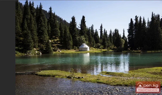
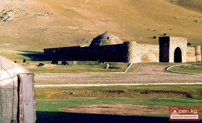
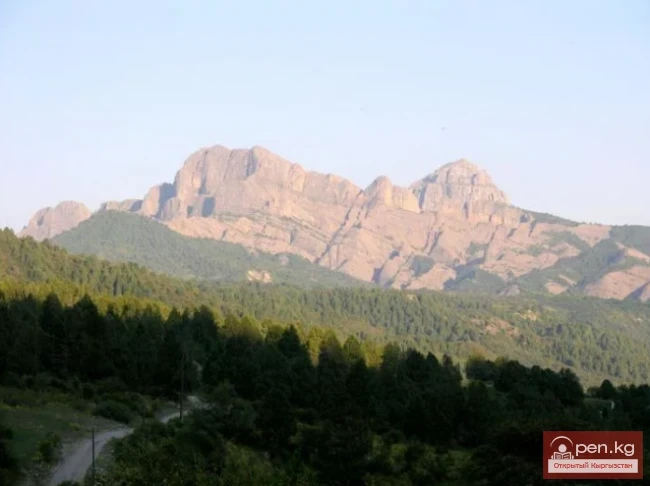
Here you can find the natural cave Kojo-Unkyur, the historical hill Dyubeli, the key spring Kurgak, and interesting objects in the recreation area of Salkyn-Tor. Very beautiful rocky gorges Kök-Jayyk, Berkut-Uya, Kyzyl-Zoo.

The dispute over the State Natural National Park has been ongoing since 2001. A coveted piece of land with a recreation area on its territory was initially illegally transferred to the mayor's office of the city of Naryn. Later, the park was even leased to private individuals.
"Salkyn-Tor" was included in the list of objects subject to privatization in 2003. Four auctions were scheduled, the last time in July 2005, but they did not take place due to the lack of applicants," says Ainura Temirova.
The governor of the Naryn region put an end to this dispute. Omurbek Suvanaliev sent a corresponding letter to the government of the Kyrgyz Republic regarding the impracticality of transferring the state protected area into private hands or for the economic activity of any administrative authorities.
The head of the government, Igor Chudinov, as reported by the press secretary of the Naryn state administration, signed the document "On amendments and changes to the resolution of the government of the Kyrgyz Republic No. 249 'On the organization of the State Natural National Park "Salkyn-Tor" in the Naryn district of the Naryn region.'

According to the government's decision, the entire property complex of the recreation area remains under state management.
Now the State Natural National Park "Salkyn-Tor" serves as a wonderful place for recreation and tourism.