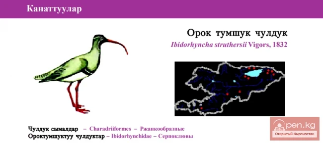
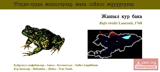
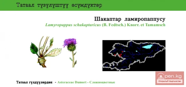
The Buurkan River originates from the lake of the same name, located to the west of the Arabel Pass at an altitude of 3820 m. The lake is 1.5 km long, 550 m wide, and 10 m deep. The outflow from the lake into the river valley occurs through a rocky threshold in a cascade of beautiful waterfalls. The water in the lake is green. The shores are rocky or marshy in places, while the main part has a specific appearance of finely carved islands and peninsulas 2-5 m long.
Within the zone, there are sources of weakly mineralized carbonated waters. The Buurkan spring is located on the left bank near the upper reaches of the river of the same name. Jyluu-Suu is located on the right bank of the river of the same name. Not far from the spring, on the southern slopes of the Terskey Ala-Too ridge, there is a small dammed lake with turquoise water.
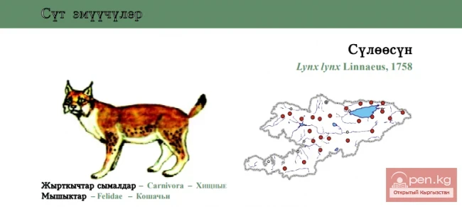
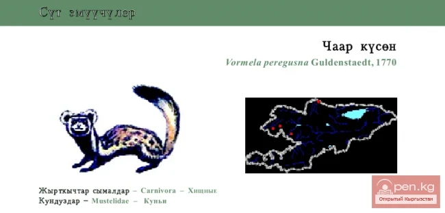
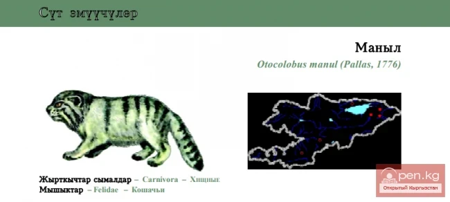
On the steep slopes of the ridges, there are real forests of stunted Turkestan juniper. The purest air, rich in phytoncides, slightly intoxicates. Paths along the rivers sometimes pass through thickets of tugai forests, which attract wild boars, porcupines, roe deer, martens, hares, and foxes.
Strictly to the north of the zone, winding around the cliffs, there is a road. The surrounding gorges are covered with moss and lichen. In some places on the steep northern slopes, Tien Shan fir and juniper cling. Soft, rounded forms of peaks accompany the road to the Dolo Pass (3030 m) in the Karadjorgo ridge. A feature of this part of the zone is the sharp changes in weather conditions. It is impossible to describe the nature in the area of the pass better than M. Jangaziev did in his poem "On the Summit of Dolon."
“We climbed to the summit of Dolon by a steep path, fighting the snowstorm.
My companion was surprised that the snowstorm caught us in the mountains this summer.
And just a moment later—the pure heavenly expanse,
The clouds hid in the twists of the mountains.
The mountain whirlwind, lifting snow from the slopes,
Suddenly fell silent, like a fire quenched by water.”

Along the floodplain of the Naryn, there are dense thickets of tugai forests, pleasantly enlivening the surrounding steppe landscape. The natural composition of these forests is very rich, including the laurel-leaved poplar, Tien Shan birch, crooked birch, sharp-leaved and Dzhungarian willows, as well as numerous shrubs, among which the mirkaria and the very valuable and tasty sea buckthorn stand out.
Fifty kilometers from the confluence of the Maly and Bolshoy Naryn, the Naryn-Too and Jetim-Too ridges converge, enclosing the valley. The river rages in the gorge, licking the rocky banks of the canyon with foamy tongues of waves. Above the right bank, the shining glaciers of the Jetim-Too ridge loom. The left side is dominated by a peak 4531 m high in the Naryn-Too ridge. The relatively high humidity of the southern slopes of the Jetim-Too ridge creates conditions for rich vegetation.
On the left terrace of the Naryn River, there is a highway leading to the "Maly Naryn" and "Upper Naryn" zones. The area at the confluence of the Bolshoy and Maly Naryn at an altitude of about 2250 m is very attractive for tourism. Here, nature itself has created a peculiar green oasis with lush vegetation.
Above the city of Naryn, on the more humid northern slopes of the Naryn-Too ridge facing the river valley, at altitudes from 1800 to 3000 m, there are forests of noble Tien Shan fir. Above 3000 m in the high-altitude zone, shrubs and sparse forests of stunted Turkestan juniper prevail, especially common in this area of the Tien Shan. In Kashka-Suu and Baibiche, the fir forest resembles a true taiga. The climate of these areas approaches conditions found in Siberia. The forests are rich in berry shrubs—barberry, honeysuckle, currants, and rowan. There are springs with cold, tasty water.